The Burial of Charles Blood

We are over half way through October and I don’t feel like I have indulged in anywhere near enough spookiness as I should have this year. I’m going to try and play creepy catch-up starting with the bizarre burial of Charles Blood at Church Leigh nr Uttoxeter, which took place while the village was cut off after a snowstorm in March 1909.

Once the funeral service had concluded & the mourners dispersed, the sexton, Edward Alcock, was filling in the grave of Charles Blood when he became aware of a knocking, seemingly coming from inside the coffin below him. He described it as the sound of someone rapping on an empty box and counted twenty taps in total, loud at first but gradually becoming fainter. Concerned the poor man had been buried alive, he called over to his brother Harry to fetch Samuel Hollins the undertaker. As the small group of mystified men stood together in the snowy churchyard, they received instructions from the rector in his warm bed, to raise the coffin from the cold grave and carry it into the church. It was something of a struggle due to the corpulent nature of the corpse within but eventually they managed to manoeuvre it. Once inside the chancel, the undertaker unscrewed the lid. It was immediately clear that there were no signs of life and nothing to suggest anything sinister was afoot. The only change was that the hands, originally placed on the deceased’s stomach, were now lying by his sides. A doctor’s assistant from Tean who was passing by the church yard was called in to confirm that Charles Blood was definitely dead and that he definitely had been when he was placed in the coffin.

Weirdly, when the coffin was lowered back into the earth, the tapping began again although this time Charles Blood was left to lie in peace. Well, it would have been peaceful apart from the tapping.

The undertaker’s explanation of the mystery was that the unnerving noises were caused by compressed air in the coffin. He dismissed the suggestion that it was earth falling on the wood, as the taps were too regular. The sexton had no rational explanation for the strange sounds, having buried hundreds of bodies before without incident. It seems he may have suspected a supernatural cause for the sounds as it’s reported that after the strange affair, he would walk a mile out of his way at night to avoid the churchyard. He wasn’t alone. Some of the more superstitious villagers at Church Leigh were convinced it was a sign of some impending disaster.

I’ve been to visit the churchyard but couldn’t see, or hear, the grave of Charles Blood. I reckon this chap knows more that he is letting on though…

Sources

Uttoxeter Advertiser 10th March 1909

Hull Daily Mail 13th March 1909

Liverpool Echo 10th March 1909

The Highwayman’s Grave

I love a tomb with a tale attached and the churchyard at Sandon delivered. An article in the Staffordshire Sentinel in December 1955, talks of, ‘a grave, said to be that of a highwayman who met his death at Sandon. Certainly the curious shape of a horse and rider on the gravestone would bear out this legend’. A misty winter’s morning, in the dead days of last December, provided the ideal conditions to seek it out and, as the fog swirled around our feet, we found it. Sadly, those curious shapes are now encrusted with lichen and much-weathered by the sixty-nine winters which have passed since the description in the Sentinel was published.

Six months on and I’m still trying to solve the mystery of the so-called highwayman’s headstone. A figure lays stricken on the floor, a man leaning over with his hand on their heart. Whether he’s trying to slay or save them isn’t obvious. To the right, two men stand look-out and at the back is a riderless horse. There’s a church in the carving but as it has a spire this can’t be Sandon, which does not. I’m describing it from a photo taken in 1965 ago which is in the Historic England collection. Unfortunately, their copyright rules don’t allow me to share it here for you to see yourself although I have contacted them to see if I can get permission.

The inscriptions on the tomb are as follows:

To the Memory of
Ann the Wife of
BRYAN WARD
who departed this life
March 19th 1807
Aged 65 Years

BRYAN WARD
of Smallrice, Gent
who departed this life
February XX 1809
Aged 74

Anna Maria their daughter
died September 15th 1797

Something else is written below the inscriptions for both Ann and Bryan but was illegible even on the 1965 photo.

The All Saints parish register has the entries for Mr Brian Ward’s burial on 23rd February 1809 and five year old Anna Maria Ward’s burial on 15th September 1797. Neither has a note attached to suggest there was anything unusual or untoward about their deaths. I’m sure that had there been, the Vicar of Sandon would have included something as above the entry of Anna Maria’s is a record of the burial of Michael Tams supplemented to say he was drowned in the River Trent on the 25 Evening of December.

The burial record for Anne Maria Ward on 15th September 1797

What I can’t find in the Sandon register is a record of the burial of Ann Ward in 1807. In fact, I can’t find any record of her burial at all.

I’m starting to suspect that the curious carving at Sandon might depict the death of Ann Ward in someway but if she wasn’t buried beneath it here at All Saints, then where is she? Are we going to be able to solve the mystery and rewrite the local legend of The Highwayman’s Grave?

The Queen’s Shoes

I’m not organised enough to do an ‘On this day in history…’ type post and so I’ve just missed the 565th anniversary of the Battle of Blore Heath. However, as I know a couple of good stories about it, here’s an ‘on this Monday just gone in history’ post instead.

The tales take place away from the blood and gore of the battlefield, a mile up the road at Mucklestone, the most westerly parish in Staffordshire. Its name may derive from the OE ‘micel’ meaning large and ‘stan’ meaning stone and it seems likely this is linked to the presence of two monoliths known as the Devil’s Ring and Finger. Satan’s stones are believed to have originally been part of a chambered tomb and the ‘ring’ stone has a porthole, apparently large enough for a person to climb through, or be passed through. Some say to do so increases fertility. Having been erroneously told that several gaps on a traumatic caving expedition were big enough to get these child-bearing hips through, I’ll stick to two kids and a small amount of dignity thank you. Talking of children, there was also a belief that passing them through the circle several times would cure them of any ailments, which seems like a strangely wholesome thing for the devil to do. Much more in keeping with the name is the local legend that the stones mysteriously appeared at the spot after a girl was murdered here.

geograph-227107-by-Mr-M-Evison (1) (1)

Queen Margaret of Anjou is said to have watched the Battle of Blore Heath from the church tower at Mucklestone. On seeing the standard of her Lancastrian commander Lord Audley fall (a cross marks the spot where he was slain), the queen knew defeat by the Yorkist army was imminent. In a fit of rage and frustration, she is said to have stamped her feet so hard that her footprints remained on the stone floor of the tower long after she fled to safety. This sounds preposterous I know but I do have a theory about this. The outline of shoes are often found carved into church roofs (I’ve yet to find a satisfactory explanation as to why) and if there was such graffiti on the church roof at St Mary’s in Mucklestone, someone may have decided that it fitted into the story very nicely. Obviously, if I’d got in touch with someone at the church to ask them if such graffiti existed to back up my theory that would have bee useful, but yeah, that thing about being organised…

Mucklestone church tower

The most well known element of the legend is that Margaret’s escape was aided by local blacksmith William Skelhorn who was ordered to reverse the shoes of the queen’s horse in an attempt to fool those who attempted to follow.  His reward was to be beheaded on his own anvil, which can be found in the churchyard opposite the site of the smithy. Whether the execution was carried out on the orders of the queen to ensure Skelhorn’s silence, or by her enemies, as punishment for assisting her, depends on who is telling the story.

skelhorn mucklestone anvil
A 19th century forgery by the parish clerk?

It’s not the only instance of the old horseshoes-on-backwards-to-disguise-your-tracks ruse to be found. Amongst others, Robert the Bruce supposedly did it to escape from London after being betrayed there (with tracks going in the opposite direction to Scotland, presumably). Logically and practically it seems an unlikely tactic for Queen Margaret or anyone else to use, and is crying out for someone to do a myth-busting style experiment. I’ll volunteer to dress up as the queen and get on a horse if necessary. I’d look great in a crown and I’ve been pony trekking. Twice.

The thing about myths and legends is that it’s relatively easy to bust them if you try. Once this happens, there are several different ways to go. Either ignore the evidence and keep telling it anyway because why ruin a good story with facts. Dismiss it as a lot of nonsense and as having no value whatsoever. Or sit yourself comfortably somewhere between the two positions, enjoying it as a story in its own right but also exploring where it came from and why, who told it and if any nuggets of truth are actually contained within.  The same themes and events turn up in our folklore time after time.

As with the horseshoe part of the myth, echoes of other aspects of the Mucklestone story can also be heard elsewhere. Over at Stoke Golding, in Leicestershire, local tradition has it that the villagers climbed onto the battlements of the church of St Margaret to watch the Battle of Bosworth on 22 August 1485, and later watched the Tudor King’s coronation at Crown Hill.  Did someone draw on these stories and create one to put Mucklestone on the map? Could someone like William Skelhorn, directly descended from and carrying on the same trade as his 15th century ancestor and a parish clerk in the mid-19th century have forged his family into history? Not too far-rier fetched is it?

Sources:

http://www.bloreheath.org/mucklestone.php

Fleming, G. (1896) Horse-shoes and Horse-shoeing

http://www.search.staffspasttrack.org.uk

Staffordshire Sentinel 17th August 1908

Staffordshire Advertiser 8th November 1865

Pills ‘n’ Chills and Deli Bakes

Yesterday I was in Tamworth for the summer food festival, enjoying excellent locally produced pork pies, sausage rolls and blue cheese.

After a gentle stroll around the town, I hopped back into the car and headed to Hopwas for a forage. For once, my walk took me along the canal in the opposite direction to the woods, a decision which may have been influenced by having read about a disused and reputedly haunted cemetery on Hints Road.

The graveyard once belonged to Hopwas Chapel, built in 1836 and dedicated to St John, and its resident ghost is said to be a small boy who can be seen by children (but not by a childish 39 year old it seems). The chapel was pulled down in the 1880s, as it was ‘full, small and inconvenient’, and replaced by the gorgeous St Chad’s Church up on the hill. A drawing of the old chapel can be seen here on the Stafforshire Past Track site. The old font survived and stands outside the new church, and the chapel’s bell still tolls in St Chad’s tower.  According to a report in the Tamworth Herald on Saturday 16th April 1898, the holy table from St John’s was made use of in the new Workhouse chapel.

St Chad’s, Hopwas, dedicated and opened in 1881

The old font from St John’s Chapel

Nearby, I found a cottage with the best name ever, which fitted in perfectly with the theme of the day, followed by a pill box in a field alongside the River Tame.

Too well guarded by nettles to even attempt to take a look inside, I plan to return as part of a much longer pill box walk along this section of the Western Command Stop Line Number 5 in winter. If I eat as much as I did at the summer festival, on the way home from the Tamworth Christmas food festival would probably be a good time….


Sources:

Click to access A%20Look%20Around%20St%20Chads.pdf

Take Me to Church Mayfield

On my recent explorations of the North, I exchanged SatNav Woman for my Mum and a map. It’s a swings and drive several times around the roundabout looking for the right exit approach. SatNav Woman doesn’t get excited by finding places like ‘Gallows Green’ on the map or stopping to ask directions from bonny locals who call you ‘Me Duck’ (ok, that was both of us), but then she doesn’t send you text messages from the car when you’re having a moment with a thousand year old font or leave her wet socks to dry on the dashboard either.

Mum's Socks

From Croxden Abbey we headed to Mayfield, and specifically, Church Mayfield as I wanted to see the early sixteenth century tower at St John the Baptist. Completed by Thomas Rollestone in 1515, he added the inscription ‘Ainsi et mieux peut etre’. I don’t speak French but I understand this translates to something like ‘thus it is and better it could be’ and appears to be a variation on the Rollestone family motto. Some have interpreted this as an indication that Thomas thought he could have done a bit of a better job on the tower. My maths is as bad as my French, but I can just about work out that this year was its 500th anniversary and at the celebrations in April, someone made an edible replica of the church in gingerbread, something so brilliant that surely neither perfectionist Thomas Rollestone nor Mary Berry could find fault.

Tower door, Mayfield

Tower door, Mayfield

The door to the tower is peppered with holes and the story goes that on 7th December 1745 the retreating army of Bonnie Prince Charlie passed through Mayfield, murdering an innkeeper and a man who refused to hand over his horse before turning their muskets on the church door, behind which the terrified villagers had barricaded themselves. Although I came in peace, the door was also locked to me and so I had to be content exploring the churchyard.

Holes in the door

Holes in the door

Underneath a yew tree there’s a medieval wayside cross moved here in the mid nineteenth century from Middle Mayfield, where it stood at a junction opposite a house known as ‘The Hermitage’ (an inscription on the door lintel reads ‘William Bott, in his old age, built himself a hermitage 1749).  Something else in the churchyard which I’ve never seen before but is so simple and effective that I’m not sure why, is a tree stump timeline, marking events in the church, village and the world during the lifetime of the Lebanese cedar which was one hundred and seventy seven years old when it was felled in 2008.

Tree time line Mayfield

En-route to our next destination (Cheadle),  we tried and failed to find the Hanging Bridge, spanning the River Dove, and also the Staffordshire/Derbyshire boundary. It was rebuilt in 1937 but, as you’ll see from the photo I’ve pinched from elsewhere, the arches of the original fourteenth century packhorse bridge are still visible. The name is said to refer to the executions of the Jacobite rebels which took place here following the trouble at Mayfield. However, as much as I’m a fan of folklore, I’m also a lover of linguistics and my suspicion the story was derived from the bridge’s name, and not vice versa, was confirmed by David Horovitz’s epic research into the place names of Staffordshire which reveals that the structure was first recorded as Le Hongindebrugge in 1296, nearly 450 years before Bonnie Prince Charlie’s troops are said to have met their end here. Of course that only raises more questions about what ‘hanging’ actually refers to here. I’ve been thinking about it for over an hour and now I’m handing it over to you, as the best I can come up with is a rope bridge. Ainsi et mieux peut etre….

Hanging Bridge, Mayfield by John M [CC BY-SA 2.0 (http://creativecommons.org/licenses/by-sa/2.0)], via Wikimedia Commons

Hanging Bridge, Mayfield by John M [CC BY-SA 2.0 (http://creativecommons.org/licenses/by-sa/2.0)%5D, via Wikimedia Commons


Sources:
http://www.mayfieldparishchurch.org/history-churchyard.html

Click to access 397633_vol2.pdf

‘Discovering Mayfield’ leaflet 2012 produced by Mayfield Heritage Group

Abbey Road

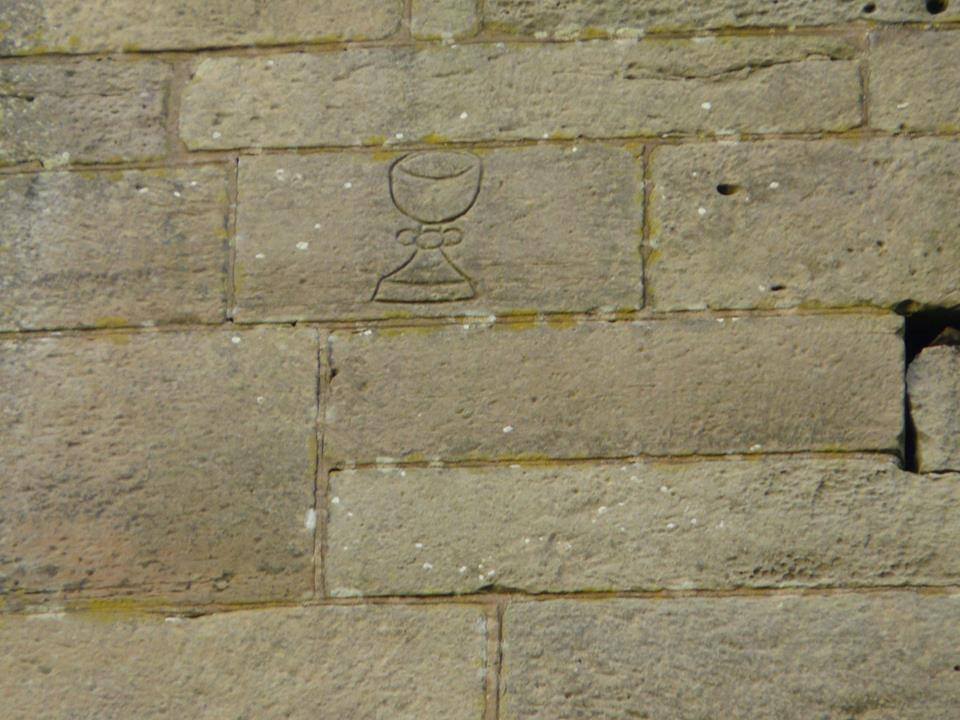
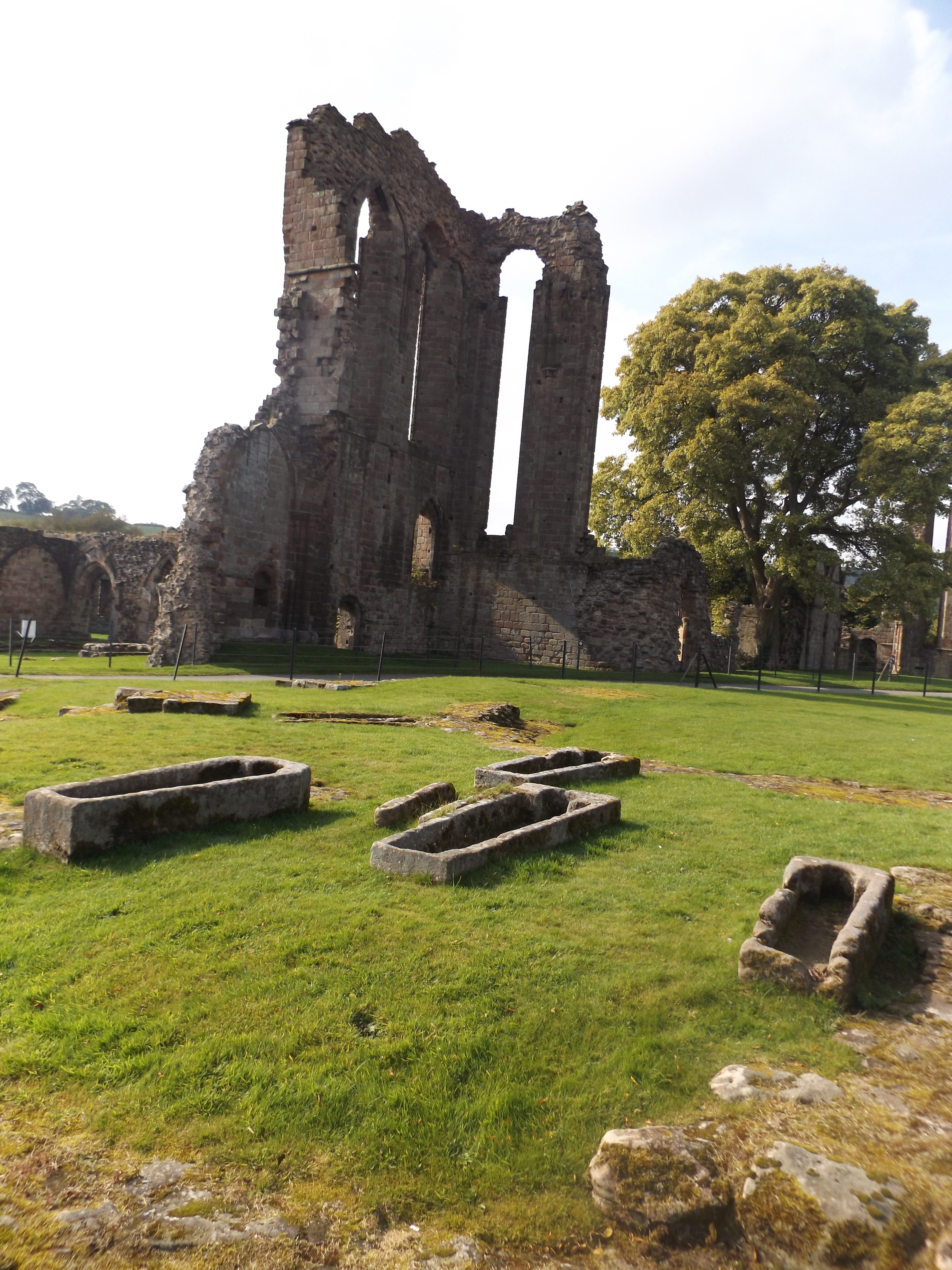
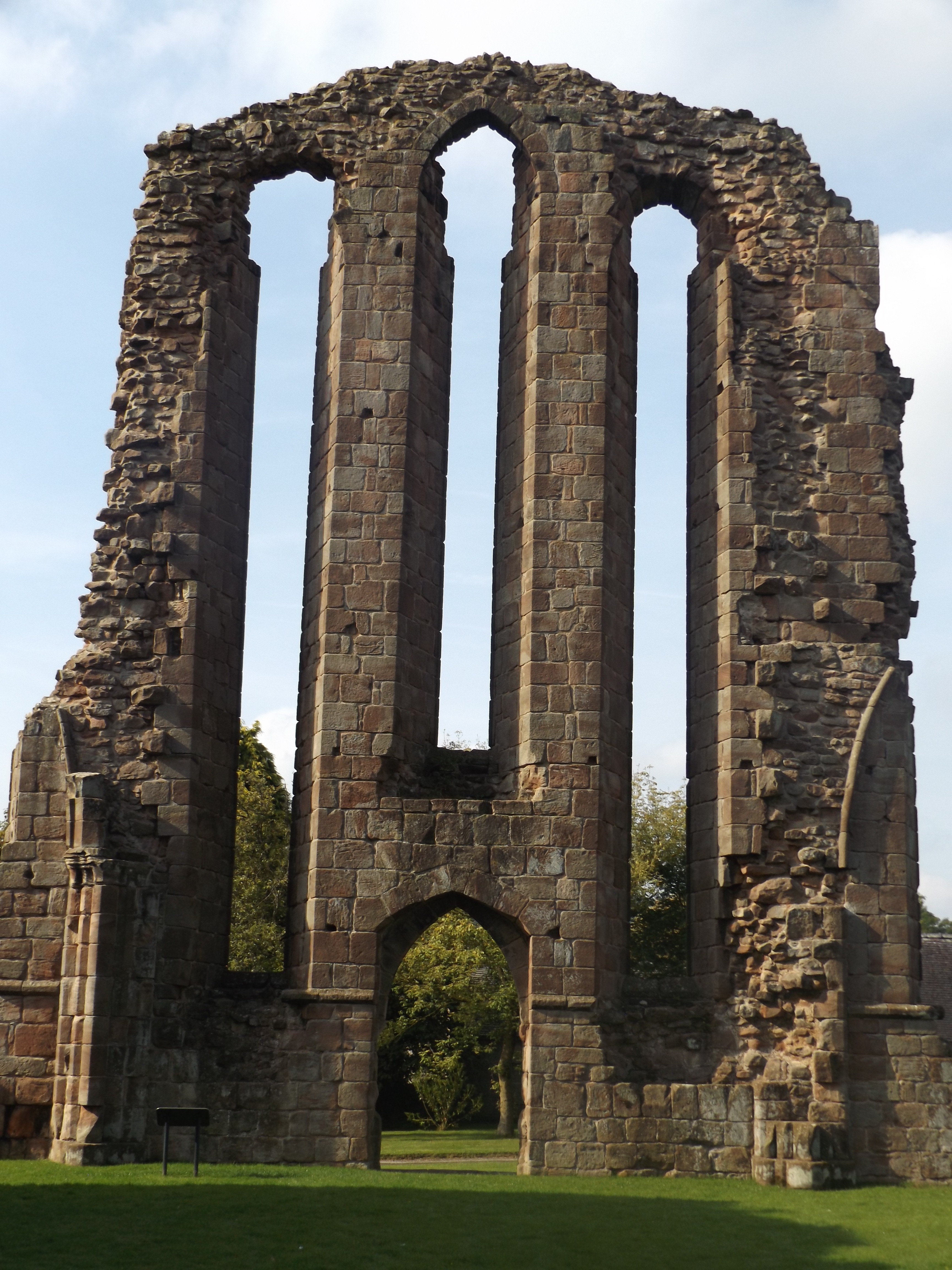
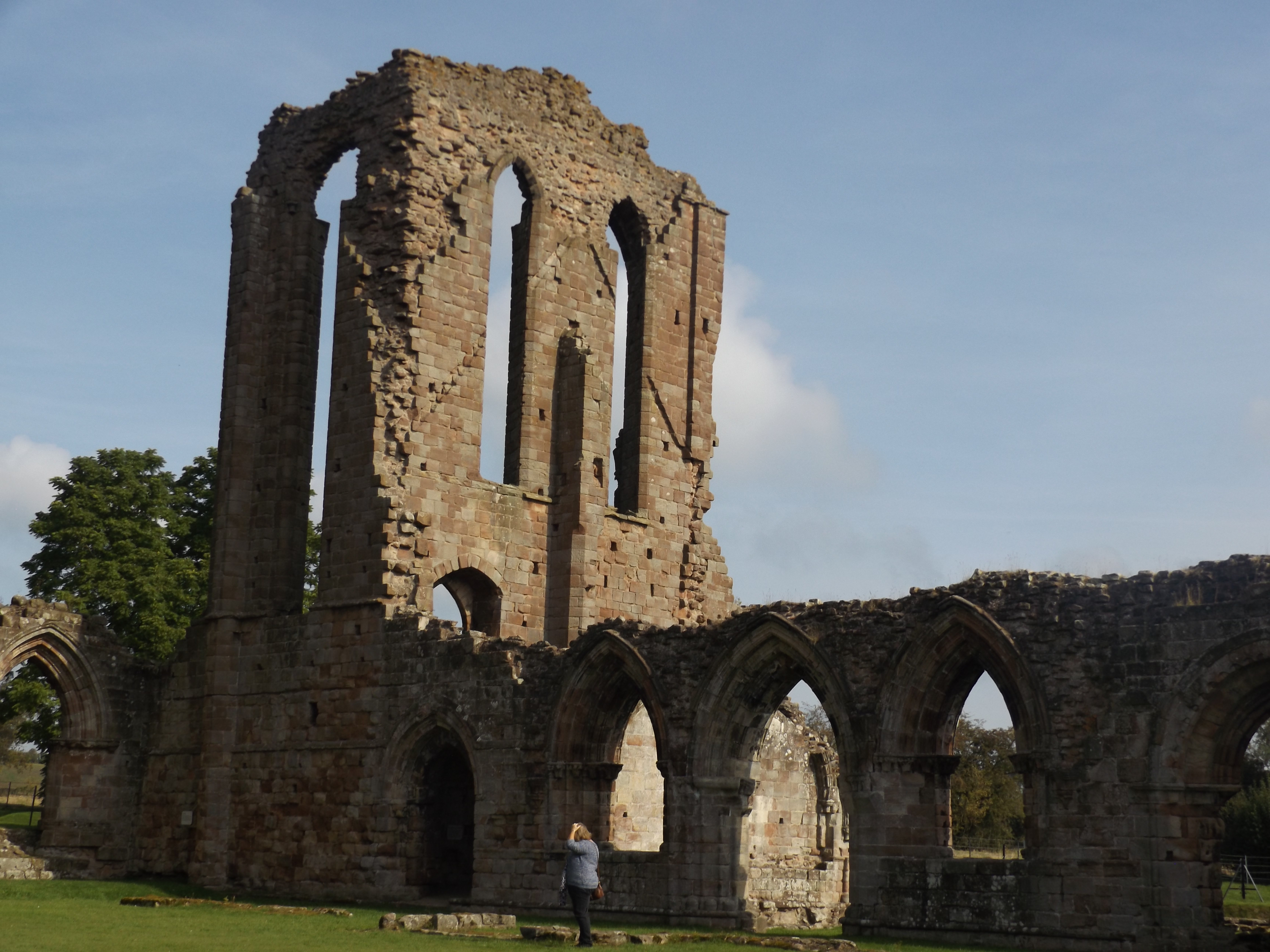
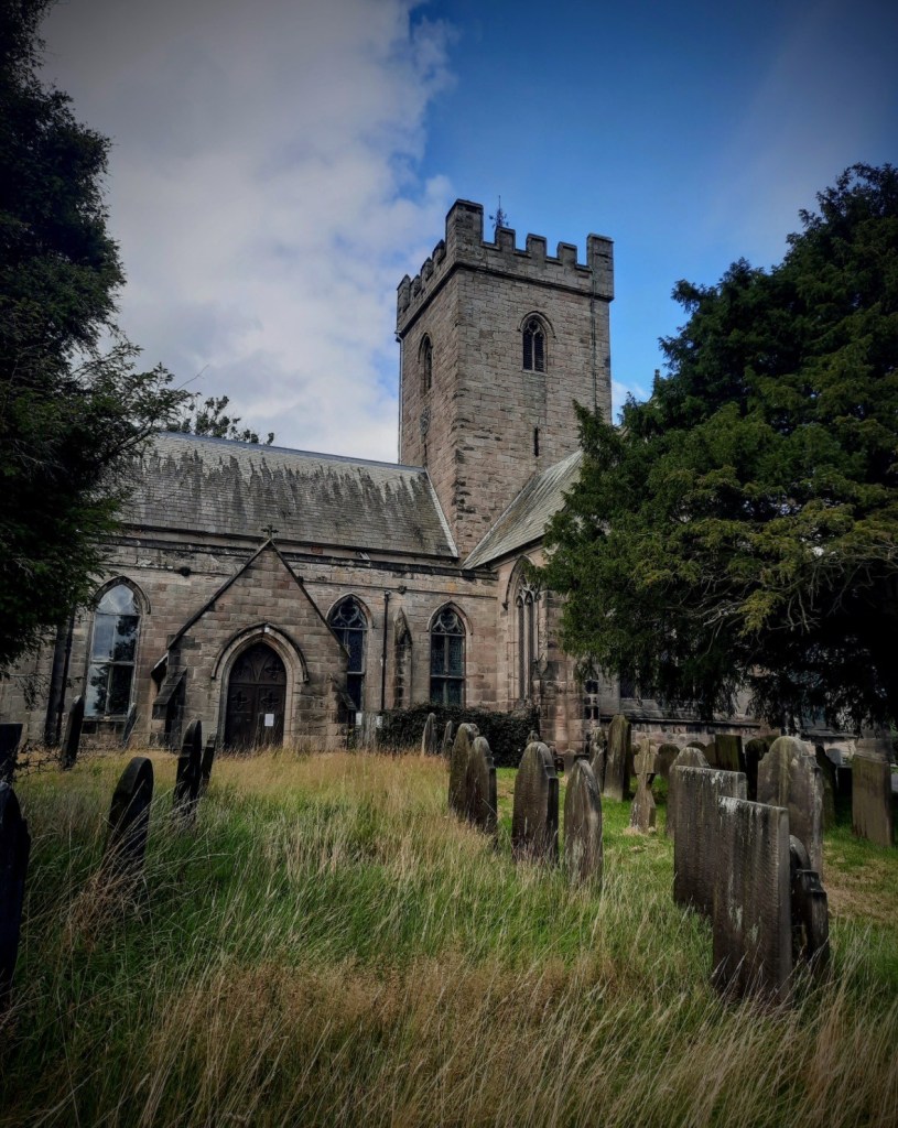
I was still feeling the effects of the lunar eclipse in the early hours of Monday on Tuesday morning. Not in a spiritual way, I was just knackered from staying up. However Croxden, the first stop on my rambles around the North of the shire last week, was a sight for my sore eyes. The tiny village is dominated by the ruins of a Cistercian Abbey founded in 1176 by Bertram de Verdun of Alton Castle (1) for the souls of his predecessors and successors.

Remains of 12thc Alton Castle founded by Bertram de Verdon. Not open to the public. As I found out...

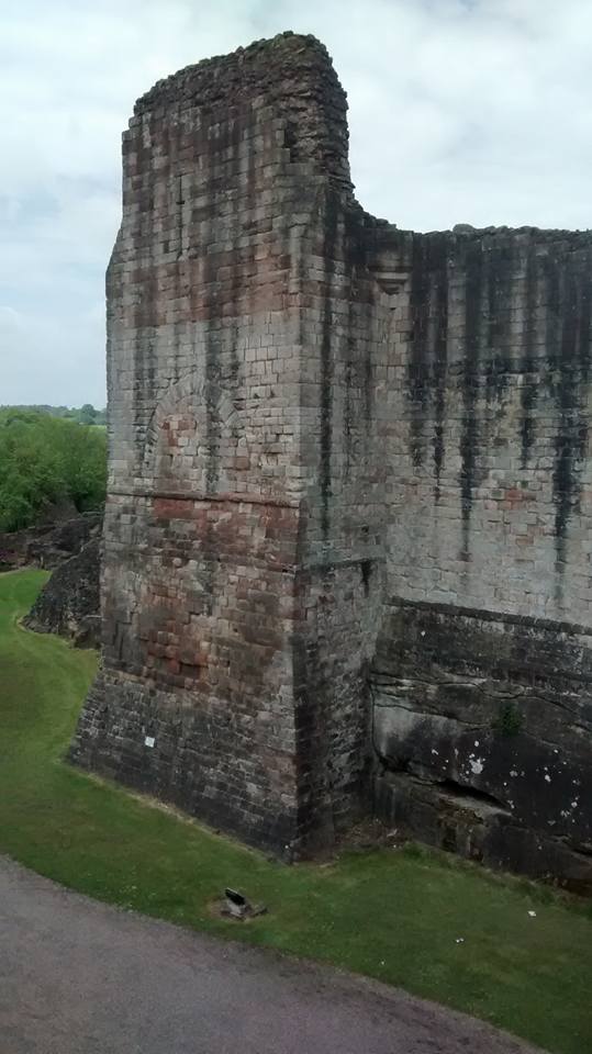
Remains of 12thc Alton Castle founded by Bertram de Verdun.

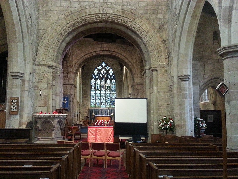
What is left of the semi-circular East end of the abbey church, unusual in England and probably inspired by the French designs the Abbey’s patrons would have known, lies to one side of the road that someone decided to cut through the site. The nave, south transept and other monastic buildings lie on the other and you can see a plan showing what is still visible above ground and what has been lost here. In 1288, a priest from Walsall called William de Schepisheved, was given the task of chronicling life inside and out of these Abbey walls.  He worked backwards to 1066 and contemporaneously until 1320 when the entries in his hand stop, although the chronicle continues until 1374.

Blood Moon. Just in case you didn't see one of the three million photos of it shared online,

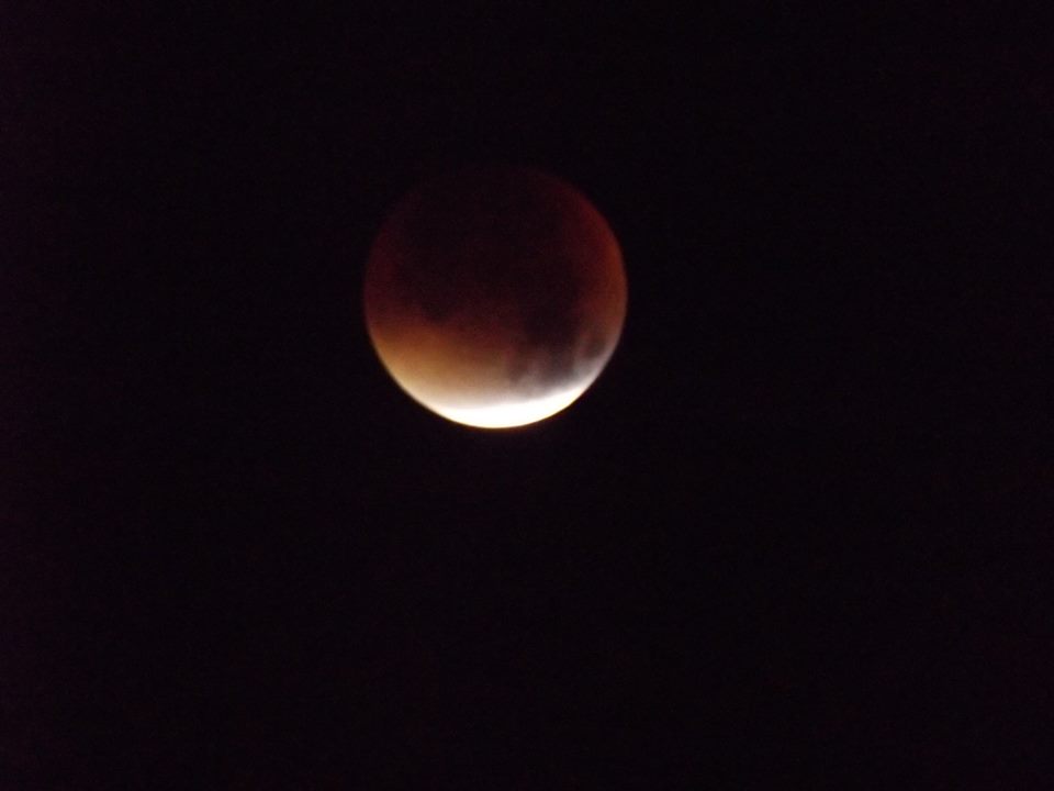
Blood Moon. Just in case you didn’t see one of the three million photos of it shared online,

We tweeted and shared our photos of the lunar eclipse. William the Chronicler recorded the celestial events he witnessed in the annals. Understandably for him and those of his time, eclipses were considered bad omens, often linked to any conflict, pestilence or bad weather that occurred. William records a solar eclipse in July 1330 and connects it to the floods and unseasonable weather which occurred two months before and for three months after, resulting in a late harvest, “…they had scarcely reaped the last of their corn with the greatest toil on the feast of All Saints and they had at last collected their peas into barns and outhouses on the feast of the blessed apostle Andrew. And what is so remarkable to see and hear, on the feast of All Saints and of St Martin fresh peas in their shells were given to the convent in the refectory instead of pears and apples”.  Another notable event in July 1301 appears in the Abbey’s annals describing how, “on the day of the Blessed Mary Magdalene, about the sixth hour, a great earthquake took place, to such an extent that all the persons in the convent, being at their first refection, were dismayed with a sudden and unlooked-for trembling”.

The chronicle also documents a connection between the abbey and Lichfield. William recorded that on Easter Eve in 1313, the great bell of the Monastery was broken by mischance and a man called Henry Michel came from Lichfield with his youths to cast another. It was reported that his first attempt failed but he started afresh and completed by the Festival of All Saints. It seems likely that this was Henry the Bellfounder who granted Lichfield’s Franciscan Friars the springs near Aldershawe which would later supply water to the whole of the city.

Plaque on Lichfield's Clock Tower, the base of which was once the water conduit which stood near the Friary.

Plaque on Lichfield’s Clock Tower, the base of which was once the water conduit which stood near the Friary.

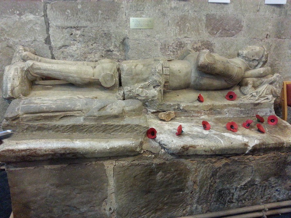
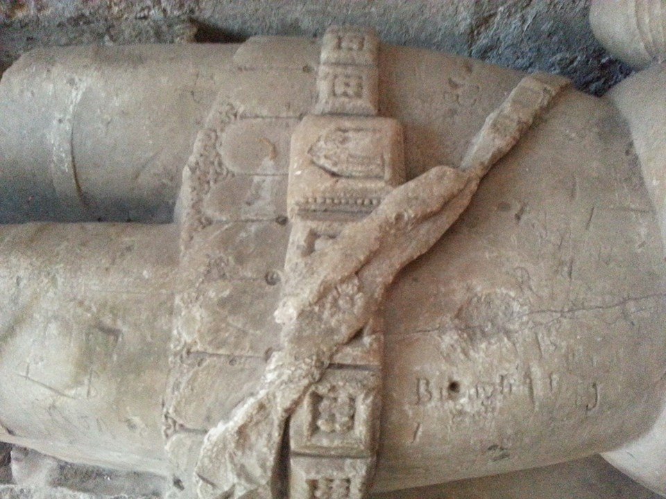
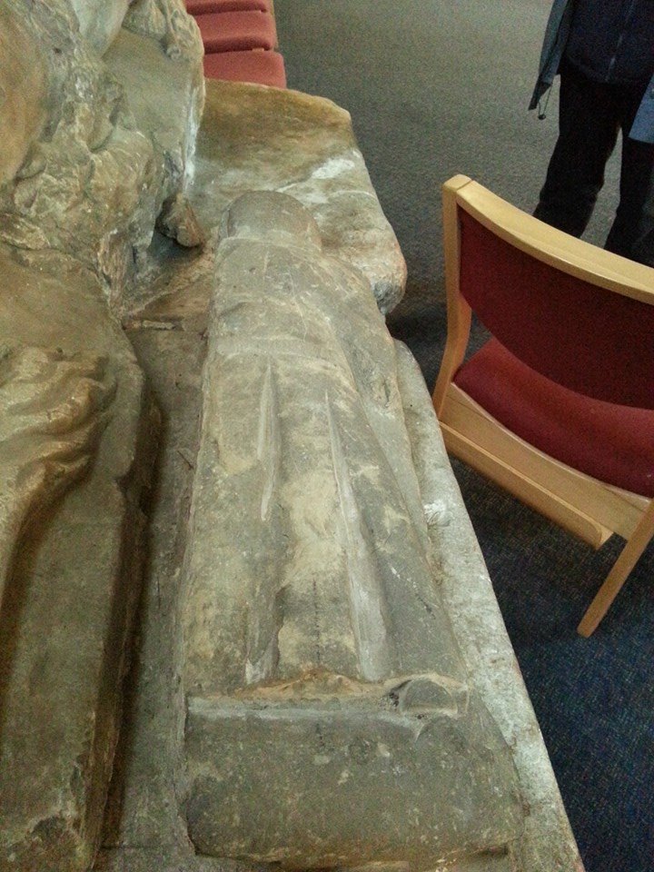
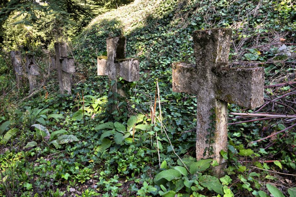
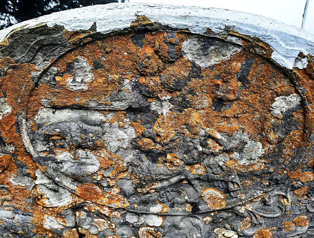
As well as life at the abbey, Death inevitably also features in the chronicle. There are the descriptions of the burials of the Verdun family including that of Lady Joan Furnival, eldest daughter and heir of Theobald de Verdun, who on October 2nd 1334, “was taken by untimely death in childbirth; for on the day she died she was only thirty years and almost two months” and was “buried near her ancestors between Lord Nicholas de Verdun, son of the founder, and her ancestor and Lord John de Verdun, her great-grandfather”. Their now empty stone coffins can be seen alongside the ruins at the east end of the church.

DSCF0302

Stone coffins at Croxden.

The entry for 1349 simply and bleakly says, ” There was a great pestilence throughout the whole world.” Nothing more. No indication of how many succumbed to and how many survived the plague here in Croxden.  The following year, 1350, another single sentence notes, “This year was a jubilee” (2), and then there is nothing until the harrowing entry made in 1361 which records, ” A second pestilence took place, and all the children that were born since the first pestilence died.” In the absence of detail, I did a little reading between the lines. After ten years, plague had reared its ugly head again and although overall mortality rates were lower than in the first outbreak, the disproportionate number of deaths amongst the young in this second wave led to it being known as ‘the Children’s Plague’. Was this was because those who had survived the plague the first time around had some sort of immunity that the children born subsequently did not? I don’t know. I’m not sure that anyone does for sure. In 1369, another ‘visitation’ is recorded.

West front of the Abbey Church

Five years later the Chronicle ends but not before recording two further natural disasters affecting the Abbey – a flood destroying all the grass growing near the water together with all the bridges across the River Churnet, and a tempest which took the lead off the dormitory, infirmary, and abbot’s chamber, throwing down half the trees in the orchard. Plague and poor harvests took their toll and by the end of the fourteenth century, the Abbey was in decline.

DSCF0278

One thing that doesn’t seem to appear in the Chronicle is the ‘fact’ that King John’s Heart is buried at Croxden. Possibly because it isn’t. I first came across the claim in Arthur Mee’s guide to Staffordshire and since have found several other sources saying the same, including William White’s Directory of Staffordshire (1851), Samuel Lewis’ Topical Directory of England (1831) and The Gentleman’s Magazine (1823). Trouble is other, more reliable sources say it’s at Croxton, Leicestershire including the Charter Roll of 1257. I’m sorry to say, I think we have to concede this one to our foxy neighbours.

A drawing of the effigy of King John in Worcester Cathedral from "HISTORY OF ENGLAND by SAMUEL R. GARDINER

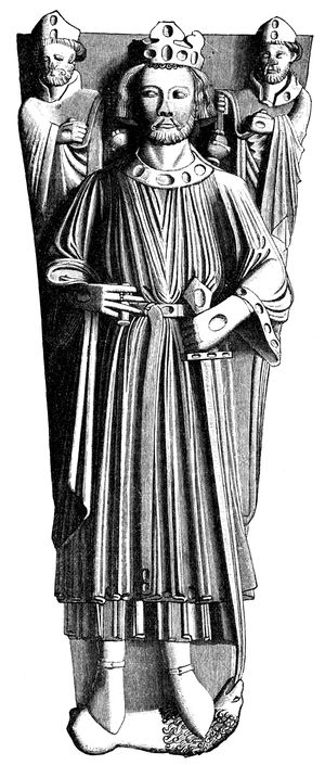
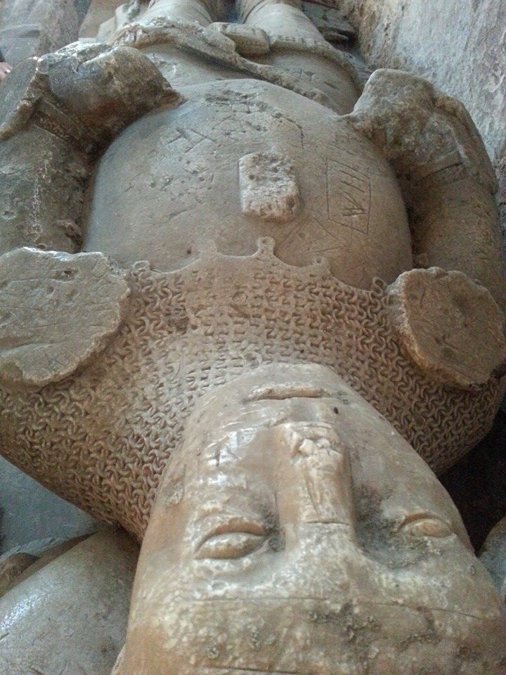
A drawing of the effigy of King John in Worcester Cathedral from “HISTORY OF ENGLAND by SAMUEL R. GARDINER

The King’s bowels were also said to have been removed at the time of his death and buried somewhere in Croxton, and to quote Simon Schama, their removal left John, ‘as gutless in death as he was said to have been in life’. The majority of John’s body rests in Worcester Cathedral, although more in pieces than at peace. When the tomb was opened in 1797, it became apparent that the bones had been disturbed, with the jaw lying by an elbow and all but four of the teeth and most of the finger bones missing – the King’s hands presumably having fallen into the hands of souvenir hunters.

The end of the road for Croxden came on 7 September 1538 when Dr. Thomas Leigh and William Cavendish received the surrender of the abbey and the roof was removed to prevent the Abbot and resident six monks from continuing to use the site. Although Croxden Abbey has been privately owned since then, it has been under state guardianship since 1936. Today, the ruins are cared for by English Heritage and it’s absolutely free to go and explore them (although I’m sure they’d appreciate a donation). Unlike staying up all night to watch a lunar eclipse, I can highly recommend it. More information on visiting and directions here.

Notes

(1) I had no idea there was a castle at Alton until I went to Alton with a friend and saw a sign for it. As we found out, it is not open to the public.

(2) I suspected that a jubilee in this context did not mean what I thought it did so I of course googled it and discovered that jubilee years had been started by Pope Boniface in 1300, and to be celebrated every hundred years thereafter. However, Pope Clement VI later amended this as people’s average lifespan was too short and so many would not live to see one. Plus there was money to be made from pilgrims. Pope Paul II later amended the frequency of jubilee years to be every twenty five. For anyone interested, the next one will be in 2025.

Sources:

https://lichfieldlore.co.uk/wp-content/uploads/2015/10/094-2009web.pdf

Self-representation of Medieval Religious Communities  Anne Müller, Karen Stöber

CROXDEN ABBEY: ITS HISTORY AND ARCHITECTURAL FEATURES.

BY CHARLES LYNAM )(North Staffordshire Field Club)

The Gentleman’s Magazine, and Historical Chronicle, Volume 89, Part 2

The Odd Couple

According to Pevsner, the Church of St Lawrence features some of the most exciting Norman work in the county.  Here be dragons and other fantastical creatures, Saxon and Scandinavian influences, a green man and other ancient faces. There are no wolves though.

Norman arch, Gnosall church

Norman arch, Gnosall church

Carving at Gnosall

Carving at Gnosall

Possible Saxon stonework, Gnosall

Possible Saxon stonework, Gnosall

Legend has it that the last wolf in Staffordshire was killed here in Gnosall in a pit near Brough Hall and that the effigy in the Lady Chapel is that of its slayer, Baron Brough  As much as I wish it were true, there is no evidence for this tale and no reason to believe the Baron ever even existed outside of Gnosall mythology. Several other names have been linked with the alabaster knight over the years, but his true identity remains unknown. Whilst such personal details are lacking, there is physical detail here in abundance, from the broken angel and the helmet at his head, to the lion at his now missing feet and experts have used these features to date the monument to the early fifteenth century. In recent years, the knight has been joined by the church’s only other effigy, taken from the recess on the opposite side of the church known as the Easter Sepulchre.

Two effigies at Gnosall church

Two effigies at Gnosall church

The unknown knight of Gnosall

Defaced – the unknown knight of Gnosall

Gnosall effigy belt

Even less is know about this second effigy, but due to its diminutive stature, it is often described as depicting a child. However, after visiting the church, words that I’d read in a paper by Dr Sophie Oosterwijk in relation to the famous Stanley Boy monument at Elford came back into my mind – “A small-sized tomb may deceive the beholder into thinking that it must commemorate a child, but there may be other explanations”. One of Dr Oosterwijk’s other explanations is that these tiny tombs may represent heart burials. It’s not only the size of the effigy that’s convinced me that someone left their heart here in Gnosall, but also the position of his or her hand over the chest, a feature it has in common with another example thought to be a fourteenth century heart burial at Coberley in Gloucestershire.

Effigy possibly depicting a heart burial at Gnosall

Effigy possibly depicting a heart burial at Gnosall

Despite the abundance of surviving Romanesque architecture here, the church is missing its original font.  However, at nearby Bradley. and Church Eaton there are examples which date to the twelfth century and recall some of the patterns and themes found at Gnosall, perhaps giving us an idea of what the Norman font at St Lawrence may have looked like. Interestingly, the broken Church Eaton font was reinstated at St Editha’s after apparently being found buried in a garden, and so it’s possible that Gnosall’s is out there somewhere, awaiting discovery under someone’s lawn.

One of Gnosall’s most intriguing features can be found outside, high on the south side of the church where stonemasons (we assume) who extended the tower in the mid fifteenth century have carved a large chalice into the stonework alongside the belfry window.

South face of the church tower at Gnosall

South face of the church tower at Gnosall

Chalice carving on Gnosall church tower (photo by Kenneth Ingram)

Chalice carving on Gnosall church tower (photo by Kenneth Ingram)

Less mysterious in origin, but still of interest, are the grooves along the wall, said to have been created by the sharpening of arrows when the grounds were used for archery practice.

Arrow grooves, Gnosall Church

Arrow grooves at Gnosall Church

There is also a rumour that this wall of the church bears the scars of target practice during the Civil War (Rodwell: 223). What we do know for certain about the church of St Lawrence and the civil war is that there are two soldiers buried here. The parish register records that on 1st October 1642, a tall young man known as John Bayne (or Bayle), ‘one of the King’s souldiers’, was buried here and that on 25th March 1643, David James, another of ‘the King’s souldiers’, was laid to rest. The date of the second may be especially significant, coming less than a week after the Battle of Hopton Heath, fought just ten miles away. Amidst the other burials and baptisms of the parish register, an interesting entry appears on an otherwise blank page. At some time between 20th March 1684 and 19th April 1685, an ‘unlettered’ hand has written the following:

Fere god and honour the King
Honor your parents at all times
Wimins tongues air like [unfinished]

Whether the writer of the verse was interrupted or simply ran out of inspiration is unknown, but we are left to draw our own conclusions on the nature of  ‘wimins tongues’. However, when it comes to singing the praises of this incredible building, I shall not be holding mine. See it for yourself on the weekend of 4th/5th July 2015, when the Church of St Lawrence, including the tower, will be open for tours as part of the G-Fest celebrations held in the village each year. Now that is exciting.

Tombstone in the graveyard at the Church of St Lawrence, Gnosall/

Tombstone in the graveyard at the Church of St Lawrence, Gnosall

With thanks to Norman and Sheila Hailes, for their tour and invaluable knowledge of the church, and to Kathleen Ingram and Cllr Kenneth Ingram and the other residents of Gnosall, for showing us around not once, but twice!

References:

Rodwell,W. (2012) The Archaeology of Churches Stroud: Amberley

Oosterwijk, S. (2010)  Deceptive appearances. The presentation of children on medieval tombs Ecclesiology Today

http://www.gnosallweb.org.uk/articles/stlawren.htm

Broken Record

The ‘Heritage at Risk’ register for 2014 was published by English Heritage today. The Register includes grade I and II* listed buildings, grade II listed buildings in London, and all listed places of worship, scheduled monuments, registered parks and gardens, registered battlefields and protected wreck sites assessed as being at risk.

There are eight entries from around the Lichfield District this year, including scheduled monuments at Alrewas, Elford, Fradley and Streethay, the Fazeley and Bonehill conservation area and three buildings, namely, the Angel Croft Hotel on Beacon Street, the Manor House at Hamstall Ridware and the old church tower at St John’s in Shenstone.

Angel Croft Railings

The Angel Croft Hotel has been deemed ‘At Risk’ for many years, but there is now a glimmer of hope that Lichfield’s fallen Angel may be saved. This year’s entry notes that, ‘permission has been granted for conversion to apartments with an agreement to secure the repair of the gates and railings. Work should start in the summer’. Time will tell, but I really do hope that 2014 will be the last time that the Angel Croft appears on the register.

Whilst the plight of the decaying Angel Croft is well known in Lichfield, other local entries on the list may be less familiar, but no less worthy of salvation. Fazeley, according to Lichfield District Council, ‘represents a remarkably intact industrial community of the period 1790-1850. It contains all the principle building types necessary to sustain the community; terraced housing, mills, factories, a church, a chapel, public houses, a school and prestigious detached Georgian houses’. They go on to say that, ‘the waterways, pools and associated structures built by Robert Peel Snr are an important part of Fazeley’s industrial heritage and have archaeological significance. Their significance extends beyond just the immediate locality as they represent one of the most important water power systems dating from the early part of the Industrial Revolution. As a contrast to Fazeley’s industrial heritage, the appraisal tell us that, ‘the historic hamlet of Bonehill…. is an important remnant of the areas agricultural past and despite the developments of the twentieth century still retains a peaceful, rural feel. It has a direct association with the nationally renowned Peel family’.

Yesterday, Gareth Thomas, GIS Manager at Lichfield District Council, uploaded a number of photos from their archive to Flickr. It just so happens that alongside the reminiscence-tastic images of Lichfield shops and businesses, Gareth has uploaded a number of photographs of the conservation area at Fazeley and Bonehill, showing us just what is at risk here, hopefully inspiring us to pay a visit ourselves.

Taken from Lichfield GIS photostream, Flickr

Taken from Lichfield GIS photostream, Flickr

Taken from GIS Lichfield photostream, Flickr

Taken from GIS Lichfield photostream, Flickr

Taken from GIS photostream, Flickr

Taken from GIS Lichfield photostream, Flickr

Taken from GIS Lichfield, Flickr

Taken from GIS Lichfield photostream, Flickr

Also making an appearance in both the Lichfield District Council’s photo collection and on the ‘At Risk’ Register, is the Manor House at Hamstall Ridware. The pictures speak for themselves – the condition of watchtower is so bad that it is deemed at risk of collapse. Perhaps appropriately for something that may not be long for this world, I first caught sight of it from the churchyard of St Michael’s and All Angels and managed to find out a little about its history here.

Taken from GIS Lichfield photostream, Flickr

Taken from GIS Lichfield photostream, Flickr

Taken from GIS Lichfield photostream, Flickr

That’s quite a crack! Taken from GIS Lichfield photostream, Flickr

Hamstall Ridware manor 3 Hamstall Ridware manor and church

Over in Shenstone, it seems there are ongoing discussions between the council, the Parish Council and the church regarding the old tower. At least for the time being, the structure is ‘considered stable’ – let’s hope that they all start singing from the same hymn sheet soon.

Old tower at St John's Shenstone, by Jason Kirkham

Old tower at St John’s Shenstone, by Jason Kirkham

Same time, same places next year folks? Let’s hope not…


Thanks to Gareth Thomas and Lichfield District Council for the archived photos of Fazeley and Hamstall Ridware, and to Jason Kirkham for his photograph of the old tower of St John’s at Shenstone.

Prior Engagement

Yesterday, I visited Hawkesyard, a place known to previous generations by a variety of names including Le Hawkeserd in Hondesacre, Armitage Park, Spode House and Hawkesyard Priory. The first house known to have existed here was a moated manor owned by the Rugeley Family, who appear to have had a variety of spellings for their own name. According to an article in the Lichfield Mercury on February 3rd 1950,  a document describing the funeral of Richard Rugeley, who, ‘…departed this mortal and transitory life on Saturday night, the 5th July 1623 at his house at Hawkesyard’, was signed by Symn Ruggeley, Thirkell Rugeley, Henry Rugley and Thomas Rugsley.

Information on the early days of Hawkesyard is sketchy but it’s thought the original hall, pulled down in 1665, was much closer to the River Trent, about half a mile to the west of Armitage Church. Nothing is thought to remain and nothing much more is known about Hawkesyard until 1760, when the estate was renamed ‘Armitage Park’ by Nathaniel Lister, who built a gothic style mansion on the sandstone hill above the site of the original hall. Beneath Lister’s new house was a plaque recording that, ‘These cellars were cut out of the rock by Richard Benton and Sons, anno Domini 1760, for Nathaniel Lister, Esq.’ Perhaps it’s still there?

Hawkesyard Hall, Armitage by Jason Kirkham

Hawkesyard Hall, Armitage by Jason Kirkham

From the 1840s, Hawkesyard was home to Mary Spode and her son Josiah, the fourth generation of the Stoke on Trent pottery dynasty, and the first not to work in the family business. Mary died in 1860, and Josiah’s wife Helen died eight years later. Both are buried at St John the Baptist in Armitage, the Anglican parish church where Josiah was the organ player and warden. Despite these strong links to St John’s, Josiah Spode converted to Catholicism in 1885, along with his niece Helen Gulson, who lived with him at Hawkesyard. On his death in 1893, Spode requested that Helen should continue to live at Hawkesyard until her death, after which the estate should be passed to the English Dominican Order of Friars. However, Helen decided to move out of the hall and into a cottage on the estate, allowing work on the new Priory and Church to begin almost immediately. Some say that this decision was inspired by a vision of the Virgin Mary appearing to Helen in the grounds of the estate, and that the altar of the new Priory Church of St Thomas Aquinas was supposedly erected over the site of this apparition.

The Priory Church at Armitage by Jason Kirkham

The Priory Church at Armitage by Jason Kirkham

Priory Church by JAson Kirkham

Priory Church by Jason Kirkham

Priory Church by Jason Kirkham

Priory Church by Jason Kirkham

Priory Church by Jaosn Kirkham

Priory Church by Jason Kirkham

The Dominicans left Hawkesyard in 1988, but their benefactors and some of their brethren remain. Josiah Spode and Helen Gulson are interred in a small chapel within the Priory Church, and outside in the gardens, are the simple concrete crosses marking the graves of monks.

Monks' Cemetery, Hawkesyard

Monks’ Cemetery, Hawkesyard by Jason Kirkham

As beautiful as the church is, it’s the gardens at Hawkesyard with their subterranean features, which have captured my imagination. They appear to have had the same effect on this reporter from the Lichfield Mercury, who visited in the Summer of 1935, and wrote the following description:

Down weather-worn and feet-worn steps, through charming little rockery glades, rich with lichens, ferns and its more wild brother – bracken- time and nature has made this wonderful spot more beautiful in its wildness. Some pathways lead down through fine old arches, gloriously hewn or erected deep into the bowels of the earth, or so it appeared; while others lead gradually upwards through narrow passages. Opening into a small glade we suddenly came across the entrance to the well-known underground passage which, descending steeply, rises just as abruptly in another part of the rockery, far remote from each other. Today this passage is awesome in appearance, the ground underfoot being feet deep with decaying leaves, and only the most venturesome pass out of the light of day into its unknown blackness. It was a curious and certainly thrilling experience to traverse this maze of paths. Another similar grotto housed a large shelter, carved in stone and the actual rock; a sort of summerhouse with a double archway entrance. In another we discovered some beautiful carving in white stone of three saintly figures, obviously beautifully carved, but decaying and rotting with age. We could not discover their identity or purpose, although they surmounted what could easily have been a small natural altar, secluded in the quiet of this wonderful grotto.

Eighty years later, there are no saints to be found in this wild part of Hawkesyard. Time and nature have now ravaged its beauty but have not diminished its curiosity. Several theories exist as to who carved these grottos and tunnels out of the rock and why, but as an investigation into the overgrown site in the mid 1990s concluded, ‘the function of all the above is not clear’. Any ideas?

Sunken Garden, Hawkesyard by Jason Kirkham

Sunken Garden, Hawkesyard by Jason Kirkham

Hollow rock at Hawkesyard by Jason Kirkham

Hollow rock at Hawkesyard by Jason Kirkham


Sources

Photos by Jason Kirkham

http://www.hawkesyardestate.com

Hawkesyard, Armitage, Staffordshire: A Documentary and Field Assessment. Chris Welch

Staffordshire Parks and Gardens Register Review (1993-96). Parts I and II. Staffordshire County Council

http://www.armitagewithhandsacre.co.uk

http://www.staffordshiregardensandparks.org/images/Newsletter/Issue40

Lichfield Mercury Archive

Well Wishers

I’ve written previously about how the appearance (and apparently, the actual location!) of St Chad’s well has changed over the years here, but I’ve recently found some contemporary accounts of the well’s previous incarnation – a ‘vertical tube built of engineering bricks, covered with a kind of gloomy sentry-box of stone’, which had apparently become so neglected in the 1940s that only a few inches of stagnant water covered in a green scum remained in the bottom of the pool. (1)

In November 1946, the Bishop of Stafford lamented that the well had once been a place of great pilgrimage but had fallen into a state of neglect and considerable disrepair and in April 1948, E Sutton, a former caretaker of the well, described it as having degenerated into a wishing well. A few weeks later, Mr Sutton submitted a further letter to the Mercury, advising, ‘I have again visited the site and found it in a worse state than on my visit there last Autumn. Then boards covered the Well. These are now removed and the Well is full of rubbish, among brick-bats and wood being a worn out coal bag! I noticed too, among the bricks and stonework lying around in wild confusion the ancient ‘St Chad’s Stone’, which the historian Leland, writing of his visit to the Well some four hundred years ago, states was then believed to be the very stone upon St Chad stood in the icy water as an act of penance, it then being the bottom of the Well. When the small building was erected over the Well in Stuart times, this stone was incorporated into the building, no doubt in order to preserve it. Many hundreds of hands have been placed upon it, mostly with reverence, since. It now lies among the rubbish, one corner broken. A fitting symbol of the ideals of 1948!’ (2)

St Chads Well

St Chad’s Well today

Saint Chad's c.1915. Taken from Wikipedia

Saint Chad’s Well c.1915. Taken from Wikipedia

I’m intrigued by this reference to ‘the ancient St Chad’s stone’. When James Rawson described the site prior to his restoration in the 1830s, he noted that, ‘the well-basin had become filled up with mud and filth; and on top of this impurity a stone had been placed, which was described as the identical stone on which Saint Chad used to kneel and pray!’. Despite Rawson’s apparent scepticism about these claims, was he somehow persuaded to use this stone in his new well structure, thereby perpetuating the myth? I’d love to see what went on in those discussions and I’d really like to know what happened to this legendary stone. St Chad may not have been anywhere near it, but the fact that people believed he had should have made it worth saving for posterity’s sake.

Water in the well

Water in the well

Unfortunately for Mr Sutton, the restoration of the well did not put a stop to people using St Chad’s Well for wishes, as evidenced by the layer of coins that still glint beneath the water, tossed in at some point over the last half century or so. It’s often suggested that this is the continuation of a ritual that our ancestors were carrying out a long, long time before St Chad arrived in Lichfield. Some things change. Some stay the same.

Notes

(1) The octagonal stone well structure erected by Rawson in the 1830s, as described by the Lichfield Mercury on May 6th 1949!

(2) A little off topic, but it’s amusing to see that it’s not just nowadays that letters appear in the Lichfield Mercury suggesting that society is going to hell in a handcart. Once again, some things stay the same…