The Road to Ruins

When they were excavating the Wyrley to Essington canal at Pipehill at the end of the eighteenth century, a 500 yard section of a Roman military barricade (or palisade) made from trunks of oak trees was discovered.It was thought to have originally stretched from Pipe Hill to the Roman settlement at Letocetum. Well, unfortunately I didn’t come across that (if it even exists anymore) on my walk from Pipe Hill to Wall and back. But here’s what I did find…

A lovely view of the city accompanied me for part of the way (although I can only count four spires. If it’s Five Spires you’re after, look here)

SAM_0896Not too far down the road, I peered over a bridge to see the disused railway line that runs from Lichfield to Walsall. You can get down to the track, although as I was on my own I didn’t risk it, the bank being steep and me being notoriously clumsy. I wonder how far you could walk along the overgrown rails? Rather than regurgitate a history of the railway here, far better is to direct you to the people who really know what they are talking about – the South Staffs Rail group. Their website, full of information, photographs and videos of the line, as it was and is, can be found here, and you can also find out about their campaign to have the line reopened.

Rail bridge Pipehill

SAM_0905

As I continued along Wall Lane, the wind was blustery and the sky dark and it almost felt autumnal. However, with bluebells and stitchwort along the roadside, hawthorn in the hedgerows and the swallows flitting over the fields of oilseed rape there was no real mistaking this was the merry month of May. I saw pheasants and rabbits and heard and saw all kinds of birds whose names I don’t know, but wished I did. However, all attempts to photograph them ended like this. I’m sticking to bricks and stuff that doesn’t move.

SAM_0879Up at St John’s in Wall, I was pondering what might have once stood here on the site of the modern(ish) church built in 1830. Some have speculated a shrine to Minerva, but my thoughts were interrupted by this graffiti on the church yard wall.

SAM_0922

I’ve got a real thing about names carved into stone anyway, but I really have to admire the chutzpah of B Thornton of Redcar in Yorkshire for leaving  practically a full postal address. Wish there was a date though… It seems he or she wanted people to know that that they’d been here but just what were you doing in this small, ancient Staffordshire village B Thornton of Redcar? Were you here to see the ruins too?

SAM_0931

Whilst I was taking this photograph of buttercups growing where Romans once slept, I remembered that bit of childhood folklore about holding one beneath your chin to see if you liked butter. If you’re interested in science stuff, the explanation for how buttercups make our chins glow is here. It seems appropriate to share its Latin name here – ‘Ranunculus acris’. I think the acris bit means bitter, and I wonder if the flower’s common name started out as bitter cup and got corrupted on account of its beautiful golden colour? Anyway, back to the ruins.

SAM_0940 SAM_0944Out of everything, it’s the remains of this small Roman street, with some of its cobbles still intact that gives me the strongest sense of connection with the past. Perhaps it’s the knowledge that you are treading the exact same ground as those who walked here thousands of years ago? Or perhaps I’d spent too much time here, alone with my thoughts….

SAM_0933

Heading out of Wall, there’s a farmyard wall which I believe was built using stone robbed out from the Roman site. Oh and another little mystery – just how does a pair of pants end up in a hedgerow like this? On second thoughts, this is one I probably don’t want to know the answer to.

SAM_0951

SAM_0919

On the road back to Lichfield, down Claypit Lane I came across another relic of the railway. On the Fosseway Level Crossing is a signal box, built in 1875. Once again, I shall point you in the direction of the South Staffs rail site who have more information on this small but wonderful part of our history, and some photographs of the interior here. Also, there is a fantastic article on the South Staffs blog from a few years back, which I remember reading via Brownhills Bob’s blog, on Emily, who worked and lived at this crossing from 1946. You really should read it  – it’s brilliant and it’s here.

Fosseway signal box

SAM_0981

I was just about to leave the crossing and carry on back to Lichfield down Claypit Lane when I saw this.

SAM_0976

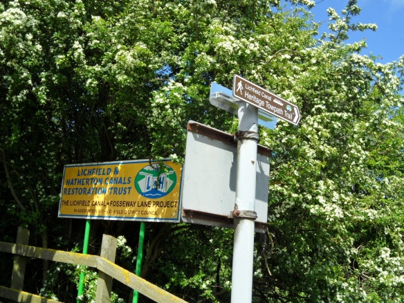
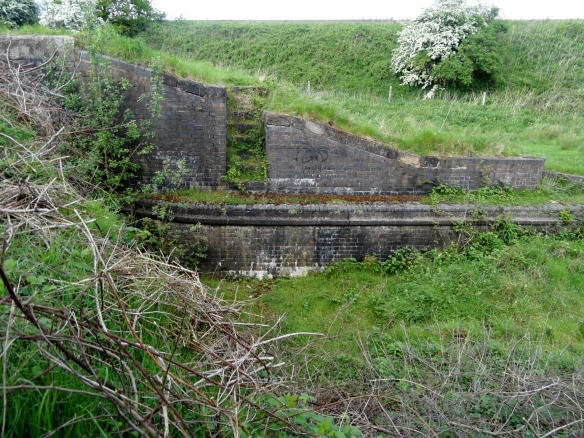
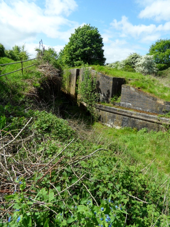
I’d heard about the trail via a talk that L&HCRT very kindly did for our Lichfield Discovered group, but hadn’t ever got around to finding it and now here it was! Once over the stile, the path takes you past what is left of this stretch of the Lichfield Canal.

SAM_0988

SAM_0990 SAM_0991

As with the railway line, much of it has been reclaimed by Nature who has decided that if us humans aren’t going to use it, then she’ll have it back thank you very much. I don’t know much about wildlife and ecology, but even I can see that this corridor is an amazing habitat for all sorts of flora and fauna. What does remain of the canal itself is fascinating, and being able to see it like this, in all its emptiness, really made me realise what an epic task building these structures would have been. And how deep it was.

I finished the walk near to Waitrose, once again amazed and delighted at just how much history and beauty there is so close to home. I’m certainly going to do it again and I recommend that you do too – it’s an easy five miles walk and even I didn’t get lost!

Sources:

file:///C:/Users/Kate/Downloads/50e_App4-Archaeological_Desktop_Survey_By_On_Site_Archaeology_Lt%20(7).pdf

http://www.pastscape.org.uk/hob.aspx?hob_id=304434

Cornercopia

Last week we went to the George and Dragon on Beacon St. After an outstanding pork pie washed down by a cheeky half, it was time to leave. On heading back towards the park, I noticed that the building on the corner of Beacon St and Gaia Lane was covered in graffiti albeit nothing of particular note, just patterns and the usual initials. However, I had a look in both directions and couldn’t see anything similar on the bricks of the adjoining buildings and so I’m curious.  Why this particular building? Is it due to its proximity to the pub, is it simply because it’s a corner where people would wait (for something or somebody…) or do you think there another reason?

The building on the corner of Gaia Lane/Beacon St opp. the George & Dragon


All The Small Things

Tomorrow’s walk will be different to today’s walk….I have walked past Christ Church three times in as many weeks. Each time was different. The first was a bleak midwinter day, the biting cold numbing my fingers as I photographed the stone heads around the church. By the second, the scene had changed and even the heads were capped in snow.

Whether somehow related to the snow or whether the weather was incidental, numbers on the reverse of head stones that I had previously passed were suddenly evident where I had never noticed them before. Interesting that only two of the several stones I could see from the road had numbers on them, so I’m guessing that they were some sort of reference mark made by the stone mason? Naturally, we look to the inscriptions on the front of headstones for information, but can the back sometimes tell us something as well?

On my third visit yesterday, the snow has been replaced by snowdrops and crocuses, the first flowers of the year and a welcome reminder after last week’s mini ice age that spring is on its way (I know we’re not out of the winter woods yet, but I’m optimistic!).

Another weather and season influenced walk was up Abnalls Lane on a wet and windy day.  Tipping my head back to gather my hair in a pony tail to stop it blowing in my eyes caused me to look up and notice fungi growing half way up a tree up high on a bank that may have been missed on a calm and sunny wander. On the same walk the bareness of winter revealed some sort of post in a hedge (I have no idea what this is – some sort of utilities marker?)

The light was poor and Abnalls Lane was more of a stream in places. With the amount of cars passing, it was only a matter of time before I ended up soaked or worse….so I changed my route. Later, outside the derelict Sandyway Farm, a pub known as the Royal Oak for the first half of the nineteenth century, one of the bricks had worked its way free of the decaying shell and lay under brambles alongside the Walsall Rd. I understand that the stamp ‘NCB Hamstead’ means it came from brickworks at the Hamstead Colliery in Birmingham, when it was part of the National Coal Board.

Is the C the wrong way around or is it me?

Admittedly, all of the above are small things but whether small things help you to build a bigger picture of the place you live in or even if they just make you smile, I think they’re worth noticing.


An Inconstant Stream

According to place name expert Margaret Gelling, Leomansley Brook has a pre-English name. It’s thought the name could contain the Celtic word lēmo, meaning ‘elm’ (1) or lēme meaning ‘limetree’ (2).

1- Conduit Heads; 2 – Start of Leomansley Brook?; 3 Site of Leomansley Mill/House/Manor; 4 – Former Beacon Place fishponds, now Beacon Park boating lake

The brook rises near to the conduit heads at Pipe Hall Farm, Burntwood (at a place I’ve just noticed was also known as The Dimbles, just as the area near to the Circuit Brook is/was!), and crosses the Lichfield/Burntwood boundary, to fill a series of pools on the edge of Leomansley/Sloppy Wood before meandering through Pipe Green.

As mentioned in my previous post, Leamonsley Mill was built on the brook at the edge of Pipe Green in the 1790s. There are a few traces of the industry that was once here – ‘Leomansley Mill Cottage’ is a little further back down the track towards Christ Church Lane and there are also some possibly related brick structures. The second photo shows the place where the brook re-emerges to flow through Pipe Green, and is shown on some maps from the late 19th and early 20th century as a ‘Spout’.

Taken June 2011. On old maps, this is marked as sluice. This part of the watercourse was filled with water once again this weekend

Taken December 2010. Shows as spout on old maps.

I found a recollection by someone who spent the summer of 1984 at the old mill cottages then known as Leomansley House (which they have included a photo of!) producing the first and only issue of what they describe as a ‘local anarcho-DIY philosophy magazine’. In their description of the old house, they describe how Leomansley Brook ran past the front door.

The other stories I’ve found about the pool relate to changes brought about by nature. In February 1902, the frozen pool was used for ice skating.  The Lichfield Mercury reported that on the Friday after the freeze, the pool was quiet, but by Saturday a group of ‘horrid hockey people’ (as one unnamed woman described them) had discovered it and monopolised the best part of the pool.

Another Mercury story, from April 1976 when the artist Eilidh Armour Brown lived at Leomansley House, tells of a water shortage at the pool

Lichfield District Council Staff had been prepared to move fish from Leomansley Pool, after the water levels dropped to a dangerous level for the fish. The fish were to be transferred to Minster Pool until the water level at Leomansley had risen. Luckily a storm that weekend brought the much needed rain and it was no longer necessary.

Things couldn’t have been more different this weekend. The normally dry part of the course along the edge of the woods was full, and levels in the pools were high, as you’d expect.

Taken November 2012. This part of the brook is normally dry.

Taken November 2012. I was told there used to be a bridge somewhere near here for farm carts to cross into the adjacent field.

Taken November 2012

As you can see in the above photo, not only was the brook refilled,  but the water was also claiming parts of the path. I imagine that’s how the name Sloppy Wood came about!

From Pipe Green, the brook is culverted under the A51, and then flows through Beacon Park, filling what used to be the fishponds for Beacon Place (now the boating lake in the park), before finally ending up at Minster Pool.

November 2012 – Through Pipe Green


November 2012 – Looking back towards Leomansley House/Mill/Manor!

June 2012 – Leomansley Brook enters Beacon Park via a culvert under the A51. The reason the water looks murky by the pipe is that a little dog was paddling just before I took the photo!

June 2012 – Passing the play area in Beacon Park. This used to be a fish pond for the mansion Beacon Place (demolished 1964).

I don’t know anywhere near as much about streams and brooks as I’d like to but am really interested in them and their importance in the development of our landscape, e.g., the formation of natural boundaries and giving names to places that grew up along them. I’m also fascinated by our relationship with watercourses like these and our attempts to manage them, for better or for worse.

Sources

(1) ‘Lichfield: The place and street names, population and boundaries ‘, A History of the County of Stafford: Volume 14: Lichfield (1990), pp. 37-42.

(2) http://finds.org.uk/staffshoardsymposium/papers/mattiasjacobsson

Features and Reviews

Hopefully, anyone reading the blog recently has found the old graffiti interesting. I know that Gareth and I, and (for a few days at least!) a large broadcasting corporation did. After all of the excitement, I thought it was time for a bit of musing….

The discoveries (or perhaps rediscoveries is more accurate) in the Lichfield District Council offices got me thinking about the potential for other ‘unseen’ history out there. There’s unseen in the sense of being hidden away from view –  in attics, down pub cellars and down the bottom of the garden. However, I also think that something in plain view can be unseen –  people may pass by everyday, but no longer see what’s actually there or the potential of it, due to familiarity. During discussions about the graffiti, someone said to me, “I’ve walked past that graffiti loads of times and never even thought about it”.

The bread oven above is in the house of someone I know. I remember them buying the property years ago and excitedly telling me after their first viewing with the estate agent, “It has an old bread oven!”. When they moved in we all keen to peer inside but prior to taking the photo, it was last interacted with as part of an Easter Egg hunt.  However, taking the photo to show a friend, sparked a whole new conversation about the oven. Was it original? If so, would this have been the kitchen? Wasn’t it once divided into two houses? How was it laid out back then? Why was the house built in the first place? And so on….My point is, sometimes, we need to look with a fresh pair of eyes to see what’s in front of our nose.

I don’t think that the history in question even has to be a specific feature like the bread oven. I find the traces of people’s everyday lives fascinating. I visited a house in The Close last Christmas. Unfortunately, I hadn’t had nearly enough mulled wine to pluck up the courage to ask if I could take photos, so I’ll have to describe it. There were stone steps down into the cellar, worn away in the centre by centuries worth of footsteps. There were attic beams with layers of fading wallpaper still clinging to them up in the attic. To describe the place as ‘lived in’ would be an understatement.  The next question inevitably is ‘lived in by who’? Actually, photos wouldn’t really have done the place justice anyway because it was more than a visual thing. You wanted to touch, as well as see. ….

I’m really hoping that Lichfield District Council open their offices up for the next heritage weekend, so that people get to look around what was one the Old Grammar School for themselves. I’m not suggesting people throw the doors of their homes open to the public, but perhaps if we want to explore the history of the city and all its inhabitants, we sometimes need to look at the ‘normal’ buildings and places, where people lived and worked, and still do! I’m by no means detracting from those special, extraordinary buildings like the Cathedral, just saying that sometimes it might be worth looking again a little closer to home.

One of these terraced houses in Leomansley still has a tall chimmney at the back. An old washroom?

A wall brace on Greenhill. Does that say R Crosskex? Who was that? See edit below.


A selection of objects found in the garden Of Vicky Sutton’s Nan’s house near to Beacon Park (not including the pink flowery plate!).

The remains of a cherry orchard can still be found near…Cherry Orchard!

Edit:

After I woke up properly, I realised this actually said R Crosskey. I found a book about Henry William Crosskey, a geologist and Unitarian minister from Lewes (1) and found that his younger brother, Rowland Crosskey came to Lichfield as an apprentice ironmonger. He emigrated to Australia for a while and then,  after he returned to England, he started a business in Birmingham. Afterwards, he took over the Lichfield firm where he had served his apprenticeship. In 1868 he became Mayor of Lichfield and donated a civic sword to the City (Is this the one still used in processions today?).  He died in 1890. From census records, it looks like his home and business premises were initially in Market St. In 1888, he was in Bore St, trading as a ‘Military Camp and Store Furnisher’ with premises on the Burton Rd in partnership with Charles John Corrie. Also, just as a point of interest, Rowland was his Mother’s maiden name.


(1)Henry William Crosskey, LL.D., F.C.S. : his life and work by Richard Agland Armstrong; with chapters by E. F. M. MacCarthy and Charles Lapworth. http://www.ebooksread.com/authors-eng/e-f-m-maccarthy-richard-acland-armstrong.shtml

(2) London Gazette 1888


Tow Bone

As I’ve been telling anyone who’ll listen, I went to Manchester at the weekend. One of the highlights (or should that be lowlights?) was a tour beneath one of the city’s warehouses to see the remains of the Manchester and Salford Junction canal.

Standing in the canal! Tow path to the left.

I’m not going to say any more about it,  writing about a place 82 miles away is stretching it even for me (but for anyone interested, there’s some more of my photos and a bit about the  experience here). So, I’ll say a bit about the Lichfield canal instead…

I imagine most people know that there is an ongoing project being carried out by the Lichfield and Hatherton Canals Restoration Trust and you can read about and see photographs of the sections of the Lichfield Canal that are already under restoration on their website. A while ago, I was at the bridge on the London Rd, and decided to walk home following the route of the disappeared canal, down to Sandfields. I know there was a section of canal here, because I had read about it in a post Annette Rubery did about Sandfields Pumping station. Here are some photos of the walk, featuring one of my favourite things – bits of old brick hinting at a trace of something long gone!

I think somewhere around here was Gallows Wharf. The gallows were apparently located somewhere near to the Shell Garage on the London Rd.


The obvious route of the canal finished about here on Shortbutts Lane.

Then I mistakenly went up Fosseway instead of taking a right onto the Birmingham Rd and lost the canal route altogether but I did find a nice plaque!

Plus some interesting but I think non-canal related bricks at the junction of Fosseway and Shortbutts Lane with the Birmingham Rd.

I knew that if I got to Sandfields Pumping Station, I’d manage to pick the canal back up!

I noticed on an 1834 map of Lichfield that the canal in this area passed something called ‘The Bone House’. The county history says ‘There was a bonehouse evidently on the north side of the Wyrley and Essington Canal west of Chesterfield Road by 1806. The miller, Thomas Wood, was ordered that year to stop production following a complaint by the vicar of St. Mary’s that the works was ‘a noisome and offensive building and a great nuisance to the inhabitants of the city’. He was still in business in 1818 and the bonehouse remained there in 1836′.

I imagine it was used to grind down animal bones to make fertiliser, but if anyone knows any different, please let me know!

The idea of exploring the impact that the presence of water had on the surrounding landscape is something that really interests me. I think walking alongside our streams and canals, around our pools and millponds gives you the chance to look at a places from a different perspective. Next time though, I might take a map!

Sources:

Lichfield: Economic history’, A History of the County of Stafford: Volume 14: Lichfield(1990), pp. 109-131

Perspexive

This morning, I went to the dentist. On the way home I walked past St John’s Hospital. With the sun shining, I decided to pop in and allow myself a minute to take in the lovely surroundings and the calm atmosphere of the courtyard, before heading home.

At least that was my intention. As hospitable as ever, someone in the courtyard came over to welcome me, and invited me to have a look around the chapel. Never one to miss an opportunity to be nosey, I accepted with thanks.

I have been inside once before, but that visit was dominated by standing in front of John Piper’s striking window for the first time. Today, I sat on a back pew and found myself next to a perspex window. A small sticker told me that the stonework behind the perspex was the remains of a Norman water stoup. I understand that this would once have held holy water, into which those entering the chapel could dip their fingers, and make the sign of the cross. Apparently, many stoups were destroyed during the reformation but whether this is the case here I don’t know.  As the chapel has been heavily restored and altered over the centuries, I was delighted to have this chance encounter with part of the older fabric of the chapel.   Unfortunately, as I hadn’t anticipated there being many photo opportunities on a trip to the dentists, I had no camera. But the chapel is open everyday until 5pm, so if you can, please do go and take a look yourself, and enjoy visiting the grounds at the same time.

This got me thinking about the idea of layers of history within buildings, where generations of people have made their mark, by accident or by design, for better or for worse.  When I was volunteering at the Guildhall, someone told me I could get out using the back door. It was news to me that there was a back door but once through it, I made the even more exciting  discovery that  traces of the older building were still in evidence. For example, whilst the main hall and the front of the Guildhall date to the mid 1800s, the blocked window on the photograph below is thought to date to the 16thc.

Brickwork from different periods, round the back of the Guildhall

Another couple of examples to be going on with – what’s gone on here with all the different brickwork at this house in The Close?

This metal….thing, above a restaurant on Bird St, must have played some role in the building’s past, but what?

And when we’re talking about layers of history, should we also consider the present and future of buildings? I notice that the Angel Croft hotel has unsurprisingly made its annual appearance on the English Heritage At Risk register…..

Sources

http://www.british-history.ac.uk/report.aspx?compid=37864

Good Foundations

I stopped by the Outer Friary carpark yesterday and hovered around until one of the archaeologists was near enough to pounce on (not literally, there was a metal fence between us). He very kindly explained that they thought they’d found a victorian house, but that they would keep looking in case any evidence of earlier activity had survived e.g. field boundaries. One thing he did mention that I thought was fantastic was how people passing by were offering their interpretations and anecdotes – one chap apparently swore that he remembered buying records out of the cellar you can see on Dave Gallagher’s photo below (which he has very kindly said I can use!).

Hope the hi-vis jacket is waterproof! Photo by Dave Gallagher

There are more of Dave’s photos on the ‘You’re probably from Lichfield, Staffs if………’ Facebook group, accompanied by some interesting discussions about what the dig has revealed.

Whether people have read about the dig on Lichfield Live, seen Annette Rubery’s great post, been made aware of what’s going on thanks to Brownhillsbob’s blog, have joined in the discussion on Facebook, or have just stopped by in the street to wonder what’s going on I think its great that we’ve all had the opportunity to see this. Of course with archaeology we all want exciting things to be discovered, but even if the archaeologists don’t turn up anything that they consider ‘significant’,  it’s allowed people to witness a dig (that isn’t on Time Team) and got people interested in what’s going on around them, which is never a bad thing. Plus it’s given us all something to talk about other than the weather….

Edit 14/5/2012

Walking past on Saturday I noticed this brick on the side of the excavations. I have found a reference to a ‘Mr Roberts’ brickyard at Streethay, near Lichfield’, in a book from 1869 (Burton on Trent: Its Water And Its Breweries by William Molyneux) which may be where this brick was made. (Mr J Roberts from Streethay also won second prize for his pony at the annual show of The Staffordshire Agricultural Society in 1867!) According to the pastscape record there was a post-medieval brickworks, including a yard and a claypit, at the helpfully named ‘Brickyard Farm’ at Streethay.  The brickworks and the associated pits show up brilliantly on the 1883 OS map, sitting near to the canal, inbetween Bearshay and Hilliards Cross.

I think bricks are underestimated so I think I’m going to do a post in honour of the not so humble brick.

A local brick


Update: 28 May 2012

The dig has been completed and the trenches have been filled in. There’s a short post here from Lichfield District council, who expect a full report to be available in three to six months.

What lies beneath Lichfield?

A very quick post to say that there is an archaeological investigation taking place at the Friary Outer car park. You can read a little more here at the project redevelopment website http://www2.lichfielddc.gov.uk/friaryouter/2012/05/02/friary-outer-archaeology-investigations/. It says they will be posting updates should anything be found.

I passed by last night and the dig has revealed what looks like the foundations of at least one building, including steps, a cellar and what could be a tiled floor.* I’m having a look at some old maps to see what used to occupy that site.

Unfortunately & unusally for me I didn’t have my camera or even my phone with me to take a photo. I’ll try and get one later but if you’ve got 10 minutes to spare on this dull bank holiday Monday, go and have a look and see it for yourself before it’s hidden from view once more. It’s intriguing to think how much history must lie beneath us, revealed to us from time to time by either by accident or design, or even nature (moles are particularly good at this apparently!)

* disclaimer – this is what it looked like to my untrained eyes. It could be something completely different!

Edit: Keep an eye on Annette Rubery’s blog as unlike me, Annette had the good sense to take a camera and will be posting some photos later! It’s here –  http://www.annetterubery.co.uk/

Edit part 2: This of course isn’t the first archaeological investigation in the Sandford St area. The Staffordshire Heritage gateway contains information about the previous discoveries near here for example,  a possible section of the ditch thought to have formed part of Lichfield’s medieval defences, remains of a house dating to around the C14th , tanning pits from the C16th to C17th, a possible post-medieval iron working complex and of course discoveries relating to the Friary complex.

Source:

Staffordshire Historic Environment Record, accessed via the Heritage Gateway


Bricks & Water

With traces of snow on the ground, but the sun shining, I headed back to Farewell last weekend.  Following my previous visit, I’d had a look at some old maps and another extremely helpful conversation with BrownhillsBob on the subject of wells. I was hopeful that this time I’d be able to find the site of the well, that gave the place its name.

This description of the well is from ‘A Tale of Fairwell’, set at the priory in 1527 and published in the early 1800s  – ‘Exactly in the centre, the sparkling tide of a large well or rather fountain leapt from a carved stone basin and hurrying hither and thither amidst rich grass floated under an arch in the wall into the pool that supplied the mill.’ Whether there is any element of truth in this description or whether it’s completely imagined, I don’t know!

All I could find is this hollow, which is marked on maps ranging from 1884 to the late 1960s, as a pond. The maps also show a well or spring to the north east marked as ‘Well’ or ‘Fare Well’.

 Just down from this old pond, is a small brook in which there are some big chunks of stone. This brings me onto the next question! What remains of the priory of St Mary, initially founded as a hermitage but shortly afterwards converted into a nunnery?

The priory was dissolved in 1527. It seems that the old nunnery chapel was retained as a church but most of it was rebuilt in 1747 in brick,  leaving only the stone chancel.

The two different parts of the church.

Pat suggested that a nearby wall might contain some of the stone from the earlier building(s).

A brick wall has been built around the church yard, and this too seems to incorporate some older stone?

A archaeological resistivity survey carried out in 1992 located areas of higher resistivity thought to relate to demolition debris from structures associated with the church. Staffordshire Record Office hold the results of the survey which ‘revealed significant archaeological remains relating to the priory, including walls of buildings and the remains of the precinct wall’. I wonder whereabouts?

Until I can get my grubby mitts on a copy of this or any other real evidence, I’ll just have to be content that Farewell is a lovely place to speculate about!