Lock Inn

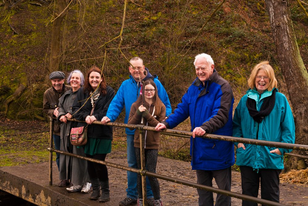
Last year, Christine Howles from the Lichfield and Hatherton Canal Restoration Trust and I spent a summer’s evening exploring the Fosseway section of the Lichfield canal. Sharing the photographs on our respective social media accounts generated so much interest that we decided to do it again but with more people and less vegetation.

Lichfield canal lock

Christine from LHCRT on our lock crusade

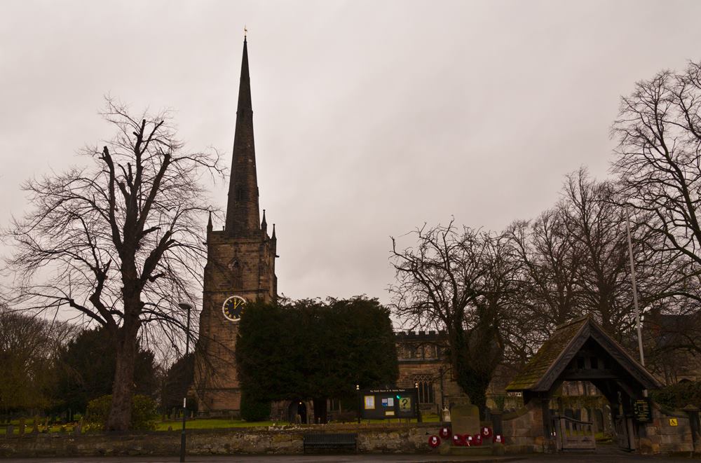
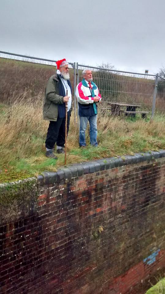
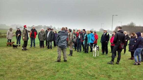
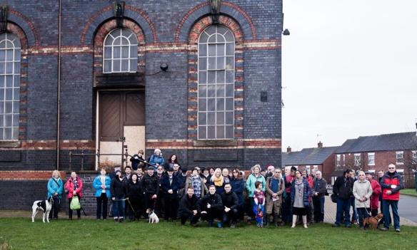
The walk was originally arranged for November but Storm Clodagh had other ideas and so it was on the Sunday after Christmas when sixty five of us gathered outside Sandfields Pumping Station. Dave Moore, stood in front of the door that the Lichfield Waterworks Trust should shortly be getting the long awaited keys to, reminded us all why this building and its contents are such an important part of our local and national heritage.

Kate & Dave Sandfields

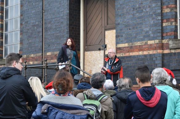
Despite how this might look, I genuinely never tire of hearing Dave talk about Sandfields. Photograph by Eddie Strain.

Another part of Lichfield’s industrial past once stood somewhere near here, west of the Chesterfield Rd and causing ‘a great nuisance to the inhabitants of the city’, according to the vicar of St Mary’s in 1806. The ‘noisome and offensive’ bone house was described as being to the north of the Wyrley and Essington Canal. Are their histories intertwined in some way? Did the latter provide a transportation link or even a source of power for the former?  Whilst we try and flesh out the history of our bone house, it’s worth having a read about Antingham Bone Mill which stood on the North Walsham and Dilham Canal and appears to have been a similar establishment.

Sandfields Canal Walk 2

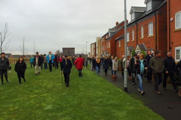
Heading along the original route of the canal. Photo by Steve Martin

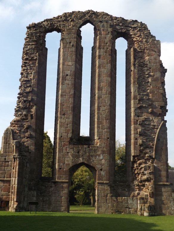
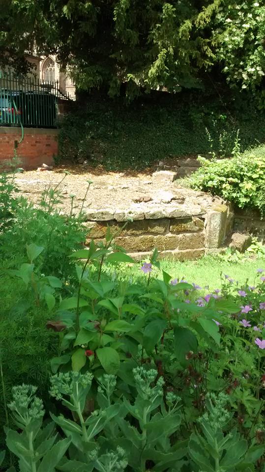
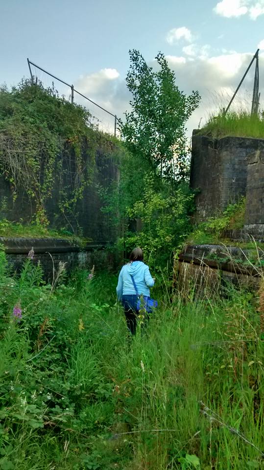
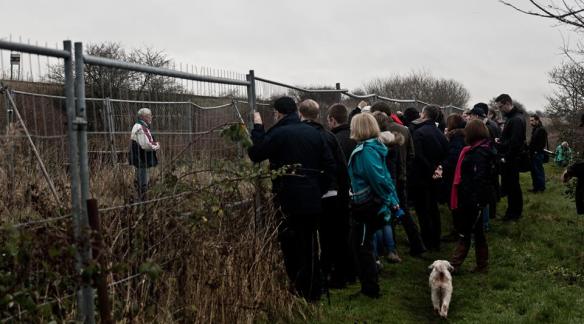
From Sandfields, we followed the original line of the canal to the start of the Fosseway Heritage Tow Path Trail. At the site of Lock 19, demolished during the building of the Southern Bypass in 2008, LHCRT directors Peter Buck and Bob Williams described the vision that the Trust has for not only the restoration of the canal in this section but also the creation of a moorings site and a wildlife haven incorporating lowland heath and wetland areas.

Lock 19

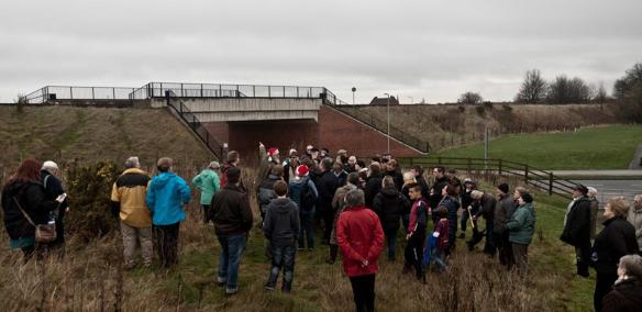
At the site of the now demolished Lock 19, photo by Dave Moore LWT

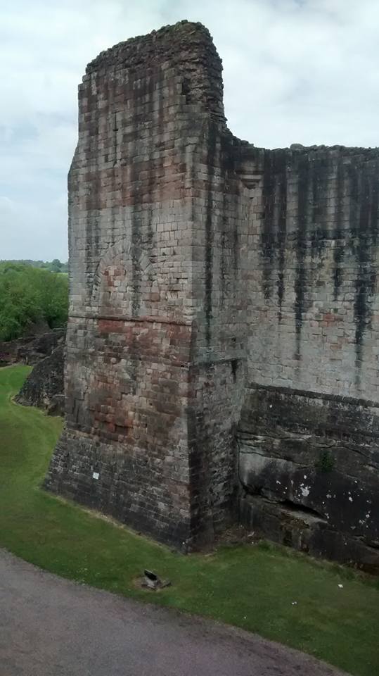
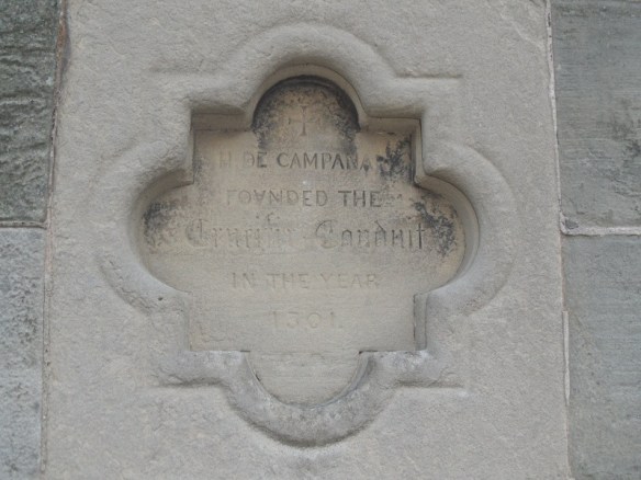
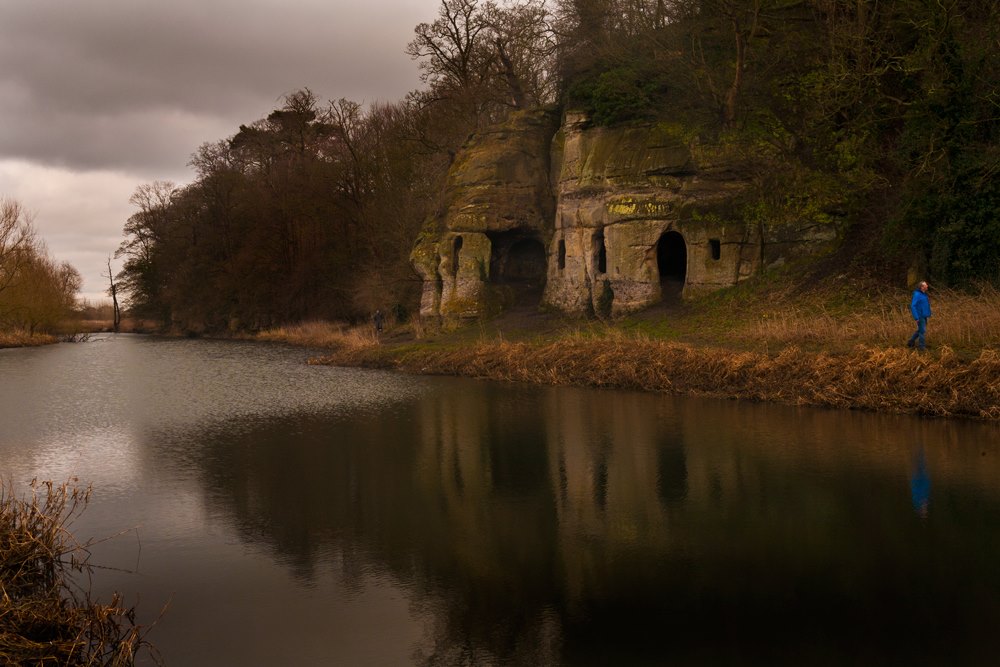
It has been reported that a hearth and lead musket balls were found near  Lock 19, possibly dating to the Civil War. The source of lead for this mini munitions factory can be found a short way along the towpath, where Peter pointed out the headwall to a culvert carrying a pipe beneath the canal. Not just any old pipe though but one that supplied the city’s Crucifix Conduit with water from the Foulwell Springs at Aldershawe, granted by Henry Bellfounder to the Franciscan Friars in 1301. The original pipe is thought to have been made of alder but was later re-laid in lead which it seems those soldiers may have helped themselves to. In 1805, the lead pipe was replaced by a cast iron one made at the Butterley Company in Derby, brought into the city via the canal and offloaded at Gallows Wharf, just as the Herkenrode Glass, recently reinstalled at the Cathedral, had been two years prior.

Conduit site.jpg

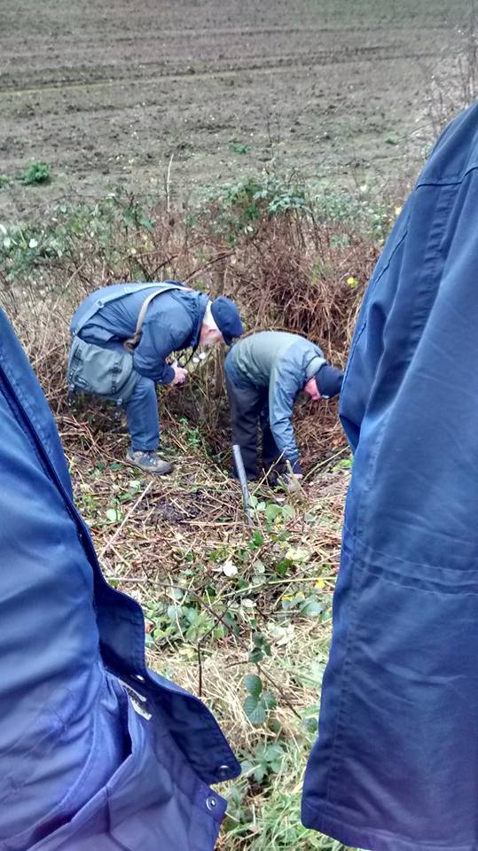
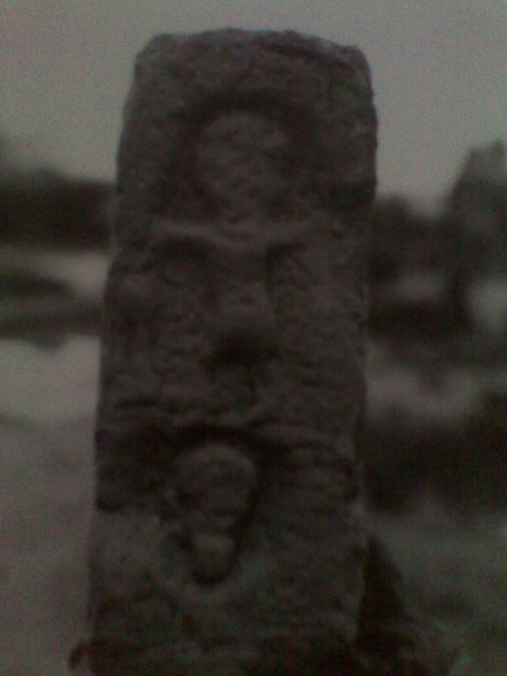
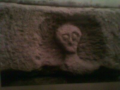
Ferreting around up a historic pipe.

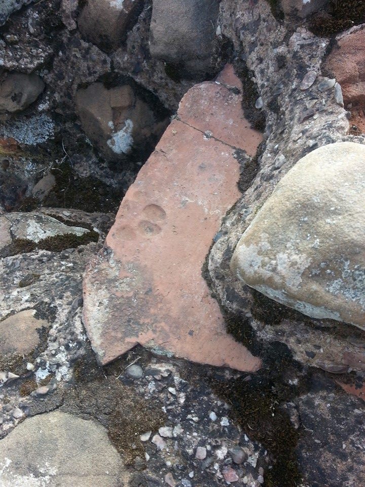
At Lock 18, the first site worked on by LHCRT and restored to commemorate the bicentenary of the opening of the canal in 1797, Peter and Bob told us more about the engineering feat that was accomplished here and across the country with tools no more sophisticated than a wheel barrow. Peter told us that during restoration work elsewhere on the route, a brick with a small thumbprint on it was discovered suggesting that children made up part of the workforce. The results of their labour may still be visible but I suspect the details of who they were, where they came from and how they lived, may have disappeared without trace.

Peter and Bob at Lock 18

Peter Buck and Bob Williams at Lock 18

This section of the Heritage Towpath Trail ends at Fosseway Lane. The bridge here was removed shortly after the canal was abandoned in 1954 and will need to be reconstructed as part of the restoration work. The cottage once occupied by the lock-keeper remains though and still displays the number plate ‘268’ allocated by the Birmingham Canal Navigation Company. We know that in 1923 the cottage was lived in by Mr and Mrs Cass as in October that year, the Lichfield Mercury reported that they had rescued a Hednesford butcher using a canal rake. Charles Peake was driving nine beasts from Tamworth when one broke away near the now demolished bridge. As Mr Peake chased the animal he fell 14ft into the lock. Fortunately, Mr and Mrs Cass heard his shouts and managed to fish him out. Though understandably shaken, Mr Peake was uninjured but the Mercury was concerned others may not be so lucky as on a dark night there was, ‘nothing to prevent anyone who doesn’t know the locality from leaving the road and walking, riding or driving straight into the lock’ and suggested that something should be done to make it safe on the basis that ,’one does not expect to be liable to fall into unprotected death traps in a civilized country’.

Lock 18 fence

An unprotected death trap no more. Photo by Dave Moore, LWT

The Lichfield to Walsall railway line also crosses Fosseway Lane. Although the last train passed by in 2003, the signal box dating back to 1875 remains, albeit in poor condition.

Fosseway signal box 3

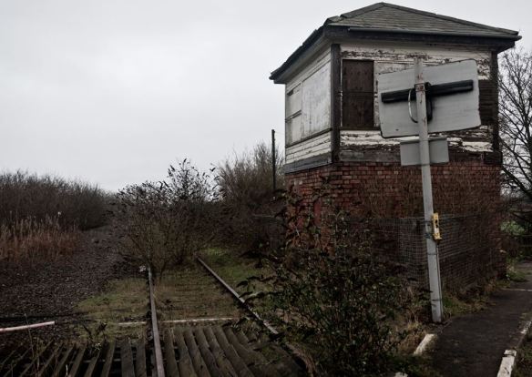
Fosseway Signal Box, Dave Moore LWT

As we gathered on the crossing, I was able to tell people about its keeper Emily who kept watch here every night between 1946 and 1963, thanks to a wonderful article about her life and her work shared on Dave Cresswell’s Rail Blog (here) and Brownhills Bob’s Brownhills Blog (here)  a couple of years ago.

Fosseway signal box

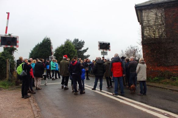
“Keep Crossing Clear” Photo by Steve Martin

After trespassing on the railway we headed down Fosseway Lane, stopping just before the junction with Claypit Lane to see Sandfields Lodge, where a private lunatic asylum operated between 1818 and 1856.   A series of visits by commissioners in 1846 revealed series of deficiencies in the provision of care at the Sandfields Asylum (you can read a transcript of the Commissioners’ Report here) and it was finally closed in 1856 after having its licence revoked due to the poor conditions.  We know that the asylum was transferred here from St John Street and it may be related to the one established on that street  in 1775 by a physician named George Chadwick. More research is needed into this and perhaps also into the reasons why by 1788, Chadwick had confined his wife to her room on the basis that she was a ‘lunatic’.

Falkland Rd canal
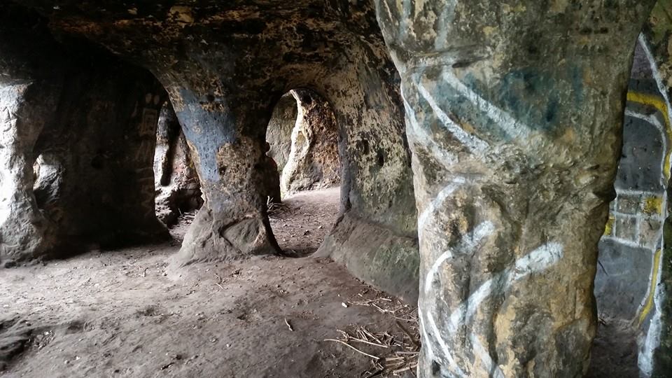
From Fosseway Lane we walked along Falkland Rd and the new route of the canal to the Birmingham Rd roundabout where a tunnel has been constructed and temporarily buried (see we really do have secret tunnels in Lichfield!).  After passing beneath the Birmingham Rd, the canal will cross under the Lichfield to Birmingham Cross City railway line via a new tunnel, scheduled to be constructed at Christmas 2017.

With the weather on the turn, the real ales and real fire at the Duke of Wellington beckoned. En-route we passed another old pub, now Redlock Cottage but once known as the Board and later as the Spotted Dog. At this stage though, it was an open pub we were all really interested in. We know the Welly was definitely an inn by 1818 when the landlord is listed as Thomas Summerfield but the early history is sketchy. I have seen it suggested here that it began life in the mid eighteenth century as a slaughter house and only later became an inn to take advantage of the passing trade brought by the canal.  It was of course the canal which had brought us here too, for beer, tea, crisps and dog biscuits (Doug the Dog definitely deserved his!). A fitting end to a great walk at the end a great year.

dog xmas tree

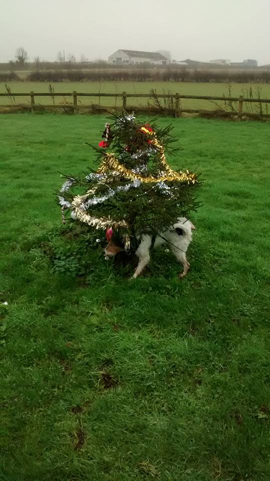
Doug the Dog doing battle with the Falklands Rd Christmas Tree. Both now Lichfield legends in their own right

Thanks to the Lichfield Waterworks Trust, the Lichfield and Hatherton Canal Restoration Trust, Steve Martin and Eddie Strain for the photographs and of course everyone who came along. Happy New Year and here’s to plenty more of this kind of thing in 2016. Make sure you follow us all on Twitter @lichdiscovered and @LHCRT1 and on Facebook here, here and here so you don’t miss out!

Sandfields crowd

Further reading:

http://www.british-history.ac.uk/vch/staffs/vol14/

History of the Trust

History of Sandfields Pumping Station – Cholera in the Black Country

Listed building entry for Sandfields Lodge

Explore the LHCRT Heritage Towpath Trail for yourself here


Bath Time

Although the waters at the Roman Baths in Bath were once known for their healing powers (the mythological Prince Bladud and his pigs are said to have been cured of leprosy after wallowing here in 863 BC), the water is now considered unsafe and is strictly off limits. This didn’t bother me in the slightest as I’d much rather be issued with an audio guide with commentary from Dr Alice Roberts than a fluffy white bathrobe.

The Great Bath at Bath

The Great Bath at Bath

The great bath is fed by a hot spring rising here at the rate of 1,170,000 litres a day and a temperature of 46 degrees Celsius. For our ancestors, the warm water gushing from the ground was the work of the gods. Even though I know the cause to be natural rather than supernatural, there was still something magical about watching vapour swirling up out of the bubbling, green-hued water into a torchlit, grey November afternoon. And it seems I’m not the only one the place has that kind of effect on. When the Romans arrived, the local goddess Sulis was already being worshipped here so they named the place after her, and built a new temple honouring both her and her Roman counterpart Minerva alongside the sacred spring.

Alongside the curing, a fair bit of cursing went on. One hundred and thirty prayers inscribed on sheets of lead or pewter were thrown into the spring between 200 and 400 AD. Many invoke the help of Sulis Minerva in seeking justice and revenge for heinous crimes such as the theft of a bathing tunic or gloves. The majority are in vernacular Latin, but one as yet untranslatable text is thought to be the only surviving example of an ancient British language. I quite like the thought that the only physical trace of something spoken thousands of years ago was not left by kings or queens but by one of the plebs like us, most likely complaining that their swimming costume had been nicked.

Curse tablets found in the Sacred Spring at Bath

Curse tablets found in the Sacred Spring at Bath

In 1727, the gilt bronze head of a statue of Sulis Minerva was discovered yet it’s not the face of the goddess which has become the symbol of Roman Bath but the face of the ‘gorgon’ found on the pediment outside her temple. And I have the fridge magnet to prove it. Re-discovered in 1790, and debated ever since, the ‘gorgon’s head’ is surrounded by a sea of symbolism including Tritons, a dolphin head shaped helmet, a star, an owl and two Victories. The ‘gorgon’ interpretation derives from the association of Minerva with Medusa and the supposed presence of a couple of snakes in the beard. Yes this ‘gorgon’ has a beard, which highlights the main problem with this explanation – gorgons are female whereas this is obviously the face of a man. It might be another example of the Romans combining a local god with of their own e.g. a classical gorgon and a British water god or could perhaps even be Neptune or Oceanus.

The so-called gorgon at Bath. I'm not convinced. But then I dropped Latin in the third year, so what do I know?

The so-called gorgon at Bath. I’m not convinced. But then I dropped Latin in the third year, so what do I know?

Other more easily identifiable gods found here include Jupiter and Bacchus whose images once formed part of the great altar where sacrifices were made. Post-sacrifice, the entrails of the animal were consulted by a haruspex (literal translation: gut-gazer) and we know there was one here in Aquae Sulis because the inscription on this stone reads ‘To the goddess Sul, Lucius Marcus, a grateful Haruspex, donated out of his devotion’. This is the only evidence we have of a priest in Britain who practised divination in this way, so it’s something of a rarity.  It has been suggested that whoever carved the stone wasn’t all that competent, originally missing out the ‘O’ from ‘Memor’ and also having to squeeze the letters ‘VSP’ after ‘the abbreviation HAR’. You’d think Lucius might have forseen these problems in the intestines.

The Haruspex Stone at Bath with the sacrificial altar behind

The Haruspex Stone at Bath with the sacrificial altar behind

Hopefully, all this talk of Romans at Bath will have whetted your appetite for something a little closer to home but just as exciting. Not only does our Roman site at Wall have carvings every bit as mysterious as those at Bath, evidence of Christianity in the area prior to St Chad’s arrival (in the form of  bronze bowl with a Chi-Rho symbol which you can see and read about here) and even rumours of our own statue of Minerva said to have been as big as a man, but not a man as it had a bust but also not a woman because it was wearing a soldier’s helmet. Unfortunately, it was used to fix a drain. If it ever existed in the first place that is.

Possibly one of the local gods at Letocetum. Found built into the walls of the Mansio at Wall.

Possibly one of the local gods at Letocetum. Found built into the walls of the Mansio at Wall.

This may represent a skull in a niche a la Roquepertuse or it may be another local god. We just don't know but it is fun speculating.

This may represent a skull in a niche a la Roquepertuse or it may be another local god. We just don’t know but it is fun speculating.

You can access the site of Letocetum all year round during daylight hours and the museum is open 11am to 4pm the last weekend of every month plus Bank Holidays between March and October. This Winter, the Friends of Letocetum have arranged a series of talks at Wall Village Hall starting on Wednesday 9th December with Dr Mike Hodder who will be talking about his own personal experiences as an archaeologist at Wall.

Further details of this and all other upcoming talks and events plus lots of other information about Letocetum can be found here on the website or there is a Facebook page here and you can follow @FndsofLetocetum on Twitter.

For anyone who would like to see the Gorgon’s Head but isn’t able to get to Bath, it will be coming to a lampost in Leomansley shortly along with a wobbly lobster. Details on request. And should anyone pinch it, I’ve got a curse ready.

Abbey Road

I was still feeling the effects of the lunar eclipse in the early hours of Monday on Tuesday morning. Not in a spiritual way, I was just knackered from staying up. However Croxden, the first stop on my rambles around the North of the shire last week, was a sight for my sore eyes. The tiny village is dominated by the ruins of a Cistercian Abbey founded in 1176 by Bertram de Verdun of Alton Castle (1) for the souls of his predecessors and successors.

Remains of 12thc Alton Castle founded by Bertram de Verdon. Not open to the public. As I found out...

Remains of 12thc Alton Castle founded by Bertram de Verdun.

What is left of the semi-circular East end of the abbey church, unusual in England and probably inspired by the French designs the Abbey’s patrons would have known, lies to one side of the road that someone decided to cut through the site. The nave, south transept and other monastic buildings lie on the other and you can see a plan showing what is still visible above ground and what has been lost here. In 1288, a priest from Walsall called William de Schepisheved, was given the task of chronicling life inside and out of these Abbey walls.  He worked backwards to 1066 and contemporaneously until 1320 when the entries in his hand stop, although the chronicle continues until 1374.

Blood Moon. Just in case you didn't see one of the three million photos of it shared online,

Blood Moon. Just in case you didn’t see one of the three million photos of it shared online,

We tweeted and shared our photos of the lunar eclipse. William the Chronicler recorded the celestial events he witnessed in the annals. Understandably for him and those of his time, eclipses were considered bad omens, often linked to any conflict, pestilence or bad weather that occurred. William records a solar eclipse in July 1330 and connects it to the floods and unseasonable weather which occurred two months before and for three months after, resulting in a late harvest, “…they had scarcely reaped the last of their corn with the greatest toil on the feast of All Saints and they had at last collected their peas into barns and outhouses on the feast of the blessed apostle Andrew. And what is so remarkable to see and hear, on the feast of All Saints and of St Martin fresh peas in their shells were given to the convent in the refectory instead of pears and apples”.  Another notable event in July 1301 appears in the Abbey’s annals describing how, “on the day of the Blessed Mary Magdalene, about the sixth hour, a great earthquake took place, to such an extent that all the persons in the convent, being at their first refection, were dismayed with a sudden and unlooked-for trembling”.

The chronicle also documents a connection between the abbey and Lichfield. William recorded that on Easter Eve in 1313, the great bell of the Monastery was broken by mischance and a man called Henry Michel came from Lichfield with his youths to cast another. It was reported that his first attempt failed but he started afresh and completed by the Festival of All Saints. It seems likely that this was Henry the Bellfounder who granted Lichfield’s Franciscan Friars the springs near Aldershawe which would later supply water to the whole of the city.

Plaque on Lichfield's Clock Tower, the base of which was once the water conduit which stood near the Friary.

Plaque on Lichfield’s Clock Tower, the base of which was once the water conduit which stood near the Friary.

As well as life at the abbey, Death inevitably also features in the chronicle. There are the descriptions of the burials of the Verdun family including that of Lady Joan Furnival, eldest daughter and heir of Theobald de Verdun, who on October 2nd 1334, “was taken by untimely death in childbirth; for on the day she died she was only thirty years and almost two months” and was “buried near her ancestors between Lord Nicholas de Verdun, son of the founder, and her ancestor and Lord John de Verdun, her great-grandfather”. Their now empty stone coffins can be seen alongside the ruins at the east end of the church.

DSCF0302

Stone coffins at Croxden.

The entry for 1349 simply and bleakly says, ” There was a great pestilence throughout the whole world.” Nothing more. No indication of how many succumbed to and how many survived the plague here in Croxden.  The following year, 1350, another single sentence notes, “This year was a jubilee” (2), and then there is nothing until the harrowing entry made in 1361 which records, ” A second pestilence took place, and all the children that were born since the first pestilence died.” In the absence of detail, I did a little reading between the lines. After ten years, plague had reared its ugly head again and although overall mortality rates were lower than in the first outbreak, the disproportionate number of deaths amongst the young in this second wave led to it being known as ‘the Children’s Plague’. Was this was because those who had survived the plague the first time around had some sort of immunity that the children born subsequently did not? I don’t know. I’m not sure that anyone does for sure. In 1369, another ‘visitation’ is recorded.

West front of the Abbey Church

Five years later the Chronicle ends but not before recording two further natural disasters affecting the Abbey – a flood destroying all the grass growing near the water together with all the bridges across the River Churnet, and a tempest which took the lead off the dormitory, infirmary, and abbot’s chamber, throwing down half the trees in the orchard. Plague and poor harvests took their toll and by the end of the fourteenth century, the Abbey was in decline.

DSCF0278

One thing that doesn’t seem to appear in the Chronicle is the ‘fact’ that King John’s Heart is buried at Croxden. Possibly because it isn’t. I first came across the claim in Arthur Mee’s guide to Staffordshire and since have found several other sources saying the same, including William White’s Directory of Staffordshire (1851), Samuel Lewis’ Topical Directory of England (1831) and The Gentleman’s Magazine (1823). Trouble is other, more reliable sources say it’s at Croxton, Leicestershire including the Charter Roll of 1257. I’m sorry to say, I think we have to concede this one to our foxy neighbours.

A drawing of the effigy of King John in Worcester Cathedral from "HISTORY OF ENGLAND by SAMUEL R. GARDINER

A drawing of the effigy of King John in Worcester Cathedral from “HISTORY OF ENGLAND by SAMUEL R. GARDINER

The King’s bowels were also said to have been removed at the time of his death and buried somewhere in Croxton, and to quote Simon Schama, their removal left John, ‘as gutless in death as he was said to have been in life’. The majority of John’s body rests in Worcester Cathedral, although more in pieces than at peace. When the tomb was opened in 1797, it became apparent that the bones had been disturbed, with the jaw lying by an elbow and all but four of the teeth and most of the finger bones missing – the King’s hands presumably having fallen into the hands of souvenir hunters.

The end of the road for Croxden came on 7 September 1538 when Dr. Thomas Leigh and William Cavendish received the surrender of the abbey and the roof was removed to prevent the Abbot and resident six monks from continuing to use the site. Although Croxden Abbey has been privately owned since then, it has been under state guardianship since 1936. Today, the ruins are cared for by English Heritage and it’s absolutely free to go and explore them (although I’m sure they’d appreciate a donation). Unlike staying up all night to watch a lunar eclipse, I can highly recommend it. More information on visiting and directions here.

Notes

(1) I had no idea there was a castle at Alton until I went to Alton with a friend and saw a sign for it. As we found out, it is not open to the public.

(2) I suspected that a jubilee in this context did not mean what I thought it did so I of course googled it and discovered that jubilee years had been started by Pope Boniface in 1300, and to be celebrated every hundred years thereafter. However, Pope Clement VI later amended this as people’s average lifespan was too short and so many would not live to see one. Plus there was money to be made from pilgrims. Pope Paul II later amended the frequency of jubilee years to be every twenty five. For anyone interested, the next one will be in 2025.

Sources:

https://lichfieldlore.files.wordpress.com/2015/10/094-2009web.pdf

Self-representation of Medieval Religious Communities  Anne Müller, Karen Stöber

CROXDEN ABBEY: ITS HISTORY AND ARCHITECTURAL FEATURES.

BY CHARLES LYNAM )(North Staffordshire Field Club)

The Gentleman’s Magazine, and Historical Chronicle, Volume 89, Part 2

Up Letocetum

Wall, located just two miles to the south of Lichfield, is an incredible place to visit at anytime of the year. This Sunday (19th July) however, the Friends of Letocetum will be bringing the remains of the Roman settlement here to life with their annual open day, held in conjunction with English Heritage and the National Trust.  Entrance is free and the event runs from 11am to 4pm, during which time you’ll be able to experience life as a Roman soldier, get creative with a Roman artist and explore what everyday life would have been like at Letocetum.  A group of Saxons are also setting up an encampment at the site and for literature fans there will be a Saxon book binder and storyteller.  Children can take part in a range of games and activities* and there will also be a stall selling Roman games, perfumes and beads.

Wall-Open-Day-

Roman style bootcamp at last year’s open day

John Crowe, chair of the Friends group and Wall Parish Council said, “Last year we welcomed over twelve hundred visitors. The whole village comes together each year for our annual open day, and we want people to come along and have fun, whilst learning more about the significance of this major Roman settlement, situated at the crossroads of two of the most important roads at the centre of Roman Britain. The Staffordshire Hoard was discovered just one mile to the west of the village, and other finds from the local area suggest that Christianity may have been established at Letocetum prior to St Chad’s arrival in Lichfield”.

Stone on display at Wall museum, featuring two carved heads and what's thought to be a shield.

This stone, one of several found built into one of the walls at Wall, is just one of the many fascinating artefacts on display at the museum. It is thought to be Romano-British and features two carved heads with horns and what has been interpreted as a shield.

“The church of St John, built in 1837 and designed by William Moffatt and George Gilbert Scott, will be open to visitors, and refreshments will be available in the village hall. There will also be volunteers on hand in the museum to talk visitors through the fascinating collection of artefacts discovered at the site, so please do come and join us for what will be an enjoyable and informative day”.

Life at Letocetum...se if you can spot the two thousand year old (ish!) paw print somewhere on the site...

Life at Letocetum…see if you can spot the two thousand year old (ish!) paw print somewhere on the site…

*there is a small charge for these activities to cover costs

Midnight on the Hill

borrowcop

Borrowcop Hill is a place that doesn’t want to give up its secrets easily. What interests me about places like this is how gaps in our knowledge create a space where legends and folklore can grow unchecked. It’s not just a hill with a nice view. It’s the burial place of kings and martyrs, the site of Lichfield Castle.

to borrowcop gazebo

Stand at the summit and you’re standing at the highest point in Lichfield. Beacons have been lit here certainly for celebrations, possibly as warnings. The grammar school moved here from St John Street in 1903 and in 1971, merged with the adjacent Kings Hill secondary modern school to form the current King Edward VI School.  Interesting how the folklore was even referenced in the school name here. Another school on the site, the just as evocatively named Saxon Hill, was opened in 1979.

borrowcop sign

Christmas 1940

At last year’s Lichfield Discovered talk by Peter Young on Philip Larkin’s connections to the city, he told us that that whilst staying with relatives at Cherry Orchard in 1940, Larkin had written three poems. Only one, ‘Out in the Lane’, was published but all three were inspired by his temporary surroundings. Peter believes the arched field of ‘Christmas 1940’ refers to Borrowcop Hill. I’ve reproduced it here from a folio collated by The Philip Larkin Society for their celebration of his birthday in August 2001. I hope they don’t mind, but I can’t find it anywhere else!

The name ‘Borrowcop’ does hint that there was once something here. Its earliest written forms, Burwey or Burwhay, feature the Old English element ‘burh’,  suggesting a fortified place (1).  Whilst there are vague reports of Erasmus Darwin recovering bits of burnt bone from somewhere up here, according to the Heritage Environment Report, ‘more recent excavations have so far failed to recover any evidence for human activity’. Well, I went up there on Sunday and I found this:

borrowcop chair

And this:

"The bubbles up your nose, spill on your summer clothes"

“The bubbles up your nose, spill on your summer clothes”

And this:

borrowcop graffiti

Plenty of human activity in what Five Spires Live , the Lichfield satirist who also doesn’t give up his secrets easily, yesterday described as  “… the perfect setting for bit of Larkin”. See, as much as I like legends, I also like the real.  I like layers of history that celebrate everything a place is and not just what we want it to be. The way our own memories of a place form our own folklores. The title for this post is one I’ve appropriated from one of my favourite songs by one of my favourite bands. It’s summer nights, it’s cheap cider (or ‘energy and guava’, if you’d rather), it’s messing about with your mates in a space maintained by the council because you’ve nowhere else to go. It’s perfect. Borrowcop or not, we’ve all been there. And like it or not, that’s as much a part of history as those kings and castles are.

1) A Survey and Analysis of the Place-Names of Staffordshire’ by David Horovitz, https://lichfieldlore.files.wordpress.com/2015/06/397633_vol1.pdf

Trailgating

Perhaps the biggest faux pax you can commit about the place that gave the world Samuel ‘Dictionary’ Johnson is to spell the name incorrectly. Outsiders, please note that these days the only acceptable ‘T’ in Lichfield comes with biscuits and/or cake. The other way to wind up a Lichfeldian is to refer to Staffordshire’s premier heritage city as a town. En-route to the Guildhall Cells, perpetrators of this crime are taken past our central railway station to illustrate just how wrong they were.

"Lichfield City Station (6668724487)" by Elliott Brown from Birmingham, United Kingdom - Lichfield City StationUploaded by Oxyman. Licensed under CC BY 2.0 via Wikimedia Commons - https://commons.wikimedia.org/wiki/File:Lichfield_City_Station_(6668724487).jpg#/media/File:Lichfield_City_Station_(6668724487).jpg

“Lichfield City Station (6668724487)” by Elliott Brown from Birmingham, United Kingdom – Lichfield City StationUploaded by Oxyman. Licensed under CC BY 2.0 via Wikimedia Commons

Once they are in the stocks, heretics are then read to from the charters, currently held at the museum in St Mary’s, which include Queen Mary’s declaration of 1553 that Lichfield was not only to be a city, as granted by her brother Edward five years earlier, but also a county in its own right.

stocks

“OK it’s a city. I get it. I’m sorry. I’m from Tamworth”

This is the charter which gave rise to the annual Sheriff’s Ride (and its much more recent and considerably shorter spin-offs), a twenty mile perambulation of the current boundary of Lichfield. I had often sat and wondered whether at any point, the boundary was physically marked in someway (I do need to get out more) and just recently found an article written in the late nineteenth century which says it was, “formerly marked by wooden posts, but they have much deteriorated and in some instances disappeared. A renewal in iron of the most important has recently taken place”.

The Sheriff perambulating Cross in Hand Lane in 2014

The 2014 Sheriff perambulating Cross in Hand Lane.

Descriptions of the boundary of the City of Lichfield date back to the late 1700s. Back then it was only a sixteen mile round trip. Although in 1806, local historian Harwood said they were based on ‘ancient writings’, I understand there is no earlier written description of exactly what constituted Lichfield. However, there are piecemeal records showing some of the boundary changes over the centuries. And there must have been a fair few changes to get from a medieval town you could walk around in an hour to a city with a circumference of sixteen miles.

Last week I spent a sunny morning trying to trace the boundary of what would have been the medieval town. With the help of John Snape’s 1782 plan of Lichfield, it’s actually fairly easy to do, even for someone as illiterate at map reading as me.  Bishop Roger de Clinton surrounded the south part of the new town he had laid out in the late twelfth century with a bank and ditch and fortified the shared northern boundary of the town and Cathedral Close. Apart from a couple of inconveniently placed walls, you can pretty much walk the whole way around.

The moat marking the northern boundary of both medieval Lichfield and the Close. Described on Snape's map as a dry ditch or dumble.

The moat marking the northern boundary of both medieval Lichfield and the Close. Described on Snape’s map as a dry ditch or dumble.

Remains of the NE Tower, part of the Close's fortifications.

Remains of the NE Tower, part of the Close’s fortifications.

Thanks to archaeological investigations, we know that the town ditch in the St John’s Street area was about five metres wide, two metres deep and inevitably, was also used as a public tip.

Castle Ditch plaque

The driveway passing the LD Council Offices follows the line of the town ditch, and there's a plaque there telling you that.

The driveway passing the Lichfield District Council Offices follows the line of the town ditch, and there’s a plaque there too.

When a section in the Council House car park was excavated in 2008, archaeologists discovered the sole of a woman’s shoe from the twelfth century, part of a medieval jug and the remains of a medieval dog’s head.

This plaque is located at the junction of Lombard St, Stowe Rd and George Lane

This plaque is located at the junction of Lombard St, Stowe Rd and George Lane.

Back to plaque, looking up George Lane which was actually once part of the town ditch

Back to plaque, looking up George Lane which was actually once part of the town ditch, possibly until the 16thc

Snape’s plan also marks the gates, or bar(r)s, at the main entrances into and out of Lichfield, and there are plaques at each of the locations, with the, hopefully temporary, exception of the Sandford Street gate. The building it was mounted on has recently been demolished but I’m sure the plaque is being kept safely somewhere….

Perhaps the best known of the gates is the one at St John Street which is still recalled in the name of St John the Baptist without the Barrs. You know, the place with all the chimneys. As the name indicates, this stood just outside the gate and started out as a hostel for those arriving when Lichfield was closed for business for the night, many of them pilgrims on their way to see the shrine of St Chad at the Cathedral.

st john sign

On the subject of names, the section of the ditch running from the gate on Tamworth Street, to the gate near St John’s Hospital was known as Castle Ditch, and this, alongside hard evidence in the form of stones turning up nearby and evidence of a slightly more fluffy nature in the form of myth and folklore, has caused endless speculation as to whether Lichfield ever had a castle proper alongside the fortified Close with its towers, turrets and strong walls.

Remains of south gate tower leading from dam Street to The Close. Excavated in the 1980s

Remains of one of the towers which were part of the south gate between Dam Street and The Close. Excavated in the 1980s.

So, plenty of opportunities to get out more here. I think the two mile-ish walk around the ditch will make an excellent Lichfield Discovered adventure. I would also happily walk sixteen miles to find one of those old iron boundary markers although I may be on my own with this. It’d also be interesting to see how Lichfield has burst its boundaries over the years gobbling up all of the surrounding settlements, so much so that it’d take you six hours and twenty four minutes to perambulate the current perimeter, according to this walking calculator I’ve found.  And that doesn’t even include getting distracted by other things or stopping off at the pub. It’ll have to wait though, as right now I’m off on an expedition to Borrowcop to see if I can capture Lichfield Castle.

1)  If we’re doing names, then I have to mention that Bakers Lane was once known as Peas Porridge Lane. Just because.

Heaven and Earth

Without wishing to state the obvious, this blog is called Lichfield Lore. Sometimes I’m worried that I might go too far (in a geographical rather than controversial sense) but although I’ve overstepped the Lichfield boundary from time to time, I have at least remained in Staffordshire. Until now.

Last month, a group of us from Lichfield Discovered, crossed the border into Derbyshire to visit Repton which, between the seventh and ninth centuries, had been one of the main residences of of the Mercian royal family. In 653AD, Peada, son of the pagan King Penda converted to Christianity in order to marry Alhflæd (sp?), the daughter of King Oswy of Northumbria. To help him to convert the rest of the kingdom, he employed four monks from Lindisfarne  – Adda, Betti, Cedd and Diuma, the latter of whom would become the first Bishop of Mercia (1). However, Peada and Alhflæd do not appear to have been a match made in Heaven nor Neorxnawang. The Venerable Bede reported in his Historia Ecclesiastica that Peada was murdered in 656AD “wickedly killed by the treachery, as is said, of his wife during the very time of celebrating Easter”. 

Church of St Wystan, Repton. Photo by David Moore

Church of St Wystan, Repton. Photo by David Moore

Rather fitting then that it was death which brought us to the ‘cradle of Christianity in the Midlands’. Although Peada is not buried here, the eighth century Anglo-Saxon crypt beneath the church was used as a mausoleum for later members of the Mercian royal family, including King Æthelbald ( ‘treacherously murdered at night by his own bodyguards’ says Bede), King Wiglaf (cause of death unknown) and his grandson Wigstan (murdered by a family member, who he objected to marrying his widowed mother. Seems his concerns were well-founded). The exact place where Wigstan was scalped is not known (Wistow in Leicestershire and Wistanstow in Shropshire both have claims) but wherever it was, it’s said that on the anniversary of his death each year, human hair grows from the earth at the spot where his blood was spilt (2). This supposed phenomenon and other miracles, led to the canonization of Wigstan, who became known as St Wystan. The crypt became a place of pilgrimage and the church above it took his name.

The crypt at Repton. Photo by David Moore.

The crypt at Repton. Photo by David Moore.

In the early eleventh century, King Cnut ordered the holy bones to be moved to Evesham Abbey and in the centuries which followed, the entrances to the crypt were sealed and its existence forgotten until 1779, when someone digging a grave for the headmaster of Repton School broke through the vaulting and fell into it. We made our entrance in a rather more conventional way.

crypt stairs

Down to the crypt and into the eighth century. Photo by David Moore.

From Repton, we headed to the Anchor Church, four connected caves alongside the River Trent, which both nature and humans had a hand in forming. I confess that the time I should have spent on the logistics of the trip was instead spent at the Whippet Inn, and so it took a bit of finding with just a postcode to guide us. However, when we did finally arrive we were pleased to see that, although thick with mud, the often flooded path that would take us to the ‘church’ was just about passable.

Inside the caves. Photo by Andy Walker.

Inside the caves. Photo by Andy Walker.

Legend has it that in the sixth or seventh century, the caves were occupied by a hermit, who spent his time here going to the river to pray. Later, the caves were supposedly inhabited by a monk called Bernard who spent his last days here, repenting for his part in the deception which persuaded returning crusader Hugh de Burdett that his wife Johanne had been unfaithful. The story goes that Hugh cut off her left hand, leaving her to bleed to death over the altar cloth she’d been embroidering for him using her own hair (what’s with the hair obsession around here?).  On a more cheerful note, in the eighteenth century, Sir Francis Burdett (presumably one of Hugh’s descendants) used the caves and riverbanks as a venue for picnics, as shall we when we visit again in the Summer.

The Anchor Church near Ingleby. Photo by David Moore.

The Anchor Church near Ingleby. Photo by David Moore.

On our way back to the cars, there was a blood-curdling scream. Had one of our party met with the ghost of Johanne searching for her lost hand or had they lost their footing and fallen victim to the mud?  No, Carol just had something in her shoe. One of those funny at the time but you really had to be there moments admittedly, but I mention it because this is what I remember first and most fondly when I think of our trip. I love places for their stories and their connections to the people of the past, but even more so for the memories made by visiting them with people in the here and now.

repton group

Looking for pirahanas in the River Trent. Photo by David Moore.

Notes

(1) In 669, Chad, brother of Cedd and the fourth Bishop of Mercia moved the See from Repton to Lichfield (phew, it is relevant to Lichfield after all!)

(2) There’s another Lichfield Discovered trip right there. Who is free on the first of June? We’ll have to split up though, gang….

(3) Another Lichfield link – in 1364 an armed mob at Repton attacked the Bishop of Lichfield and the Prior. Actually, finding places with a tenuous link to Lichfield could be a whole blog post in its own.

References

http://www.reptonchurch.org.uk/

Repton and its Neighbourhood by F C Hipkins

The Oxford Dictionary of Saints by David Hugh Farmer

http://jimjarratt.co.uk/follies/page57.html

Click to access anchor_a3.pdf

Lily's Medieval Jigsaw Puzzle

Recently, twelve year old Lily made a very interesting discovery in Lichfield. Here’s her account of how the contents of a cardboard box found in an old gaol cell turned out to be far more exciting than than anyone could have imagined….

“In November 2014, I went to the Lichfield Gaol Cells in the Guildhall. It was a Lichfield Discovered event, and we were going to look and see if we could find any graffiti, names, or dates on the gaol cell doors. About 7 or 8 of us came to the event all in all, I came with my Dad. Everyone else managed to find lots of writing and names on the doors, I didn’t find much. Near the end of the session, we were looking inside the third jail cell, the one that is not normally open to the public. My Dad pointed out 2 boxes of old looking tiles on the floor, we took a quick look, but we didn’t pay much attention to them.

Tiles 1

Tiles in cardboard boxes in gaol cell now used for storage

The next time we came to the gaol cells was on 21st February, we had come back to see if there was any more graffiti that we had missed, also to take a second look at the boxes of tiles (Jo at the museum said it was ok). This time I had come with my Mom and there was around 8 people that turned up this time. Me and my Mom started looking through the tiles, we had picked about 5 up and we laid them on a chair to photograph them, but they werereally dusty so we couldn’t see if there were any other patterns on them.

There were so many tiles that we couldn’t fit any more on, we decided to move all of the tiles into the 4th cell, onto a wooden bed that the prisoners used to sleep in, (personally I would NEVER think of sleeping on one of them). We started taking some more tiles out of the box and moving them onto the bed. We moved them a few at a time, because the box was too heavy to lift. I had realised that there were a few tiles with the same pattern on. I really wanted to get a better look at what the patterns looked like, so my mom went to Wilko (just up the road) to buy 2 paintbrushes. When she got back we started brushing off the dust and dirt from the tiles we had got out, we could see the patterns a lot clearer. We had nearly finished emptying out the first box of tiles, and at the bottom my Mom found a bit of tile with ‘Lichfield Friary’ written on the back. She showed it to Kate and she said “Maybe it came from the old Friary!” and then we all got really excited!

tiles 2

Tile with Lichfield Friary writing on the back

We had found lots of bone shaped tiles that were exactly like the one that said ‘Lichfield Friary’ on it.

Tiles 3

“Bone” shaped tiles

Whatever the floor was, it was really big. We had found LOADS of tiles that looked the same, and maybe they belonged to the same floor. I started trying to see if any of the tiles might fit together, there were loads of circular tiles, some with patterns on, and some without. There was one round tile, with a triangle and circles intertwined in a pattern. There were also pizza shaped tiles, without a tip, like someone had taken a pizza and cut the middle out with a cookie cutter, if you get what I mean. Those tiles had a kind of moon, with a starfish shape in the middle.

Tiles 4

Circular “pizza” tiles with moon and star pattern

tiles 5

Plain “pizza” tiles

We had found one of these tiles that was complete and one that was broken, but fitted back together again. All the rest were broken, but I managed to get a full circle out of the fragments we had found. It was like a massive jigsaw-puzzle, but I did it in the end, and what was even more exciting, was that the circular tile fit perfectly inside the ring of pizza shaped tiles! Same with the tiles with no pattern on, but we didn’t find another circular tile.

There was also another set of tiles. We had found about 8-10 of the same type, they were square, and they all had the same pattern on, the kind that can make 2 different types of patterns, depending on which way you put them.

Tiles 6

Square tiles with pattern – my faves 🙂

Most of them were complete, apart from 3-4 of them which we only had corners of. I put them together, and they nearly made a 9 square pattern. These were my favourite tiles, and I hoped we found some more of them, we only had half a box or so left to get out. We did find a couple more of these tiles eventually. We finished emptying out the box, and then we started taking pictures of all the tiles. There wasn’t much time left, so we took all of the photos really quickly. As a result, not many of the pictures were very good. And the light was quite dim in the cells, so the light wasn’t the best either.

It was nearing the end of the session, so we had to put all of the tiles back in the boxes. I couldn’t help thinking that the tiles were from the old medieval Friary. At least some of them.

Kate asked me if I could do some research to see if the tiles were from the Friary, Me and my Mom went to the Lichfield Records Office, to go and look at ‘The Lichfield Friary’ by P. Laithwaite, which was reprinted from the Transactions of the Birmingham Archaeological Society where a report of Councillor T. Moseley’s findings from his exploration of the site in 1933 was given.

Laithwaite BAS 1934

D77/23/67 Copyright Lichfield Record Office

There were only 6 pages in the book. Page 5 had a drawing of some if the exact tiles we had found (the ones that looked like pizzas with the middle cut out) some with patterns, and some without.

EPSON scanner image

D77/23/67 The Lichfield Friary by P.Laithwaite Copyright Lichfield Records Office

Me and my mom were like O-O (AMAZED!). On the next page (page 6) there was a drawing on 3 tiles with different patterns on, all of which we had found in the box of tiles! 😀 (and my favourite one, the one that we had got like a 9 block square of the floor.)

EPSON scanner image

D77/23/67 Drawing of square tiles from The Lichfield Friary by P.Laithwaite Copyright Lichfield Records Office

We had found what we had come looking for, proof that the tiles in the boxes were Medieval from The Grey Friars’ Church at The Friary!”

Note – this is not where the story ends! Lily is having an afternoon on the tiles with Jo Wilson, Lichfield City Council Museum and Heritage Officer and medieval tiles expert, Karen Slade this week, so look out for an update soon. Lily’s doing such a great job – the initial discovery, the ongoing research, and writing it all up afterwards – that I’m thinking of joining the Right Revd Jonathan Gledhill in retirement and leaving Lichfield Lore in her more than capable young hands.


Far From the Madding Crowd

Once, when Cuthbert Brown was a boy and the circus came to town (sorry, city), one of the elephants died and was buried on Levett’s Fields. Mr Lichwheeld and I had joked that we should organise a community archaeological dig to look for Nelly but with work starting on the demolition of Lichfield’s Fire Station recently, this may prove unnecessary.

Demolition of Lichfield fire station tower, January 2015.Photo by Joe Gomez

Demolition of Lichfield fire station tower, Levett’s Fields January 2015.Photo by Joe Gomez

Welephant wins 2011 Lichfield Pancake Race. Image from Lichfield Live

Nelly is not the only elephant with links to Lichfield Fire Station. Image from Lichfield Live

In the pre-Friary Road days, the Big Top also used to pitch up at the Bowling Green fields. Presumably at that time the Bowling Green pub was still a seventeenth century timber framed building. The only image of this I can find online is included in the 1732 engraving of the south west prospect of the city, as seen here on Staffordshire Past Track (zoom in and it’s the building in the foreground, beneath the central spire of the cathedral). The pub was rebuilt in the 1930s but the Victoria County History mentions that a clubhouse still in existence in the 1980s may be the same one which existed in 1796. Definitely worth a trip to the pub.

The Friary prior to development. Taken from Gareth Thomas' (GIS Officer for Lichfield District Council) Pinterest site

The Friary prior to development. Taken from Gareth Thomas’ (GIS Officer for Lichfield District Council) Pinterest site

One of the best things about looking through old newspapers is that you come across stories that you wouldn’t even think to look for. Whilst searching for more information on the Bowling Green, I came across the following obituary from March 1820.

At Lichfield, aged 67, John Edwards, the Hermit of the Bowling Green in that city. He came to the neighbourhood in the prime of life – a perfect stranger, retiring with disgust or disappointment from other and brighter scenes of life; but further particulars have never transpired respecting his history. The subscriptions of the benevolent have contributed to shed a comparative comfort on his latter days. A short time previous to his decease, he published a short “Essay on Freemasonry”. The medical gentlemen gratuitously attended his during his illness.

So many questions about Mr Edwards arise from this small snippet but I suppose if further particulars respecting his history had not transpired back then, the chance of uncovering anything now is fairly slim. Is it fair to say that Mr Edwards’ attempts to distance himself from society seem to have inadvertently made him into a celebrity of sorts? I wonder what became of his Essay on Freemasonry?

Whatever Mr Edwards’s reasons for preferring a life a solitude, it seems that in the eighteenth century it could be a career choice. Of sorts. Apparently, always on the lookout for opportunities to impress or outdo their friends and neighbours,eighteenth century land owners employed professional hermits to sit and be mystical amidst their fake temples and other follies. I found an example in the form of Mr Powys of Morcham (Morecambe?) near Preston, Lancashire, who advertised an annuity of £50 per annum for life to,

…any man who would undertake to live seven years underground, without seeing anything human, and to let his let his toe and finger nails grow, with his hair and beard, during the whole time.

Board and lodging was provided in the form of apartments said to be, ‘very commodious with a cold bath, a chamber organ, as many books as the occupier pleased, and provisions served from his (Mr Powys’) own table’.  By 1797, it was reported that the ‘hermit’, a labouring man,  was in his fourth year of residence, and that his large family were being maintained by Mr Powys. Just what quality of life must a man with a family have been leaving behind to agree to live like this? If this was about showing off to others, it’s curious that Powys stipulated that his ‘hermit’ was to live without seeing anything human.

Great Haywood Cliffs by Jason Kirkham

Great Haywood Cliffs by Jason Kirkham

In August 2002, around two hundred years after this dark appointment, notices appeared in The Guardian, The Stage, The London Review of Books and the Staffordshire Newsletter, advertising for an ‘ornamental hermit’ to take up residence at the Great Haywood Cliffs near the Shugborough estate in Staffordshire, as part of an exhibition called ‘Solitude’. The Shugborough Hermit would be required to live in a tent near to the cliffs (living inside them was deemed too risky) and only had to commit to the weekend of the 21st and 22nd September 2002. Out of  two hundred and fifty enquiries from all over the world,  artist Ansuman Biswas was chosen and I’d love to hear from anyone who visited him at Shugborough that weekend. Mr Biswas went on to spend forty days and forty nights alone in the Gothic Tower at Manchester Museum in 2009, with the aim of becoming, ‘symbolically dead, renouncing his own liberty and cutting himself off from all physical contact”‘.

I think I’d rather run away and join the circus.

Sources:

The Hermit in the Garden: From Imperial Rome to Ornamental Gnome, Gordon Campbell,  Oxford University Press 2013

 http://news.bbc.co.uk/1/hi/england/2205188.stm

Bad Neighbours

Legend has it that in July 1403, two feuding neighbours from opposite sides of the River Trent set out to fight on opposite sides at the Battle of Shrewsbury. Sir William Handsacre was for the rebel Sir Henry ‘Hotspur’ Percy and loyal to King Henry IV was Sir Robert Mavesyn, whose name was said to derive from the French malvoisin meaning ‘dangerous neighbour’. At Bridge Meadow, near to the site of High Bridge, it’s believed that the paths of the two enemies crossed, as did their swords. Living up to his name, Mavesyn killed Handsacre but his victory was short-lived and he met his end at the Battle of Shrewsbury, ‘standing with the King and fighting by his side even unto death’, if the epitaph on his tombstone in the church of St Nicholas at Mavesyn Ridware is to be believed.

The church dates to the mid-twelfth century and stands near to the site of the manor house, which Sir Robert would have once called home. The medieval house was replaced in the early eighteenth century by what William Pitt described in 1817 as, ‘a convenient box, pleasantly situated for a summer residence’. However, still in existence and visible from the churchyard is the ancient timber framed gatehouse, built using trees felled in late 1391 or before the spring of 1392, according to dendrochronology.

SAM_1511

The Church of St Nicholas, Mavesyn Ridware

The old gatehouse at Mavesyn Ridware, seen from the churchyard of St Nicholas

The old gatehouse at Mavesyn Ridware, from the churchyard of St Nicholas

The final resting place of Sir William is unknown but in 1866, William Painter of The Red Lion Inn at Handsacre wrote a letter on the matter to George Griffith, author of ‘The Two Houses: A Staffordshire Tragedy’, a dramatic work based on the events of 1403. According to Mr Painter, when the church of St John the Baptist in Armitage was rebuilt in the mid-nineteenth century, a stone coffin was discovered in the north wall. Inside was a skeleton, with a full set of teeth and a sword. Local tradition had it that these were the mortal remains of Sir William Handsacre. (1)

In 1972, Sir William must have turned in his grave (whether in St John’s or elsewhere) when vandals destroyed much of his former home, Handsacre Hall. In a bid to preserve what remained, I understand that the surviving fragments were moved to Avoncroft Museum in Bromsgrove, where again dendrochronology was used to date the timbers, giving a suggested date of around 1310, with some reused timbers from an earlier hall. According to the report by the Staffordshire Archaeological Society, the house had been derelict for at least six years prior to this and a photograph of the building taken around this time can be found on Staffordshire Past Track here. In its heyday it looked like this.  

SAM_1629

Information board at the site of Handsacre Hall

Nowadays the site is a Scheduled Ancient Monument, still surrounded by a moat, ten metres wide and four feet deep, but also by a housing estate. It’s said that on the island in the centre there are visible brick and sandstone remains and no doubt there is plenty of evidence of past lives at the hall below ground. Visiting in high summer, the only thing I could see (and feel unfortunately), were stinging nettles. Will be interesting to see what a return visit in winter will reveal.

Part of the moat which once surrounded Handsacre Hall

Part of the moat which once surrounded Handsacre Hall. And nettles. Lots of nettles…

Sources

Staffordshire Archaeological and Historical Society Volume XV Transactionf for 1973/4 – Stanley R. Jones Handsacre Hall, Armitage: a note on its destruction

http://ridwarehistory.yolasite.com/mavesyn.php

Staffordshire HER 09638

Greater Medieval Houses of England and Wales, 1300 – 1500: Volume 2 by Anthony Emery

A topographical history of Staffordshire by William Pitt.