Soul Sister

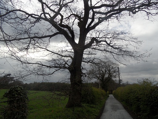
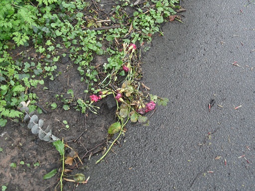
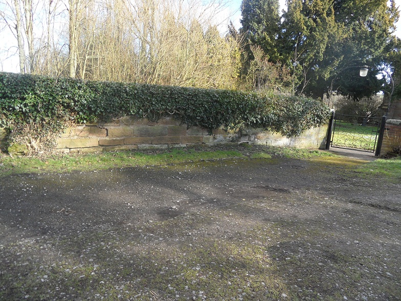
Friend and well hunting expert Pixy Led described Nun’s Well at Cannock Wood as being, “…perhaps the most hidden of all the springs and wells I have investigated”, and it was only thanks to his post about the site on his brilliant Holy and Healing Wells blog that this well hunting amateur was able to locate it. Between Pixy’s and my visits, it appears the site has been tidied up considerably and this is my attempt to do the same historywise, purely to satisfy my own curiosity.  It’s much more appealing than sorting out the cupboard under the stairs. Or cleaning for the Queen.

nuns well board

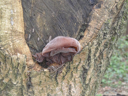
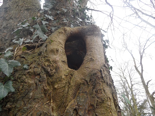
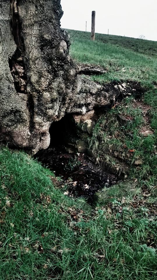
Nun’s Well is a spring rising in a chamber cut from rock with a sixteenth century Tudor style brickwork arch. Legend has it that the well has healing powers, specifically for sore eyes, and takes its name from a nun who was murdered there. Centuries after she was pushed to her death, two farm labourers discovered her earthly remains in the sealed up well and her ghost materialised before them. As Pixy points out on his blog, however, two of the best known works on Staffordshire folklore don’t even mention the well let alone its resident spirit.  I have found a reference in Robert Garner’s 1844 Natural History of the County of Stafford, which also doesn’t mention the ghost story but does offer an alternative explanation of how the well got its name,

“To descend to more recent times we lately visited a spot where one of our early monastic institutions was placed, Redmore, from which the nuns were soon removed to Polesworth because the gay cavaliers riding that way to hunt on Cannock Chase spoiled their devotions. With some trouble we found the solitary quadrangular site not far from Gentleshaw in some low ground embosomed in a wood through which a brook flows now ochrey from the scoriae of an ancient smelting place above and here also is a well considered medicinal and still called the nun’s well”.

It’s still not an entirely satisfactory version of events though (although there’s something undeniably satisfying about seeing something described as being embosomed in a wood. Must be the logophile in me).

nunswell sign

There does appear to have to have been a monastic institution near to the well. Records show that in 1141, King Stephen granted land at Radmore or Red Moor to two hermits called Clement and Hervey and their companions. Frequent disturbances from passing foresters, rather than gay cavaliers, interrupted the quiet contemplations of Clement, Hervey and co, causing them to ask Empress Matilda if she could find them somewhere a bit quieter. It’s recorded that she agreed to this on the condition that their religious house be converted to the Cistercian order. It seems the hermits kept their part of the deal, and the retreat became a Cistercian abbey but according to the History of the County of Warwick, the foresters continued to cause problems. As soon as Henry II ascended the throne in 1154, the now Cistercian Monks petitioned him to transfer them to his manor at Stoneleigh. Henry did so and traces of the original abbey can still be found at Stoneleigh Abbey, now a grand country house.

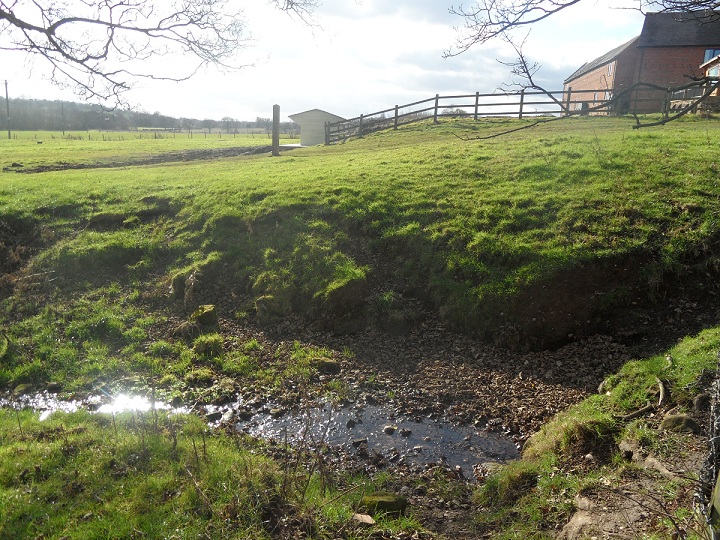
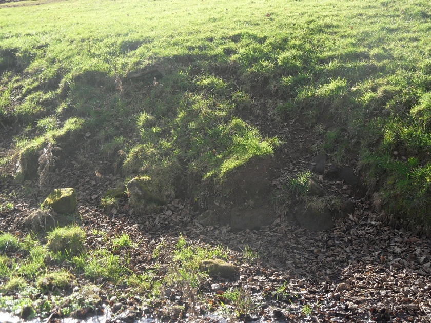
Whether anything of the original abbey remains at Radmore is where things get really messy. Ordnance Survey maps of the area from the 1880s onwards show the site of a priory near to the well (see the 1949 map incorporated in Brownhills Bob’s post on Gentleshaw Reservoir here). According to Walsall place names expert and tricycle rider Duignan this is actually a muck up on behalf of the surveyors who, “… have mistaken furnace slag for ancient ruins (of the abbey)”.  What he found on the site was, “heaps of furnace slag, evidently of great antiquity, with 300-400 year old oak tress standing on and beside the slag”. It seems from the description of the site given by Historic England that that these could mark the site of a medieval bloomery or iron furnace. A medieval moated site also exists in the vicinity and there are suggestions that this is the site of a royal lodge established by Henry II shortly after the monks moved on to pastures quieter. As Staffordshire County Council’s Historic Environment Character Assessment report says, ‘the precise location of the abbey is unknown, but it is believe to have stood near Courtbank Coverts near Cannock Wood where a scheduled moated site and bloomery survive’.

nuns well fence

So, in the area we have a moated site, a hunting lodge, iron working and a short-lived abbey (somewhere) but how and where does the nun fit in to all this? Duignan suggests the name arose as the land was owned by the nunnery at Farewell. I read an interesting line in the History of the County of Stafford’s section on the Abbey at Radmore which says, ‘King Stephen granted Radmore, probably between 1135 and 1139, to Clement, Hervey, and their companions as the site for a hermitage…Bishop Roger de Clinton confirmed this grant and gave the hermits permission to follow any rule they wished and to receive and instruct any holy women who came to them after adopting a rule”. That suggests to me that there may have been holy women here at Radmoor…nuns? Hardly the most watertight of etymological explanations I know but then I don’t think Duignan’s is that convincing either. Is it? Although Nun’s Well is not technically a wishing well, please do feel free to throw in your two pence worth.

nunswell water


Sources:

G C Baugh, W L Cowie, J C Dickinson, Duggan A P, A K B Evans, R H Evans, Una C Hannam, P Heath, D A Johnston, Hilda Johnstone, Ann J Kettle, J L Kirby, R Mansfield and A Saltman, ‘Houses of Cistercian monks: The abbey of Radmore’, in A History of the County of Stafford: Volume 3, ed. M W Greenslade and R B Pugh (London, 1970), p. 225 http://www.british-history.ac.uk/vch/staffs/vol3/p225 [accessed 4 March 2016].

https://historicengland.org.uk/listing/the-list/list-entry/1003750

‘Parishes: Stoneleigh’, in A History of the County of Warwick: Volume 6, Knightlow Hundred, ed. L F Salzman (London, 1951), pp. 229-240 http://www.british-history.ac.uk/vch/warks/vol6/pp229-240 [accessed 7 February 2016].

http://cistercians.shef.ac.uk/abbeys/stoneleigh.php

Signs of Spring

Every visit to the churchyard of St Michael’s leaves me wondering about the significance of this ancient place in the early chapters of Lichfield history. Thanks to archaeology, some answers have been provided over the years and landscape features such as the natural springs beneath the churchyard may give further clues as to what first drew people to this site thousands of years ago.  Nigel Johnson from Lichfield Lock and Key had told me that the water still flowed, and could be seen seeping out near to the steps up to the churchyard before trickling down Greenhill (except last week when I visited and the water had frozen!)

This natural spring has flooded the church’s crypt in the past.

Last Tuesday’s visit – frozen spring water on a freezing Spring morning

The churchyard was once used as pasture (1) but now the cattle and sheep are long gone and wildlife has been allowed to reclaim much of the churchyard. Bird song fills the air and along the paths and amongst the graves are clusters of spring flowers. Snow drops are still hanging on in there, and primroses and daffodils are now well on their way. During my recent visits, I’ve also met several dogs (and their owners!) and some of the neighbourhood cats.

I noticed that Georgia Locock, a young wildlife enthusiast who has her own blog on Lichfield’s wildlife has also been along to the churchyard on the lookout for Spring recently and you can see her lovely photographs here.

On the south (I think!) side of the church itself, I noticed stone heads, very similar to those at Christ Church. A couple of years prior to working on Christ Church, Thomas Johnson, the Lichfield architect, carried out an extensive restoration here at St Michael’s in 1842/1843 and presumably these heads are one of his additions. Whilst his work at Christ Church is generally applauded, Johnson’s work at St Michael’s has been criticised by some, as much of the original medieval fabric of the church was destroyed during his renovation. (I don’t know much about architecture, and so am not really in a position to comment. However, there does seem to be a certain irony in removing original features, and adding new ‘medieval style’ ones, such as these heads.) Again, as at Christ Church, I wonder who these faces captured in stone belong to and who carved them?

Looks like someone was inspired to create their own head alongside the carved ones….

Many of the  headstones and memorials that surround the church feature the names of the stonemasons that created them – Joseph Johnson of St John St (was this any relation to Thomas?), John Winslow of Tamworth St, John Hamlet of Dam St, James and George Lamb of Sandford St amongst others. Did any of these craftsmen also work on the church itself?

It seems Joseph Johnson may have ended up in a debtors prison. His name appears in the London Gazette, in a section entitled ‘Pursuant to the Acts for the Relief of Insolvent Debtors in England. The following PRISONERS, whose Estates and Effects have been vested in the Provisional Assignee by Order of the Court for Relief of Insolvent Debtors, and whose Petitions and Schedules, duly filed, have been severally referred and transmitted to the County Courts hereinafter mentioned, pursuant to the Statute in that behalf, are ordered to be brought up before the Judges of the said Courts respectively, as herein set forth, to be dealt with according to Law’.  Mr Johnson is listed to go before the Judge of the County Court of Warwickshire, holden at Coventry, on Monday the 21st day of June 1852, at Twelve o’Clock at Noon and is described as,

Joseph Johnson, formerly of the city and county of the city
of Lichfield, Stone Mason and Builder, afterwards of the
same place, Stone Mason, Builder, and Licensed Victualler,
and at the same time of Snow Hill, Wolverhampton, Staffordshire, Stone Mason and Builder, and late of the city
and county of the city of Lichfield, Stone Mason, Builder,
and Licensed Victualler


The Edinburgh Gazette of January 16th 1863, notes that John Hamlet, listed as an architectural draughtsman and stonemason of Dam St, Lichfield, has been awarded bankruptcy. How did they fall upon such hard times?  I’d like to find out more about these craftsmen whose job it was to record the lives of others in stone.

Notes:

1 – I was surprised to read in the county history that the churchyard was once let as pasture, although in 1801, the grazing of cattle was deemed inappropriate due to the ‘damage and desecration’ caused and it was decided that only sheep should be allowed. However, this was ignored, with tragic consequences – in 1809, there is an entry in the church register for the burial of a child, Joseph Harper, who was killed by a cow in the church yard.

Sources

Lichfield: Churches’, A History of the County of Stafford: Volume 14: Lichfield (1990), pp. 134-155.

Click to access page.pdf

Click to access page.pdf

History, Gazetter and Directory of Staffordshire  (1834), William White

http://archiver.rootsweb.ancestry.com/th/read/STAFFORDSHIRE/2001-04/0986182998


Tree following: Mayday

It took a bit of effort to drag myself out into the murky, wet evening. Glad I made the effort though. Before I’d even got to the woods, I had a treat when a heron swooped down onto a roof and remained there for a few moments before flying off in the direction of Waitrose. I’ve spotted a heron a couple of times near the old mill pool over there. On twitter, Brownhills Bob & someone from the Pipe Green Trust thought he may have been heading to a heronry at Aldershawe.

Another few steps and I found myself passing a slightly wonky fairyring of mushrooms. I didn’t get too near. I’ve read what happens to mortals who do…..

Once in the woods, the trees, plants and hedgerows glistened, but with drops of recent rainfall, rather than may dew.

I wanted to measure my tree, to get an idea of how old it was. It soon became apparent that this was no task to undertake alone. The people in the flats overlooking the lane, and this robin that turned up to watch, probably wondered what on earth I was doing.

Happily, I managed to enlist someone’s help and we discovered that the trunk measured about 3.2m which could mean that it is anything from around 210 years old to around 130 years old. According to the Royal Forestry Society, a tree could grow between 1.5cm & 2.5cm per year, depending on things like location, soil quality.  So I’m going to read up on Mitchell’s Rule and then maybe I’ll have another go at estimating the age!

Tree measuring task completed, I headed back down the lane and met a couple out for a walk. They didn’t seem to mind the weather, in fact they thought it was lovely…….


Into the woods….

I was lured into the woods by the promise of wood anemones…..then along the path past the old Leomansley mill pools….and finally onto the edge of Pipe Green common.


Tree following: …..bring May flowers

Leomansley Woods are lovely all year round but within the next few weeks they will be at the peak of their beauty. Well, I think so. You’ll have to visit and see if you agree.

There’s just a smattering at the moment, but soon the bluebells will fill the gaps between the trees and paint the woodland floor with their colour.

Getting bluer by the day

I could put a photo on here from last year but why spoil the anticipation? It’s not long to wait now! In the meantime there’s plenty more going on of interest, although I confess I’m not always sure what exactly. I’m still fumbling my way through with a variety of Woodland Trust swatch books and a junior nature guide but I am learning slowly. I’ve realised that trying to identify the plants from photographs is not the way to do it. Clearly, it’s a bit tricky to see if the leaves smell of anything (for example, according to my book, hemlock has ‘the strong smell of mice’!) and it’s hard to see other subtle details from a photograph too.

I know these are tulips.....

Fungus

This is some kind of fungus......

No idea???


No idea part 2????

The dandelions had closed up due to the rain (or maybe they’ were hiding, having heard of my plans to turn them into marmalade……).

Not so dandy

Elsewhere along the lane, other plants were still showing evidence of the last downpour.

Raindrops on leaves

The tree itself now has buds and I’m pretty sure that it is an oak. The path running past the tree goes past Leomansley House/Manor and leads to Pipe Green. Pipe Green is a wonderful area of meadowland managed by a trust and they have an equally wonderful website with details of all the birds, plants and animals you might spot whilst you are there. Have a look at the website here and then go and visit! I’m going to go and see if I can spot the wood anemones.

Oak Aged

Galls & Buds come out to play

Following the sale of the Maple Hayes Estate, to which it belongs, Leomansley Wood now has a new owner. Let’s hope that it will now be cared for and managed as well as it should be.


Tree following: April Showers…..

It was time to revisit my tree on the lane next to Christ Church.  

Now I think it might be a horse chestnut.

I managed to dodge the heavy showers that had been falling on and off all day, but there was plenty of evidence of them. The air had an earthy smell and looking back towards Christchurch Lane from the A51 end, I noticed the reflection of the trees in the puddles. I’m not sure whether the onion ring crisp spillage adds to or detracts from the scene.

Soggy Crisps

I bet that the crisps were an after school snack, dropped in the haste to get get home before the next shower, but I wonder how these flowers came to be here? From the nearby churchyard perhaps?

Discarded flowers

 It was good to see some new arrivals along the lane.


This reminds me. How are those bluebells in Leomansley Woods coming along?

Tree following: Tree Routes

As far I understand it, the path running past Christ Church was at one point the old Walsall Rd, ‘realigned under an Act of 1832 with the new Queen Street and Walsall Road bypassing the route along Lower Sandford Street and what was later called Christchurch Lane. That lane takes its name from the church opened in 1847, and by then it had been continued south-west from the church to the new Walsall road, the old line from Lower Sandford Street having been turned into a drive for Beacon Place’.(1)

The path is surrounded by trees that I believe were planted in the mid-19th century by the Hinckleys of Beacon Place, the estate that occupied most of what is now Beacon Park between 1800-ish and 1964, when the house was demolished.

So that’s a bit of historical scene setting, now what about the tree!

There’s one along this path in particular that seems to attract attention. Several people have commented on it in the past. I even heard a girl refer to it as ‘The Skeleton Tree’! I’m not even sure what kind of tree this is but how could I resist following it?!

How do holes like this form in a tree? As usual, on nature matters I can’t offer any upfront answers (though rest assured I shall be trying to find out, part of the reason I’m doing this is to learn things!) but I can give you a peep into the hole nearest to the ground.


And a close up of the one at the top…….


Nearby, the snowdrops are looking very shabby now.

I love to see these little flowers at the end of the winter, but I have to confess I’m even happier when I see these…

Not quite a host, but enough to signal that spring has arrived in this part of Lichfield! The wild garlic has also made an appearance. The aroma from the leaves is incredible, I’m sorry I can’t share it. No pretty white flowers yet though, let’s see what April brings for the Old Walsall Road!

Talking of Walsall, I’ve just found out that the brilliant & enthusiatic Morgan, a Walsall Countryside Ranger has started a Walsall Wildlife blog. She’s one of the most knowledgable people I know about nature and I’ve learnt loads from her (although clearly this is very much an ongoing education 😉 ). I really recommend that you check out this and the Walsall Wildlife flickrstream.  I bet Morgan even knows how those holes in the trees got there……!

Sources:

(1)’Lichfield: The 19th century’, A History of the County of Stafford: Volume 14: Lichfield (1990), pp. 24-32. URL: http://www.british-history.ac.uk/report.aspx?compid=42338  Date accessed: 25 March 2012.


Bricks & Water

With traces of snow on the ground, but the sun shining, I headed back to Farewell last weekend.  Following my previous visit, I’d had a look at some old maps and another extremely helpful conversation with BrownhillsBob on the subject of wells. I was hopeful that this time I’d be able to find the site of the well, that gave the place its name.

This description of the well is from ‘A Tale of Fairwell’, set at the priory in 1527 and published in the early 1800s  – ‘Exactly in the centre, the sparkling tide of a large well or rather fountain leapt from a carved stone basin and hurrying hither and thither amidst rich grass floated under an arch in the wall into the pool that supplied the mill.’ Whether there is any element of truth in this description or whether it’s completely imagined, I don’t know!

All I could find is this hollow, which is marked on maps ranging from 1884 to the late 1960s, as a pond. The maps also show a well or spring to the north east marked as ‘Well’ or ‘Fare Well’.

 Just down from this old pond, is a small brook in which there are some big chunks of stone. This brings me onto the next question! What remains of the priory of St Mary, initially founded as a hermitage but shortly afterwards converted into a nunnery?

The priory was dissolved in 1527. It seems that the old nunnery chapel was retained as a church but most of it was rebuilt in 1747 in brick,  leaving only the stone chancel.

The two different parts of the church.

Pat suggested that a nearby wall might contain some of the stone from the earlier building(s).

A brick wall has been built around the church yard, and this too seems to incorporate some older stone?

A archaeological resistivity survey carried out in 1992 located areas of higher resistivity thought to relate to demolition debris from structures associated with the church. Staffordshire Record Office hold the results of the survey which ‘revealed significant archaeological remains relating to the priory, including walls of buildings and the remains of the precinct wall’. I wonder whereabouts?

Until I can get my grubby mitts on a copy of this or any other real evidence, I’ll just have to be content that Farewell is a lovely place to speculate about!