Lock Inn

Last year, Christine Howles from the Lichfield and Hatherton Canal Restoration Trust and I spent a summer’s evening exploring the Fosseway section of the Lichfield canal. Sharing the photographs on our respective social media accounts generated so much interest that we decided to do it again but with more people and less vegetation.

Lichfield canal lock

Christine from LHCRT on our lock crusade

The walk was originally arranged for November but Storm Clodagh had other ideas and so it was on the Sunday after Christmas when sixty five of us gathered outside Sandfields Pumping Station. Dave Moore, stood in front of the door that the Lichfield Waterworks Trust should shortly be getting the long awaited keys to, reminded us all why this building and its contents are such an important part of our local and national heritage.

Kate & Dave Sandfields

Despite how this might look, I genuinely never tire of hearing Dave talk about Sandfields. Photograph by Eddie Strain.

Another part of Lichfield’s industrial past once stood somewhere near here, west of the Chesterfield Rd and causing ‘a great nuisance to the inhabitants of the city’, according to the vicar of St Mary’s in 1806. The ‘noisome and offensive’ bone house was described as being to the north of the Wyrley and Essington Canal. Are their histories intertwined in some way? Did the latter provide a transportation link or even a source of power for the former?  Whilst we try and flesh out the history of our bone house, it’s worth having a read about Antingham Bone Mill which stood on the North Walsham and Dilham Canal and appears to have been a similar establishment.

Sandfields Canal Walk 2

Heading along the original route of the canal. Photo by Steve Martin

From Sandfields, we followed the original line of the canal to the start of the Fosseway Heritage Tow Path Trail. At the site of Lock 19, demolished during the building of the Southern Bypass in 2008, LHCRT directors Peter Buck and Bob Williams described the vision that the Trust has for not only the restoration of the canal in this section but also the creation of a moorings site and a wildlife haven incorporating lowland heath and wetland areas.

Lock 19

At the site of the now demolished Lock 19, photo by Dave Moore LWT

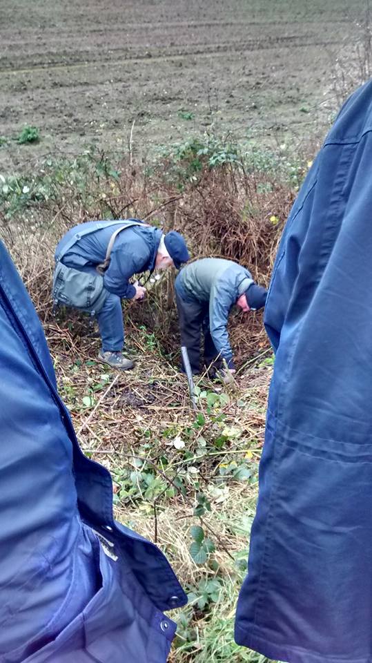
It has been reported that a hearth and lead musket balls were found near  Lock 19, possibly dating to the Civil War. The source of lead for this mini munitions factory can be found a short way along the towpath, where Peter pointed out the headwall to a culvert carrying a pipe beneath the canal. Not just any old pipe though but one that supplied the city’s Crucifix Conduit with water from the Foulwell Springs at Aldershawe, granted by Henry Bellfounder to the Franciscan Friars in 1301. The original pipe is thought to have been made of alder but was later re-laid in lead which it seems those soldiers may have helped themselves to. In 1805, the lead pipe was replaced by a cast iron one made at the Butterley Company in Derby, brought into the city via the canal and offloaded at Gallows Wharf, just as the Herkenrode Glass, recently reinstalled at the Cathedral, had been two years prior.
Conduit site.jpg

Ferreting around up a historic pipe.

At Lock 18, the first site worked on by LHCRT and restored to commemorate the bicentenary of the opening of the canal in 1797, Peter and Bob told us more about the engineering feat that was accomplished here and across the country with tools no more sophisticated than a wheel barrow. Peter told us that during restoration work elsewhere on the route, a brick with a small thumbprint on it was discovered suggesting that children made up part of the workforce. The results of their labour may still be visible but I suspect the details of who they were, where they came from and how they lived, may have disappeared without trace.

Peter and Bob at Lock 18

Peter Buck and Bob Williams at Lock 18

This section of the Heritage Towpath Trail ends at Fosseway Lane. The bridge here was removed shortly after the canal was abandoned in 1954 and will need to be reconstructed as part of the restoration work. The cottage once occupied by the lock-keeper remains though and still displays the number plate ‘268’ allocated by the Birmingham Canal Navigation Company. We know that in 1923 the cottage was lived in by Mr and Mrs Cass as in October that year, the Lichfield Mercury reported that they had rescued a Hednesford butcher using a canal rake. Charles Peake was driving nine beasts from Tamworth when one broke away near the now demolished bridge. As Mr Peake chased the animal he fell 14ft into the lock. Fortunately, Mr and Mrs Cass heard his shouts and managed to fish him out. Though understandably shaken, Mr Peake was uninjured but the Mercury was concerned others may not be so lucky as on a dark night there was, ‘nothing to prevent anyone who doesn’t know the locality from leaving the road and walking, riding or driving straight into the lock’ and suggested that something should be done to make it safe on the basis that ,’one does not expect to be liable to fall into unprotected death traps in a civilized country’.

Lock 18 fence

An unprotected death trap no more. Photo by Dave Moore, LWT

The Lichfield to Walsall railway line also crosses Fosseway Lane. Although the last train passed by in 2003, the signal box dating back to 1875 remains, albeit in poor condition.

Fosseway signal box 3

Fosseway Signal Box, Dave Moore LWT

As we gathered on the crossing, I was able to tell people about its keeper Emily who kept watch here every night between 1946 and 1963, thanks to a wonderful article about her life and her work shared on Dave Cresswell’s Rail Blog (here) and Brownhills Bob’s Brownhills Blog (here)  a couple of years ago.

Fosseway signal box

“Keep Crossing Clear” Photo by Steve Martin

After trespassing on the railway we headed down Fosseway Lane, stopping just before the junction with Claypit Lane to see Sandfields Lodge, where a private lunatic asylum operated between 1818 and 1856.   A series of visits by commissioners in 1846 revealed series of deficiencies in the provision of care at the Sandfields Asylum (you can read a transcript of the Commissioners’ Report here) and it was finally closed in 1856 after having its licence revoked due to the poor conditions.  We know that the asylum was transferred here from St John Street and it may be related to the one established on that street  in 1775 by a physician named George Chadwick. More research is needed into this and perhaps also into the reasons why by 1788, Chadwick had confined his wife to her room on the basis that she was a ‘lunatic’.

Falkland Rd canalFrom Fosseway Lane we walked along Falkland Rd and the new route of the canal to the Birmingham Rd roundabout where a tunnel has been constructed and temporarily buried (see we really do have secret tunnels in Lichfield!).  After passing beneath the Birmingham Rd, the canal will cross under the Lichfield to Birmingham Cross City railway line via a new tunnel, scheduled to be constructed at Christmas 2017.

With the weather on the turn, the real ales and real fire at the Duke of Wellington beckoned. En-route we passed another old pub, now Redlock Cottage but once known as the Board and later as the Spotted Dog. At this stage though, it was an open pub we were all really interested in. We know the Welly was definitely an inn by 1818 when the landlord is listed as Thomas Summerfield but the early history is sketchy. I have seen it suggested here that it began life in the mid eighteenth century as a slaughter house and only later became an inn to take advantage of the passing trade brought by the canal.  It was of course the canal which had brought us here too, for beer, tea, crisps and dog biscuits (Doug the Dog definitely deserved his!). A fitting end to a great walk at the end a great year.

dog xmas tree

Doug the Dog doing battle with the Falklands Rd Christmas Tree. Both now Lichfield legends in their own right

Thanks to the Lichfield Waterworks Trust, the Lichfield and Hatherton Canal Restoration Trust, Steve Martin and Eddie Strain for the photographs and of course everyone who came along. Happy New Year and here’s to plenty more of this kind of thing in 2016. Make sure you follow us all on Twitter @lichdiscovered and @LHCRT1 and on Facebook here, here and here so you don’t miss out!

Sandfields crowd

Further reading:

http://www.british-history.ac.uk/vch/staffs/vol14/

History of the Trust

History of Sandfields Pumping Station – Cholera in the Black Country

Listed building entry for Sandfields Lodge

Explore the LHCRT Heritage Towpath Trail for yourself here


Lichfield Discovered Meet-Up

Our Lichfield Discovered monthly meet-up is at the King’s Head on Bird Street tonight (Tuesday 8th September). It starts at 7.30pm but don’t worry if you’re late, just join us when you can. We’ll be there for a while….We’ve got plenty to talk about including plans for our Halloween get-together at a suitably historic location just outside the city, the possibility of a garden archaeology project next year and we’ll be chucking around ideas about some experimental local history (this may or may not involve charabancs). We need to have a bit of a chat about the future direction of the group and of course, there’s bound to be general chatter about all things Lichfield.

Kings Head, Lichfield

These meet-ups are informal, open to everyone and you can get involved as much, or as little as you’d like. You can come along and have a say in what we do and how we do it, or you can just come along and say ‘hello’. There’s no obligation to come every month, just as and when you want to.

As ever, the best place to keep up to date and get in touch is on twitter @lichdiscovered or like our Lichfield Discovered Facebook group.

(Apologies for the late notice with this. I had some technical issues with the blog which I am hugely grateful to Philip John for sorting out. I hope nobody bought one of those mobile phones)

Trailgating

Perhaps the biggest faux pax you can commit about the place that gave the world Samuel ‘Dictionary’ Johnson is to spell the name incorrectly. Outsiders, please note that these days the only acceptable ‘T’ in Lichfield comes with biscuits and/or cake. The other way to wind up a Lichfeldian is to refer to Staffordshire’s premier heritage city as a town. En-route to the Guildhall Cells, perpetrators of this crime are taken past our central railway station to illustrate just how wrong they were.

"Lichfield City Station (6668724487)" by Elliott Brown from Birmingham, United Kingdom - Lichfield City StationUploaded by Oxyman. Licensed under CC BY 2.0 via Wikimedia Commons - https://commons.wikimedia.org/wiki/File:Lichfield_City_Station_(6668724487).jpg#/media/File:Lichfield_City_Station_(6668724487).jpg

“Lichfield City Station (6668724487)” by Elliott Brown from Birmingham, United Kingdom – Lichfield City StationUploaded by Oxyman. Licensed under CC BY 2.0 via Wikimedia Commons

Once they are in the stocks, heretics are then read to from the charters, currently held at the museum in St Mary’s, which include Queen Mary’s declaration of 1553 that Lichfield was not only to be a city, as granted by her brother Edward five years earlier, but also a county in its own right.

stocks

“OK it’s a city. I get it. I’m sorry. I’m from Tamworth”

This is the charter which gave rise to the annual Sheriff’s Ride (and its much more recent and considerably shorter spin-offs), a twenty mile perambulation of the current boundary of Lichfield. I had often sat and wondered whether at any point, the boundary was physically marked in someway (I do need to get out more) and just recently found an article written in the late nineteenth century which says it was, “formerly marked by wooden posts, but they have much deteriorated and in some instances disappeared. A renewal in iron of the most important has recently taken place”.

The Sheriff perambulating Cross in Hand Lane in 2014

The 2014 Sheriff perambulating Cross in Hand Lane.

Descriptions of the boundary of the City of Lichfield date back to the late 1700s. Back then it was only a sixteen mile round trip. Although in 1806, local historian Harwood said they were based on ‘ancient writings’, I understand there is no earlier written description of exactly what constituted Lichfield. However, there are piecemeal records showing some of the boundary changes over the centuries. And there must have been a fair few changes to get from a medieval town you could walk around in an hour to a city with a circumference of sixteen miles.

Last week I spent a sunny morning trying to trace the boundary of what would have been the medieval town. With the help of John Snape’s 1782 plan of Lichfield, it’s actually fairly easy to do, even for someone as illiterate at map reading as me.  Bishop Roger de Clinton surrounded the south part of the new town he had laid out in the late twelfth century with a bank and ditch and fortified the shared northern boundary of the town and Cathedral Close. Apart from a couple of inconveniently placed walls, you can pretty much walk the whole way around.

The moat marking the northern boundary of both medieval Lichfield and the Close. Described on Snape's map as a dry ditch or dumble.

The moat marking the northern boundary of both medieval Lichfield and the Close. Described on Snape’s map as a dry ditch or dumble.

Remains of the NE Tower, part of the Close's fortifications.

Remains of the NE Tower, part of the Close’s fortifications.

Thanks to archaeological investigations, we know that the town ditch in the St John’s Street area was about five metres wide, two metres deep and inevitably, was also used as a public tip.

Castle Ditch plaque

The driveway passing the LD Council Offices follows the line of the town ditch, and there's a plaque there telling you that.

The driveway passing the Lichfield District Council Offices follows the line of the town ditch, and there’s a plaque there too.

When a section in the Council House car park was excavated in 2008, archaeologists discovered the sole of a woman’s shoe from the twelfth century, part of a medieval jug and the remains of a medieval dog’s head.

This plaque is located at the junction of Lombard St, Stowe Rd and George Lane

This plaque is located at the junction of Lombard St, Stowe Rd and George Lane.

Back to plaque, looking up George Lane which was actually once part of the town ditch

Back to plaque, looking up George Lane which was actually once part of the town ditch, possibly until the 16thc

Snape’s plan also marks the gates, or bar(r)s, at the main entrances into and out of Lichfield, and there are plaques at each of the locations, with the, hopefully temporary, exception of the Sandford Street gate. The building it was mounted on has recently been demolished but I’m sure the plaque is being kept safely somewhere….

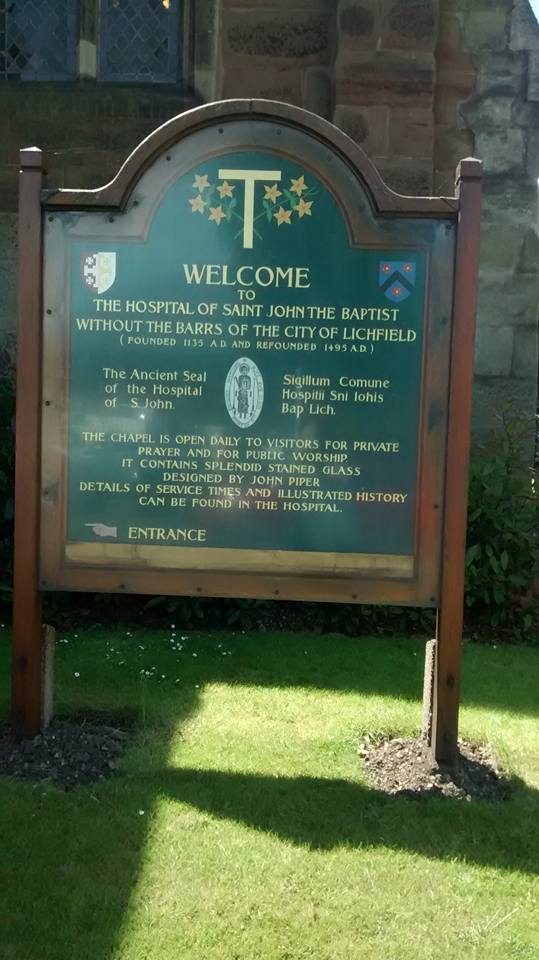
Perhaps the best known of the gates is the one at St John Street which is still recalled in the name of St John the Baptist without the Barrs. You know, the place with all the chimneys. As the name indicates, this stood just outside the gate and started out as a hostel for those arriving when Lichfield was closed for business for the night, many of them pilgrims on their way to see the shrine of St Chad at the Cathedral.

st john sign

On the subject of names, the section of the ditch running from the gate on Tamworth Street, to the gate near St John’s Hospital was known as Castle Ditch, and this, alongside hard evidence in the form of stones turning up nearby and evidence of a slightly more fluffy nature in the form of myth and folklore, has caused endless speculation as to whether Lichfield ever had a castle proper alongside the fortified Close with its towers, turrets and strong walls.

Remains of south gate tower leading from dam Street to The Close. Excavated in the 1980s

Remains of one of the towers which were part of the south gate between Dam Street and The Close. Excavated in the 1980s.

So, plenty of opportunities to get out more here. I think the two mile-ish walk around the ditch will make an excellent Lichfield Discovered adventure. I would also happily walk sixteen miles to find one of those old iron boundary markers although I may be on my own with this. It’d also be interesting to see how Lichfield has burst its boundaries over the years gobbling up all of the surrounding settlements, so much so that it’d take you six hours and twenty four minutes to perambulate the current perimeter, according to this walking calculator I’ve found.  And that doesn’t even include getting distracted by other things or stopping off at the pub. It’ll have to wait though, as right now I’m off on an expedition to Borrowcop to see if I can capture Lichfield Castle.

1)  If we’re doing names, then I have to mention that Bakers Lane was once known as Peas Porridge Lane. Just because.

Discovering the Future

Our Lichfield Discovered group has been walking, talking, photographing and filming its way around Lichfield and the surrounding area for over eighteen months. The group is growing in popularity and naturally we’re delighted about this but, in order to keep doing all the great stuff we do and to do more of it in the future, we’ve decided that we need to shake things up a little. As any number of motivational quotes on Facebook will tell you, change is a good thing, and here are some of the reasons why:

  • We want more people from the local community to get involved in and have a say in what we do.
  • Involving a wider range of people will bring different skills, different interests and different perspectives to the group.
  • We’ve done a good job so far, but we know that with the help of others, we can do even better! There’s the potential to do so much more here in Lichfield….
  • We’re rubbish at making posters. Really.

So, that’s why we want to make changes, and here’s our plan for implementing them:

  • Lichfield Discovered will keep its own identity but will sit under the umbrella of the Lichfield Waterworks Trust (sandfields.org).
  • We will have our own planning meetings but we will have the administration support of the Lichfield Waterworks Trust (e.g. a treasurer), if and when needed, with one or two of us attending the Trust’s committee meetings regularly to report back on what Lichfield Discovered is up to and vice versa.
  • Being part of this larger organisation will allow us to seek funding for future projects if this is something we wish to explore in the future.
  • Thanks to the administrative support offered by the Trust, we will not need to formally elect a chair, secretary or treasurer. However, there are lots of roles that people can take on for example, publicity (including posters!), minute taking, event planning, local history research and helping with refreshments.
Lichfield discovered

We believe this arrangement will be mutually beneficial to both groups, as our community history and heritage activities in and around Lichfield will help to support the Lichfield Waterworks Trust’s bid to save Sandfields Pumping Station for the public, for the purposes of education and community development.

There will be a meeting on Monday 11th May at 7.30pm at St Mary’s in the Market Square, Lichfield to discuss these ideas further. Please come along even if you are only potentially interested in getting involved at this stage and please invite anyone else that may be interested to come along too.

The Lost Pubs of Lichfield pub walk. Photo by John Gallagher

The Lost Pubs of Lichfield pub walk. Photo by John Gallagher

Finally, I’d like to take this opportunity to say thank you to everyone who has supported Lichfield Discovered in some way up until now,  whether by making the tea, giving a talk, sharing a photo, publicising our events or ‘just’ coming along and joining in. Also to St Mary’s for allowing us to use their room for our talks.

We’ve done some great things so far, and with your help, we will be able to do even more in the future.  To keep up to date on developments, or to get in touch, please email me at lichfieldlore-blog@yahoo.co.uk, visit the Lichfield Discovered blog here, follow us on twitter @lichdiscovered or like us on Facebook (where you can even share a motivational quote about change with us if you like!).

Heaven and Earth

Without wishing to state the obvious, this blog is called Lichfield Lore. Sometimes I’m worried that I might go too far (in a geographical rather than controversial sense) but although I’ve overstepped the Lichfield boundary from time to time, I have at least remained in Staffordshire. Until now.

Last month, a group of us from Lichfield Discovered, crossed the border into Derbyshire to visit Repton which, between the seventh and ninth centuries, had been one of the main residences of of the Mercian royal family. In 653AD, Peada, son of the pagan King Penda converted to Christianity in order to marry Alhflæd (sp?), the daughter of King Oswy of Northumbria. To help him to convert the rest of the kingdom, he employed four monks from Lindisfarne  – Adda, Betti, Cedd and Diuma, the latter of whom would become the first Bishop of Mercia (1). However, Peada and Alhflæd do not appear to have been a match made in Heaven nor Neorxnawang. The Venerable Bede reported in his Historia Ecclesiastica that Peada was murdered in 656AD “wickedly killed by the treachery, as is said, of his wife during the very time of celebrating Easter”. 

Church of St Wystan, Repton. Photo by David Moore

Church of St Wystan, Repton. Photo by David Moore

Rather fitting then that it was death which brought us to the ‘cradle of Christianity in the Midlands’. Although Peada is not buried here, the eighth century Anglo-Saxon crypt beneath the church was used as a mausoleum for later members of the Mercian royal family, including King Æthelbald ( ‘treacherously murdered at night by his own bodyguards’ says Bede), King Wiglaf (cause of death unknown) and his grandson Wigstan (murdered by a family member, who he objected to marrying his widowed mother. Seems his concerns were well-founded). The exact place where Wigstan was scalped is not known (Wistow in Leicestershire and Wistanstow in Shropshire both have claims) but wherever it was, it’s said that on the anniversary of his death each year, human hair grows from the earth at the spot where his blood was spilt (2). This supposed phenomenon and other miracles, led to the canonization of Wigstan, who became known as St Wystan. The crypt became a place of pilgrimage and the church above it took his name.

The crypt at Repton. Photo by David Moore.

The crypt at Repton. Photo by David Moore.

In the early eleventh century, King Cnut ordered the holy bones to be moved to Evesham Abbey and in the centuries which followed, the entrances to the crypt were sealed and its existence forgotten until 1779, when someone digging a grave for the headmaster of Repton School broke through the vaulting and fell into it. We made our entrance in a rather more conventional way.

crypt stairs

Down to the crypt and into the eighth century. Photo by David Moore.

From Repton, we headed to the Anchor Church, four connected caves alongside the River Trent, which both nature and humans had a hand in forming. I confess that the time I should have spent on the logistics of the trip was instead spent at the Whippet Inn, and so it took a bit of finding with just a postcode to guide us. However, when we did finally arrive we were pleased to see that, although thick with mud, the often flooded path that would take us to the ‘church’ was just about passable.

Inside the caves. Photo by Andy Walker.

Inside the caves. Photo by Andy Walker.

Legend has it that in the sixth or seventh century, the caves were occupied by a hermit, who spent his time here going to the river to pray. Later, the caves were supposedly inhabited by a monk called Bernard who spent his last days here, repenting for his part in the deception which persuaded returning crusader Hugh de Burdett that his wife Johanne had been unfaithful. The story goes that Hugh cut off her left hand, leaving her to bleed to death over the altar cloth she’d been embroidering for him using her own hair (what’s with the hair obsession around here?).  On a more cheerful note, in the eighteenth century, Sir Francis Burdett (presumably one of Hugh’s descendants) used the caves and riverbanks as a venue for picnics, as shall we when we visit again in the Summer.

The Anchor Church near Ingleby. Photo by David Moore.

The Anchor Church near Ingleby. Photo by David Moore.

On our way back to the cars, there was a blood-curdling scream. Had one of our party met with the ghost of Johanne searching for her lost hand or had they lost their footing and fallen victim to the mud?  No, Carol just had something in her shoe. One of those funny at the time but you really had to be there moments admittedly, but I mention it because this is what I remember first and most fondly when I think of our trip. I love places for their stories and their connections to the people of the past, but even more so for the memories made by visiting them with people in the here and now.

repton group

Looking for pirahanas in the River Trent. Photo by David Moore.

Notes

(1) In 669, Chad, brother of Cedd and the fourth Bishop of Mercia moved the See from Repton to Lichfield (phew, it is relevant to Lichfield after all!)

(2) There’s another Lichfield Discovered trip right there. Who is free on the first of June? We’ll have to split up though, gang….

(3) Another Lichfield link – in 1364 an armed mob at Repton attacked the Bishop of Lichfield and the Prior. Actually, finding places with a tenuous link to Lichfield could be a whole blog post in its own.

References

http://www.reptonchurch.org.uk/

Repton and its Neighbourhood by F C Hipkins

The Oxford Dictionary of Saints by David Hugh Farmer

http://jimjarratt.co.uk/follies/page57.html

Click to access anchor_a3.pdf

Water Slides

Ross Parish has been researching holy wells since the 1980s and has published several books on the subject.  Ross is currently working on a Staffordshire volume and a couple of weeks back, we were delighted to have him at our Lichfield Discovered meeting to share his research with us. Ross took us through the history of holy wells, and some of the customs associated with them, pouring cold water on some of the popular views that have sprung up around them. At the risk of firing up inter-county rivalry, you’ve heard the saying ‘The best bits of Derbyshire are in Staffordshire’?. Well, Staffordshire is also a bit hard done by when it comes to the tradition of well dressing. Google it and you’ll find claims aplenty that it’s ‘unique to Derbyshire’. Try telling the people of Endon and Mayfield that. Interestingly, we also went through a phase of decorating St Chad’s well here in Lichfield for a time, but this tradition seems to have dried up in 2010.

St Chad's Well Lichfield,  only decorated by nature these days.

St Chad’s Well Lichfield, only decorated by nature these days.

With so many fascinating sites to chose from,  we forgave Ross for not including St Chad’s in his top ten list of Staffordshire wells. You can discover the ones that did make it, along with an abundance of other fascinating information, on the slides of the talk that Ross has very kindly shared with us online here.

If you’ve a thirst to know more about holy wells and sacred springs, here in Staffordshire and further afield, please do check out Ross’ blog here and also take a look at the Facebook group he’s involved in here.


Sites for Sore Eyes

Springs and wells are sources not only of water but also of folklore and legend. There are healing springs and fortune telling wells. Some are associated with saints, others with spirits.

St Chad's in Lichfield. Photo by Lichwheeld

St Chad’s in Lichfield was believed to cure sore eyes (photo by Lichwheeld)

On Monday 9th February, Ross Parish, author of the Holy and Healing Wells blog and a series of books on the subject, will be giving a talk to our Lichfield Discovered group. Ross will be telling us about some of the sites we have here in Staffordshire and some of the traditions and stories associated with them. The talk starts at 7.30pm at St Mary’s in the Market Square (where there was a once a well of the same name at the west end!) and there is no entry charge, although voluntary donations towards the running of St Mary’s are always welcome. After the talk, people are invited to stay behind to discuss the future vision of the county’s archive and heritage service, over a cup of Staffordshire water (plus milk and teabag).

Serving Time

Throughout the year, the Lichfield Discovered group has hosted some fascinating talks on a range of subjects from symbolism in cemeteries (we never did find out about the mackerel!) to urban exploration and we’ve visited pubs, the Cathedral Close, Roman forts, pill boxes and tunnels. Before we hang up our boots and put the lid back on the biscuit tin for 2014, we have two more events coming up, which I want to let people know about.

This coming Monday (10th November), we are delighted to welcome local author and journalist Joss Musgrove Knibb who will be taking a look at the previously unpublished letters of four Staffordshire Regiment soldiers who fought, and in some cases died, in the trenches of WW1. The vibrant letters of Alfred Bull of Lichfield, Sydney Norton of Tamworth, James Stevenson of Stoke-on-Trent and Jake Armes on the 1914 Christmas Truce bring the voices of these men vividly to life. With lots of photographs, stories and ‘trench humour’, it will be a thought provoking way of marking the centenary. The event takes place at 7pm at St Mary’s in the Market Square, Lichfield. There is no charge, but donations towards the centre are always appreciated.

First Lines by Joss Musgrove Knibb

First Lines by Joss Musgrove Knibb

The letters are part of Joss’ recently published book – First Lines. First Lines is published by Gazelle Press and is available to purchase across the region. Local outlets include WH Smiths (Three Spires Shopping Centre), St Mary’s Heritage Centre, The Cathedral Shop and the National Memorial Arboretum. First Lines retails at £9.99.

On Saturday 15th November we are meeting at the Guildhall at 2pm, where we’ll be exploring what remains of the city’s old gaol, first opened in 1548. After three hundred years, changes in the law meant that Lichfield’s prisoners were transported to Stafford after their trial, but a small number of cells were retained and used as the city lock-up. In 1847, the Inspector of Prisons visited the gaol and found that ‘the initials and names of many prisoners were cut deep into the wood work’. On our visit we’ll be attempting to locate and record this graffiti and have access to some of the cells which are not usually open to the public. Any names or initials that are discovered will then be compared with prison documents held by Lichfield Record Office at a later date. As it would be good to have an idea of numbers (it might get a bit cosy in those cells if there are too many of us!), please let me know if you would like to join us. We also need people to bring torches and cameras to help with the recording process.

prison door

We’re currently working on next year’s programme of events for Lichfield Discovered but so far we’ve pencilled in a visit to the Spital Chapel – one of Tamworth’s oldest and loveliest buildings, a talk on Holy Wells of the Midlands, a visit to the timber framed Sinai Park House (where there’s also a holy well!) and closer to home, an exploration of Beacon Park and Beacon Street. As ever, we are open to suggestions and so if there’s anywhere you’d like to visit, or anything you’d like to know more about, tell us and we’ll see what we can do! Dates to follow, so watch this space. You can also keep up to date by following us on twitter @lichdiscovered or liking us on Facebook.

Spital Chapel of St James, Tamworth

Spital Chapel of St James, Tamworth. During an archaeological dig in the latter half of the 20thc, to find any earlier structures on site, three skeletons were unexpectedly discovered in the area where the table is.


Something for the Weekend

Chatting to a friend last weekend about everything that goes on in Lichfield made me realise that I do take some of it for granted. Then, a few days later, another friend chastised me for being rubbish at promoting things, even events I’m involved in myself! So, influenced/shamed by both of them, here’s a quick run down of some of the history related goings-on in and around Lichfield this weekend.

Sheriff's Ride passing the pinfold, 2013

Sheriff’s Ride passing the pinfold, 2013

On Saturday morning, the Sheriff of Lichfield will set off with a party of horses and riders to perambulate the city’s boundary. This has happened on the Feast of the Nativity of the Blessed Virgin Mary (or on the nearest Saturday at least), every year since 1553 when Queen Mary made Lichfield a separate county with its own Sheriff, as a way of saying thanks for all the support during that game of thrones business.

Alterntive Sheriff's Ride 2013

Alternative Sheriff’s Ride 2013

Pinfold Rd

Once the traditional Sheriff’s Ride has passed by and headed up Cross in Hand Lane, a group of us will be setting off from the Beacon Street pinfold in the opposite direction on the Alternative Sheriff’s Ride, which has happened every year since 2013 when my friend Lichwheeld had the idea and thought, ‘Well, why not?!’. At around four miles, the alternative ride will be considerably shorter than the current circuit of twenty miles, which has increased from the sixteen miles described in the 1800s by Thomas Harwood, as follows:

It begins at a place called the Cross and Hand near the end of a street there called Bacon street and from thence goeth northward along the lane leading to Longdon Church unto a little lane at the further side of Oakenfields and so along that little cross lands unto another lane that leadeth from Lichfield to King’s Bromley and then along that lane towards Lichfield unto a little lane lying between the Grange Ground and Collin’s Hill Field commonly called the Circuit lane unto the further end of it betwixt two fields the one called Hic-filius and the other Piper’s Croft and so over across a lane that leadeth from Lichfield to Elmhurst and then into another little lane between Stichbrooke Ground and Gifforde’s Crofte and so along that little lane to a green lane at the further side of the Lady being the land of Zachary Babington Esquire and down that lane to a called Pone’s Brook and so over that brook into another lane called Stepping Stones lane and so along that lane taking in the land of Richard Dyott Esq Pone’s Fields unto a lane leading from Lichfield to Curborough Somerville so along that lane towards Lichfield until you come to the upper end of the grounds called Scott’s Orchard and then leaving that lane turn into a field of Lichfield called Whisich at a stilt going into the fields called Browne’s Fields and so taking in the field clled Whisich then go by the closes called Browne’s Fields Hedge unto the grounds called God’s Croft Hedge and so along that hedge taking in the field called Whisich lane called Goslinge’s lane and along Goslinge’s Lane unto a lane called Matthew Coal Lane and so over across that lane into a field called Cross field at or near an elm tree and so along a head land about the middle of Cressfield unto the nearer end of Gorsty Bank into the lane leading from Lichfield to a cross way called Burton turnings and from thence along Ikenield street taking in Spear Hill and Boley unto a cross way leading from Lichfield to Whittington and so along that lane towards Whittington unto the south end of Austin’s Coat Grounds then turning upon the left hand at that brook to a gate going into Fulfin Grounds unto the moors called Dernford Moors and so along by the hedge of those moors unto the nether side of Dernford Mill stream and so going by the mill door to the pool dam and going along by the pool and the brook taking in Horslade and a meadow belonging to Freeford House unto a bridge called Freeford Bridge in a lane leading from Lichfield to Tamworth and so from that bridge up the sandy lane to Freeford House and along that lane to the corner of the meadow and then turning into Bispells at the corner of the meadow and so going by the meadow hedge until you come to the brook that runneth to Freeford Bridge and so going up a little pool taking in all Bispells unto a ford called Baltrex ford and then entering into Old field turn up the left hand to the brook that runs from Freeford Pool and so along that brook to Freeford Pool and along by the pool and the brook that comes from Swynfen Mill until you come into the lane that leads from Swynfen unto the mill and so along that lane to a gate that leads from Lichfield unto Swynfen called Old Field Gate and then not coming in at that gate but going to the corner of the hedge adjoining to Cley Lands come in at a gap and taking in all Old field come by the demesnes of Swynfen unto a place called Long bridge and so entering into a little lane between Long furlong and Long bridge grounds leading to Well crofts and so taking in all Well crofts along by the Knowlc Leasowes being the Hospital Land unto Ikeneld street and so along Ikeneld street unto the further side of a close called Gorsty Leasowe and leaving the hedge on the left hand taking in that close going along by that hedge leading to Hare house Ground and so along that hedge unto the top of Dean’s Slade taking in all Hare house Ground northward enter into Park field leaving the hedge on the right hand and so following that hedge unto a little lane at Aldershawe that comes down that lane to the gate and through the gate then turn upon the left hand by Aldershawe Hedge taking in the barn and so go into the Wheat Close leaving the hedge on the left hand unto the road called the Fosse way up to the top of Mickle hill then crossing over Pipe green along an old decayed cart way into a lane end that leads to Pipe grange lane to the further side of Padwell’s and so taking in Padwell’s leaving the hedge on the left hand to a little lane that leadeth into Ashfield leaving the hedge on the left hand into the grounds called Lammas Grounds and leaving the hedge on the left hand and so into Lemondsley then following the brook to Pipe green gate and so along the brook in Pipe green into a little lane that butteth upon the lane that leadeth from Lichfield to Pipe and crossing that lane into Smithfield at the corner of Abnell Hedge and so taking in all Smithfield leaving Abnell Ground on the left hand unto the Cross and Hand where it began

All you need to join in is a roadworthy bike and a sense of humour. I’m not sure if we’ll be visiting God’s Croft Hedge or Hic-filius on our ride, but I do know that we’ll be stopping off at a secret location for tea and cake half way around, and finishing up in the beer garden of the George and Dragon. The traditional ride will arrive back in the city via Beacon St around 6.15pm, about the time that Beacon Park will be filling up with people and their picnic rugs, ready for the free Proms in the Park concert, organised by Lichfield District Council.

The horns are kept in the church of St Nicholas

The horns are kept in the church of St Nicholas

At eight o’clock on Monday morning (8th September), the current generation of Abbots Bromley horn dancers will collect their thousand year old reindeer antlers from St Nicholas, beginning a ten mile journey around the village and out to Blithfield Hall, before returning to the church twelve hours later. Whether the dance began as a pagan fertility ritual or is to do with hunting rights, no-one really knows but the mystery surrounding its origins is part of the tradition’s appeal.  Last year, I watched the dance as darkness fell in the village.

Horn Dance 1

This year, I’ll be spectating at Blithfield Hall at midday, along with the other commoners being kept off the lawns below the Ha-Ha, to ensure I’m back in time for our Lichfield Discovered ‘Weeping Angels’ talk that evening.

We may not have David Tennant, but we do have public historian David Moore to talk to us about the symbolism in Victorian cemeteries. We also have custard creams. The talk starts at 7pm, at St Mary’s in the Market Square, Lichfield. We don’t charge, but we do make a voluntary collection which we donate to the centre for use of the room.

Weeping Angel (c) David Moore

Weeping Angel (c) David Moore

There’s plenty more happening in the weeks to come, but for now, enjoy the weekend in Lichfield and please share any photos you take during it with us for our new Lichfield Discovered photo project ‘A Year in Lichfield‘. Email them to ayearinlichfield@yahoo.com, or share them on Twitter (@lichdiscovered) or on Facebook.


Ale Tales

One of the many lost pubs that John Gallagher found for us on the brilliant Lichfield Discovered tour he led on Monday was the former Windsor Castle on Dam Street (1). There is a great story about this pub, which J W Jackson shared in his Lichfield Mercury column in 1939. I feel like I should take it with a pinch of salted peanuts, but it’s worth sharing again here.

‘Its (the Windsor Castle’s) backyard runs along the back of the workshops of Messrs R Bridgeman and Son, the well-known ecclesiastical sculptors, and it appears, years ago, the carvers in order to obtain liquid refreshment without leaving their work, ingeniously removed several bricks from the wall which separated the shop from the Windsor Castle, and through the aperture received bottles of stout or beer from the licensee (a lady at that time) at a certain time each morning and then replaced the bricks. This arrangement worked very smoothly for a long time until one morning the late Mr R Bridgeman brought a visitor into the shop to see the sculptors at work just at the time when the ‘refreshment’ was due and, of course, the men could not remove the loose bricks. Suddenly, a voice sounded clearly through from the other side of the wall, ‘Now, then you b___s, don’t you want your porter this morning?’ Mr Bridgeman, who had his back to the men at that moment, swung around quickly and taking in the situation shouted ‘Joe, come here at once and block up this hole and use cement’. (Joe was Joe Stokes who lived for many years in the little old cottage which still stands in Quonian’s Lane, adjoining the offices)’.

Mr Jackson goes on to describe how the workers got around this setback by bringing bottles into the workshop in their wheelbarrows, storing the empties in their tool chests until the coast was clear, and then returning them to the establishment for a refill.

The former 'Windsor Castle' public house

The former ‘Windsor Castle’ public house

Mr Jackson refers to the Windsor Castle as Lichfield’s oldest licensed house, a claim which I was puzzled by after reading in the official listed building description that the property only dates back to the ‘mid to late 18thc with late 19thc alterations’. However, by delving into Lichfield’s District Council’s online planning records, I have found a survey of the building (2) carried out around seven years ago, which suggests that part of the building may in fact date back to the 16thc. According to the surveyors, the original building would have been a simple one room wide structure running north/south along Dam St. The current facade was added in the early 19thc and it’s thought that the height of the roof was increased and the oriel windows added at this time too (although I’m sure John showed us a photograph of the pub without these windows on? Can anyone else remember?)

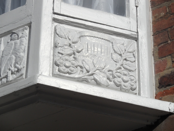
Whenever they were added, those windows feature a curious and seemingly eclectic collection of carvings.  I’m not even sure what some of them are supposed to be, but in Lichfield’s very own pub quiz version of ‘Only Connect‘, I give you a man with a fish, a man drinking beer, some sort of castle, Lichfield Cathedral and an owl, a man composing music (possibly the same man as the one with the fish?) and a building with some foliage. Are they telling a tale of some sort, and if so, what is it?

windsor castle 5

windsor castle carvings

windsor castle carvings 4windsor castle carvings 2

windsor castle arvings 3

Notes:

1) A great write up of the walk can be found here, together with some photographs of the other pubs we visited on the night.
2)Something else I noticed on the survey were references to, ‘inappropriate repair works undertaken to the brickworks using a cement based mortar’, which, in view of how the Bridgeman workers’ cheeky ruse came to an end, made me smile.

Sources:

Lichfield Mercury Archive
Smiths Gore Condition Survey, 16 Dam Street, Lichfield (08/00186/LBC)