
Without wishing to state the obvious, this blog is called Lichfield Lore. Sometimes I’m worried that I might go too far (in a geographical rather than controversial sense) but although I’ve overstepped the Lichfield boundary from time to time, I have at least remained in Staffordshire. Until now.
Last month, a group of us from Lichfield Discovered, crossed the border into Derbyshire to visit Repton which, between the seventh and ninth centuries, had been one of the main residences of of the Mercian royal family. In 653AD, Peada, son of the pagan King Penda converted to Christianity in order to marry Alhflæd (sp?), the daughter of King Oswy of Northumbria. To help him to convert the rest of the kingdom, he employed four monks from Lindisfarne – Adda, Betti, Cedd and Diuma, the latter of whom would become the first Bishop of Mercia (1). However, Peada and Alhflæd do not appear to have been a match made in Heaven nor Neorxnawang. The Venerable Bede reported in his Historia Ecclesiastica that Peada was murdered in 656AD “wickedly killed by the treachery, as is said, of his wife during the very time of celebrating Easter”.
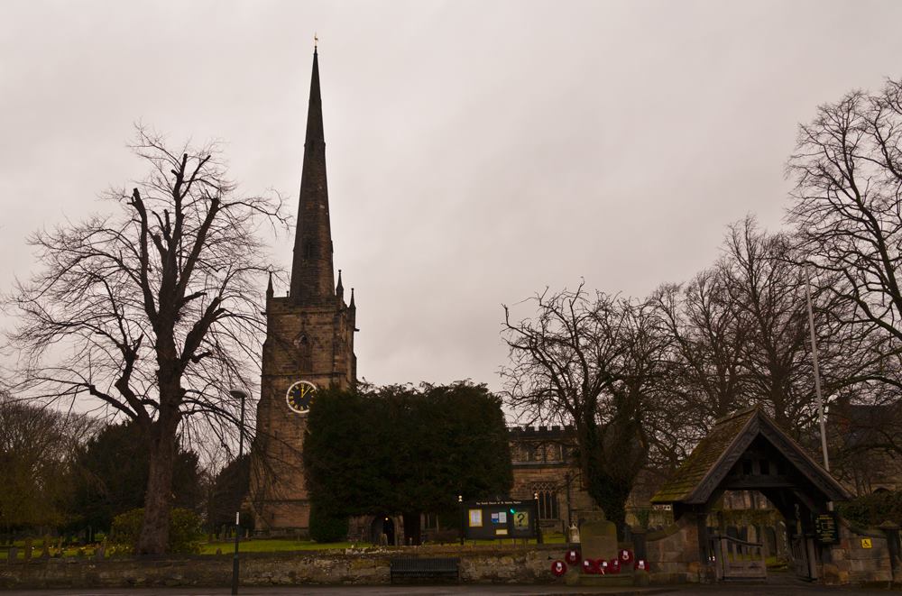
Church of St Wystan, Repton. Photo by David Moore
Rather fitting then that it was death which brought us to the ‘cradle of Christianity in the Midlands’. Although Peada is not buried here, the eighth century Anglo-Saxon crypt beneath the church was used as a mausoleum for later members of the Mercian royal family, including King Æthelbald ( ‘treacherously murdered at night by his own bodyguards’ says Bede), King Wiglaf (cause of death unknown) and his grandson Wigstan (murdered by a family member, who he objected to marrying his widowed mother. Seems his concerns were well-founded). The exact place where Wigstan was scalped is not known (Wistow in Leicestershire and Wistanstow in Shropshire both have claims) but wherever it was, it’s said that on the anniversary of his death each year, human hair grows from the earth at the spot where his blood was spilt (2). This supposed phenomenon and other miracles, led to the canonization of Wigstan, who became known as St Wystan. The crypt became a place of pilgrimage and the church above it took his name.

The crypt at Repton. Photo by David Moore.
In the early eleventh century, King Cnut ordered the holy bones to be moved to Evesham Abbey and in the centuries which followed, the entrances to the crypt were sealed and its existence forgotten until 1779, when someone digging a grave for the headmaster of Repton School broke through the vaulting and fell into it. We made our entrance in a rather more conventional way.

Down to the crypt and into the eighth century. Photo by David Moore.
From Repton, we headed to the Anchor Church, four connected caves alongside the River Trent, which both nature and humans had a hand in forming. I confess that the time I should have spent on the logistics of the trip was instead spent at the Whippet Inn, and so it took a bit of finding with just a postcode to guide us. However, when we did finally arrive we were pleased to see that, although thick with mud, the often flooded path that would take us to the ‘church’ was just about passable.
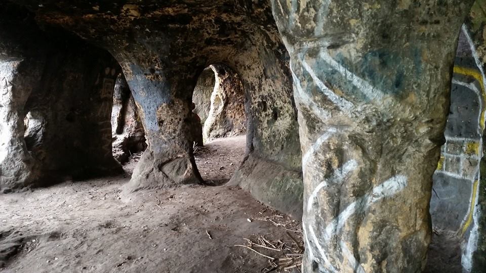
Inside the caves. Photo by Andy Walker.
Legend has it that in the sixth or seventh century, the caves were occupied by a hermit, who spent his time here going to the river to pray. Later, the caves were supposedly inhabited by a monk called Bernard who spent his last days here, repenting for his part in the deception which persuaded returning crusader Hugh de Burdett that his wife Johanne had been unfaithful. The story goes that Hugh cut off her left hand, leaving her to bleed to death over the altar cloth she’d been embroidering for him using her own hair (what’s with the hair obsession around here?). On a more cheerful note, in the eighteenth century, Sir Francis Burdett (presumably one of Hugh’s descendants) used the caves and riverbanks as a venue for picnics, as shall we when we visit again in the Summer.
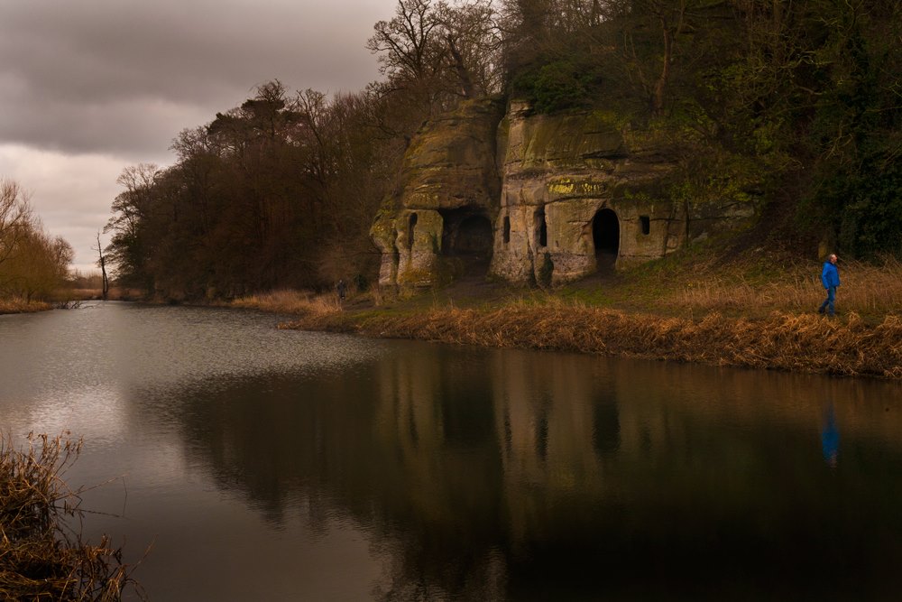
The Anchor Church near Ingleby. Photo by David Moore.
On our way back to the cars, there was a blood-curdling scream. Had one of our party met with the ghost of Johanne searching for her lost hand or had they lost their footing and fallen victim to the mud? No, Carol just had something in her shoe. One of those funny at the time but you really had to be there moments admittedly, but I mention it because this is what I remember first and most fondly when I think of our trip. I love places for their stories and their connections to the people of the past, but even more so for the memories made by visiting them with people in the here and now.
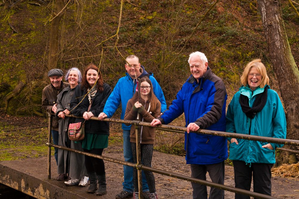
Looking for pirahanas in the River Trent. Photo by David Moore.
Notes
(1) In 669, Chad, brother of Cedd and the fourth Bishop of Mercia moved the See from Repton to Lichfield (phew, it is relevant to Lichfield after all!)
(2) There’s another Lichfield Discovered trip right there. Who is free on the first of June? We’ll have to split up though, gang….
(3) Another Lichfield link – in 1364 an armed mob at Repton attacked the Bishop of Lichfield and the Prior. Actually, finding places with a tenuous link to Lichfield could be a whole blog post in its own.
References
http://www.reptonchurch.org.uk/
Repton and its Neighbourhood by F C Hipkins
The Oxford Dictionary of Saints by David Hugh Farmer


