Heads and Tales

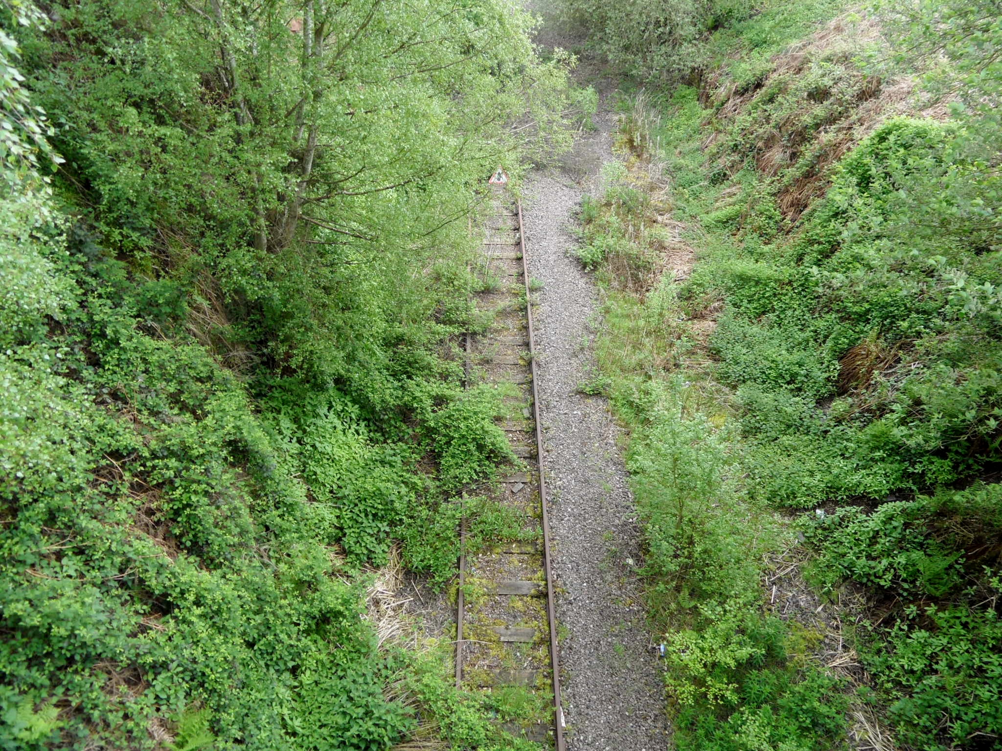
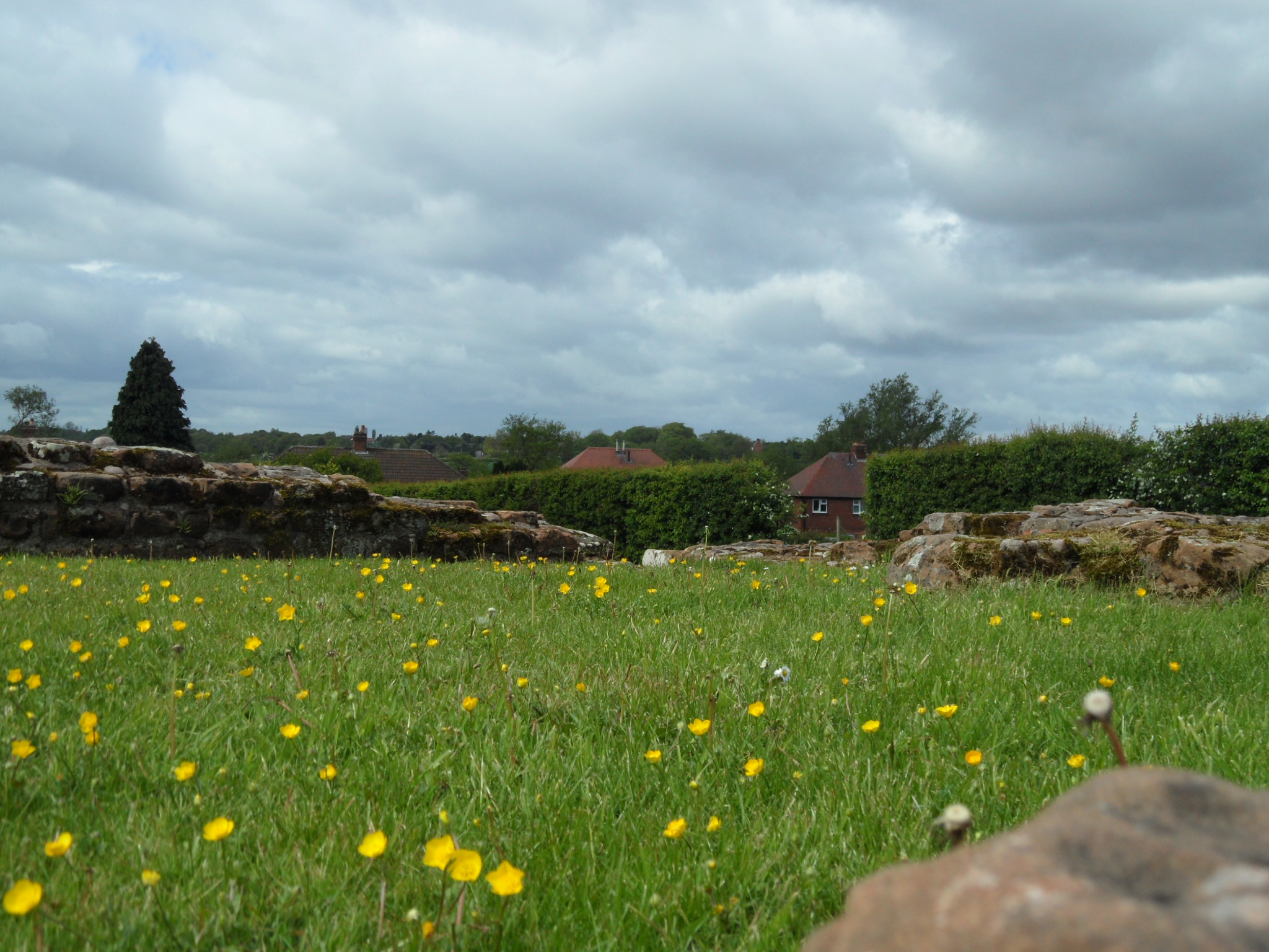
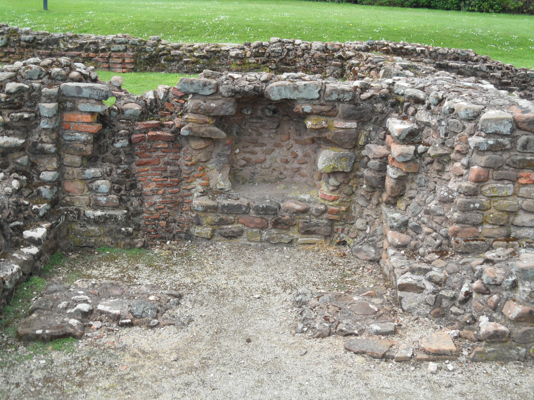
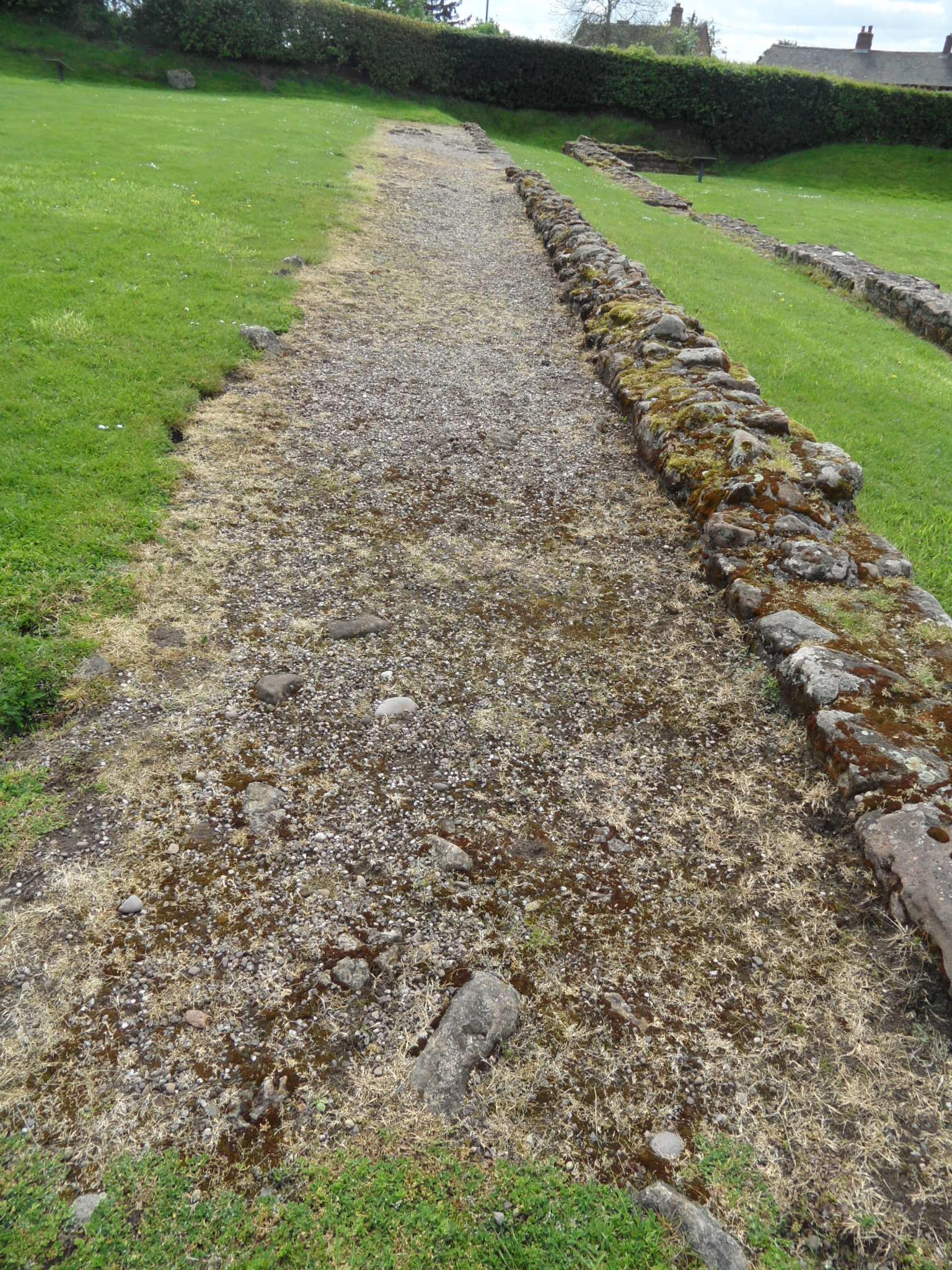
Just outside of Lichfield, in the village of Wall, are the remains of the Roman settlement of Letocetum, a latinized version of an Iron Age place name meaning ‘grey wood’. The foundations of the bath house and guest house (or mansio), established here to provide rest and recuperation and a change of horses to those travelling along Watling Street, are still visible.  As you’d expect, some fascinating archaeological finds have been unearthed at the site, giving us a glimpse of what life in Letocetum was like almost two thousand years ago. Many of these are displayed in the site museum, including my favourite – a carved stone, discovered built into the foundations of the mansio, along with seven others, which I suspect not many people even realise exist.

Stone on display at Wall museum, featuring two carved heads and what's thought to be a shield.

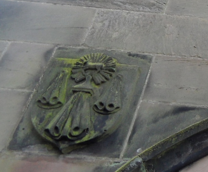
Carved stone on display at Wall museum, featuring two carved heads and what’s thought to be a shield.

The carving seems to show two horned heads facing each other, with a circular object, interpreted as a shield, to their right. Heads also appear on some of the other stones found alongside it.  One depicts a figure with a club in one hand, and a severed head or skull at its feet. Another features a head in what may be some sort of niche and a fourth has a head with an open mouth, that may suggest it is screaming.

Carved onto a fifth stone are two ‘warrior’ figures with shields, stood side by side. A pattern of sorts around their legs has been interpreted as representing water. A second pair of figures, enclosed in a frame or box of some sort lie at right angles to these ‘warriors’. Two further stones have inscriptions, or at least partial inscriptions CUINTI…CI and DDBRUTI, and on the eighth stone is a carving which resembles a Christian cross, although it may be a pagan symbol representing the sun.

All but one of the stones were built into the foundations of the mansio in an inverted position, and there is a theory that they were originally part of a Romano-British shrine dedicated to a native god or gods (the names of whom may be recorded on those inscripted stones), which was demolished sometime around the building of the mansio. The reason for the shrine’s demolition at this stage is unclear, but it has been suggested that it may have been replaced by a yet to be discovered temple dedicated to a Roman god built elsewhere on the site. Incorporating the stones upside down suggests that the native gods represented by the carvings were still respected, and perhaps even feared by the builders of the mansio – I understand that inverting an object was thought to neutralise its power.

There is also a ninth carved stone, found separately from the others, in a hypocaust in the north east of the mansio. It appears to depict a phallus, and was inserted after construction to provide additional protection for the building.

Unfortunately, the stone with the ‘cross’ has disappeared and no photographs appear to exist. The other stones are kept at Birmingham Museum and Art Gallery but photographs of them can be found in the eleventh report of excavations at Wall, included in Volume XXI of the Staffordshire Archaeological and Historical Society transactions for 1979-80. Along with all of the Society’s other transactions, this is accessible online to members (it’s well worth joining if you are interested in the area’s archaeology).  I haven’t got around to asking for permission to use the photographs here, and so in an attempt to stay on the right side of copyright law, whilst trying to give a better idea of what the carvings on the stones look like, here are some drawings I did of them. Apologies to archaeologists and artists everywhere.

Carved stone 1

carved stone 2

carved stone 3

carved stone 4

I’m not drawing the ninth stone. You can probably work out what that one looks like for yourselves….

This all fits quite nicely (albeit unintentionally!) with the theme of ‘Hidden Histories’ for this year’s heritage weekend in Lichfield (20th/21st September). If you are interested in finding out more about the story of Wall, and hearing about some of the other archaeological discoveries made here, there is free guided walk around the village led by the Friends of Letocetum on Sunday 21st September.  The walk is free and open to everyone, and will be starting out from the the village car park at 10.30am.

 Sources

Staffordshire Archaeological and Historical Society Transactions for 1979 -80 Volume XX1

Made of Stone

During the last couple of weeks, if you’ve walked along the path that runs along the top of Beacon Park (between the A51 and the football pitches), chances are that you might have spotted this pile of moss covered stones. A lot of the vegetation in this area has been removed recently, making their presence much more obvious than when I first came across them in Spring last year.

SAM_1044 SAM_1048

Back when I first noticed them, I did a bit of asking around and I was given three different stories regarding their provenance. The most likely explanation came from someone at Lichfield District Council who said that the stonework was a section of the balustrade which runs around the park at the Beacon Street/Bird Street entrance, which had been removed to make a new corner entrance (near to the Chandlers kiosk/public toilets) sometime in the 1980s. However, someone else thought that the stones were what remained of a structure belonging to the farm which once occupied this area of the park and another person suggested that they were part of some sort of tower which was at Stowe Pool until it was dismantled after becoming structurally unsafe.

Last week, Bob Houghton, from the Burntwood Family History Group and Lichfield and Hatherton Canal Restoration Trust noticed them and sent me an email to say that some of the people who work at the park had told him that they were from the old post office which once stood on Bird Street, where Ego now is. So now we have yet another explanation!

To be honest, I’m torn between the truth and enjoying the ongoing speculation about what the stones are and how they came to be in a patch of woodland in the park. As the moss grows fat on these old stones, I hope that the stories keep growing too.

SAM_1157

The last time I walked past the stones,  I found a handful of bits and bobs scattered around them.  I’m pretty sure these are jigsaw pieces to other stories and nothing at all to do with this little puzzle. However,  if you want to include a scrabble tile, some pottery, a piece of tile and an old clay pipe into your version of the story, then please feel free!


The Road to Ruins

When they were excavating the Wyrley to Essington canal at Pipehill at the end of the eighteenth century, a 500 yard section of a Roman military barricade (or palisade) made from trunks of oak trees was discovered.It was thought to have originally stretched from Pipe Hill to the Roman settlement at Letocetum. Well, unfortunately I didn’t come across that (if it even exists anymore) on my walk from Pipe Hill to Wall and back. But here’s what I did find…

A lovely view of the city accompanied me for part of the way (although I can only count four spires. If it’s Five Spires you’re after, look here)

SAM_0896Not too far down the road, I peered over a bridge to see the disused railway line that runs from Lichfield to Walsall. You can get down to the track, although as I was on my own I didn’t risk it, the bank being steep and me being notoriously clumsy. I wonder how far you could walk along the overgrown rails? Rather than regurgitate a history of the railway here, far better is to direct you to the people who really know what they are talking about – the South Staffs Rail group. Their website, full of information, photographs and videos of the line, as it was and is, can be found here, and you can also find out about their campaign to have the line reopened.

Rail bridge Pipehill

SAM_0905

As I continued along Wall Lane, the wind was blustery and the sky dark and it almost felt autumnal. However, with bluebells and stitchwort along the roadside, hawthorn in the hedgerows and the swallows flitting over the fields of oilseed rape there was no real mistaking this was the merry month of May. I saw pheasants and rabbits and heard and saw all kinds of birds whose names I don’t know, but wished I did. However, all attempts to photograph them ended like this. I’m sticking to bricks and stuff that doesn’t move.

SAM_0879Up at St John’s in Wall, I was pondering what might have once stood here on the site of the modern(ish) church built in 1830. Some have speculated a shrine to Minerva, but my thoughts were interrupted by this graffiti on the church yard wall.

SAM_0922

I’ve got a real thing about names carved into stone anyway, but I really have to admire the chutzpah of B Thornton of Redcar in Yorkshire for leaving  practically a full postal address. Wish there was a date though… It seems he or she wanted people to know that that they’d been here but just what were you doing in this small, ancient Staffordshire village B Thornton of Redcar? Were you here to see the ruins too?

SAM_0931

Whilst I was taking this photograph of buttercups growing where Romans once slept, I remembered that bit of childhood folklore about holding one beneath your chin to see if you liked butter. If you’re interested in science stuff, the explanation for how buttercups make our chins glow is here. It seems appropriate to share its Latin name here – ‘Ranunculus acris’. I think the acris bit means bitter, and I wonder if the flower’s common name started out as bitter cup and got corrupted on account of its beautiful golden colour? Anyway, back to the ruins.

SAM_0940 SAM_0944Out of everything, it’s the remains of this small Roman street, with some of its cobbles still intact that gives me the strongest sense of connection with the past. Perhaps it’s the knowledge that you are treading the exact same ground as those who walked here thousands of years ago? Or perhaps I’d spent too much time here, alone with my thoughts….

SAM_0933

Heading out of Wall, there’s a farmyard wall which I believe was built using stone robbed out from the Roman site. Oh and another little mystery – just how does a pair of pants end up in a hedgerow like this? On second thoughts, this is one I probably don’t want to know the answer to.

SAM_0951

SAM_0919

On the road back to Lichfield, down Claypit Lane I came across another relic of the railway. On the Fosseway Level Crossing is a signal box, built in 1875. Once again, I shall point you in the direction of the South Staffs rail site who have more information on this small but wonderful part of our history, and some photographs of the interior here. Also, there is a fantastic article on the South Staffs blog from a few years back, which I remember reading via Brownhills Bob’s blog, on Emily, who worked and lived at this crossing from 1946. You really should read it  – it’s brilliant and it’s here.

Fosseway signal box

SAM_0981

I was just about to leave the crossing and carry on back to Lichfield down Claypit Lane when I saw this.

SAM_0976

I’d heard about the trail via a talk that L&HCRT very kindly did for our Lichfield Discovered group, but hadn’t ever got around to finding it and now here it was! Once over the stile, the path takes you past what is left of this stretch of the Lichfield Canal.

SAM_0988

SAM_0990 SAM_0991

As with the railway line, much of it has been reclaimed by Nature who has decided that if us humans aren’t going to use it, then she’ll have it back thank you very much. I don’t know much about wildlife and ecology, but even I can see that this corridor is an amazing habitat for all sorts of flora and fauna. What does remain of the canal itself is fascinating, and being able to see it like this, in all its emptiness, really made me realise what an epic task building these structures would have been. And how deep it was.

I finished the walk near to Waitrose, once again amazed and delighted at just how much history and beauty there is so close to home. I’m certainly going to do it again and I recommend that you do too – it’s an easy five miles walk and even I didn’t get lost!

Sources:

file:///C:/Users/Kate/Downloads/50e_App4-Archaeological_Desktop_Survey_By_On_Site_Archaeology_Lt%20(7).pdf

http://www.pastscape.org.uk/hob.aspx?hob_id=304434

Wolverhampton Wandering

I had to pop into Wolverhampton today. I knew from my search for an ancient cross in Lichfield a couple of years back that there was a Saxon cross shaft here and went to find it.  Unlike the Lichfield cross, I didn’t have to try too hard – it’s huge! Its size, and also the fact that it is made from sandstone not found in Wolverhampton, has led some archaeology types to suggest that it is probably a reused Roman column, possibly from Wroxeter or even just up the road in Wall.

Saxon Cross Shaft, WolverhamptonThe elements and pollution have not treated the shaft kindly but its still clear that this was an incredible piece of craftmanship – the Black Country History website describes it as, ‘one of the finest cross shafts in the Midlands’. The carvings of acanthus leaves which decorate the shaft alongside those of birds and beasts have given archaeologists some problems when trying to establish a date as they suggest different periods. The plaque accompanying the shaft in the churchyard has decided to go with the earlier date of the ninth century, whilst others believe late tenth century is more accurate.

Cross Shaft Wolverhampton

On the way out of the churchyard I noticed another stone with a good back story. Known as the Bargain Stone, its said to be where the good (and probably not so good) folk of Wolverhampton would agree sales and make deals by shaking hands through the hole. The nearby plaque suggests it is an old gargoyle and the hole is what remains of its mouth.

SAM_0031

Talking of hands, why didn’t it occur to me to put my hands over the railings to take a better photo?

As if ancient crosses and stones weren’t enough of a treat, we also found Holden’s Brewery’s Great Western near to the train station. This is a proper pub – cobs on the bar, Holden’s Golden Glow (amongst other delights) on tap and really friendly staff. Although we were tempted to sit outside in the sun, the interior was so quirky and there was such a nice atmosphere, we sat inside.

Great Western

Wished I’d got the train. Definitely not driving next time.

The Great Western

The great Great Western

We walked off our pork baps with a little bit of a wander around the city streets. This building caught my eye, not only because it has no floors, meaning you can see down into the cellar, but also because of the handwritten sign someone had stuck to the window.

SAM_0045SAM_0046I’m not sure a traffic warden would be the person I’d turn to in a trapped bird scenario but maybe they do things differently in Wolverhampton.

Another perplexing sign is the one suggesting that the half timbered building on the junction of Victoria St and St John’s Lane was built in AD1300. It wasn’t and no-one knows the reason behind the claim – the best suggestions anyone has seems to be that it was some kind of joke to emphasise that it was a really, really old building! It more likely dates back to the seventeenth century when it was once an inn known as The Hand. These days its home to Wolverhampton Books & Collectables, where you can buy anything from an ancient tome on the history of Staffordshire to a souvenir 1950s Wolverhampton Wanderers hankerchief (which you may, or may not, wish to blow your nose on, depending on your allegiances…).

SAM_0053

SAM_0055

We took the scenic route back to Lichfield (not through choice but because I went the wrong way on the ring road), passing through Wednesfield, Sneyd, the intriguingly named New Invention and Brownhills before stopping off at Waitrose for a couple bottles of Golden Glow.

Sources:

http://blackcountryhistory.org/collections/getrecord/WOHER_MBL337/

http://www.historywebsite.co.uk/listed/lindylou.htm

Objects of My Affection Pt 1

Our next Lichfield Discovered meeting is fast approaching (7pm on 10th March at Lichfield Heritage Centre) and this time round we’re having a bit of a show and tell. We’ll be having a go at telling one hundred years of Lichfield History in twelve objects and we want people to get involved by bringing along their Lichfield related objects to show us all.

There are loads of objects that I’d love to be able to bring along with me, but can’t, either because they’re lost, immovable or I’d be arrested. So instead, over the next week or so, I’ll share some of them here instead.

First up, the earthenware jars found in the south wall of Farewell Church during its partial demolition.

Farewell Church

St Bartholomew’s in Farewell was once the site of a Benedictine Nunnery. The place name refers to the ‘pure or clear’ spring which still flows here. The original church incorporated material from the nunnery, but much of it was demolished and rebuilt in brick in the 1740s.

Trust me, there is a spring beneath here.

Trust me, there is a spring beneath here.

In my opinion, it takes something pretty special to top an ancient spring, but here at Farewell, the most interesting thing for me is the discovery of three rows of different sized earthenware vessels in the south wall of the church at the time of the renovations. The jars were lying on their sides, their openings facing inside the church, covered with a thin coat of plaster. Sadly most were broken during the work but one of the jars found its way to Mr Greene’s Museum of Curiosities on Market St, Lichfield. Its whereabouts is now unknown but luckily, someone did make a woodcut engraving of it, as seen here on Staffordshire Past Track. The purpose of the jars remains a bit of a mystery. The accepted explanation is that they were ‘acoustic jars’, used, as the name suggests, to improve the acoustics in the church, based on a theory from a Roman architect called Vitruvius. However, others have suggested that they may be related to the idea of votive offerings (interesting article here).

It’s a good example of how important is it to not to separate objects from their stories . Without knowing the context in which it was found, the jar becomes just another piece of pottery and without being able to examine the jar itself, the real reason why (and when) it was placed in a church wall in Farewell centuries ago may never be known.

When Spring finally does arrive, do try and visit Farewell via Cross in Hand Lane, the old pilgrims route & former road to Stafford. It’s a lovely walk to a lovely place with the banks of the ancient holloways covered in flowers and the Ashmore Brook running alongside if you fancy a paddle.

farewell

Shine On

Still curious about the old church of St John the Baptist at Shenstone, I did a bit more reading.  Inevitably, I’ve ended up even more curious than I was before.

In 1890, the Lichfield stone mason and sculptor Robert Bridgeman was appointed by a restoration committee to carry out work on the now disappeared pinacles of the tower. (You can see how the old church used to look, pinnacles and all, from drawings of the church in the late eighteenth and early nineteenth century here on Staffordshire Past Track). At the time Mr Foulkes, an architect living at The Ivy House, in Shenstone, wrote to the committee saying,

I am anxious to assure the Restoration Committee how fully I concur in the steps they have taken to preserve the old tower, for both on practical and sentimental ground it should be upheld. The appointment of Mr Bridgeman as restorer is the best your Committee could make, and I know he will thoughtfully and carefully carry out the work entrusted to him.

Mr Foulkes then goes on to give some of the history about the old church saying,

The old tower so called is really not very ancient, except perhaps the internal base; the upper part boasts of no architectural feature of note, the details being of a debased character, and early in the present century there evidently existed a kind of central beacon flag-pole and vane combined. There were also diagonal shaped dials upon the tower. One other feature worthy of mention, and of which I fear no trace remains, was a stone hollowed out in the Romish times, for the reception of holy water. It formerly stood near the north door and over it was carved the figure of a lamb’.

It took a while for the last line to click but eventually I remembered reading about a carved stone in the report of the excavation of the old church in 1973 by Dorothy and Jim Gould of the South Staffordshire Archaeolgical and History Society. A note by Mr J W Whiston, appended to the SAHS report says that there is no reference to the carving in any published description of the church, but that, ‘although mutilated, the carving can be identified as the arms originally granted to the Merchant Taylors Company of London before, in the time of Elizabeth I, the chief of augmentation was added (a lion passant and guardanty). These arms were frequently used by provincial merchant-taylors’. It also mentions that there is a similar carving on the porch of St Michaels in Lichfield. When I checked back on my photos of St Michaels from last spring, I found it (which saved me a trip). Funny how you see things that you don’t realise the significance of at the time, but fit into the big jigsaw eventually.

St Michaels Carving

The carving at St Michaels, Lichfield

Not knowing anything about the Merchant Taylors’ Company I looked them up and found that their patron saint is St John the Baptist. As you can see from the above (sort of), their coat of arms features a pavilion with a mantle either side, with the Holy Lamb within a sun. Perhaps this is the lamb to which Mr Foulkes was referring? You can read more about the company here.

Bottom right hand side of door - is this the carved stone?

Bottom right hand side of door – is this the carved stone? Should have taken a closer look.

According to William Whites Directory of Staffordshire (1834), the annual feast or wake at Shenstone was held on the Sunday after St John the Baptist’s day. Something that’s not mentioned in the archaeology report, or the newspaper report as far as I can see, is the existence of a holy well somewhere in the churchyard. On the saint’s day (or Midsummer if you prefer), St John’s Well  was believed to be a place of healing and of miracles. I can’t see it on any of the old ordnance survey maps but I am hoping it’s still gurgling away and hasn’t dried up. On the subject of St John and Midsummer, I know I probably shouldn’t speculate about the place name Shenstone – bright/beautiful/shining stone or rocky place – but the idea of the sun and bonfires associated with the festivities of St John’s Eve and Midsummer has popped into my head and now I can’t get rid of it. Feel free to shoot me down in flames.

I’ll try and distract myself with another example of pieces of the jigsaw fitting together eventually.  In an account of ‘ Ancient Shenstone’ by Madge Rogers in the Lichfield Mercury in the late 1940s that I was reading, she mentions, ‘A Peat Moor once stretched highly polished stone was erected in the churchyard, and was the tomb of 25 year old Richard Burgess of Leicester who journey by stage coach to the Welsh Harp in Stonnall and there took his own life’.

I don’t really understand the bit about Peat Moor but the story of Richard Burgess sounded familiar.  I remembered that a while ago, when trawling the newspaper archive for something to do with pubs, I had read a story from the Derby Mercury, June 1754, about a young Gentleman who was travelling with the Chester Stage Coach, on his way to Ireland to be married. Apparently, en-route he had received a letter from his fiancee’s Father, telling him not to pursue his journey, as she would not marry him. When the stage coach stopped off at Noon at the Welsh Harp near Lichfield, the young man took his own life. Surely this must be the same tragic young man?

To think up until recently the only place I’d ever visited in Shenstone was the Tesco Express. What a fascinating place it is, and I haven’t even started to read about the prehistoric and Roman connections yet.

Sources

The History and Antiquities of Shenstone in the County of Stafford, Henry Sanders
South Staffordshire Archaeological and Historical Society Transactions XV
Derby Mercury Archive
Lichfield Mercury Archive

The Two Towers

With ‘Heritage at Risk’ the theme of our Lichfield Discovered meeting this month, I was having a flick through the English Heritage At Risk Register to see whether there were any other buildings in the district keeping the Angel Croft Hotel company on the list. It seems much of what’s considered ‘at risk’ in these parts is landscape features – a causewayed enclosure and settlement sites in Fradley/Streethay, a round barrow at Alrewas and a site near Elford, although built heritage does appear in the form of the walls and gate piers at Colton House, the ruined remains of an old manor house at Hamstall Ridware and the old church tower at Shenstone. The inclusion of the latter was of particular interest as I’d been there for a nose just days before.

SAM_9814SAM_9807

When the present church of St John’s was built in the 1850s, the existing church was partly demolished leaving just the tower and the south door visible. Time and nature are doing their best to finish the job the Victorians started – English Heritage have assessed it as being category A meaning that it is at ‘Immediate risk of further rapid deterioration or loss of fabric; no solution agreed’.

SAM_9830

The tower had a wooden ladder but no staircase

The ruins are thought to incorporate Norman features and possibly some Anglo-Saxon masonry.

As you’d expect, many of the village’s old residents are to be found here in their eternal rest. According to William Pitt, at least one of them did not go gentle into that good night – Susannah Southwell of Shenstone was married at the age of 112 (although he doesn’t record how old the groom was nor how long it was until death did them part). The Wikipedia entry for Shenstone says that a 2007 survey found that it was one of the ten worst places in England for finding single women. Perhaps that’s always been the case?

SAM_9818

Local sandstone was used to build both new and old churches and it’s this geology that caused David Horovitz to question whether the place name Shenstone really does mean ‘shining stone’, suggesting that sandstone could “hardly be described as ‘bright, shining or beautiful'” (although anyone who has seen Lichfield Cathedral glowing in the late afternoon sunshine may well disagree). Mr Horovitz has suggested that Shenstone may instead refer to a personal name, or even to stone monuments left behind by the Romans (remains of a villa have been discovered on the outskirts of the village and Wall is only around a mile away).One of the reasons I love the study of place names is that it can give us a glimpse of somewhere as seen through the eyes of people who once lived there hundreds, if not thousands, of years ago. The view can be a little hazy though and sometimes we can only guess at why our ancestors chose the descriptions they did.

Whatever the true meaning may be, it is the ‘shining stone’ theory that inspired Jo Naden’s steel sculpture for the village’s Lammas Land in 2002, described by the invaluable PMSA website as follows, “(The artist) chose to site her sculpture in the Black Brook, which runs through the Lammas Lands used by the Celts as a site for harvest festival rites, in order to make a connection with Celtic culture. Trees, held sacred by the Celts, are reflected in the mirror finish of the stainless steel, while the text inscribed on it* is taken from the words of an unknown ninth-century Irish author. The placing of the stone at a point near where a bridge built on a north-south orientation crosses a stream running from west to east would have been considered sacred by the Celts because it symbolised the meeting of polar opposites”.
*A flock of birds settle ….. the green field re- echoes where there is a brisk bright stream

I stood on the little footbridge watching the swollen Black Brook flow over the sculpture for a few minutes until I was ordered off by a toddler clutching a handful of twigs ready to make an offering of pooh sticks to the water at this sacred spot.

SAM_9843SAM_9842Sources:

A Landscape Survey of the Parish of Shenstone, edited by Richard Totty for The Staffordshire Archaeological and Historical Society Lichfield 2009

A Topographical History of Staffordshire, William Pitt

‘A Survey and Analysis of the Place-Names of Staffordshire’
by David Horovitz, LLB

L is for…

Back in October, during the Lichfield Discovered group walk around Leomansley, a friend of mine, Kerry, happened to mention that she’d discovered a large stone, buried at the bottom of her Leomansley garden. Not just any old stone either – it has a perfect ‘L’ carved into it which clearly has some significance. The question is what?

leomansley stone 2

My initial thought was that it was a boundary stone of some kind. As far as I can see, the area where the stone was discovered was undeveloped until the mid 20th century and was previously agricultural land known as Parnell’s field. I know that there was also common land in Leomansley, stretching south and east from Leamonsley Mill Pond to the Walsall Road  as well as a Lammas meadow, and so my best guess is that this could be a dole stone or similar, used to mark out strips of land or perhaps to mark the common land from land owned by others?

There’s a reference from May 1659, transcribed by Thomas Harwood in 1806 from a ‘Boke made in the 16 yere of the regne of kynge Edward the Fourthe. Thomas Dodde being Mastur of the Gilde of our Ladye Saynt Marie and of Seynt John the Baptiste in Lichfelde of all the lands and tenements lungyng to the forsaide Glide and the fyldes abowte Lychefeld and yn the towne” (1) including the following:

Parnelle’s Fylde – It’m, won acre in the myddyes of Parnelle’s fylde lyyng in brede betweene the londe of the Prioris of St Johanes and the londe of theres of Stafford in brede and shotes upon Lemonsley. It’m won crofte lying betwene Pipemyre and Lemonsley in lenkythe and betwene the londe of William Byrde and Lemonsley in brede.

To be honest, I can’t visualise how the jigsaw of land fitted together and so I think a trip to the record office, first stop the St Michael’s Tithe Map, is in order. (2)

In the meantime, Kerry and I would love to hear from anyone who may have any ideas on what the stone is, what it was for and of course, what the L might stand for. Leomansley? Lammas?  Also, as greedy as ever, I’m wondering if more stones might be out there somewhere. Time to do some gardening I think….

Big thanks to Kerry for sharing her discovery and for letting me share her photograph.

Notes

1) The spellings are as they are found in Harwood’s book. I like how even the spelling of Lichfield is inconsistent!

2) Something else Leomansely agriculture related. I had wondered why Saxon Walk, a cul-de-sac off the lane leading off Christchurch Lane, past Leomansley Woods, towards Pipe Green was so called. According to John Shaw, the name was taken from the name of the field which it was built on – Saxon’s Nook. Might be a good opportunity to take a look at some of the other old field names whilst I’ve got the Tithe Map out. Place names carry meanings.

3) I suppose I should consider the possibility that the stone actually came from elsewhere and ended up here through use as a garden feature or something.

Sources:

The History and Antiquities of the Church and City of Lichfield, Thomas Harwood

A History of the County of Stafford: Volume 14: Lichfield

Street Names of Lichfield John Shaw

Saxon Walk


Something Old, Something Neo

At the end of the summer I went with friends to visit the Bridestones. Admittedly, this Neolithic burial chamber is a fair few miles from Lichfield and technically is not even in Staffordshire but definitely worth an excursion both in real life and also, I hope, via the blog.

The Bridestones are thought to be somewhere between six thousand and four thousand years old. When you think that the estimate for the monument’s age alone covers a range of around two thousand years, you realise just how little we can be certain of and how vast the time scales are when it comes to ‘prehistory’. It’s an absolute wonder that these stones are still standing, and all the more remarkable when you read of their treatment in the past. Back in the eighteenth century, the site was regarded as a convenient quarry and was plundered for its stone, some of which was used to build local houses and some of which was taken to build the nearby toll road, as described in Henry Rowlands’ 1766 Mona Antiqua Restaurata

There was a large heap of stones that covered the whole an hundred and twenty yards long, and twelve yards broad These stones have been taken away from time to time by masons and other people for various purposes. And in the year 1764 several hundred loads were carried away for making a turnpike road about sixty yards from this place which laid it open for examination.


There are also rumours that some of the stone can be found in the ornamental gardens at Tunstall Park, which was opened to the public in June 1908. I’m a little sceptical about this but it does once again raise that interesting idea of recycling materials from older structures. The stones are said to have sustained yet more damage in the nineteenth century, both accidentally, when a fire lit at the site caused the stones to crack, and deliberately, when an engineer working on the Manchester Ship Canal supposedly demonstrated how detonation worked on one of the larger stones.

When trying to understand sites like the Bridestones, we look to archaeology to provide us with answers. The Stoke on Trent Museum Archaeological Society have a fascinating report on their website which contains drawings of what the Bridestones may have looked like back in the eighteenth century together with details of the archaeological investigations which have since taken place and what they can tell us about this ancient structure. You can read it here. However, as well as evidence provided by science, I also enjoy the folklore and myths that grow up around sites like the Bridestones. There are stories that they mark the resting place of a murdered pair of newly weds, a Saxon woman and her Viking groom. Others say weddings once took place here. Was the name ‘Bridestones’ given to the site to reflect these stories, or were they invented to explain an already existing name? I think it’s worth considering that stories were (and still are) ways of sharing and passing on information and that perhaps sometimes this information might yet be contained within such stories, however naive and implausible they seem upon first listen.

As I mentioned at the start, the Bridestones sit on the Staffordshire/Cheshire border, just inside the latter county. There’s a boundary stone very close by on the drive leading to the site and surely it was due to the presence of the Bridestones themselves that the border was established here in the first place, acting as a memorable boundary landmark. Why did our ancestors chose to erect their monument at this particular spot in the first place though?

Despite being ransacked and not looked after properly over the years, this is still an incredible place and you should definitely take the time to hop over the border and pay this old Cheshire couple a visit.

Bones of Contention

Last week, together with other members of the Lichfield Discovered group, I enjoyed a Gruesome and Ghostly tour around the city lead by one of Lichfield’s Green Badge Guides. Some tales were familiar (although it’s always fascinating to hear someone else’s version of a story you know), others were complete revelations. I was particularly intrigued by the story of an ancient adult male skeleton, apparently discovered with the remains of a tiny baby in his arms when an access road was being built behind Bakers Lane. (1) Obviously when listening to stories in these circumstances, you’re never quite sure where truth ends and anecdote, myth and legend creep in, and I was interested to know whether there was any substance to this story. As of yet I haven’t been able to find anything on this particularly, but as you might expect, searching for skeletons in Lichfield turns up all sorts of intriguing information….

In 1925, the Tamworth Herald got very excited when it heard that workers digging a trench in the grounds of St John’s Hospital in Lichfield had discovered human remains, announcing that the skeletons discovered were ‘probably over 700 years old’ and that they may be ‘priors and their bretheren’. The Rev John Ernest Auden, chaplain at the hospital, wrote to the Lichfield Mercury to set the record straight – yes, ten bodies had been discovered but it was unlikely that they were seven hundred years old, or even half that. It was also unlikely that they were priors as such burials were usually discovered alongside an article of their service, often a chalice and patten, as had been discovered in 1917 at the former leper’s hospital at Freeford (2).  It was much more likely that they were old residents of the hospital. Archaeological evidence in the form of tiles and pottery found alongside the bodies suggested that they had been there for around two hundred years. Rev Auden also recalled how, when he was curate of St Mary’s in 1886 to 1889, he could remember funerals taking place at St Johns and several older people he had known, including former resident of the hospital Henry Cartmale and City Coroner Charles Simpson, could recollect burials taking place in the grounds. Rev Auden also pointed out that there were three fairly modern gravestones under the Yew Tree supporting this.

Part of the courtyard at St John’s Hospital

Apparently one woman had protested at ‘the hideous sacrilege and desecration in using ground solemnly consecrated and dedicated as God’s acre for ever, for a bed for sewers’, and so Rev Auden took the opportunity to reassure her, and anyone else that was concerned about the work that was being carried out, that the bones had been collected and reburied together and that the Hospital Quadrangle would soon resume its peaceful aspect, plus the manholes.

Although they did make assumptions in this particular instance, to be fair to the Tamworth Herald, evidence for much older burials, in and around the hospital, was discovered in 1967, when according to the County History, a medieval burial was found during alterations to the almshouses. In June last year, Annette Rubery and local newspapers reported that further remains were found just one metre below the pavement outside the hospital, when workers were repairing a gas pipe, although I don’t think the date of this burial was ever confirmed?

In another post, I’ll look at ‘Councillor Moseley’s Graveyard’, the nickname given to the site of the Friary after Thomas Moseley secured permission to excavate the site in the 1930s, uncovering several skeletons and other archaeological remains, and also the area in and around Lichfield’s Cathedral Close, where amongst other discoveries, a very unusual burial was reportedly found within the walls of one of the buildings in the early eighteenth century. They don’t call this the Field of the Dead for nothing you know (4).

Notes:

(1) One of the reasons I find this particularly interesting is that it seems unusual that it’s a male skeleton with a young child. Over in St Michael’s churchyard, the remains of an adult with a child were discovered, but this was thought to be a mother who had died in childbirth (and was of course in consecrated ground). For more information on that see here. Also, it makes you think about past uses of land and what discoveries like this can tell us. Edit: I’ve just re-read the report and the actual wording is ‘an adult and tiny baby found buried together…it is possible they represent a mother and child who died at childbirth’, so I should make it clear.

(2) For more information on the human remains discovered at Freeford, and thought to be related to the fomer lepers hospital there, see here

(3) Mr Charles Simpson b. April 9th 1800. Solicitor, Town Clerk and Coroner for the City of Lichfield, and Clerk of the Peace for Staffordshire 1825.  d. April 22nd 1890Details from the Shrewsbury School Register 1734 – 1908, edited by….Rev J E Auden!

(4) As I’m sure everyone knows by now, Lichfield doesn’t really mean Field of the Dead, it’s just an old myth that’s most likely stuck because it’s more evocative than the real meaning of the the name which is thought to be something like ‘common pasture in or beside the grey wood’. For more on the place name and yet more Lichfield bones see here 

Sources:

:Lichfield Mercury Archive

Tamworth Herald Archive

www.annetterubery.co.uk

Hospitals: Lichfield, St John the Baptist’, A History of the County of Stafford: Volume 3(1970), pp. 279-289

Shrewsbury School Register 1734 – 1908, edited by Rev J E Auden