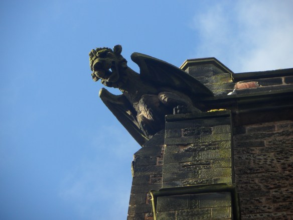
According to Pevsner, the Church of St Lawrence features some of the most exciting Norman work in the county. Here be dragons and other fantastical creatures, Saxon and Scandinavian influences, a green man and other ancient faces. There are no wolves though.
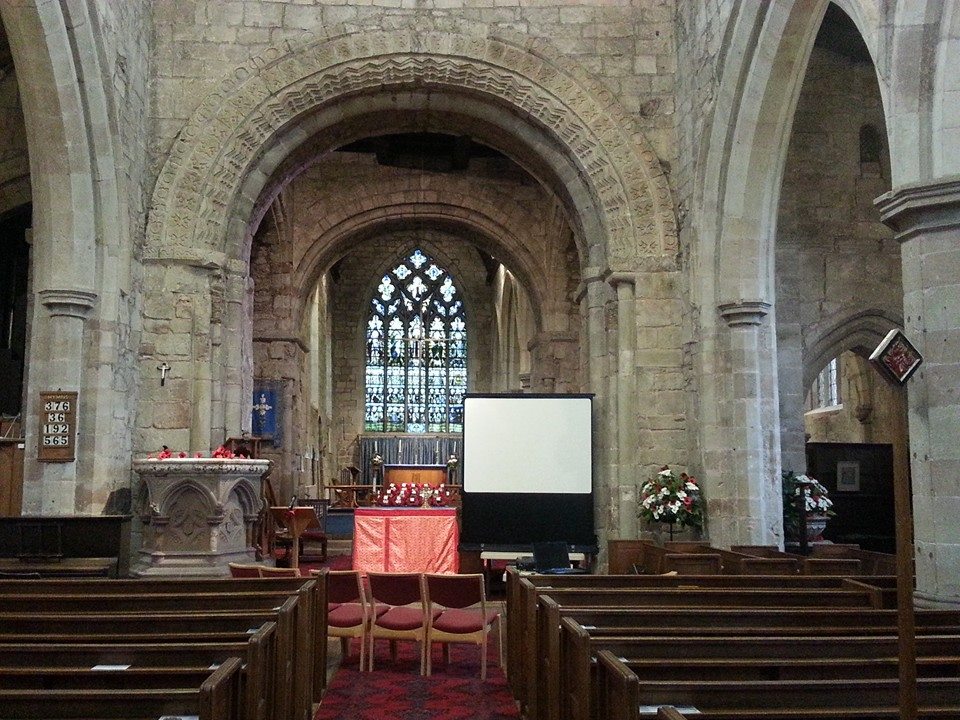
Norman arch, Gnosall church
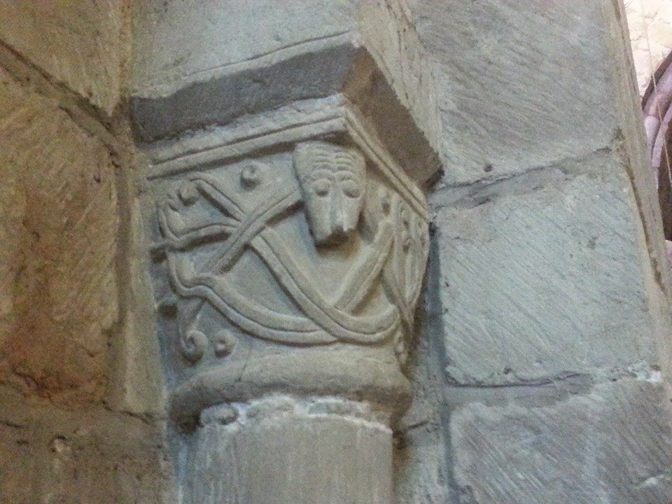
Carving at Gnosall
Possible Saxon stonework, Gnosall
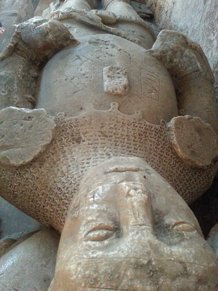
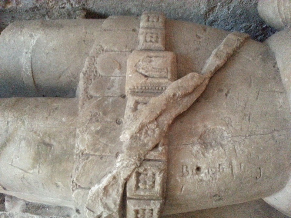
Legend has it that the last wolf in Staffordshire was killed here in Gnosall in a pit near Brough Hall and that the effigy in the Lady Chapel is that of its slayer, Baron Brough As much as I wish it were true, there is no evidence for this tale and no reason to believe the Baron ever even existed outside of Gnosall mythology. Several other names have been linked with the alabaster knight over the years, but his true identity remains unknown. Whilst such personal details are lacking, there is physical detail here in abundance, from the broken angel and the helmet at his head, to the lion at his now missing feet and experts have used these features to date the monument to the early fifteenth century. In recent years, the knight has been joined by the church’s only other effigy, taken from the recess on the opposite side of the church known as the Easter Sepulchre.
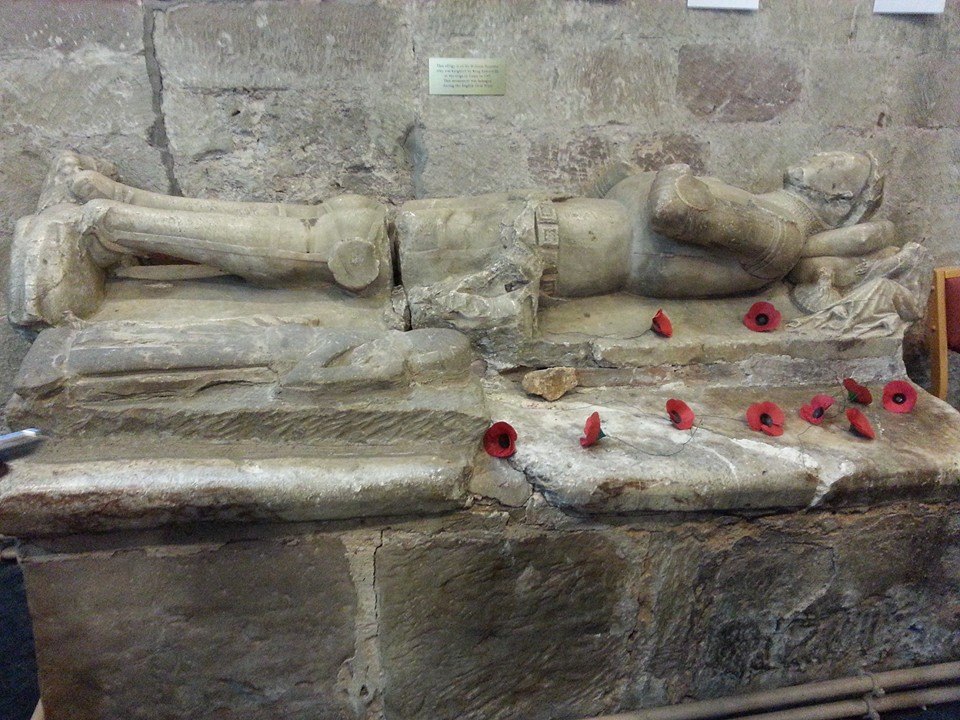
Two effigies at Gnosall church
Defaced – the unknown knight of Gnosall
Even less is know about this second effigy, but due to its diminutive stature, it is often described as depicting a child. However, after visiting the church, words that I’d read in a paper by Dr Sophie Oosterwijk in relation to the famous Stanley Boy monument at Elford came back into my mind – “A small-sized tomb may deceive the beholder into thinking that it must commemorate a child, but there may be other explanations”. One of Dr Oosterwijk’s other explanations is that these tiny tombs may represent heart burials. It’s not only the size of the effigy that’s convinced me that someone left their heart here in Gnosall, but also the position of his or her hand over the chest, a feature it has in common with another example thought to be a fourteenth century heart burial at Coberley in Gloucestershire.
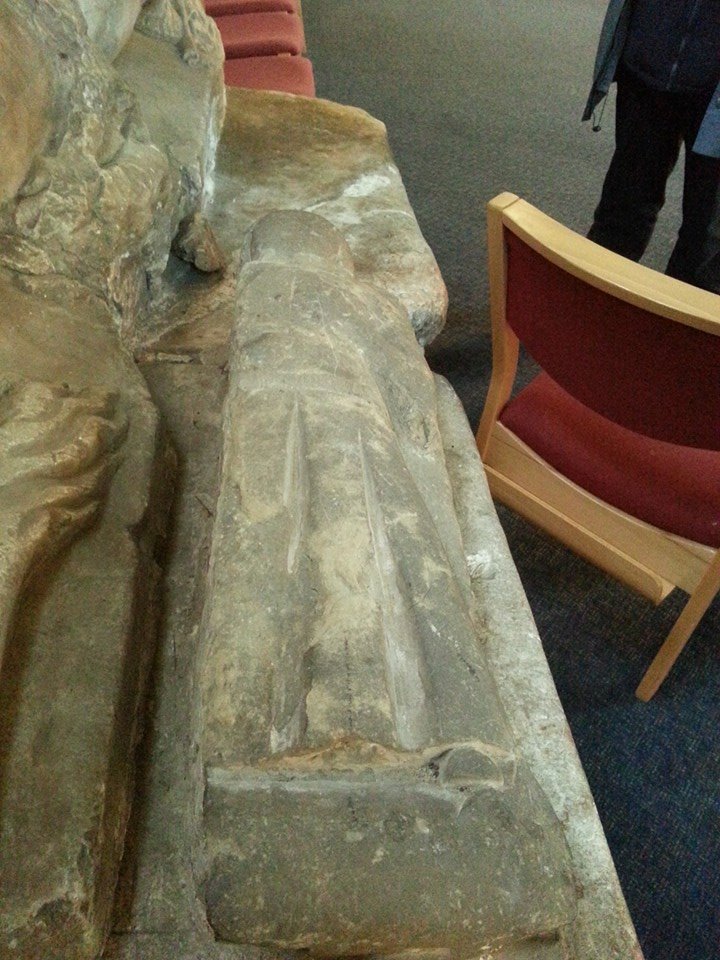
Effigy possibly depicting a heart burial at Gnosall
Despite the abundance of surviving Romanesque architecture here, the church is missing its original font. However, at nearby Bradley. and Church Eaton there are examples which date to the twelfth century and recall some of the patterns and themes found at Gnosall, perhaps giving us an idea of what the Norman font at St Lawrence may have looked like. Interestingly, the broken Church Eaton font was reinstated at St Editha’s after apparently being found buried in a garden, and so it’s possible that Gnosall’s is out there somewhere, awaiting discovery under someone’s lawn.
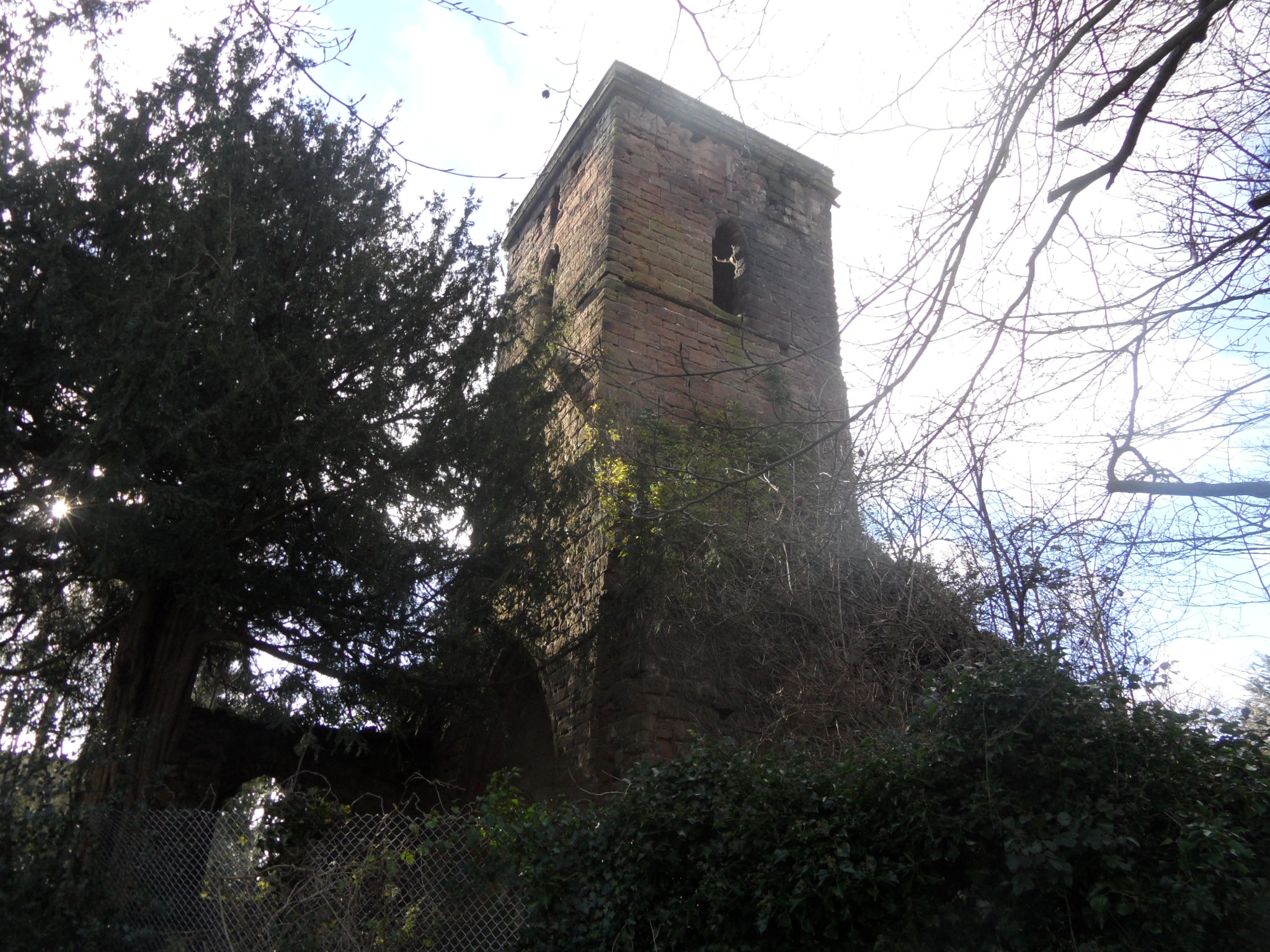
One of Gnosall’s most intriguing features can be found outside, high on the south side of the church where stonemasons (we assume) who extended the tower in the mid fifteenth century have carved a large chalice into the stonework alongside the belfry window.
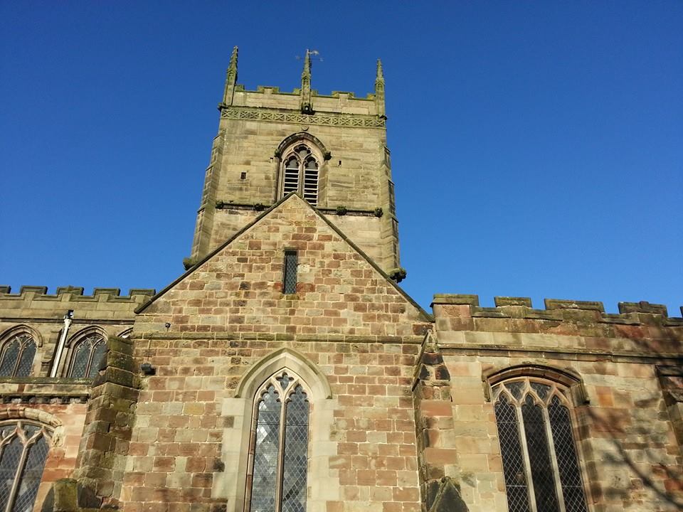
South face of the church tower at Gnosall
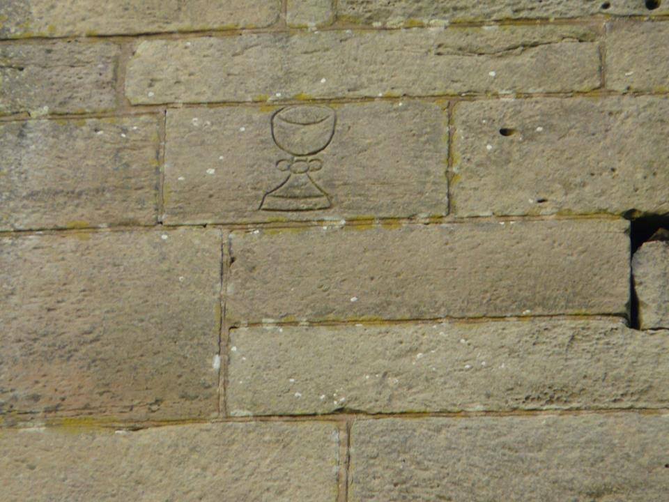
Chalice carving on Gnosall church tower (photo by Kenneth Ingram)
Less mysterious in origin, but still of interest, are the grooves along the wall, said to have been created by the sharpening of arrows when the grounds were used for archery practice.
Arrow grooves at Gnosall Church
There is also a rumour that this wall of the church bears the scars of target practice during the Civil War (Rodwell: 223). What we do know for certain about the church of St Lawrence and the civil war is that there are two soldiers buried here. The parish register records that on 1st October 1642, a tall young man known as John Bayne (or Bayle), ‘one of the King’s souldiers’, was buried here and that on 25th March 1643, David James, another of ‘the King’s souldiers’, was laid to rest. The date of the second may be especially significant, coming less than a week after the Battle of Hopton Heath, fought just ten miles away. Amidst the other burials and baptisms of the parish register, an interesting entry appears on an otherwise blank page. At some time between 20th March 1684 and 19th April 1685, an ‘unlettered’ hand has written the following:
Fere god and honour the King
Honor your parents at all times
Wimins tongues air like [unfinished]
Whether the writer of the verse was interrupted or simply ran out of inspiration is unknown, but we are left to draw our own conclusions on the nature of ‘wimins tongues’. However, when it comes to singing the praises of this incredible building, I shall not be holding mine. See it for yourself on the weekend of 4th/5th July 2015, when the Church of St Lawrence, including the tower, will be open for tours as part of the G-Fest celebrations held in the village each year. Now that is exciting.

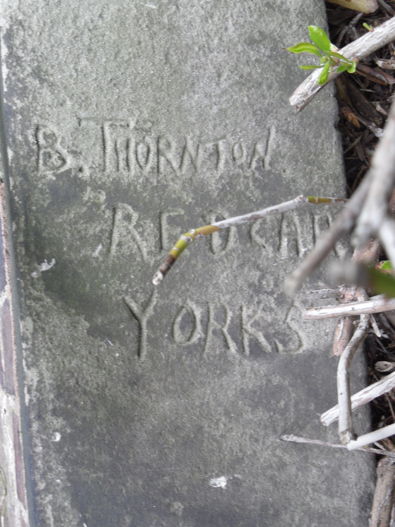
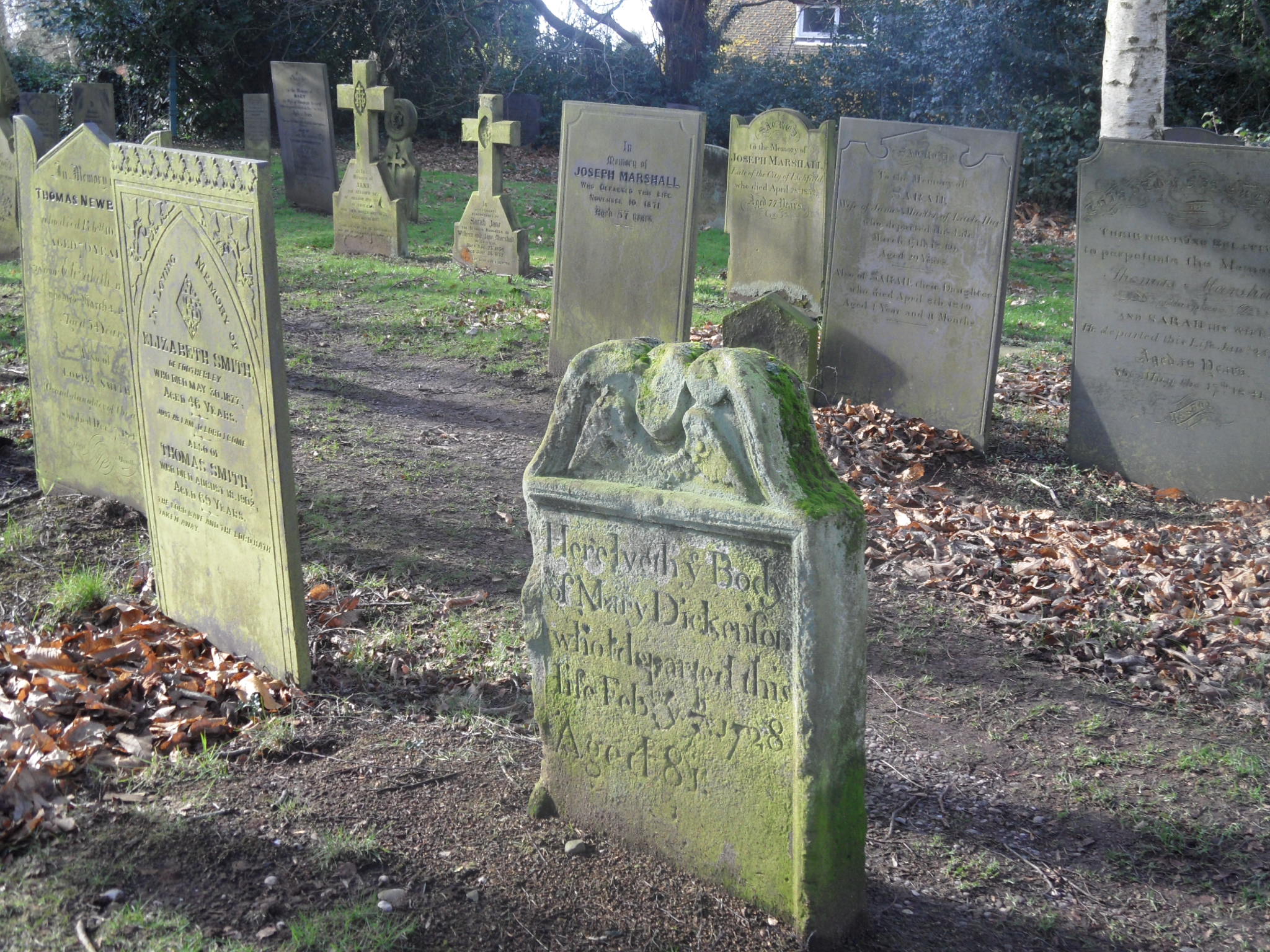
Tombstone in the graveyard at the Church of St Lawrence, Gnosall
With thanks to Norman and Sheila Hailes, for their tour and invaluable knowledge of the church, and to Kathleen Ingram and Cllr Kenneth Ingram and the other residents of Gnosall, for showing us around not once, but twice!
References:
Rodwell,W. (2012) The Archaeology of Churches Stroud: Amberley
Oosterwijk, S. (2010) Deceptive appearances. The presentation of children on medieval tombs Ecclesiology Today