Hidden Depths

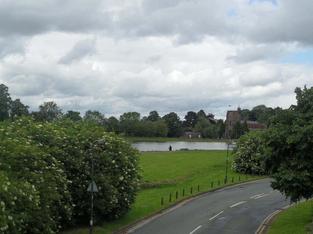
Circuit Brook marks part of the northern boundary of the city and runs through the Christian Fields Local Nature Reserve.  Last week I went for a walk to find the brook and found a whole lot more besides.

Despite the blue lines on the map, water was scarce, although some evidence of its presence lingered on in the channels it had forged over the centuries.

For much of the walk, we were separated from the route of the stream by steep embankments and rampant nettles, and at particularly challenging points, both!  Concerned about both the possibility of broken limbs and the availability of dock leaves, I didn’t stray far from the path, and used the zoom on my camera instead. Not very adventurous I know, but at least I lived to tell the tale!

Steeper than it looks! No, really it is!

Zoom.

Amidst the nettles is this green post. Any ideas?

A little way into the walk, watery looking plants and a visible outline convinced us that we’d found the site of the well marked on our Ordnance Survey map.

The smell of mint is what first alerted us to what we think is a well

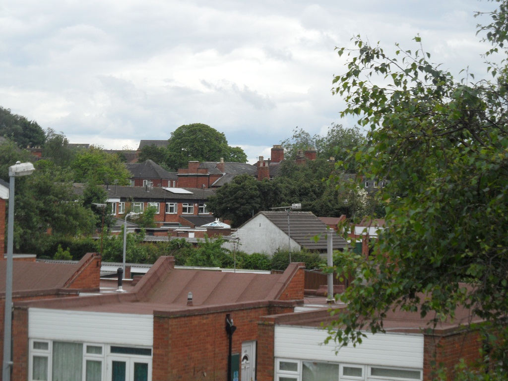
At the point where we lost the route of the brook altogether we retraced our steps back and tried to pick it up again further upstream. This time the route took us along a flat, public footpath with woodland and fields to our left and the busy western bypass and underpasses to our right,  reminding us that we were right on the fringe of the city here.

Bypass underpass

A footbridge gave us easy access to the stream here, but once again it was dry.

Had we not turned back, we’d have found ourselves in Elmhurst.  What I hadn’t realised at the time was that part of the route apparently dates back to Saxon times, and incorporates an archaeological feature known as ‘The Dimble’. It’s great that the name is still evident in the area today. I’d like to find out more about this ancient walkway (the information I’ve included here is pretty much all I’ve been able to find so far), and also clarify exactly what  a ‘Dimble’ is, as I’ve seen a couple of different definitions.

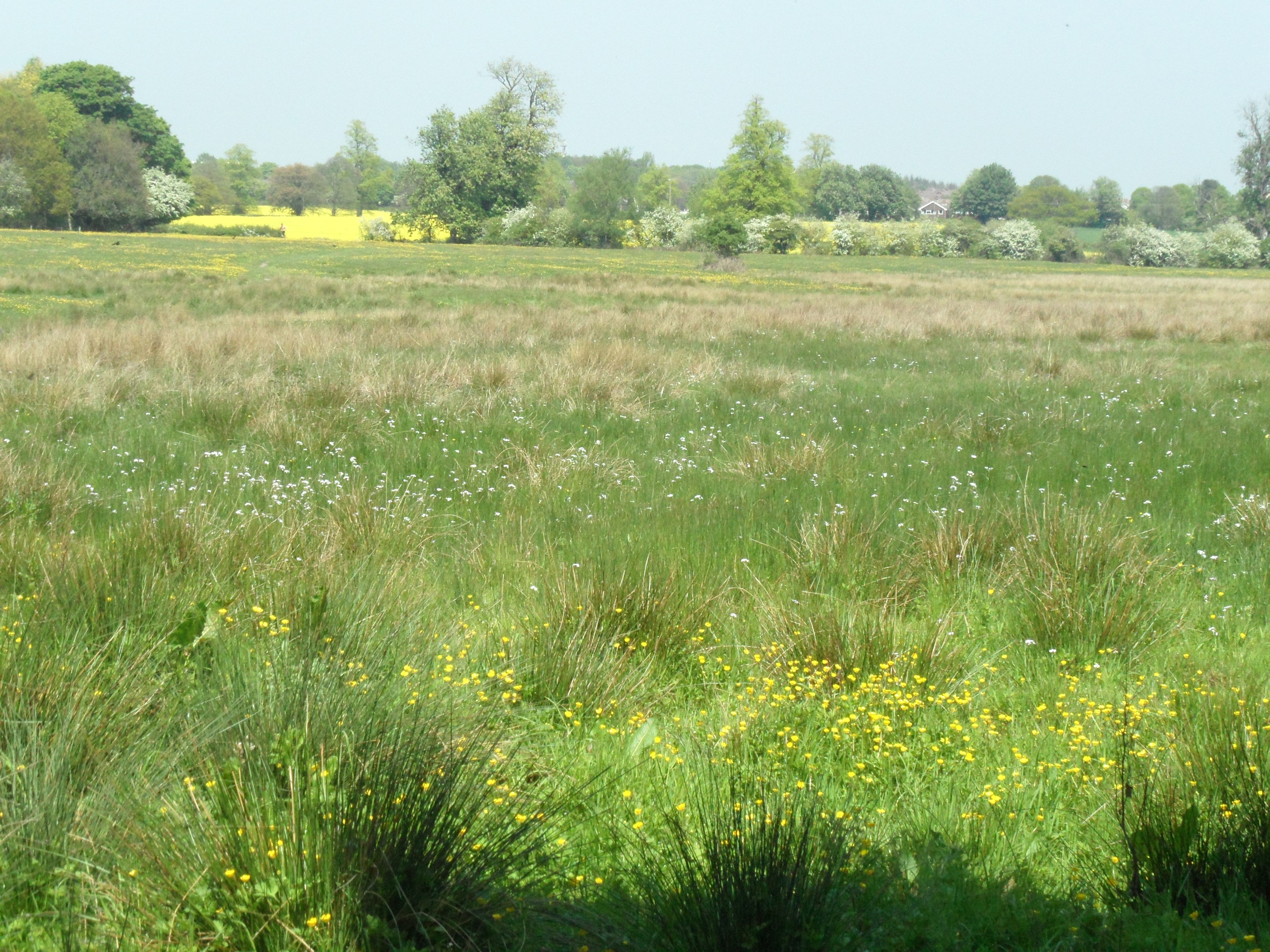
I was also unaware until reading up on it, that the Christian Fields LNR was a landfill site until the 1980s when it was capped. Twenty or so years of allowing nature (and volunteers) to reclaim the site, has resulted in a place reclaimed for people to enjoy and explore. So go and enjoy & explore!

Notes:

Big thanks to Brownhills Bob for providing me with a map of the site and information about the nature of water, especially the advice to keep an eye on that well…..

Information on Christian Fields LNR taken from http://www.lichfielddc.gov.uk/info/200029/countryside/83/site_management/4

Appeal of Bells

If you heard the bells of St Michael’s ringing out late yesterday afternoon, you were listening to the launch of a restoration fund for the bells, which are in need of essential maintenance work.

According to the churchwardens accounts, the bells have been rung in the past to mark important national occasions, and in the bell tower there are plaques commemorating some of these and more locally significant events.

The blue plaque commemorates the ringing of bells for the marriage of Charles & Diana; the brown one commemorates a farewell peal for the retirement of Prebendary P Howard in 1947

Bell Tower steps

After negotiating the narrow and windy staircase back down into the church, I had a look around the rest of this lovely building. According to the listed building description, although the church is thought to be 13th century in origin (with a 14thc tower), much of the building dates back to the restoration of 1842/3 by Thomas Johnson. However, the church history booklet (a snip at £1.50!) suggests that whilst the church had undoubtedly needed some restoration work at this time, much of this work was  unnecessary and things of historic interest may have been lost. The booklet goes on to say that some of the restoration work was undone at the end of the 19thc.

Royal coat of arms(1711) above the chancel

The royal arms, as seen above the chancel, are from 1711, and replaced an earlier version. I’ve read that after the reformation, anglican churches were encouraged to display the royal coat of arms somewhere prominent, reminding people that the monarch was also head of the Church of England. The custom of displaying the royal arms continued until Victorian times, but these days can be found in only around 15% of churches. You can read more about the Churches Conservation Trust’s guide to Royal Arms in English churches here.

Having previously read that the Marquis of Donegal had erected a spacious family mausoleum near the chancel, I have to confess I was a little disappointed to find no trace at all of the ostentatious Chichesters of Fisherwick Hall. However, the church booklet explained that the rabbit infested mausoleum had been replaced by a stokehold in the 1842/3 restoration, and the bones buried elsewhere. Seems like none of Donegal’s buildings were destined to last long….

The chap below fared a little better than Donegal. Whilst his bones also ended up elsewhere, his effigy survived the ‘restoration’ and is behind a bench in the chancel. It’s thought to be William de Walton who endowed the church with land and died around 1344. I particularly like the inclusion of the faithful dog watching over his master in death.

One man & his dog – William de Walton’s effigy

The church has several other monuments, including most famously, that of Samuel Johnson’s mother, father and brother.

Back outside in the churchyard,  a woman approached me and asked ‘Are you thinking the same as me?’. Actually I wasn’t, because whilst I was thinking about missing bones, the woman was thinking about missing apples. Apparently in previous years, rich windfall pickings were to be had from the trees growing alongside the footpath. This year it was hard to spot a single fruit.

Peals but no peel

One thing I read in the history booklet, which I’d love to hear people’s thoughts on,  is that around the year 2000, a pump was installed to keep the crypt from flooding. I read in an archaeology report that ‘St Michael’s is a low hill with natural springs’. Could this have anything to do with the flooding?  I’ll explore this ancient burial ground in a post of its own. In the meantime, perhaps we could get the University of Leicester involved in a hunt for William de Walton and the Marquis of Donegal. They seem quite good at that sort of thing…..

Part of the 9 acres making up St Michael’s churchyard

Sources:

St Michael’s Church. Lichfield – A Short History by Rev Carpenter 1947

A short account of the city and close of Lichfield – Thomas George Lomax, John Chappel Woodhouse & William Newling

Archaeological Desktop Survey OSA Report No. OSAO6DTO2 (Onsite Archaeology January 2006)

Cross County

Looking for ancient crosses in Lichfield, has so far lead only to hints of their existence – a one line reference in an old book here, a placename there. Nothing concrete (or should I say stone?).  So imagine how happy I was when I visited Ilam Park yesterday and found that were two thought to date back to the 10thc standing in the churchyard with a third shaft incorporated into the church wall…..

Church of the Holy Cross, Ilam, Staffs


…..and imagine how much I kicked myself when I got home and found out there was yet another stone, known as ‘The Battle Stone’, located in the grounds of Ilam Hall that I had missed!

However, as a consolation, I learnt at home that this spring near to the church is thought by some to be St Bertram’s Well (although others place this on a hillside near to the village).

St Bertram’s Well?

The Shrine of St Bertram (also known as St Bertelin or maybe Beorhthelm of Stafford) is inside the church. As you might expect, there is more than one account of St Bertram’s life. The most well known version seems to be the tragic story that he was a Mercian Prince whose wife gave birth to a child in a forest. The wife and baby were killed by wolves and St Bertram became a hermit near to Ilam, It’s thought this story might be represented on the churches font, which dates back to around the 12thc.

You can decide for yourself, if you look at this website on Romanesque sculpture, which gives a detailed description of the font, together with photos.

However, Stafford Borough Council have this version on their website, which doesn’t feature the tragic part of the legend.

The legend of St Bertelin derives from the 14th century account of him by Capgrave in his ‘Nova Legenda Anglie’, retold by Dr Robert Plot in his ‘Natural History of Staffordshire’ (1686). He is reputed to have been the son of the Mercian prince, the friend and disciple of St Guthlac who, after St Guthlac’s death c 700, continued his holy vocation on the islet of Betheney now Stafford. Here, he remained until forced to retreat from the ill-will of jealous detractors, when he repaired to Ilam, in Dovedale, Derbyshire where ultimately he died. His burial place in Ilam church was once a place of pilgrimage.

His burial place still seems to be a place where people come, not just seeking out history like me, but for spiritual reasons. As you can see from the photo of the shrine, prayers (I didn’t read them) and candles are still left there.

I have found a copy of the ‘Nova Legenda Anglie’, but as my Latin only stretched to ‘Caecilius est pater’, I need a bit of time alone with google translate.  So, I’ll leave the legend of St Bertram/Bertelin there for now other than to say that it’s believed that the remains of St Bertelin’s chapel in Stafford were excavated in the 1950s and they discovered part of a 1,000 year old cross. And this one is made of wood!

Ilam, Stafford and I’ve seen references to existing crosses in Wolverhampton, Leek, Chebsey (between Eccleshall & Stafford), amongst other places. With the discovery of the ‘Battlestone’ in Ilam (the one that I missed!) in the foundations of a cottage, during a restoration in 1840, I’m still clinging to the hope that at least a fragment of one survives somewhere in Lichfield!

Sources:

http://www.heritagegateway.org.uk/gateway/

http://list.english-heritage.org.uk/ (Entry numbers 1038113, 1012654, 1012653,

Corpus of Romanesque Sculpture in Britain & Island http://www.crsbi.ac.uk/index.html

http://www.geograph.org.uk/photo/705619

http://www.megalithic.co.uk/ (St Bertram’s Well http://www.megalithic.co.uk/article.php?sid=14731)

http://www.staffordbc.gov.uk/in-touch-with-the-past

Rolling in the Shallow

One of my absolute favourite things in a landscape is water – waterfalls, oceans, lakes, canals.  All wonderful.  Here, in Leomansley we’ve got a brook and I love that too.

Two days ago I stopped and paused at a small bridge that crosses over Leomansley Brook. It was flowing more than usual, with little fishes darting about in the clear water. I would have gone home happy just having seen the fish but then as I watched them, something else caught my eye.

It looks like a stone with a star etched on to it. Unfortunately, as well as raising the water level, the rain has also raised the nettles and so I couldn’t get down for a closer look. I went back the following day with a fishing net and my Mum but the net was far too short and my Mum wasn’t game enough to take on the stingers either! And so there it remains, still in the brook, where it may have been for hundreds or years….or since last week! I took another photo and it looked a bit different. (This time I noticed a big nail a little further upstream too).

What is it and how or why does it have those markings? Is it even a stone? I would love to hear any theories anyone has!

A little later I’m going to write up a post about another little mystery around these parts. This and the stone might not be anything at all, but I actually don’t think that matters. What I think does matter is getting out there and looking, thinking, sharing and most importantly enjoying what’s around you.

Under the Bridge

It might not have rained on St Swithin’s day here in Lichfield but water was still the theme this weekend. On Saturday, I was supposed to be at the Festival of History at Kelmarsh in Northamptonshire. However, it seems that nature wanted to get involved in the reenactment of history too and successfully managed to put the marsh back into Kelmarsh. Maybe Dr Rawson was right when he warned “Drive nature out as you will, and she will come back”!

Here in Lichfield, I’ve read that marshy land was known as ‘moggs’ and that the Museum Gardens were once known as Swan Moggs or the Bishop’s Fish Pool.  You can see an artist’s impression from 1848 of the scene in 1548 here.

A causeway was built to separate the Moggs from from Minster Pool in the early 1300s, and the road became known as Newebrugge St, later Brugge St and eventually Bird St. According to Rawson, the original bridge was widened by 5 foot in 1768. It was replaced by a new bridge in 1816, but I was quite excited to see that the listed building description  says that the remains of the old bridge could still be below the water of Minster Pool. Has anyone anyone ever been down there to have a look, I wonder? I’m probably not quite excited enough to hire a wetsuit and go looking for it, but you never know!

Adding Olympic Flames to the waters of Minster Pool, near the Causeway Brige

It seems that other interesting discoveries have been made near the site of the bridge. According to the Pastscape record, during the 19th century there was a malthouse on the causeway and in 1802, when they were digging a well they discovered a roman goblet called a cyathus and fragments of several human remains. How did they come to be there?

Once again, it’s worth taking a look at John Snape’s 1781 map of Lichfield as it show the extent of the Moggs at that time.

While we’re at it, here’s John Speed’s 1610 map again as well!

1610 map of Lichfield

As you might expect, the Bird St ward banner features the Causeway.

Something I’m especially interested in relating to all this are the references I’ve seen to a well in the vicinity. So far, I’ve seen it called Merelynswele, Merliche Well and Maudlin’s Well and various sources seem to place it adjoining the Bishop’s Fish Pool, and accessible from Shaw Lane.

View down Shaw Lane, off Beacon St

I might be wrong but is the original name made up of three watery elements i.e. Mere-lyns-wele with mere as in Windemere, lyn deriving from the celtic word for for lake and of course wele for well?

The name of the well seems to have changed over the years.  For example, John Jackson suggested that the well became known as Maudlin’s as, ‘Tradition says some person having enjoyed his bottle rather too freely tumbled into this well which has since been distinguished by its present epithet Maudlin signifying a state of inebriation. It is clearly however an abbreviation of Magdalen’s’. Dr Rawson referred to it as Merliche, the pool-marsh well.

What I really need to do is to get down to the record office to have a look at the plan of Maudlins Well and Dean’s Croft that they I’ve just found out that they have. Wait, Dean’s Croft? That sound’s familiar….. Might wait until it stops raining AGAIN though 😦

Sources:

(1) An inquiry into the history and influence of the Lichfield waters by Rawson 1840

(2) A short account of the city and close of Lichfield by Thomas George Lomax, John Chappel Woodhouse, William Newling

History & Antiquities of the Church & city of Lichfield by Thomas Harwood

Collections for a History of Staffordshire Part II- Vol VI (1886)

History of the City and Cathedral of Lichfield by John Jackson

A History of the County of Stafford Vol 14: Lichfield edited by MW Greenslade


Bell-ow the Water

Water is in abundance at the moment, so Sandford Street seems quite an appropriate topic.   The street was once split into two parts -Sandford St and Sandford St, below the water. I believe that the latter is now known as Lower Sandford St, lay outside the city gate, and was once the main road to Walsall.

This plaque is near to the traffic lights on Swan Rd (confusing!) & the corner of Lower Sandford St


Hopefully, this will make more sense in conjunction with John Snape’s 1781 map.

John Snape 1781 map, taken from wikipedia

I’ve only just found out that around the same time as this map was made, an artist called John Glover painted a view of  Lichfield Cathedral from Sandford St. It’s in the Samuel Johnson Birthplace Museum and can be seen here.

The water in question seems to be Trunkfield Brook (formerly Sandford Brook) which still flows, with varying success, through the Festival Gardens. It’s thought that the name Sandford (earlier Sondeforde) might relate to a crossing over the brook, near to the gate. Apparently, a bridge was built there around 1520. I wonder if the brook was bigger in the past, as I’m pretty sure even I could jump over it. Almost.

Trunkfield Brook, often more mud than water.


In view of the above, I think that the symbol on the Sandford St below the water ward banner, as shown below, is pretty self explanatory.

More of a challenge to decipher is the banner for the other part of Sandford St (i.e the bit within the city). Why did they choose to represent this with a bell?

In the absence of anything I can find that links this part of Lichfield specifically to bells, so far all that I can think of is that it might relate to the iron & brass foundry set up in Sandford St in 1879. On an 1884 town plan, it’s shown behind the Queen’s Head. Although it was set up by a Yoxall based firm called Perkins & Sons, Tuke & Bell, who already had a foundry on Beacon St bought it in 1923 and renamed it the Lichfield Foundry Ltd. The Sandford Street works lasted right up until 1983, so there must be plenty who remember it, or even worked there.

On a street somewhere in Lichfield. I’ll be honest, I forgot to note down which one!

So, does this explain the bell? If so, it’s interesting that the foundry wasn’t in existence until 1879, and so the design on the ward banner is unlikely to date to before then. If not…..???

Sources:

‘Lichfield: Economic history’, A History of the County of Stafford: Volume 14: Lichfield (1990), pp. 109-131. URL: http://www.british-history.ac.uk/report.aspx?compid=42349&strquery=sand  Date accessed: 07 July 2012.

A short account of the city and close of Lichfield by Thomas George Lomax, John Chappel Woodhouse, William Newling

A View from the Bridge

A quick trip to the shop turned into a two hour walk, a good proportion of which was spend in the Stowe area of Lichfield. I found the plaque marking the approximate site of the old gate or barr into the city and then I remembered that the Cruck House was nearby.

Cruck House


Site of Stowe Gate, end of George Lane/Lombard St

Stowe Gate plaque

 I wanted to get over to Stowe Pool, to see if there were any water lilies this year and crossed over using the bridge,  something I hadn’t ever done in 8 years of living in Lichfield!

View from the bridge


The rooftops of Stowe


Willows


There were water lilies in the pool although possibly not as many as there were the same time last year. Whether this is because the sun has gone awol this year, I don’t know. I didn’t spot any nests amongst them either. This might be as they’ve chosen to move onto the specially built wildfowl islands built in the centre of the pool instead!

June 2012


June 2011


Back to the ward banners in the Guildhall and I think that Stowe’s is the one showing St Chad’s cross, relating to the fact that St Chad’s Church and St Chad’s well are found inside this ward.

Although the Stowe St gate is long gone,  I do get a sense of being outside the city here. It’s a wonderful place to explore and enjoy. One of the definitions I’ve seen for the placename Stowe is ‘meeting place’, and from my lookout point up on the bridge I saw children playing, people out for a walk and couples sat talking. If you ever get the chance to join them, you should.

Tree following: White Heat

“No, I can’t come out with you, I’m supposed to be working”. “You know you want to… I’m only going to be around for the next few days and then I don’t know when I’ll be back in Lichfield again”. “Oh, go on then…..”

Yes, my old friend summer is back in town, and so I went to see how my tree that I follow on the path from Leomansley Wood to Pipe Green is getting on. To be honest I’m now following pretty much the whole path, so the tree doesn’t get that much of a look in these days. I’m sure it’ll come in to its own as the seasons progress though!

It was a delight for most of the senses.  Birdsong and drumming woodpeckers, butterflies and an abundance of mostly white flowers along the floor and hedgerows, the warmth of the sun, the cool of the breeze and the shade of the trees and of course the scent of early summer in the air. Taste is the only one that eluded me on my walk (although I’m sure there were probably some wild goodies I could have tried if I was both more knowledgeable and brave about these things). I think my tea & cake when I got home might just about count though.

Tree following: Mayday

It took a bit of effort to drag myself out into the murky, wet evening. Glad I made the effort though. Before I’d even got to the woods, I had a treat when a heron swooped down onto a roof and remained there for a few moments before flying off in the direction of Waitrose. I’ve spotted a heron a couple of times near the old mill pool over there. On twitter, Brownhills Bob & someone from the Pipe Green Trust thought he may have been heading to a heronry at Aldershawe.

Another few steps and I found myself passing a slightly wonky fairyring of mushrooms. I didn’t get too near. I’ve read what happens to mortals who do…..

Once in the woods, the trees, plants and hedgerows glistened, but with drops of recent rainfall, rather than may dew.

I wanted to measure my tree, to get an idea of how old it was. It soon became apparent that this was no task to undertake alone. The people in the flats overlooking the lane, and this robin that turned up to watch, probably wondered what on earth I was doing.

Happily, I managed to enlist someone’s help and we discovered that the trunk measured about 3.2m which could mean that it is anything from around 210 years old to around 130 years old. According to the Royal Forestry Society, a tree could grow between 1.5cm & 2.5cm per year, depending on things like location, soil quality.  So I’m going to read up on Mitchell’s Rule and then maybe I’ll have another go at estimating the age!

Tree measuring task completed, I headed back down the lane and met a couple out for a walk. They didn’t seem to mind the weather, in fact they thought it was lovely…….


Into the woods….

I was lured into the woods by the promise of wood anemones…..then along the path past the old Leomansley mill pools….and finally onto the edge of Pipe Green common.