Blue Sunday

My second ‘starting off at pub, and exploring the surrounding area’ type walk of the week, but this time with real life swans with just the one neck.

The sunny beer garden at the Red Lion was busy and I couldn’t help but feel that those who chose to remain inside the pub were missing out.  They were, and it wasn’t just the just the sun but also the wonderful sight of a pair of swans gliding down the canal with their eight cygnets. At one point the young ones were startled by a barking dog on one of the moored boats and darted back to huddle around one of their parents.

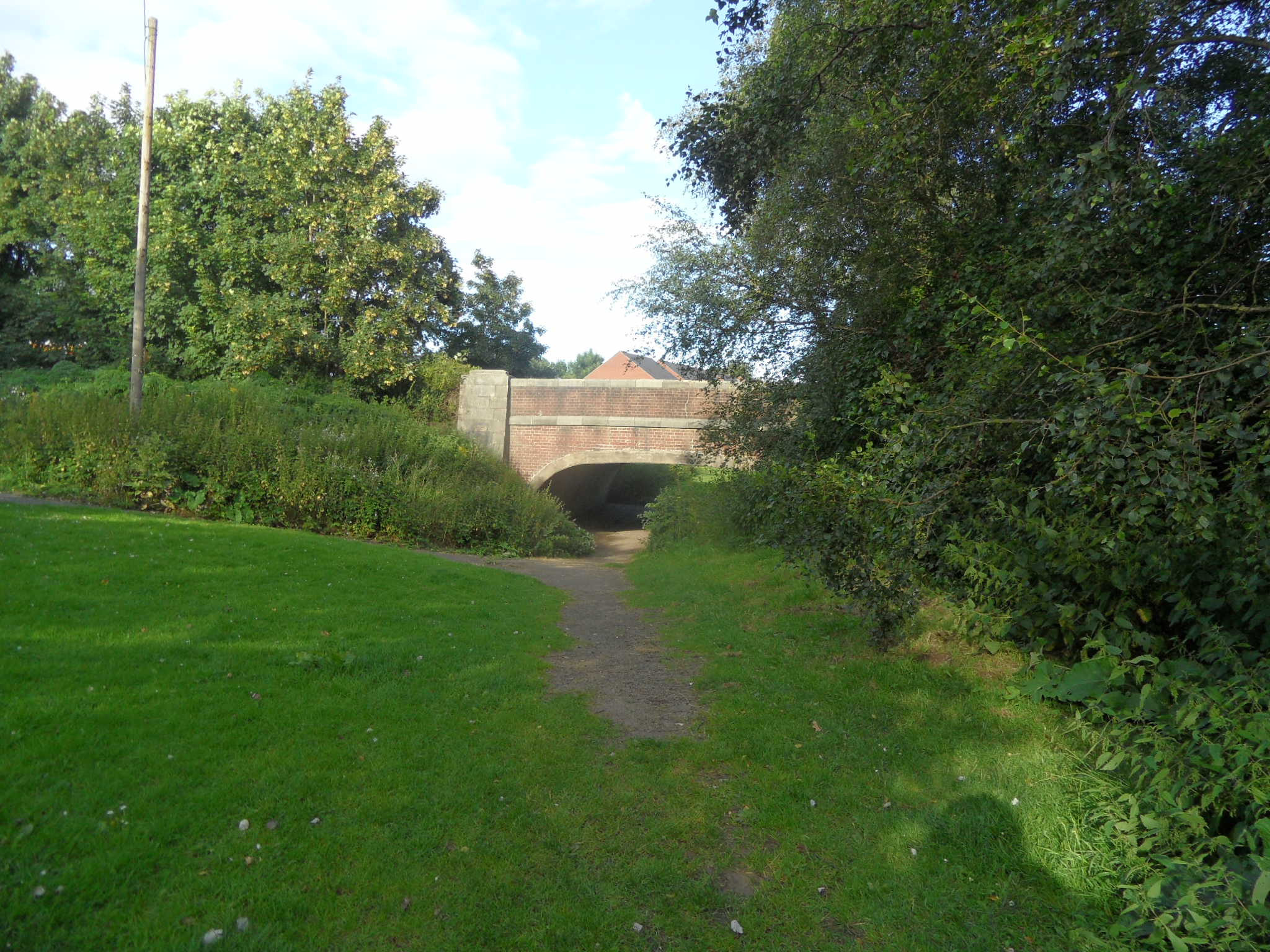
We began our walk by crossing the Lichfield Road Bridge (aka the Tummy Bridge in my house) to get to the towpath on the opposite side of the canal to the Red Lion. The next bridge along is the Hopwas School Bridge. As the name suggests it is near to the village school, named after founder Thomas Barnes. A lovely example of the local lad made good story, Thomas is said to have been abandoned as a baby, and discovered in a barn by villagers who gave him a surname to represent his humble beginnings. Educated and cared for by the villagers, Thomas became a successful London merchant. Had I walked a little to the right of the school, I would have seen the original schoolmaster’s house with a plaque reading ‘This house was built at the charge of Mr Thomas Barnes native of this place and a citizen of London in the year of our Lord 1717 for the dwelling of a person to teach the children of this village to read English’.

Instead, we kept on walking under the bridge and along the tow path. Something I did wonder about but couldn’t think of any explanation for at the time was the small door in the bridge itself. After doing a bit of post-walk googling it seems it might be a storage place for stop planks, used to block off part of the canal when maintenance work needs to be carried out. I think.

There was also some machinery on the other side of the tow path that looked interesting but again, I’m not quite sure of its purpose.

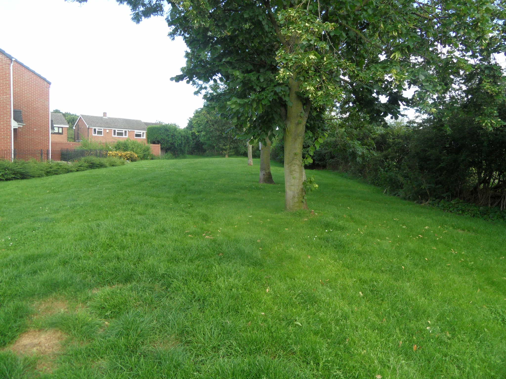
This, however, I did recognise to be one of the well documented pillboxes that stand in this area, defences against an invasion that thankfully never came.

Growing alongside the pillbox was a hint of what was to come in those infamous and ancient woods about which I’ve heard so much but seen so little, only ever passing by in the car. I’m pleased to say that Hopwas Woods lived up to my expectations, with a display of bluebells that put even my beloved Leomansley Wood in the shade. I attempted to capture it in photos, although they could never do it justice.

From then on I saw blue everywhere – the boats, the sky over the distant towers of Tamworth, a piece of pottery by the side of the canal and, after a big lunch and this short walk, a hammock at the water’s edge that looked very inviting indeed….


Watering Hole

On the way home from Tixall (of which more later), I stopped off at Longdon village and called into the Swan With Two Necks for a drink. I only had time for a very quick look around the village but even in this short space of time managed to find lots of interest, much of it water-related, which seems only natural in a place also known as Brook End. I hope to return to Longdon and the surrounding area (and of course the pub!) in the not too distant future. Amongst other things, I want to see if there are any nuggets of truth in an old ghost story I found about Lysways Hall….

The pub name Swan with Two Necks is apparently a distortion of ‘Swan with Two Nicks’, referring to the marks made on the birds’ beaks to denote ownership. More info here

Talking of ownership, the SWTN has been under the management of Mary McMeechan since 1st March 2013, the latest in a long line of landlords stretching back to 1755!

Brook End Mill dates back to the 1700s and appears on the Yates Map of Staffordshire.

The mill race still runs and you can follow it for a way up a public footpath.

This area is full of wells, some with brilliant names & legends attached. I think if I’d have carried on up past here, I’d have come to my all time favourite – Giddywell! Never mind, I did find this one near to the mill and there’s always next time…

I’m not sure if this pump is original. There are some other Staffordshire water pumps on this website, perhaps I should send them the photo and get their expert opinion?

These cottages are thought to be a 16th timber framed building that was divided up into separate houses at some point in the last half a millenium or so!

Over to the experts again, and this time John Higgins of the Mile Stone Society who researched Staffordshire Mileposts and found that in 1893, 335 posts were ordered from Tipton firm Charles Lathe & Co at a cost of 19s.6d each, including this one in St James’ Close

All The Small Things

Tomorrow’s walk will be different to today’s walk….I have walked past Christ Church three times in as many weeks. Each time was different. The first was a bleak midwinter day, the biting cold numbing my fingers as I photographed the stone heads around the church. By the second, the scene had changed and even the heads were capped in snow.

Whether somehow related to the snow or whether the weather was incidental, numbers on the reverse of head stones that I had previously passed were suddenly evident where I had never noticed them before. Interesting that only two of the several stones I could see from the road had numbers on them, so I’m guessing that they were some sort of reference mark made by the stone mason? Naturally, we look to the inscriptions on the front of headstones for information, but can the back sometimes tell us something as well?

On my third visit yesterday, the snow has been replaced by snowdrops and crocuses, the first flowers of the year and a welcome reminder after last week’s mini ice age that spring is on its way (I know we’re not out of the winter woods yet, but I’m optimistic!).

Another weather and season influenced walk was up Abnalls Lane on a wet and windy day.  Tipping my head back to gather my hair in a pony tail to stop it blowing in my eyes caused me to look up and notice fungi growing half way up a tree up high on a bank that may have been missed on a calm and sunny wander. On the same walk the bareness of winter revealed some sort of post in a hedge (I have no idea what this is – some sort of utilities marker?)

The light was poor and Abnalls Lane was more of a stream in places. With the amount of cars passing, it was only a matter of time before I ended up soaked or worse….so I changed my route. Later, outside the derelict Sandyway Farm, a pub known as the Royal Oak for the first half of the nineteenth century, one of the bricks had worked its way free of the decaying shell and lay under brambles alongside the Walsall Rd. I understand that the stamp ‘NCB Hamstead’ means it came from brickworks at the Hamstead Colliery in Birmingham, when it was part of the National Coal Board.

Is the C the wrong way around or is it me?

Admittedly, all of the above are small things but whether small things help you to build a bigger picture of the place you live in or even if they just make you smile, I think they’re worth noticing.


These Routes Were Made for Walking

Last weekend I had an email telling me about a history project over at Bonsall, a village in the Peak District. The Heritage Lottery Fund has awarded them an All Our Stories grant to create six walking trails and accompanying illustrated leaflets, each focusing on different aspects of the village’s history. Getting people involved in the exploration and the celebration of their history is key to the Bonsall project – the trails and leaflets will be researched and developed by the people of the village themselves. To further encourage participation from the community, a programme of talks, workshops, visits and film shows has been put together.  You can follow the progress of the project by following their blog here and the trails will be launched on Sunday 12th May 2013. I’m already planning to visit in the summer, to discover more about the landscape and stories of a place shaped by mining and mills.

Header from the Bonsall History Blog – A walk through history

Walking trails are a gentle guide, holding your hand as they show you around, but always happy to let go and allow you to make your own discoveries. One of the beauties of exploring places in this way is that even when following the same trails, your walk will be different to my walk, and tomorrow’s walk will be different to today’s.

It’s always inspiring to see what’s going on elsewhere, be it in Bonsall, or the Black Country or anywhere else a wider range of people are encouraged to get involved with telling the stories of a wider range of people and places. Looking at things from a different perspective opens your eyes to possibilities in the place you live in and offers suggestions on how you might listen to the untold stories that surround you. Exploring new places is always a pleasure, but finding new ways of exploring familiar places can be just as rewarding.


Concrete Evidence

Due to a vague notion I had that canals had to follow a straight line, my previous attempt to follow the route of the Wyrley & Essington canal from the London Rd bridge to Sandfields Pumping Station had not been a resounding success. Determined to find the stretch of the Curly Wyrley (the canal’s nickname derived from the way it, ahem, doesn’t follow a straight line) that I’d missed,  I had a walk along the Birmingham Rd. Near to the Duke of Wellington, half a canal bridge and two modern street names – ‘Wyrley Close’ and ‘Essington Close – confirmed that this had once been part of the route of the canal between Shortbutts Lane and Sandfields.

Canal where?

Essington Close and Wyrley Close to the left as you look at the photo.

Standing in Essington Close looking back up the line of the canal towards the bridge.

In fact, I’d already been over the bridge plenty of times before but just never taken any notice of the clues staring me in the face. My excuse is that my head is always turned the other way, ready to look out for the old Maltings on the other side of the road.

Lichfield Maltings

One of my first friends in Lichfield used to live on the site.  One of our favourite topics of conversation, inevitably, was the history of the building we could see from her house, especially on those occasions when my friend had chatted with one of the employees and was able to regale me with tales of burning buildings, footsteps and orchards.  Through these chats and a bit of reading, we discovered that the malthouse had belonged to The City Brewery Company (Lichfield). In October 1916, a fire destroyed most of the brewery leaving only this building, and the red brick brewery manager’s house and offices (see my earlier post on the fire here). Shortly afterwards, Wolverhampton & Dudley Breweries took over the site.

What we didn’t appreciate enough at the time is that as we were scouring the archives for events that took place nearly a century ago, history was also happening right there under our noses – in 2004, this was one of only six remaining operational floor maltings in the country.The following year, it closed and the building was eventually purchased by a propery developer. Thanks to a Historic Building Assessment and photographs from urban explorers, the architectural features of the building have been documented. However, I wish we’d have talked to more people and asked more questions and recorded the first hand experiences of people doing a job that would very shortly cease to exist, in a building that would soon no longer be used for its primary purpose. You live and learn….

After standing unused for several years, scaffolding now surrounds the malthouse, and the adjoining modern shed has now gone. This could be an indication that the building’s transformation from industrial to residential use is now underway.  It seems to me that giving new life to an old building like this is a good way to balance the need to protect the past and the need to look to the future.  I hope that wherever possible the old features that tell the story of the building’s old life are retained, as recommended by the Historic Building Consultant’s assessment.

On the opposite side of the road to the Maltings, I followed a drive that lead under a railway bridge to some rusting gates. Until I got home and looked at an old map, I had no idea that this had formerly been a concrete works. Back in 1986, the Domesday project recorded that this was once the site of Bison Concrete. Unlike the canal and the maltings, I can see no reference to the site’s recent history. Maybe the time when we celebrate concrete is still to come…

I think that those of us that don’t have the nerve to explore & photograph the inside of derelict buildings or the necessary funds to pay for the physical restoration of a building, do have another weapon that we can employ in the defence of our history – the ability to listen.

The three places I visited above are all a part of Lichfield’s industrial heritage. On my way over to them, I passed a fourth – Sandfields Pumping Station. David Moore is gaining a lot of support for his campaign to safeguard this overlooked yet important part of our social and industrial history. You can listen to what he has to say by visiting his blog here!

Notes

I think my research could also be described as a bit ‘curly wurly’ as I never seem to be able to resist taking the scenic route instead of going from A to B. When I was on the Domesday site, I read some of the other entries for the Birmingham Rd area and the one that especially caught my eye was ‘Shire Horses – Lichfield’, with an accompanying photograph of said horses emerging from stables on the Birmingham Rd. Does anyone know anything about these in addition to the short description here?

On a final curly wurly note, this tree on the Birmingham Rd looks like it has teeth.  The one next to it doesn’t, so I’m not sure why…

Bark worse than its bite?

Sources:

http://www.english-heritage.org.uk/publications/maltings

ExpLore – Lanes Around Leomansley

Walking is such a pleasure. I get seriously itchy feet if deprived for more than a day or so, and my spirits are always lifted after a good old trudge around. Exploring somewhere for the first time is fantastic, but I also love to walk around the places I know. It somehow gives me feel warm and comfortable feeling, like a favourite old cardigan. And of course, sometimes there can be surprises up even the most familiar sleeve…

I’ve decided I’d like to try and put some walks here so that people can get out and explore for themselves.  One of my best loved walks is of course around Leomansley, so here’s a walk around the lanes that I hope you’ll enjoy doing for yourself. Naturally,  I always encourage straying from the path to investigate something that looks interesting. Getting lost is part of the fun!

Lanes Around Leomansley

The map below gives a rough idea of the route, which is about 2km (depending on how many diversions you take!). I’ve marked some of the points that I think are of interest but of course there may be other things…….Below the map is a PDF with a written version of the route, giving information about each of the points. Hope you enjoy it, I’d like to hear how you get on!

Lanes Around Leomansley walk


Familiar Looking

Always happy to be distracted from shopping, I had a wander down Quonians Lane to take a photo of a door (that’s a whole different post!).  Everyone loves Quonians Lane with its strange name and its carvings and plaques. Annette Rubery wrote a lovely piece about it back in May, which you can read here.  I love Quonians Lane too, although now my visits are tinged with sadness that the company, whose workers created these wonderful objects and many more across the city, the county and the country, is no more.

I saw the triangular roof of a small outbuilding above the brick wall and went to have a look, thinking it would be quite interesting in its own right. It was a lovely surprise to find these two marble statues stood in the doorways. If you want to see them for yourselves, go down Quonians Lane, and just after you get to the headless angel take a right, through the wall.

So the moral of this story once again is what I say in my ‘About Lichfield Lore‘ spiel.  “Go out and have a look at what’s around you. Then when you’ve done that, go back and have another look!”  I believe this more with each day I do this blog. I think that you can make new discoveries in the same place, depending on a whole range of things including the weather, your mood, what you’re thinking about at the time, the time of day or year or who you’re with. Actually I might change that to include having a smell/touch/listen too. Not sure about taste because I’m not sure I should be encouraging the kind of thing this young man got up to here…..

Anyway, today is a perfect day for me to bang on about this, as it’s the day we heard the news that around ninety further objects had been found at the Staffordshire Hoard site, three years after the original discovery was made. If that doesn’t convince you of the merits of having at least a second look, then I don’t know what will….


Tow Bone

As I’ve been telling anyone who’ll listen, I went to Manchester at the weekend. One of the highlights (or should that be lowlights?) was a tour beneath one of the city’s warehouses to see the remains of the Manchester and Salford Junction canal.

Standing in the canal! Tow path to the left.

I’m not going to say any more about it,  writing about a place 82 miles away is stretching it even for me (but for anyone interested, there’s some more of my photos and a bit about the  experience here). So, I’ll say a bit about the Lichfield canal instead…

I imagine most people know that there is an ongoing project being carried out by the Lichfield and Hatherton Canals Restoration Trust and you can read about and see photographs of the sections of the Lichfield Canal that are already under restoration on their website. A while ago, I was at the bridge on the London Rd, and decided to walk home following the route of the disappeared canal, down to Sandfields. I know there was a section of canal here, because I had read about it in a post Annette Rubery did about Sandfields Pumping station. Here are some photos of the walk, featuring one of my favourite things – bits of old brick hinting at a trace of something long gone!

I think somewhere around here was Gallows Wharf. The gallows were apparently located somewhere near to the Shell Garage on the London Rd.


The obvious route of the canal finished about here on Shortbutts Lane.

Then I mistakenly went up Fosseway instead of taking a right onto the Birmingham Rd and lost the canal route altogether but I did find a nice plaque!

Plus some interesting but I think non-canal related bricks at the junction of Fosseway and Shortbutts Lane with the Birmingham Rd.

I knew that if I got to Sandfields Pumping Station, I’d manage to pick the canal back up!

I noticed on an 1834 map of Lichfield that the canal in this area passed something called ‘The Bone House’. The county history says ‘There was a bonehouse evidently on the north side of the Wyrley and Essington Canal west of Chesterfield Road by 1806. The miller, Thomas Wood, was ordered that year to stop production following a complaint by the vicar of St. Mary’s that the works was ‘a noisome and offensive building and a great nuisance to the inhabitants of the city’. He was still in business in 1818 and the bonehouse remained there in 1836′.

I imagine it was used to grind down animal bones to make fertiliser, but if anyone knows any different, please let me know!

The idea of exploring the impact that the presence of water had on the surrounding landscape is something that really interests me. I think walking alongside our streams and canals, around our pools and millponds gives you the chance to look at a places from a different perspective. Next time though, I might take a map!

Sources:

Lichfield: Economic history’, A History of the County of Stafford: Volume 14: Lichfield(1990), pp. 109-131

Hidden Depths

Circuit Brook marks part of the northern boundary of the city and runs through the Christian Fields Local Nature Reserve.  Last week I went for a walk to find the brook and found a whole lot more besides.

Despite the blue lines on the map, water was scarce, although some evidence of its presence lingered on in the channels it had forged over the centuries.

For much of the walk, we were separated from the route of the stream by steep embankments and rampant nettles, and at particularly challenging points, both!  Concerned about both the possibility of broken limbs and the availability of dock leaves, I didn’t stray far from the path, and used the zoom on my camera instead. Not very adventurous I know, but at least I lived to tell the tale!

Steeper than it looks! No, really it is!

Zoom.

Amidst the nettles is this green post. Any ideas?

A little way into the walk, watery looking plants and a visible outline convinced us that we’d found the site of the well marked on our Ordnance Survey map.

The smell of mint is what first alerted us to what we think is a well

At the point where we lost the route of the brook altogether we retraced our steps back and tried to pick it up again further upstream. This time the route took us along a flat, public footpath with woodland and fields to our left and the busy western bypass and underpasses to our right,  reminding us that we were right on the fringe of the city here.

Bypass underpass

A footbridge gave us easy access to the stream here, but once again it was dry.

Had we not turned back, we’d have found ourselves in Elmhurst.  What I hadn’t realised at the time was that part of the route apparently dates back to Saxon times, and incorporates an archaeological feature known as ‘The Dimble’. It’s great that the name is still evident in the area today. I’d like to find out more about this ancient walkway (the information I’ve included here is pretty much all I’ve been able to find so far), and also clarify exactly what  a ‘Dimble’ is, as I’ve seen a couple of different definitions.

I was also unaware until reading up on it, that the Christian Fields LNR was a landfill site until the 1980s when it was capped. Twenty or so years of allowing nature (and volunteers) to reclaim the site, has resulted in a place reclaimed for people to enjoy and explore. So go and enjoy & explore!

Notes:

Big thanks to Brownhills Bob for providing me with a map of the site and information about the nature of water, especially the advice to keep an eye on that well…..

Information on Christian Fields LNR taken from http://www.lichfielddc.gov.uk/info/200029/countryside/83/site_management/4

Sheriffs Ride…I walk!

I understand that for about 330 years, Lichfield was not just a city, it was a county, one of 18 towns and cities in England which gained county corporate  status at one time or another, for a variety of reasons e.g. Poole became a county separate to Dorset for reasons involving piracy! Lichfield’s status was granted by Mary I, apparently as a reward to the city for support during the Duke of Northumberland‘s rebellion.

A perambulation of the border of the city had been taking place since 1548, when Lichfield was made a city in Edward VI’s charter. However, that was carried out in view of the Sheriff of Staffordshire. Queen Mary’s charter, gave Lichfield the privilege of having its own Sheriff, who took over the perambulating duties and began the tradition of the Sheriff’s Ride which still takes place every September, on the Saturday nearest to the Nativity of the Blessed Mary. This year, it’s this Saturday (8th September).

According to the county history, the earliest records of Lichfield’s boundaries date back to the late 1700s (although older records of surrounding places indicate that changes in the borders have occurred over the years, particularly in the north and west). For those wondering, Lichfield is no longer a county, it reverted back to being part of Staffordshire in 1888.

Sheriff’s Ride, 1908. Taken from Lichfield DC flickr stream.

Thomas Harwood wrote in 1806,

The boundaries of the city of Lichfield according to ancient writings are a circuit of about sixteen miles.

Unfortunately, he doesn’t say where they are from, or just how ancient these writings are. However, it’s still interesting to read these ‘ancient writings’, not least because of the place names, familiar and not so that crop up along the route. (Some of the spellings are pretty interesting too!)

It begins at a place called the Cross and Hand near the end of a street there called Bacon street and from thence goeth northward along the lane leading to Longdon Church unto a little lane * at the further side of Oakenfields and so along that little cross lands unto another lane that leadeth from Lichfield to King’s Bromley and then along that lane towards Lichfield unto a little lane lying between the Grange Ground and Collin’s Hill Field commonly called the Circuit lane unto the further end of it betwixt two fields the one called Hic-filius and the other Piper’s Croft and so over across a lane that leadeth from Lichfield to Elmhurst and then into another little lane between Stichbrooke Ground and Gifforde’s Crofte and so along that little lane to a green lane at the further side of the Lady being the land of Zachary Babington Esquire and down that lane to a called Pone’s Brook and so over that brook into another lane called Stepping Stones lane and so along that lane taking in the land of Richard Dyott Esq Pone’s Fields unto a lane leading from Lichfield to Curborough Somerville so along that lane towards Lichfield until you come to the upper end of the grounds called Scott’s Orchard and then leaving that lane turn into a field of Lichfield called Whisich at a stilt going into the fields called Browne’s Fields and so taking in the field clled Whisich then go by the closes called Browne’s Fields Hedge unto the grounds called God’s Croft Hedge and so along that hedge taking in the field called Whisich lane called Goslinge’s lane and along Goslinge’s Lane unto a lane called Matthew Coal Lane and so over across that lane into a field called Cross field at or near an elm tree and so along a head land about the middle of Cressfield unto the nearer end of Gorsty Bank into the lane leading from Lichfield to a cross way called Burton turnings and from thence along Ikenield street taking in Spear Hill and Boley unto a cross way leading from Lichfield to Whittington and so along that lane towards Whittington unto the south end of Austin’s Coat Grounds then turning upon the left hand at that brook to a gate going into Fulfin Grounds unto the moors called Dernford Moors and so along by the hedge of those moors unto the nether side of Dernford Mill stream and so going by the mill door to the pool dam and going along by the pool and the brook taking in Horslade and a meadow belonging to Freeford House unto a bridge called Freeford Bridge in a lane leading from Lichfield to Tamworth and so from that bridge up the sandy lane to Freeford House and along that lane to the corner of the meadow and then turning into Bispells at the corner of the meadow and so going by the meadow hedge until you come to the brook that runneth to Freeford Bridge and so going up a little pool taking in all Bispells unto a ford called Baltrex ford and then entering into Old field turn up the left hand to the brook that runs from Freeford Pool and so along that brook to Freeford Pool and along by the pool and the brook that comes from Swynfen Mill until you come into the lane that leads from Swynfen unto the mill and so along that lane to a gate that leads from Lichfield unto Swynfen called Old Field Gate and then not coming in at that gate but going to the corner of the hedge adjoining to Cley Lands come in at a gap and taking in all Old field come by the demesnes of Swynfen unto a place called Long bridge and so entering into a little lane between Long furlong and Long bridge grounds leading to Well crofts and so taking in all Well crofts along by the Knowlc Leasowes being the Hospital Land unto Ikeneld street and so along Ikeneld street unto the further side of a close called Gorsty Leasowe and leaving the hedge on the left hand taking in that close going along by that hedge leading to Hare house Ground and so along that hedge unto the top of Dean’s Slade taking in all Hare house Ground northward enter into Park field leaving the hedge on the right hand and so following that hedge unto a little lane at Aldershawe that comes down that lane to the gate and through the gate then turn upon the left hand by Aldershawe Hedge taking in the barn and so go into the Wheat Close leaving the hedge on the left hand unto the road called the Fosse way up to the top of Mickle hill then crossing over Pipe green along an old decayed cart way into a lane end that leads to Pipe grange lane to the further side of Padwell’s and so taking in Padwell’s leaving the hedge on the left hand to a little lane that leadeth into Ashfield leaving the hedge on the left hand into the grounds called Lammas Grounds and leaving the hedge on the left hand and so into Lemondsley then following the brook to Pipe green gate and so along the brook in Pipe green into a little lane that butteth upon the lane that leadeth from Lichfield to Pipe and crossing that lane into Smithfield at the corner of Abnell Hedge and so taking in all Smithfield leaving Abnell Ground on the left hand unto the Cross and Hand where it began

*now Featherbed Lane

The ride now begins at the Guildhall, rather than Cross in Hand Lane but I’ve always thought it would be great to do the journey described above, looking out for the place names and landscape features mentioned (and potentially getting very lost, as some of them used in the directions may no longer exist!). As I don’t have a horse (my equine experience  consists only of  a few pony trekking expeditions, one of which ended in me being bitten by one in Cumbria), it’s a journey to make on foot, and probably in stages.  I have recently made a start but rather pathetically only got as far as Featherbed Lane. Only another 15 1/2 or so miles to go then. Just as well I’m not the Sheriff of Lichfield.

Cross in Hand Lane

Sources:

http://www.lichfield.gov.uk/events.ihtml

Lichfield: The place and street names, population and boundaries ‘, A History of the County of Stafford: Volume 14: Lichfield (1990), pp. 37-42. URL: http://www.british-history.ac.uk/report.aspx?compid=42340

The History & Antiquities of the Church & City of Lichfield, Thomas Harwood 1806