An Old Wives' Tale

Inside the south porch of St James the Great at Longdon, above the inner door which leads in to the rest of the church, there is a Norman archway. There’s a Green Man (more information on him and his mysterious origins here) here, carved onto one of the capitals, and below this is the ‘Bride’s Hand’, a rough carving of a hand, with a heart in its centre. According to the church’s visitor guide, the name relates to the old tradition that women arriving at the church to be wed would place their own hand on the carved one, in the hope that it would bring happiness and fertility to their marriage. Apparently, some Longdon brides still observe this custom.

Until I did some reading on the subject,  I had no idea how much the rite of marriage has changed over the centuries. I understand that until the Reformation, the majority of the wedding ceremony, including the exchanging of rings and vows, would take place here at the doors of the church and it seems it was only after the couple were husband and wife that they would enter the church, for a nuptial mass.

SAM_1571

The Bride’s Hand

SAM_1552

Inner door of south porch with Norman arch


SAM_1567

Green Man at Longdon

The Staffs Past Track site has a photograph of the ‘Bride’s Hand’ taken in 1950 and as well as mentioning the above custom, the caption also says that it is believed to be a talisman against the evil eye. Until a fortnight ago, I knew nothing of the symbolism that could be contained within a hand. In Hoar Cross, I came across a hand shaped door knocker, something I assumed meant nothing more than a quirky taste in door furniture. However, when Joss Musgrove Knibb, of the Lichfield Gazette, told me that a similar style of knocker was popular in the Mediterranean, I did more reading. I know that jumping to conclusions about ancient beliefs based on an hour of googling is not advisable. But I’m going to do it anyway.

SAM_1272

Door knocker at Hoar Cross

It seems that the symbol of a hand predates the three Abrahamic religions, but that it appears in all three. In Islam, it is the ‘Hamsa’, sometimes known as ‘the hand of Fatima’ and in Judaism it is known as ‘Hamesh’,or ‘the hand of Miriam’. Although the symbol seems less popular in Christianity, it is apparently known as ‘the Hand of Mary’.

SAM_1566

Madonna’s Head in between the arches of the Stonywell Chapel, inside the church

So, it seems this symbol is associated with women, and I’ve seen it mentioned a couple of times, although admittedly only on Wikipedia and a couple of other non-academic sites, that it has connections to fertility and pregnancy.  I’ve also read that an eye was sometimes added to the centre of the palm, to make its power to avert the evil even stronger. Here at Longdon, in place of an eye, we have a heart. Don’t we?

Of course, the hand at Longdon may ‘just’ be a bit of graffiti, that’s been adopted as a bit of superstition, but who carved it here at Longdon, and when and why? I’ve been to a fair few churches, and have never come across this before. The positioning and the known use of the hand as a protective symbol, does make you wonder….gives the concept of a ‘hand in marriage’ a whole new perspective!

Sources:

The Parish Church of St James the Great – A Guide for the Visitor

For Better, for Worse: British Marriages, 1600 to the Present by John R. Gillis

http://voyseyandjones.wordpress.com/tag/fatima-hand-door-knocker/

http://israelity.com/tag/archeology/


Wolverhampton Wandering

I had to pop into Wolverhampton today. I knew from my search for an ancient cross in Lichfield a couple of years back that there was a Saxon cross shaft here and went to find it.  Unlike the Lichfield cross, I didn’t have to try too hard – it’s huge! Its size, and also the fact that it is made from sandstone not found in Wolverhampton, has led some archaeology types to suggest that it is probably a reused Roman column, possibly from Wroxeter or even just up the road in Wall.

Saxon Cross Shaft, WolverhamptonThe elements and pollution have not treated the shaft kindly but its still clear that this was an incredible piece of craftmanship – the Black Country History website describes it as, ‘one of the finest cross shafts in the Midlands’. The carvings of acanthus leaves which decorate the shaft alongside those of birds and beasts have given archaeologists some problems when trying to establish a date as they suggest different periods. The plaque accompanying the shaft in the churchyard has decided to go with the earlier date of the ninth century, whilst others believe late tenth century is more accurate.

Cross Shaft Wolverhampton

On the way out of the churchyard I noticed another stone with a good back story. Known as the Bargain Stone, its said to be where the good (and probably not so good) folk of Wolverhampton would agree sales and make deals by shaking hands through the hole. The nearby plaque suggests it is an old gargoyle and the hole is what remains of its mouth.

SAM_0031

Talking of hands, why didn’t it occur to me to put my hands over the railings to take a better photo?

As if ancient crosses and stones weren’t enough of a treat, we also found Holden’s Brewery’s Great Western near to the train station. This is a proper pub – cobs on the bar, Holden’s Golden Glow (amongst other delights) on tap and really friendly staff. Although we were tempted to sit outside in the sun, the interior was so quirky and there was such a nice atmosphere, we sat inside.

Great Western

Wished I’d got the train. Definitely not driving next time.

The Great Western

The great Great Western

We walked off our pork baps with a little bit of a wander around the city streets. This building caught my eye, not only because it has no floors, meaning you can see down into the cellar, but also because of the handwritten sign someone had stuck to the window.

SAM_0045SAM_0046I’m not sure a traffic warden would be the person I’d turn to in a trapped bird scenario but maybe they do things differently in Wolverhampton.

Another perplexing sign is the one suggesting that the half timbered building on the junction of Victoria St and St John’s Lane was built in AD1300. It wasn’t and no-one knows the reason behind the claim – the best suggestions anyone has seems to be that it was some kind of joke to emphasise that it was a really, really old building! It more likely dates back to the seventeenth century when it was once an inn known as The Hand. These days its home to Wolverhampton Books & Collectables, where you can buy anything from an ancient tome on the history of Staffordshire to a souvenir 1950s Wolverhampton Wanderers hankerchief (which you may, or may not, wish to blow your nose on, depending on your allegiances…).

SAM_0053

SAM_0055

We took the scenic route back to Lichfield (not through choice but because I went the wrong way on the ring road), passing through Wednesfield, Sneyd, the intriguingly named New Invention and Brownhills before stopping off at Waitrose for a couple bottles of Golden Glow.

Sources:

http://blackcountryhistory.org/collections/getrecord/WOHER_MBL337/

http://www.historywebsite.co.uk/listed/lindylou.htm

Friars on the Run

On Monday morning we’ll learn if human remains found beneath a car park in Leicester are those of Richard III, buried in the city’s Greyfriars church after his defeat at Bosworth in 1485.

Archaeological Dig Open Day at Greyfriars Leicester. 8th September 2012.
Image by RobinLeicester, Wikimedia Commons.

Naturally, the possible discovery of England’s lost king has generated a huge amount of interest and last week I had an email from someone in Lichfield who has been doing some background reading on the subject. In trying to find out more about the story of Greyfriars and King Richard III, they found that the Greyfriars were also linked to King Richard II. The reason for the email was to see if anyone knew anything more about the role of Lichfield in the story, as per the the following passage from the ‘History of the County of Leicestershire’.

The sympathies of the Leicester Franciscans for Richard II brought serious consequences upon the friary in 1402. A Franciscan declared to Henry IV that he and ten other friars of the house at Leicester, together with a master of divinity, had conspired in favour of the deposed Richard. In consequence eight Franciscans of Leicester, with the master of divinity, were arrested and brought to London for trial. The remaining two friars escaped. After two juries had failed to convict, a third jury found the prisoners guilty, and they were executed. Two other Franciscans from Leicester, presumably the two who had at first escaped, were executed at Lichfield about the same time.  In 1402, at a general chapter of the Franciscans held at Leicester, it was forbidden to any of the Order to speak against the king.


My anonymous correspondent wondered why the friars were executed here in Lichfield? What had brought them here in the first place, and was there any sympathy for them or Richard II amongst the Franciscan population here?

Remains of North Wall of Nave of Lichfield’s Franciscan Friary.

Other sources expand on the story a little to tell us that it was Prince Henry, the future Henry V (or at least members of his household) who caught and beheaded the friars at Lichfield. Our own county history tells us that in 1402, Henry IV had ‘ordered knights, squires, and yeomen from various parts of the country to meet him at Lichfield for his campaign against Owain Glyn Dŵr‘. This explains perhaps in part why the friars came to be executed here, but if there’s anyone who can add anything further to this story of fugitive Leicester friars in Lichfield, it’d be great to hear from you.

Notes:

A programme called ‘Richard III:The King in the Car Park’ will be shown on Channel 4 at 9pm on Monday 4th February.

Talking of archaeology digs in car parks, I believe that the report on the Friary Outer is due out anytime now – as far as I’m aware Victorian cellars and medieval pottery were the main discoveries. Of course, everyone knows that if you want to find lost kings in Lichfield, it’s Borrowcop you need to investigate….

Richard II visited Lichfield several times. Most famously he spent Christmas in 1397 at the Bishops Palace, returning to the city two years later as a prisoner of his cousin Henry Bolingbroke, soon to be Henry IV.

Edit 4/2/2013 – I probably don’t need to tell you this but it’s been confirmed beyond any reasonable doubt that it is him! King Richard the Third’s remains will now be interred at Leicester Cathedral. I believe there may be a link between this story and Elford too?

Sources:

Friaries: Friaries in Leicester’, A History of the County of Leicestershire: Volume 2(1954), pp. 33-35. URL: http://www.british-history.ac.uk/report.aspx?compid=38172

Historical Dictionary of Late Medieval England, 1272-1485, page 212 edited by Ronald H. Fritze and William Baxter Robison

Lichfield: History to c.1500′, A History of the County of Stafford: Volume 14: Lichfield(1990), pp. 4-14. URL: http://www.british-history.ac.uk/report.aspx?compid=42336

The Faces of Christ Church

I visited Christ Church on a numbingly cold and drab January afternoon, and I welcomed the sight of the first crocuses and snowdrops beginning to appear amongst the stones erected as memorials to those who once lived here in the parish.

Of course, memorials can take different forms and the blue clock on the tower is dedicated to the memory of Sarah Worthington, of Maple Hayes, presented by her husband Albert Octavius of the Burton brewing company. (1)

As you look at the clock face, on either side of the window below you notice faces of a different kind. On closer inspection, more of these faces can be found all around the church and I’ve included a few examples below.

The church was built in 1847, in the Gothic Revival style, and so I imagine the architect Thomas Johnson (of Davidson House, St John St) included them to emulate the corbel heads found in medieval churches (a good example and explanation can be seen on the V&A website here). This might explain what they are, and why they are here, but not necessarily who they are! (3)

As I stood thinking about the faces, someone arrived to unlock the church door. I explained that I’d been looking at the stone heads and was told that there are more inside and was invited in. Apparently, despite being the subject of much debate, no-one quite knows the story behind them. One suggestion that has been put forward is that they are benefactors of the church. Two of the chest tombs behind the church belong to Ellen Jane Hinckley, the founder of the church and her husband Richard Hinckley, who gave land in the corner of their Beacon Place estate on which to build the church. (2) Are they also here at their church in stone form? Is the portrait of Thomas Johnson the architect or the church’s first curate Thomas Alfred Bangham to be found here? Do they depict people who used to live in the parish or are these heads in fact creations from inside the head of the stonemason?!

Inside, the majority of corbel heads are in and around the chancel, which has the most stunning ceiling. Although this is not my first time inside the church, it is the first time I’ve been in and concentrated solely on the building, rather than what is going on within it.  It hardly needs pointing out that my photos do it no justice whatsoever, but they do at least give some idea of the beautiful murals painted for the church’s Golden Jubilee by Pre-Raphaelite artist John Dixon Batten in 1897,  and the reredos, designed by GF Bodley and carved by the sculptors Bridgemans of Lichfield (a discovery of both a new word and a new example of Bridgemans’ work for me!). (4)

I made my way back outside down the aisle, laid with original Minton tiles (5).

The day should have seemed even greyer after the rich, warm colours of the church but with a copy of the newly purchased and brilliantly researched ‘History of Christ Church’ in my bag and the knowledge that such treasures were to be found on my doorstep, it actually felt considerably brighter.

Edit 10/02/2013 Good news! There’s a sign outside Christ Church saying that there is an open day on 9th March – a great opportunity to go and visit this lovely church for yourself. By then, there may even be some spring flowers and wild garlic in the lane alongside which is a nice thought, when you’re sat typing with snow drifting down outside the window. More details here

Notes

(1) The clock was made by John Smith and Sons of Derby a business founded in 1856. Whilst the firm is still going strong, the original headquarters were at risk as these photos and a news story from February 2011 (read here) show. I’d be interested to know what the current state of the building is? Also, it’s not only the clock we have the county of Derbyshire to thank for! The church’s Millenium Gates were created by David Tucker, a master Blacksmith from Derbyshire, that I wrote about here

(2) The third of the Hinckley Tombs belongs to Mrs Hinckley’s son from her second marriage to Hugh Dyke Acland. Mrs Hinckley’s daughters from her first marriage, are the girls depicted in Francis Chantrey’s sculpture known as ‘The Sleeping Children’ as Lichfield Cathedral

Hinckley Tombs, Christ Church

(3) In a 1950s edition of Life magazine, I came across an interesting article about Southwell Minster in Nottinghamshire. Their old carved heads had eroded badly, and so a stonemason was enlisted to restore them. However, rather than recreate the old images, he carved new images of people associated with the church at that time including a bell ringer, the clock winder, a dog whipper (actually in charge of the grounds) and the youngest member of the church choir (who would now be in his 60s). You can read the article and see the photos here 

(4) I believe that Bodley and Bridgemans also collaborated on the South African war monument in Duncombe Place, York, which is where the sailor on the wall of Lichfield Registry Office was originally destined for but was apparently rejected  for being too warlike.

(5) Between 1844 and 1858, Herbert Minton donated tiles to 46 Staffordshire churches & parsonages. More information can be found in the report ‘Minton Tiles in the Churches of Staffordshire’, carried out by Lynn Pearson for the Tiles and Architectural Ceramics Society. At the time of the report in the year 2000, amongst others, there were also examples at St Mary’s, Aldridge, possibly St James’ Church, Brownhills (though covered) and St Peter’s, Elford. An online version of the report with photographs can be found here 

Sources:

Christ Church Lichfield – A History by Ursula Frances Turner, later revisions Robert Hazel, Julia Baker and Larry Ridout

Public Sculpture of Staffordshire and the Black Country – George Thomas Noszlopy and Fiona Waterhouse

Water Tower

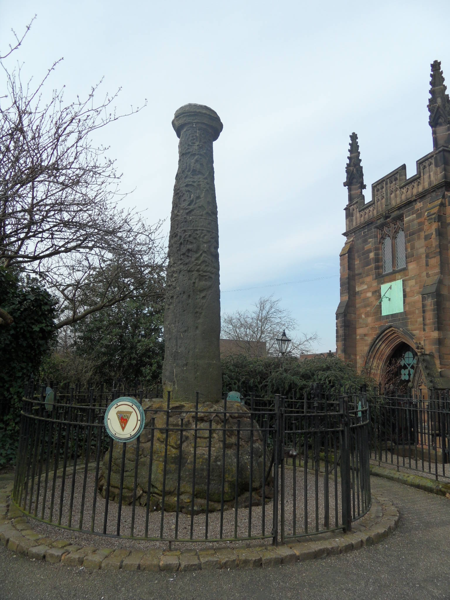
I pass by the Clock Tower at the Friary several times a week and in the stillness of the night, I can hear it chime, slightly out of synch with the Christ Church clock. According to Annette Rubery‘s wonderful new book, Lichfield Now and Then, the tower was built in 1863 to mark the 300th anniversary of the Conduit Lands Trust. When the new Friary Rd was built, the tower was moved to its present location. The Wikipedia entry here has some photos of it in its original site at the junction of Bird St and Bore St. The Staffordshire Past Track has some great photos of the tower being dismantled, including one of the bells being lowered down (is this one of those I can hear?).

The tower was originally built over the site of an ancient water conduit, known as the Crucifix conduit. Some say this name came from a crucifix on top, others say it derived from its location near to The Friary.  Back in 1865*, someone called CW wrote in to ‘Notes and Queries’ (a publication resembling a magazine, but actually sold under the description of ‘A Medium of Inter-Communication for Literary Men, General Readers, etc’!) on the subject:

At Lichfield is a structure The Crucifix Conduit. It has been rebuilt within the last few years and now there is a plain cross on the top. Did the original have a crucifix? Was the crucifix, if any, destroyed in Puritan times?  Is there any drawing of the building in existence And if so where can see it?

A literary man (or possibly a general reader!) replied as follows:

The old conduit at the Friary gate does not appear have been surmounted with a crucifix but was so called from Crucifix being the name of the locality on which stood. Gregorius Stoneing receiver of the rents of possessions of the Fryars Minors of Lichfield after dissolution thereof in his account in the court of Augmentation answered, and so was charged with, and the rent of a certain water course within the compass circuit of the late house of Fryars aforesaid running from Poolefurlonge to Lichfield street, viz to a certain called the Crucifix demised to John Weston at the will of the Lord. (Shaw’s Staffordshire  1820) A engraving of the old crucifix conduit will be found A Short Account of the Ancient and Modern State Lichfield 1819′.

A quick search on the invaluable googlebooks finds that book, and as promised, a drawing of the crucifix as it looked in 1819.

I had thought that the Crucifix conduit was no longer in use by the time the clock tower was built – the listed building description says it was built over the ‘redundant conduit’. However, different accounts suggest that the conduit was still used as a public water supply beyond this date.  The County History says ‘In 1863 it (the Crucifix Conduit) was adapted as the base of a clock tower designed in a Romanesque style by Joseph Potter the younger, but the conduit continued in use’.This probably explains why what look like drinking fountains can be seen built into this section of the tower!

I find this next bit confusing and am happy to be corrected! What I understand is that the water came from a spring at Aldershaw. In 1301, Henry Bellfounder granted the Fransican monks the right to built a conduit head over the spring, and to pipe the water to the Friary. He apparently did this for motives of charity and for the sake of his and his ancestors’ souls’ health.  Although it seems the water was supposed to be for the friars’ use only, a public conduit was built outside the Friary gates.  When the Friary was dissolved in the mid-16th century, I understand that the Conduit Lands Trust took over the responsibility for maintaining the water supply to Lichfield when the spring at Aldershaw was granted to the ‘Burgesses, Citizens and Commonalty’ of the City of Lichfield. A fountain marks the approximate site of the original public conduit (and of course the later clock tower) near to  the library and record office. Although the water is no longer suitable for drinking, it serves as a symbolic reminder of the water supply that was once available here.

A stone conduit head dating back to 1811 can apparently still be found over the spring at Aldershaw. The spring was known as Foulwell which may not sound like the most appealing place to get water from, but as BrownhillsBob explained to me that the name ‘foul’ is most likely to mean ‘obstructed’ in this context. What’s also interesting is that the well seems to have an alternative name – Donniwell, which crops up in some transcriptions of old documents (dating back to the 4th year of the reign of Edward VI which would be 1551. I think.) that Thomas Harwood made in 1806.

Funnily enough, searching to find an interpretation of the name lead me back to another edition of ‘Notes and Queries’, (this earlier issue from 1855 was described as a ‘Medium of Inter-Communication between for Literary Men AND Artists, Antiquaries, Genealogists etc). Someone else had questioned the meaning of Donniwell in relation to the spring near Lichdfield, and received the following answer from WLN of Bath.

The word Donni or Donny in Donniwell is merely the old Keltic (sic) vocable don (otherwise on or an), water,  with the diminutive y, and signifies the little stream or brook The word is still retained in the name of the rivers Don in Yorkshire, the Don which falls into the sea at Aberdeen, another Don in county Antrim Ireland, and in the Don in Russia. Hence, too, the Keltic name for the Danube, Donau, latinised Danubius. There is also Donnyland in Essex and the two rivers Oney in Salop and Herts, Honiton or Onyton in Devon and the Uny in Cornwall are all different forms of the same root.

I might offer many other illustrations but will refer only to the same word in the primitive nomenclature of Palestine the Dan which, with the later Hebrew prefix Jor (river) we now by a double pleonasm, call the river Jordan

So there’s one idea…..anyone have any other ideas of where this name may have derived from?

Coincidentally yet appropriately, today is the 8th December, the Feast of the Conception of St. Mary, the date on which two wardens were appointed each year to keep the conduits and watercourses of Lichfield’s water supply in repair.  I also like the idea that the chiming bells of the Clock Tower provide an appropriate, yet coincidental link to the name and occupation of the man who originally gave the spring at Aldershaw which fed the conduit (at least I think its coincidental….). I also find it interesting that back in the mid 19th century people were asking similar questions to the ones that I’m asking today. It seems it’s not just me that is fascinated by the idea of springs, wells, conduits and water in general!

Now I know a little more about where the water came from, and where it went to, I’d like to know more the inbetween part i.e. the actual route of the water. That also goes for the conduit between Pipe Hill and the Cathedral Close too. As it looks unlikely that I’ll be able to go looking for the conduit head at Aldershaw (it’s on private property) as I did with the one at at Pipe Hill, I shall have to concentrate instead on tracking down the archaeology reports and journals that reveal more about our medieval conduits,  at Lichfield Record Office.

Also, for more about the Friary, Gareth Thomas has added some original deeds and plans to his blog All About Lichfield.

*This date is a little strange as the Clock Tower was built in 1863. Perhaps the letter was written before this time and not published until 1865.

Edit: 10/12/12

I’ve just been reading part of The History of the South Staffordshire Water Works Company. This suggests that a public water conduit of some description, pre-dates the granting of the spring at Aldershaw to the Friars. Apparently, there was a public conduit in the early 13thc, and there are also references in the Cathedral records to a Conduit St, and a conduit in the high street.  Are these are connected to the Crucifix conduit or separate? And where did this water come from?

The document also gives some really interesting information on the pipes themselves. It says that originally wooden pipes were used (bored tree trunks). It refers to a document from 1707, that says the pipes ‘being made of alder had become rotten, leaky and in decay and accordingly taken up and replaced by leaden pipes’. Interesting that the pipes were made of Alder, and the water came from Aldershaw. It also says that in 1801, the Conduit Lands Trust replaced a small gauge lead conduit from Aldershaw with a larger diameter cast iron main, which enabled a greater volume of water to be carried to the City. It also gives this interesting information on what happened when supply started to exceed demand.

By 1821, Aldershaw was proving to be inadequate source and a scheme was devised to supplement the spring’s supply, by collecting the surface water from Tunstalls Pool, the Moggs and other pools and diverting water into the common conduits. When the situation worsened in the mid 1850’s, the trustees acquired the Trunkfield Mill and Reservoir and a pumping engine was installed to increase the supply. In 1868 the supply of Aldershaw yielded 15,000 gallons a day. Trunkfield supplied 160,000 gallons a day, all of which was pumped to Crucifix Conduit. Water was provided to fifty seven public pumps, thirteen standpipes and public taps, thirty fire hydrants and three hundred and forty three houses.

The document isn’t too specific about their sources, so having to take what they say on face value for now. Lots more reading to do I think….Luckily for me, local historian Clive Roberts is going to send me some information he has on the Conduit Lands Trust!

Sources:

Lichfield Then and Now Annette Rubery

A short account of the city and close of Lichfield by Thomas George Lomax, John Chappel Woodhouse, William Newling

The History & Antiquities of the City of Lichfield by Thomas Harwood (1806)

Lichfield: Public services’, A History of the County of Stafford: Volume 14: Lichfield(1990), pp. 95-109

Water Technology in the Middle Ages: Cities, Monasteries, and Waterworks after the Roman Empire by Roberta J Magnusson

Walsall Road, Lichfield, Staffordshire. A Report on an Archaeological Evaluation
Marches Archaeology Lyonshall : Marches Archaeology, 2000, 18pp, figs, tabs
Work undertaken by: Marches Archaeology

History of the city and cathedral of Lichfield by John Jackson

Notes and Queries 12th Volume 1855

Notes and Queries 3rd Series Volume 8, 1865

An Inconstant Stream

According to place name expert Margaret Gelling, Leomansley Brook has a pre-English name. It’s thought the name could contain the Celtic word lēmo, meaning ‘elm’ (1) or lēme meaning ‘limetree’ (2).

1- Conduit Heads; 2 – Start of Leomansley Brook?; 3 Site of Leomansley Mill/House/Manor; 4 – Former Beacon Place fishponds, now Beacon Park boating lake

The brook rises near to the conduit heads at Pipe Hall Farm, Burntwood (at a place I’ve just noticed was also known as The Dimbles, just as the area near to the Circuit Brook is/was!), and crosses the Lichfield/Burntwood boundary, to fill a series of pools on the edge of Leomansley/Sloppy Wood before meandering through Pipe Green.

As mentioned in my previous post, Leamonsley Mill was built on the brook at the edge of Pipe Green in the 1790s. There are a few traces of the industry that was once here – ‘Leomansley Mill Cottage’ is a little further back down the track towards Christ Church Lane and there are also some possibly related brick structures. The second photo shows the place where the brook re-emerges to flow through Pipe Green, and is shown on some maps from the late 19th and early 20th century as a ‘Spout’.

Taken June 2011. On old maps, this is marked as sluice. This part of the watercourse was filled with water once again this weekend

Taken December 2010. Shows as spout on old maps.

I found a recollection by someone who spent the summer of 1984 at the old mill cottages then known as Leomansley House (which they have included a photo of!) producing the first and only issue of what they describe as a ‘local anarcho-DIY philosophy magazine’. In their description of the old house, they describe how Leomansley Brook ran past the front door.

The other stories I’ve found about the pool relate to changes brought about by nature. In February 1902, the frozen pool was used for ice skating.  The Lichfield Mercury reported that on the Friday after the freeze, the pool was quiet, but by Saturday a group of ‘horrid hockey people’ (as one unnamed woman described them) had discovered it and monopolised the best part of the pool.

Another Mercury story, from April 1976 when the artist Eilidh Armour Brown lived at Leomansley House, tells of a water shortage at the pool

Lichfield District Council Staff had been prepared to move fish from Leomansley Pool, after the water levels dropped to a dangerous level for the fish. The fish were to be transferred to Minster Pool until the water level at Leomansley had risen. Luckily a storm that weekend brought the much needed rain and it was no longer necessary.

Things couldn’t have been more different this weekend. The normally dry part of the course along the edge of the woods was full, and levels in the pools were high, as you’d expect.

Taken November 2012. This part of the brook is normally dry.

Taken November 2012. I was told there used to be a bridge somewhere near here for farm carts to cross into the adjacent field.

Taken November 2012

As you can see in the above photo, not only was the brook refilled,  but the water was also claiming parts of the path. I imagine that’s how the name Sloppy Wood came about!

From Pipe Green, the brook is culverted under the A51, and then flows through Beacon Park, filling what used to be the fishponds for Beacon Place (now the boating lake in the park), before finally ending up at Minster Pool.

November 2012 – Through Pipe Green


November 2012 – Looking back towards Leomansley House/Mill/Manor!

June 2012 – Leomansley Brook enters Beacon Park via a culvert under the A51. The reason the water looks murky by the pipe is that a little dog was paddling just before I took the photo!

June 2012 – Passing the play area in Beacon Park. This used to be a fish pond for the mansion Beacon Place (demolished 1964).

I don’t know anywhere near as much about streams and brooks as I’d like to but am really interested in them and their importance in the development of our landscape, e.g., the formation of natural boundaries and giving names to places that grew up along them. I’m also fascinated by our relationship with watercourses like these and our attempts to manage them, for better or for worse.

Sources

(1) ‘Lichfield: The place and street names, population and boundaries ‘, A History of the County of Stafford: Volume 14: Lichfield (1990), pp. 37-42.

(2) http://finds.org.uk/staffshoardsymposium/papers/mattiasjacobsson

Elegy Written in a Lichfield Churchyard

Many churches dedicated to St Michael are found on hills. Lichfield’s St Michael’s of course is at Greenhill, on a sandstone ridge 104 metres above sea level.   It’s thought a church has been on the site since 1190, but that the surrounding churchyard is older. There are hints as to this earlier history of this site, but as far as I can see things are still very much at the questions, rather than answers stage. Many people believe the position of the church on a hill, and its dedication to St Michael may indicate a previous pagan site.   I hadn’t realised until reading that the crypt was liable to flooding, that there are natural springs on the hill. Is this relevant to the story, and if so, how?

The answers we do have were, of course, mostly provided by archaeology. Evidence suggests there may have been activity here in the mesolithic era. In 1978, an excavation in the South East corner of the churchyard discovered five flints (albeit not in a primary context).

Four years earlier, the building of a new vestry at the church gave archaeologists the opportunity to open a trench. Unsurprisingly for a churchyard they discovered human remains – forty nin complete or partial skeletons. Of these, all but two were buried in the customary Christian manner, with their head to the west. However the head of ‘Skeleton 21’, was to the east. Apparently, this can sometimes suggest that the remains of a Christian priest have been uncovered. By being buried with their feet to the west they were ready to rise and face their flock on judgement day, as they had done in life. However, the archaeologist noted the absence of a chalice and patten, objects that priests were often buried with (as was the case with the remains of the priest near the old leper hospital in Freeford).  ‘Skeleton 58’ also differed from the others being buried with his/her knees tucked under the chin. This crouched burial style is apparently more associated with Pre-Norman conquest burials, although I’m still doing some background reading to try and shed more light on what exactly this kind of burial is thought to signify in this context.

The archaeology report also mentions skeletons 2 and 8,  those of an adult, and a baby placed on the adult’s shoulder, and speculates this may be a woman who died in childbirth. It’s discoveries like this, I think, that remind you that these were real people with real lives (that were all too short in many cases).

By the mid 16th century, church records are kept (I’ve used those transcribed by Harwood), and begin to tell us a much more detailed story of the churchyard,  enabling us to gives names and identities to those laid to rest here. For example, this is the entry for 1560

– Recevyd for the ffyrst grasse of the Churche Yarde
– for the later Grasse of the Churche Yarde
– of gatherynge in Easter Wyke
– for light at the buryall of Jamys Bywater’s Wyffe and her Chylde
– for light at the monthe mynde of Roberte Walker
– for light at the monthe mynde of Roger Walker
– for light at the buryall of a Chylde of the Walle
– for light at the mynnynge of Mr Swynfen
– for light at the buryall of Roberte Cowper’s Wyffe

The church records also records costs for ‘killing molldiwarps’ in 1597, bestowing ‘on the workmen at several tymes in beare and ale’ in 1602, and money ‘payd for catching urchins’ in 1612 (urchins meant hedgehogs. I hope!).

While some things never change – a footnote tells how a person named Hollingbury was tried at Lichfield in 1612 for stealing lead from the church, others thankfully have – ‘William Key of Bliffeld and Nicholas Hatherton of Lichfield two prisoners condemned according to the Laws of this land and executed here at this Cittie were both buryed in one grave the 17th day of October 1592’.

There are still those buried at a later date whose names are not specifically recorded. An entry in the register says that for ‘From April 14 1642 to Feb 19 1645 were buried twenty five soldiers’, and I’ve either read or been told that victims of the plagues that struck Lichfield (51 per cent of Lichfield’s population died of plague in 1593-4, and 32 per cent, in 1645-6) were buried in pits here.

The majority of headstones seem to date from the 18th century onwards, although there may be earlier memorials here. I have seen examples of gravestones dating back to the early 1600s in other churchyards, such as this one at Southwell Minster in Nottinghamshire.

Examples older gravestones at Southwell Minster

Of course, some people, presumably those wealthy citizens of the city, even erected monuments like this well known one belonging to Chancellor Law, which used to have a clock in the centre.

As with many places, we might never get definitive answers about the origins of St Michael’s churchyard, but who knows? As we’ve seen before, one discovery can change everything. And in the meantime, it’s a fascinating part of the city to keep asking questions about!

Sources

Gould, Dorothy & Gould, J 1974-5 `St Michael’s churchyard, Lichfield, Staffs’ Trans S Staffordshire Archaeol Hist Soc 16 58-61 

The history and antiquities of the church and city of Lichfield by Thomas Harwood


Cross County

Looking for ancient crosses in Lichfield, has so far lead only to hints of their existence – a one line reference in an old book here, a placename there. Nothing concrete (or should I say stone?).  So imagine how happy I was when I visited Ilam Park yesterday and found that were two thought to date back to the 10thc standing in the churchyard with a third shaft incorporated into the church wall…..

Church of the Holy Cross, Ilam, Staffs


…..and imagine how much I kicked myself when I got home and found out there was yet another stone, known as ‘The Battle Stone’, located in the grounds of Ilam Hall that I had missed!

However, as a consolation, I learnt at home that this spring near to the church is thought by some to be St Bertram’s Well (although others place this on a hillside near to the village).

St Bertram’s Well?

The Shrine of St Bertram (also known as St Bertelin or maybe Beorhthelm of Stafford) is inside the church. As you might expect, there is more than one account of St Bertram’s life. The most well known version seems to be the tragic story that he was a Mercian Prince whose wife gave birth to a child in a forest. The wife and baby were killed by wolves and St Bertram became a hermit near to Ilam, It’s thought this story might be represented on the churches font, which dates back to around the 12thc.

You can decide for yourself, if you look at this website on Romanesque sculpture, which gives a detailed description of the font, together with photos.

However, Stafford Borough Council have this version on their website, which doesn’t feature the tragic part of the legend.

The legend of St Bertelin derives from the 14th century account of him by Capgrave in his ‘Nova Legenda Anglie’, retold by Dr Robert Plot in his ‘Natural History of Staffordshire’ (1686). He is reputed to have been the son of the Mercian prince, the friend and disciple of St Guthlac who, after St Guthlac’s death c 700, continued his holy vocation on the islet of Betheney now Stafford. Here, he remained until forced to retreat from the ill-will of jealous detractors, when he repaired to Ilam, in Dovedale, Derbyshire where ultimately he died. His burial place in Ilam church was once a place of pilgrimage.

His burial place still seems to be a place where people come, not just seeking out history like me, but for spiritual reasons. As you can see from the photo of the shrine, prayers (I didn’t read them) and candles are still left there.

I have found a copy of the ‘Nova Legenda Anglie’, but as my Latin only stretched to ‘Caecilius est pater’, I need a bit of time alone with google translate.  So, I’ll leave the legend of St Bertram/Bertelin there for now other than to say that it’s believed that the remains of St Bertelin’s chapel in Stafford were excavated in the 1950s and they discovered part of a 1,000 year old cross. And this one is made of wood!

Ilam, Stafford and I’ve seen references to existing crosses in Wolverhampton, Leek, Chebsey (between Eccleshall & Stafford), amongst other places. With the discovery of the ‘Battlestone’ in Ilam (the one that I missed!) in the foundations of a cottage, during a restoration in 1840, I’m still clinging to the hope that at least a fragment of one survives somewhere in Lichfield!

Sources:

http://www.heritagegateway.org.uk/gateway/

http://list.english-heritage.org.uk/ (Entry numbers 1038113, 1012654, 1012653,

Corpus of Romanesque Sculpture in Britain & Island http://www.crsbi.ac.uk/index.html

http://www.geograph.org.uk/photo/705619

http://www.megalithic.co.uk/ (St Bertram’s Well http://www.megalithic.co.uk/article.php?sid=14731)

http://www.staffordbc.gov.uk/in-touch-with-the-past

Stumped

I had an email from Pat telling me there was a lump on the side of the A51, near to the junction with Abnalls Lane.  I assumed that it was an old tree stump, but Pat thinks it might be something more than that, and recalls seeing some stone there last year.

I went and had a closer look. Pat said in his comment on the Cross City post, the lump is covered in vegetation, but there is likely to be something solid underneath, as the grass is cut around it. I took a few photos and then the self -conciousness of being stood on a busy A-road taking photos of a grassy lump got the better of me and I headed back up Abnalls Lane.

So, does anyone else know anything about this, or do we just have to wait until the grass dies away in the Autumn to get a better look?!

In the meantime, it’s worth taking a trip up Abnalls Lane. In parts, it’s thought to be a holloway, and at times you’re surrounded by hedgerows, tree roots and sandstone, with carved names and dripping water.  It takes you past the site of one of Lichfield’s Scheduled Ancient Monuments – a moated site on the edge of Pipe Green and over the border into Burntwood.  It also passes nearby the site of Erasmus Darwin’s botanical garden, although unfortunately the site is not open to the public.

Spires of Lichfield from moated site at Abnalls Lane on the Lichfield/Burntwood Boundary

Interestingly, a section on Burntwood in the History of the County of  Stafford says that,

The road, now Abnalls Lane, was known as Pipe Lane at least between 1464 and 1683.  The point where it goes over the boundary was described in 1597 as ‘the place where the broken cross in Pipe Lane stood’; a ditch at Broken Cross was mentioned in 1467.

Is this one of the crosses already counted in Cross City, or a different one? 

Also, on the subject of research into stone things, at the end of Abnalls Lane, there are some interesting names – The Roche and Hobstonehill (according to the History of the County of Stafford, the placename ‘Hobbestone’ was mentioned in 1392).   

I think I need to spend my summer holidays at Lichfield Record Office.

Sources:

‘Townships: Burntwood’, A History of the County of Stafford: Volume 14: Lichfield (1990), pp. 195-205. URL: http://www.british-history.ac.uk/report.aspx?compid=42356  Date accessed: 27 July 2012.


Cross City

There’s some evidence that there were several stone crosses in Lichfield, although as far as I know, no physical remains have ever been found.

The most well documented of these is the market cross. According to the Lichfield volume of the History of the County of Stafford (1), a market cross stood north of St. Mary’s in the late Middle Ages and then some time around 1530, Dean Denton surrounded it with eight arches and added a roof  to keep the market traders dry. The building was topped with eight statues of apostles, two brass crucifixes on the east and west sides, and a bell, as you can see in this picture on the Staffordshire Past Track site.    The cross was destroyed in the civil war, and replaced with a market house, as shown in the illustration below (although it is referred to as a cross on the notes?) which has also now disappeared.

Taken from John Jackson’s book, History of the City and Cathedral of Lichfield, 1805

There is a possibility that there was a preaching cross in the grounds of St John’s Hospital as documentation shows that Dean FitzRalph preached outside in the cemetery. (2) Information on this specific example is really sketchy, but there is a surviving preaching cross in Bloxwich which you can read about in a great article on The Borough Blog.

More evidence exists for a cross at the junction of Tamworth St and Lombard St. There is a cross like structure shown there on John Speed’s 1610 map, and in 1805 Thomas Harwood wrote that there was a stone cross in Tamworth St. (3) There are also a couple of references in old property deeds such as one from April 1316 describing a ½ burgage in street between the Stone Cross and Stow Gate.(4)

The Market Cross and the Stone Cross at Tamworth St can be seen depicted on John Speed’s 1610 map of Lichfield

A cross apparently stood near Cross in Hand Lane in Lichfield, giving rise to a theory that it this is where the lane got its name from (the other theory is that is was a pilgrimage route, to St Chad’s shrine, where people would walk with ‘cross in hand’. The route has recently been incorporated into a new pilgrimage and heritage route called Two Saints Way). Harwood said,  “(Beacon Street) extends from the causeway over the Minster pool which separates it from Bird Street to houses at the extremity of the city called the Cross in the Hand and where stood an ancient cross ad finem villas.’ The pastscape record for the cross is here.

This week I came across another reference, this time Bacone’s Cross, and which was also thought to be in Beacon St, at the end of the town. Was the ancient cross at Cross in Hand Lane and Bacone’s Cross the same cross?

The Bacone’s Cross/The Cross in Hand and the Tamworth St cross were both situated at the ends of the town. Does this mean that they were boundary markers of some sort?  If so, could there have been more crosses marking other places on the City’s boundary.  There were city gates at both Beacon St and Tamworth St.  However, the probable sites of the gates don’t correspond exactly with the probable sites of the crosses e.g. the above example says ‘between the Stow Gate and the Stone Cross’.

Tamworth Gate plaque on Lee Garden Chinese Restaurant Credit: Ell Brown (taken from flickr photostream).

In the absence of more information about Lichfield specifically, I looked elsewhere to see if crosses would have been used to mark boundaries. St Albans was surrounded by a ditch, like Lichfield (and there’s a link with the story of the  Christian martyrs but that’s a bit too much of a tangent for now!). The History of the County of Hertford, says this about the city’s boundary (5)

Crosses were at an early date erected at important points in the line of boundary, and at each of the entrances to the town, namely, the Stone Cross or North Gate Cross  at the north on the Sandridge Road, the Red Cross in Sopwell Lane, at the entrance by the old road from London, the Cross with the Hand in Eywood Lane, the Black Cross, probably at the angle where Tonmans Dike goes from the boundary of the houses in Fishpool Street towards the Claypits, and St. John’s Cross at an angle of the boundary in what is now known as Harley Street, but lately as Mud Lane.

It’s interesting to see that some of the names are the same – Stone Cross, Cross with the Hand – but I don’t want to start jumping to conclusions until there is much more evidence!

Finally, there is a document relating to property in Freeford (4), which describes ‘three selions of land at Lichfield, near Le Hedeless Cross, on the road towards Freeford’ in the time of Edward III – Henry V. Does this refer to the Tamworth St Stone Cross, or another cross altogether?

What happened to these crosses? Time? Religious differences? Where did they end up? There’s something in one of my all time favourites book that gives me hope (possibly misguided) that there is a chance, no matter how slim, that things that have long been thought to have vanished might turn up again one day in some form or another. In England in Particular (6), in the section on Wayside and Boundary Crosses, it says that,

Some crosses have been found in hedgebanks, with shafts used as gateposts. A number have been found by researching field names:two fields called Cross Park revealed previously undiscovered stones.

Fingers crossed!

Edit:

In view of the above, I thought it’d be worth having a look at field names etc, in Lichfield. There is an entry in an transcribed inventory relating to the real estate of the vicars that says Deanslade: Falseway to cross called Fanecross (4). There’s a Banecross on another transcription and I think one of these could be down to a typo and that they could be the same place, There is also an entry for a place known as Croscroft, which was on the road to Elford, near St Michael’s Churchyard (3)

Another edit:

I was hoping there would be an ancient cross somewhere in Lichfield. Well, I finally found one! Actually that’s a fib. What I found is a photograph in a book of archaeologists finding one. A decorated cross shaft was discovered built into the foundations of the north wall of the nave of Lichfield Cathedral. It’s thought to be Saxon or Saxo-Norman, and could be a surviving remnant of the earlier church on the site. I wish I could share a photograph here, but all I can do is tell you that it’s on plate 1 in the ‘South Staffordshire Archaeological and Historical Society Transactions 1980-1981 Volume XXII’ book, on the local history shelves at the library!.

Sources:

(1) Lichfield: Economic history’, A History of the County of Stafford: Volume 14: Lichfield(1990), pp. 109-131http://www.british-history.ac.uk/report.aspx?compid=42349#s6

(2) Hospitals: Lichfield, St John the Baptist’, A History of the County of Stafford: Volume 3(1970), pp. 279-289

(3) The history and antiquities of the church and city of Lichfield by Thomas Harwood

(4) Collections for a History of Staffordshire Part II- Vol VI (1886), William Salt Archaeological Society

(5)  ‘The city of St Albans: Introduction’, A History of the County of Hertford: volume 2 (1908), pp. 469-477

(6) England in Particular, Sue Clifford & Angela King for Common Ground