Daisy, Daisy

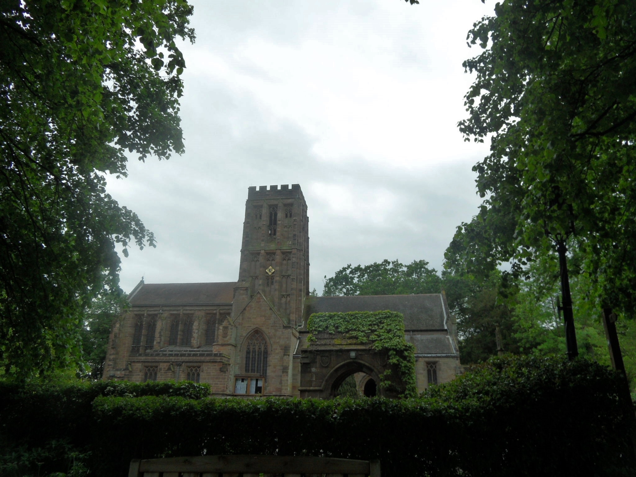
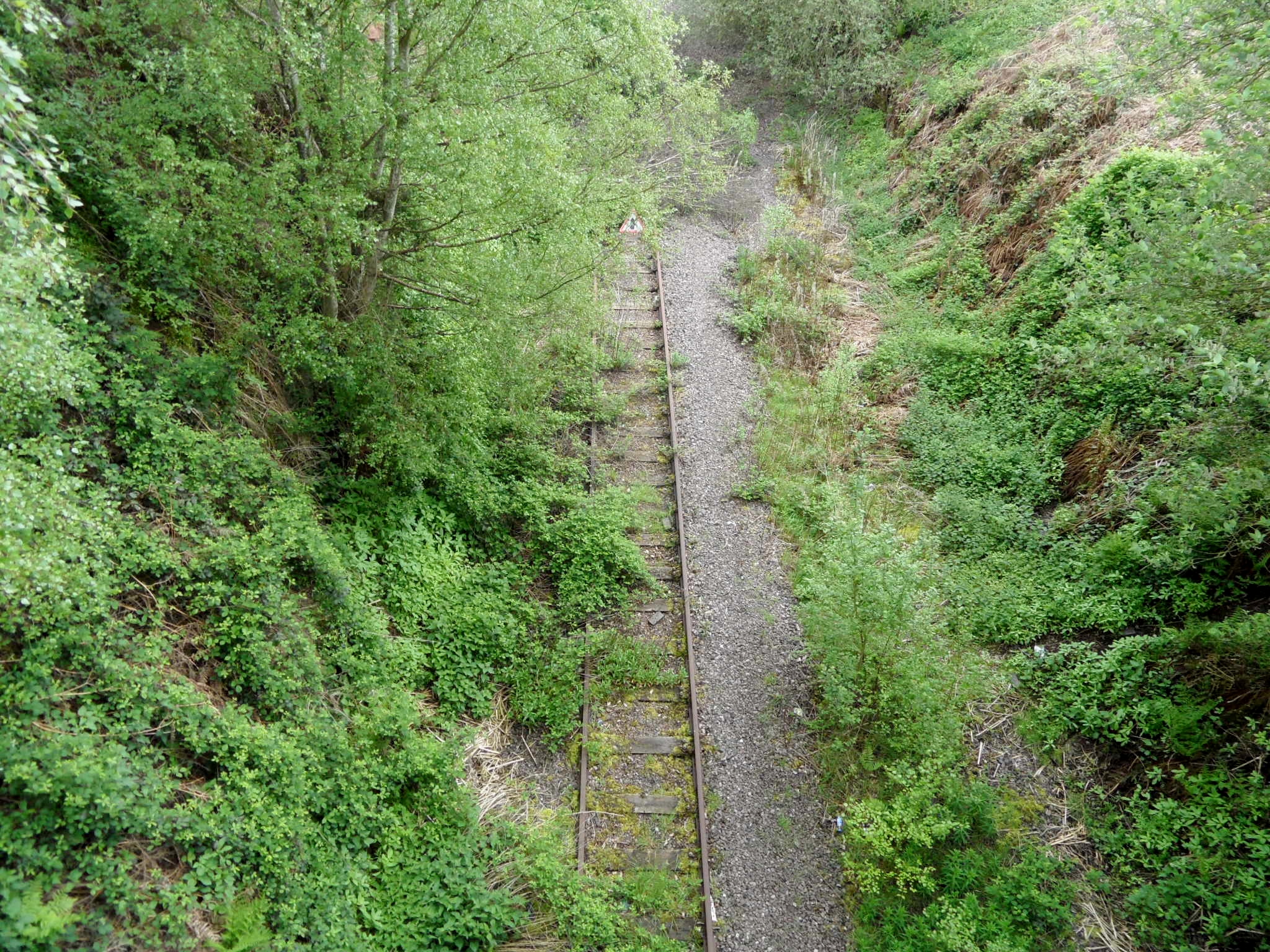
Recently, I’ve spent more time in churches than ever before in my life (with the possible exception of the Summer of 2004, when I went to so many weddings that I was able to recite 1 Corinthians 13 off by heart). When I was younger, history for me was all about the castles. Churches were boring. The only remotely interesting thing about them was that, with their crenellations, some of them looked a bit like castles. Now I know that they can tell stories just as good as any castle, but you just need to know where to look.

SAM_1851

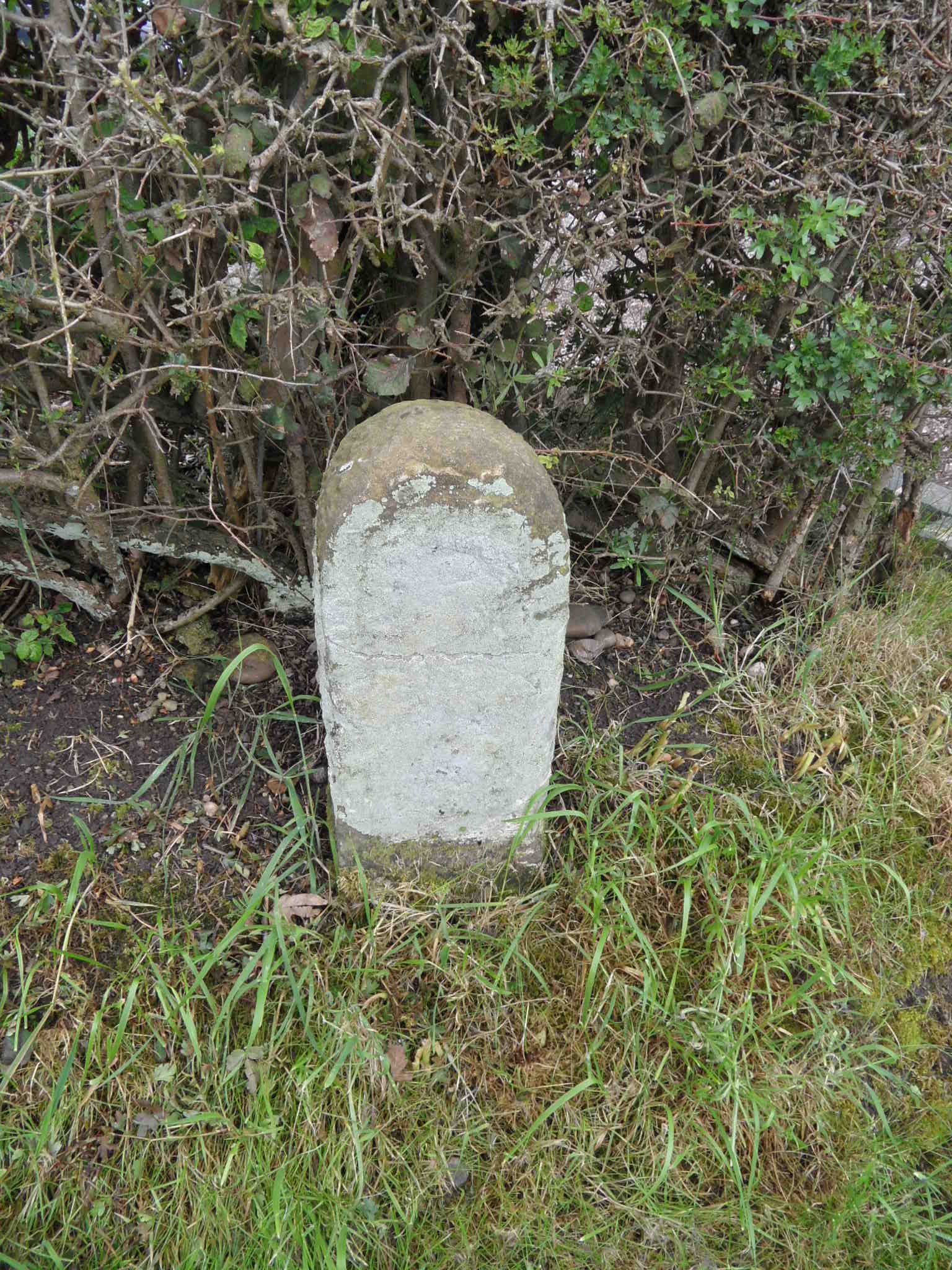
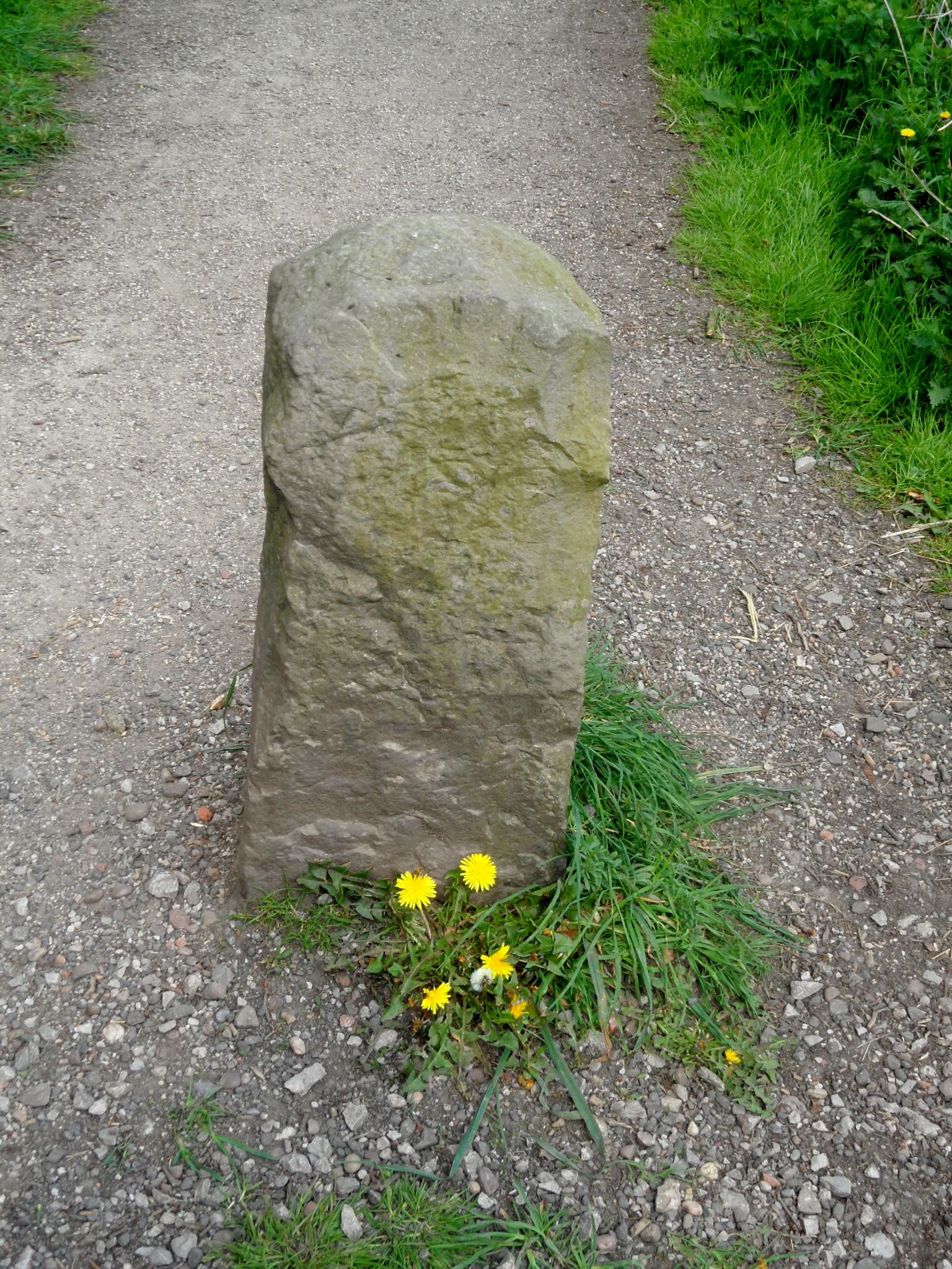
Before even stepping inside All Saints in Kings Bromley, there are plenty of interesting tales. ‘Lady Godiva’s’ cross in the churchyard, originally dates back to the 14th century, but was restored in 1897.

SAM_1842

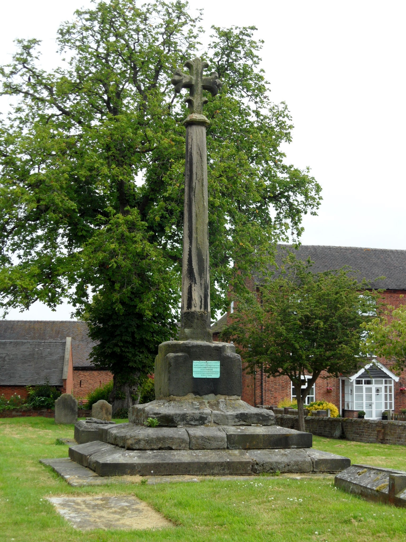
I was delighted but intrigued to see a reference to one of my childhood heroines here. The story I knew as a little girl was that Godiva pleaded with her husband Leofric, Earl of Mercia, to reduce the taxes he imposed on the people of Coventry. Leofric tried calling her bluff by saying he would do so, if she rode through the marketplace in the buff. Unfortunately for him, his wife not only had compassion, but also really, really long hair which according to Roger of Wendover who first recorded the story, ‘covered the whole of her body like a veil’, as she climbed onto her horse and successfully carried out her legendary protest. The connection with Kings Bromley is that Godiva and Leofric had a summer residence or hunting lodge here, where Leofric died in 1057 and may well have been involved with an earlier church which could have stood on this site.

SAM_1844

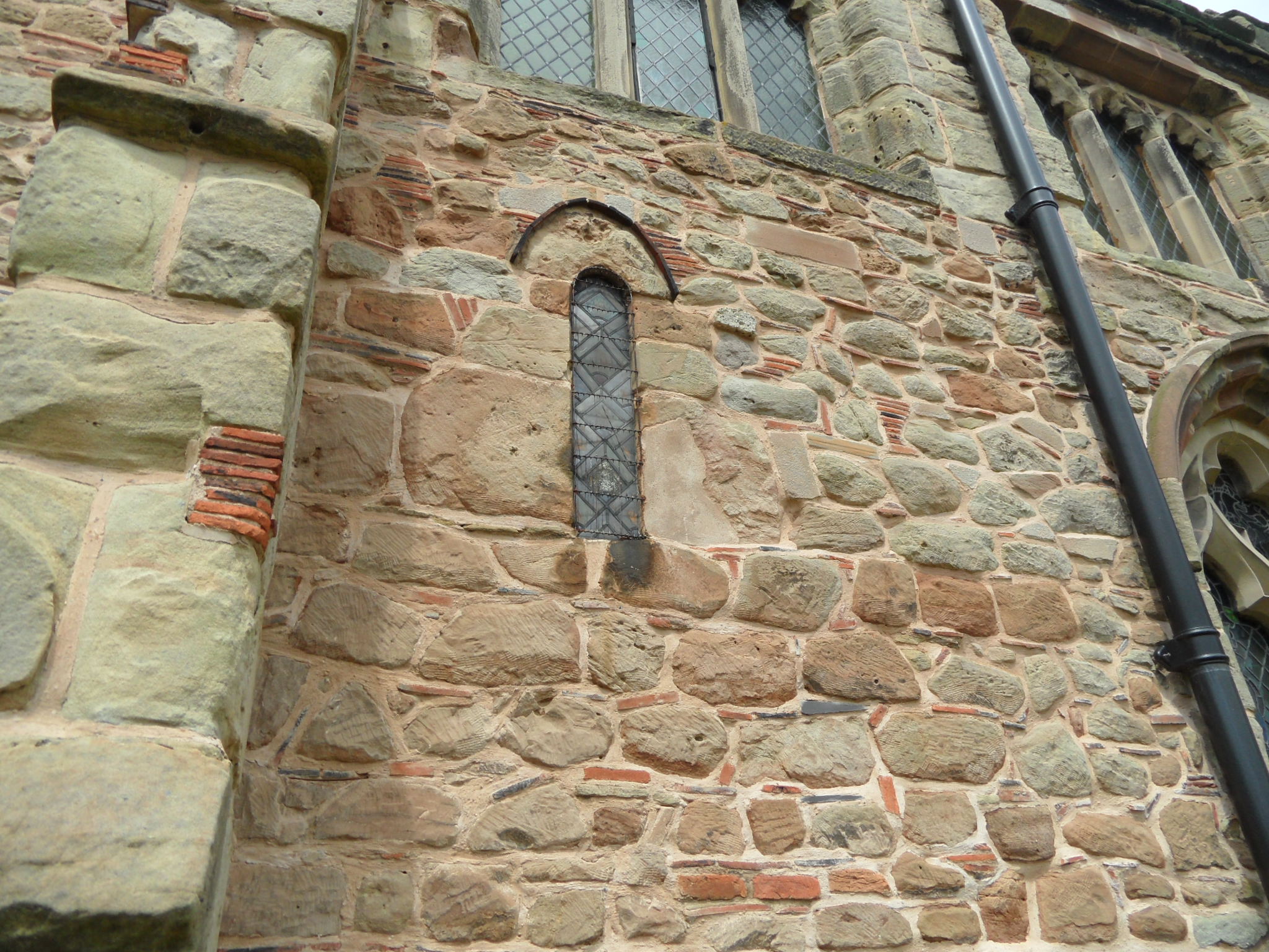
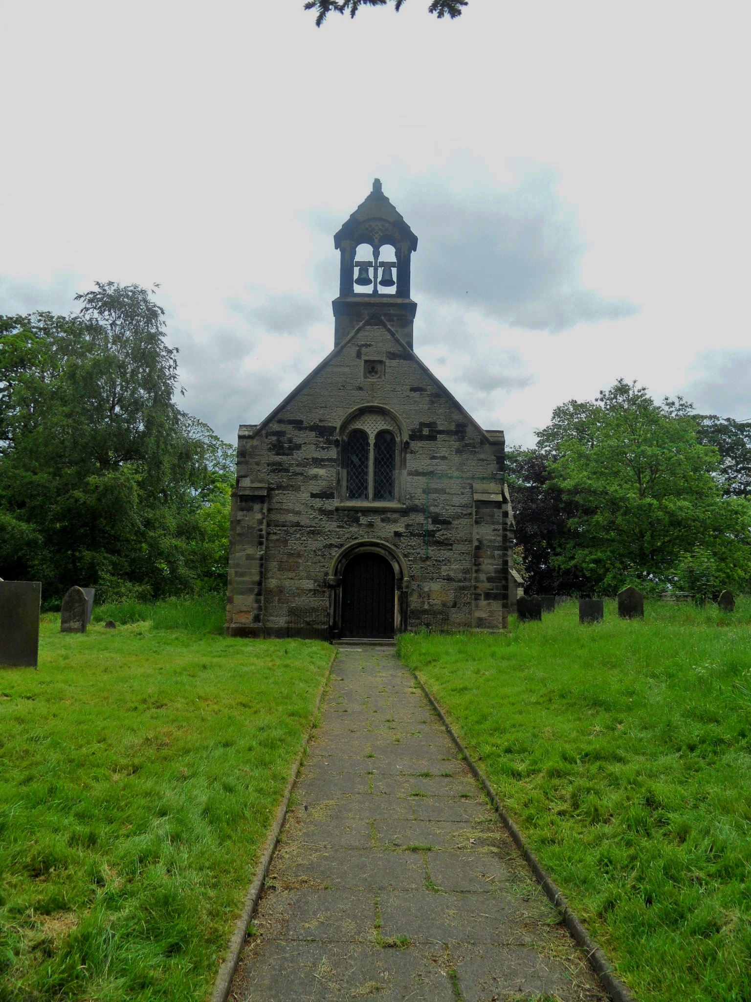
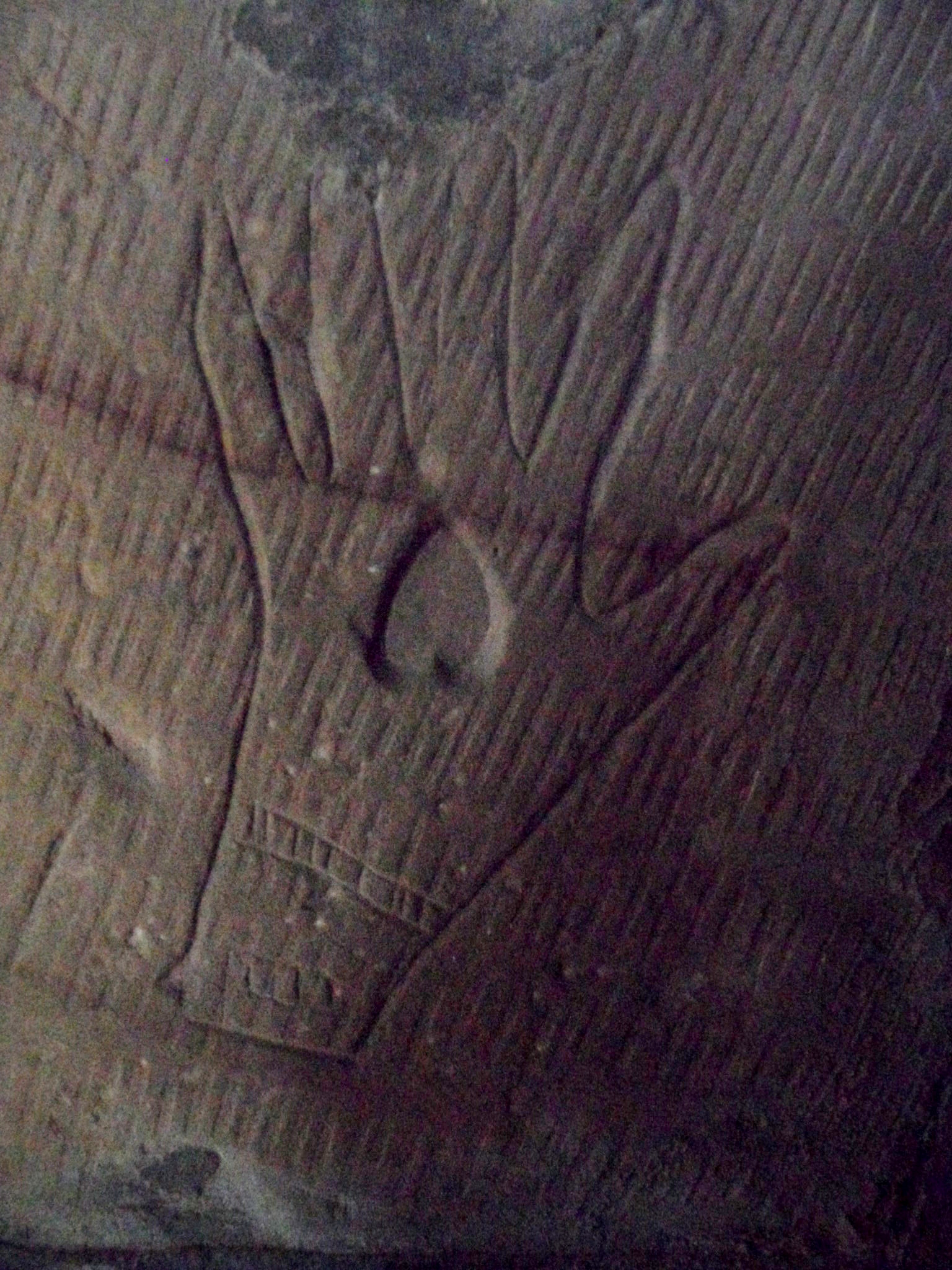
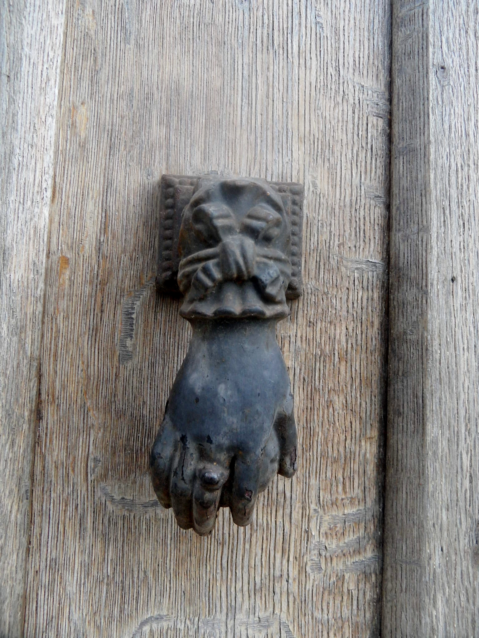
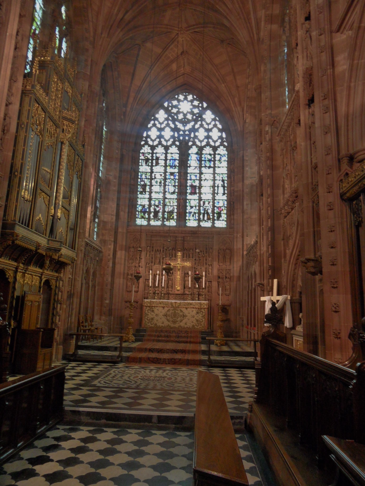
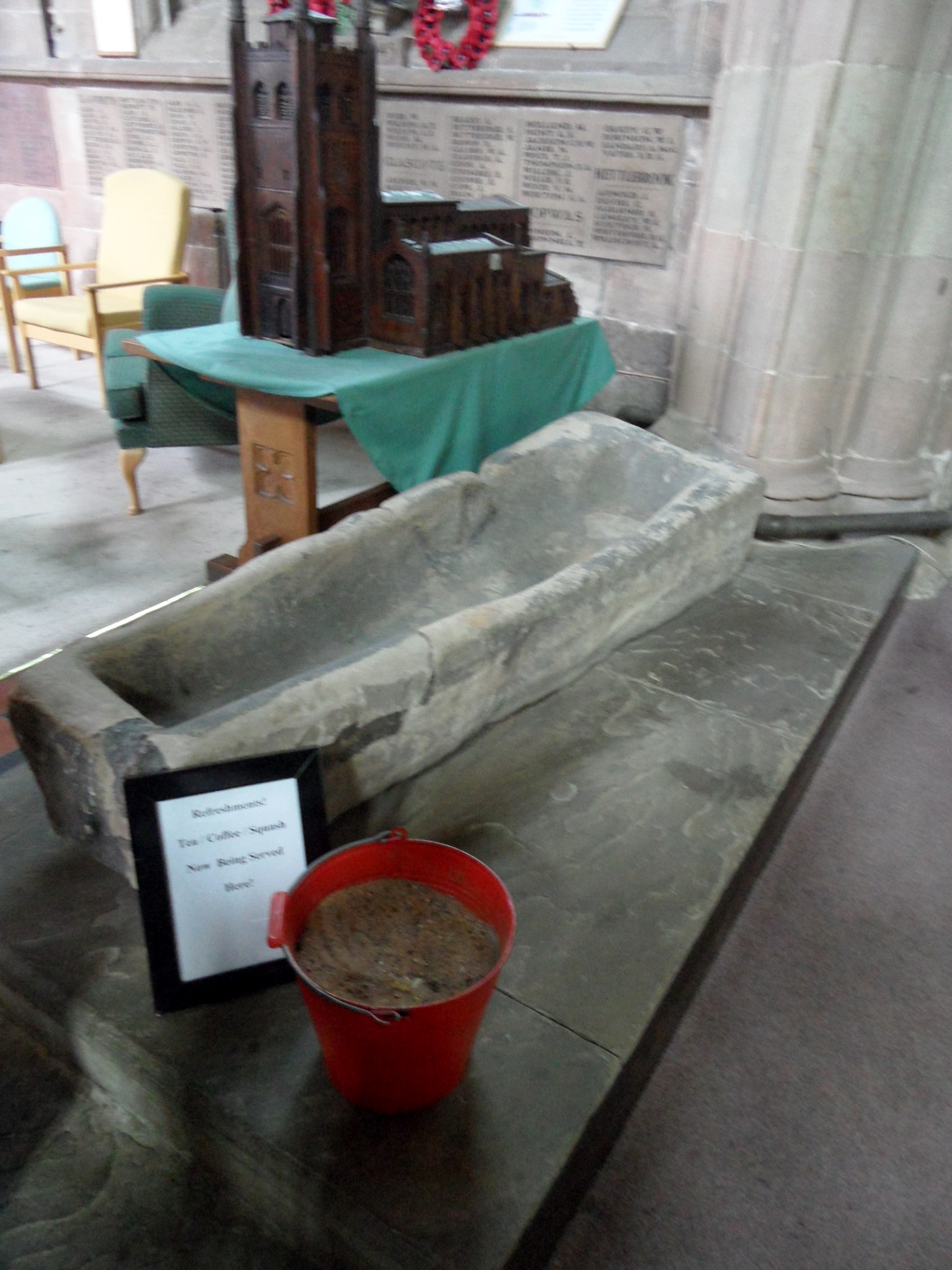
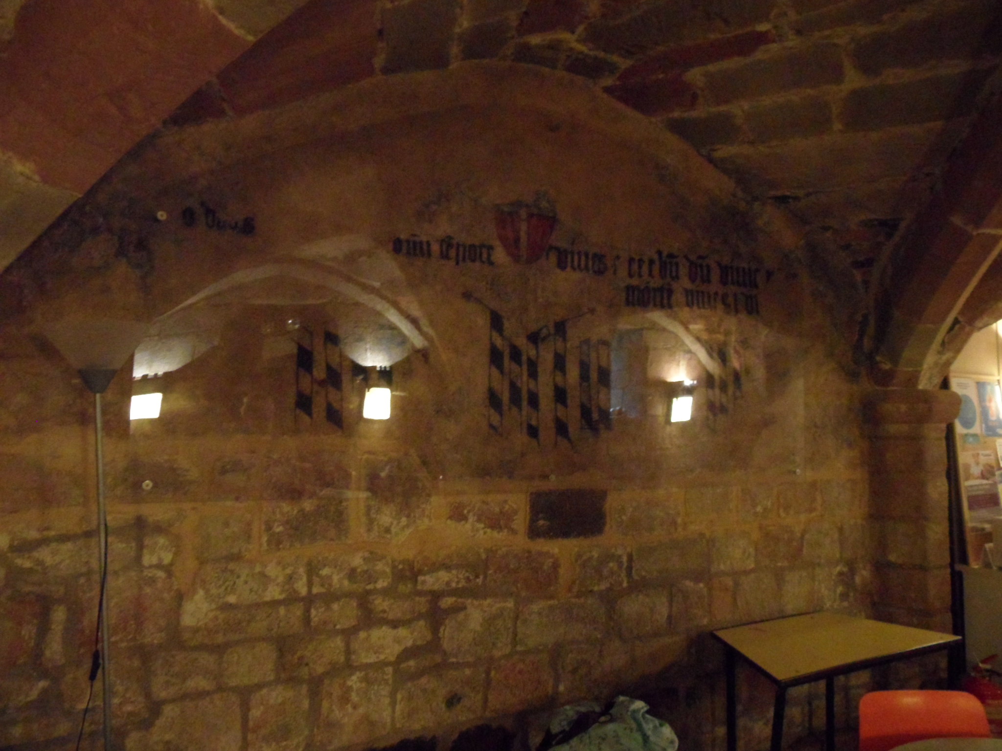
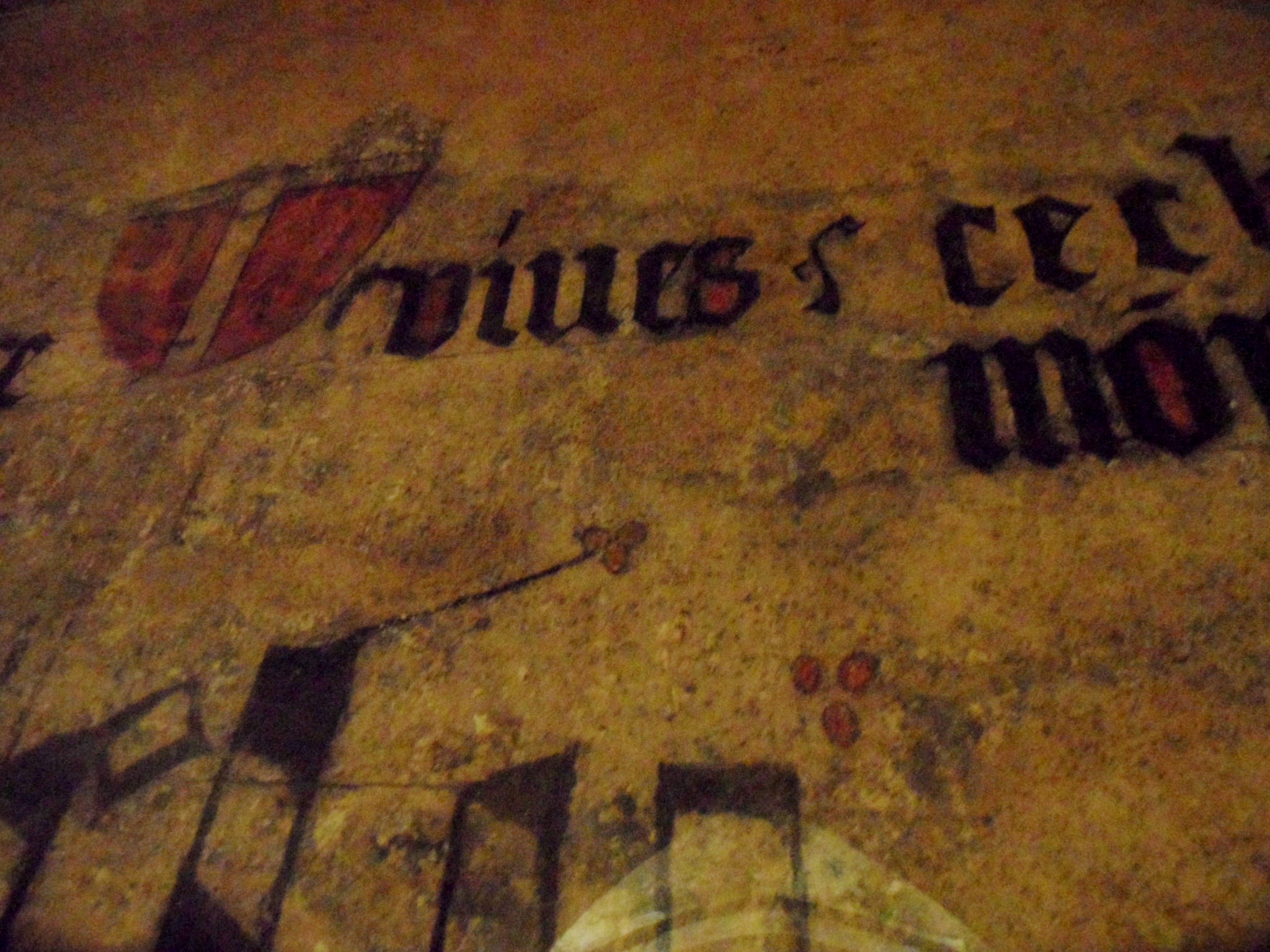
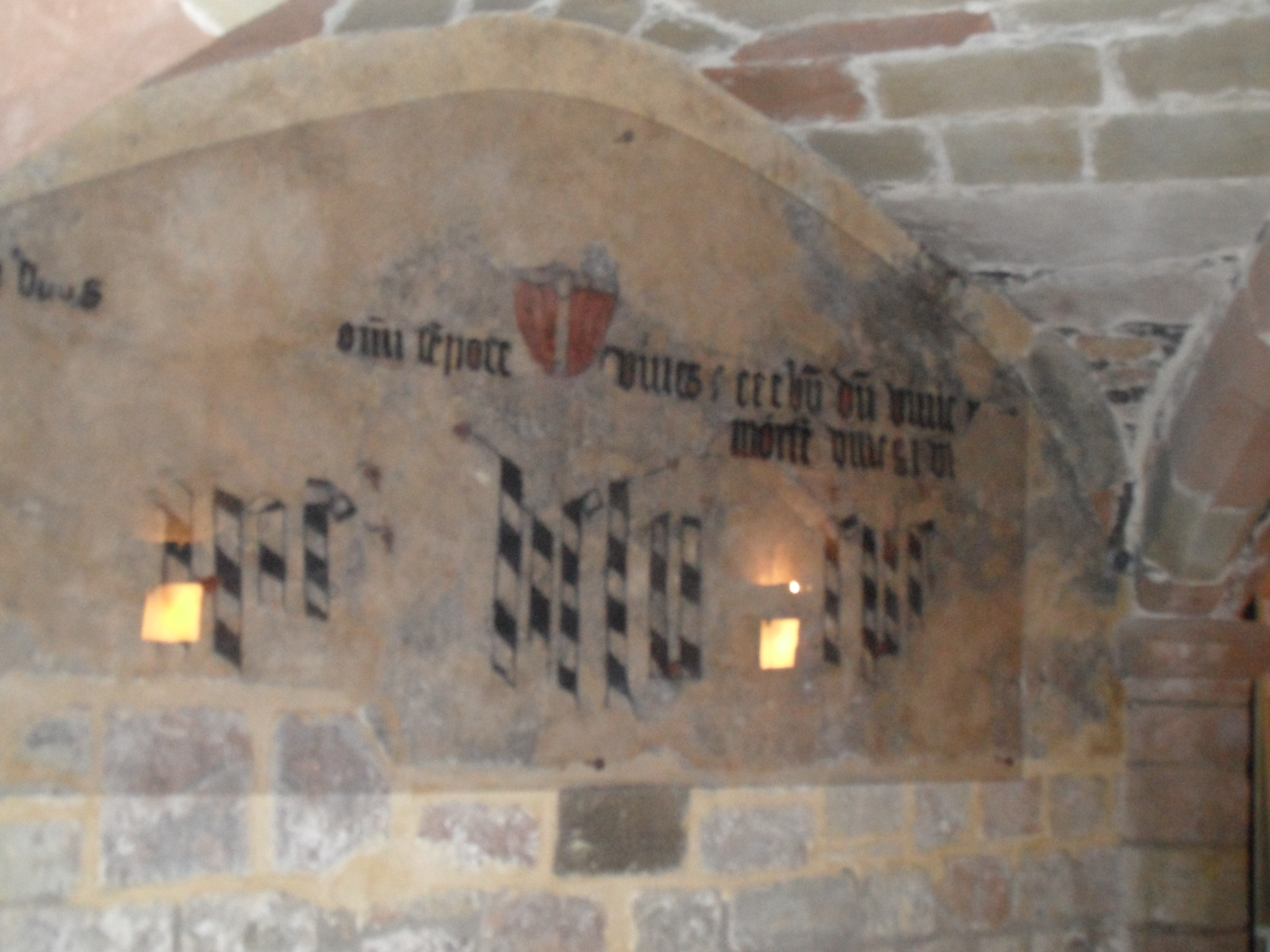
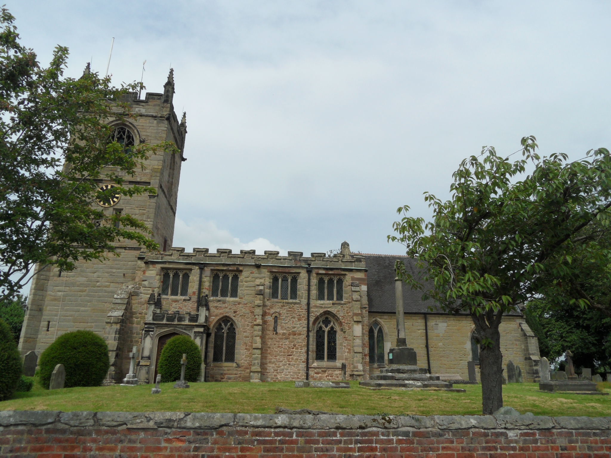
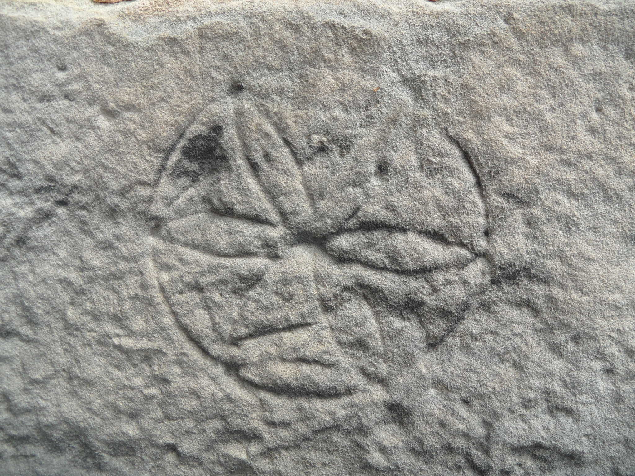
Unlike others I’ve seen recently, I’m pleased to say the church itself hasn’t been fully restored by those pesky Victorians, but has a range of architectural styles and features dating back to at least the eleventh century, but possibly even earlier than that – the HER description says that this is an Anglo-Saxon wall, and somewhere within it there is possibly even a Romano-British brick. On a buttress near to this ancient wall is a medieval scratch dial which, with the assistance of the sun, would once have helped the priest be on time for mass. On the buttress in-between the porch and the sixteenth century tower there is another carving, but unlike the scratch dial, no-one is quite sure of its significance.

SAM_1845

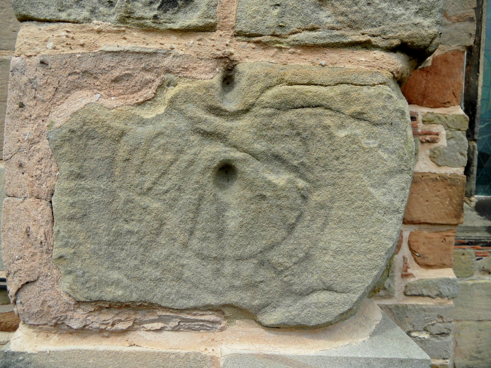
The daisy wheel carving is described as a mason’s mark in the churches information sheet. Although this is the first I’ve seen, this symbol regularly crops up on old buildings, especially churches. Whilst some believe these carvings have a practical function, others believe they were carved for good luck or protection against evil spirits.

SAM_1846

On a bit of a tangent, on the subject of childhood and daisies and folklore, I did wonder about some of the little rituals surrounding these flowers that we unthinkingly carried out as kids. The name is thought to come from the old English ‘Daes Eage’ meaning ‘day’s eye’, and refers to the way the flower opens and closes with sunlight. I’ve read that wearing daisy chains was thought to protect you from being abducted by fairies (must work, I’m still here!) and that one of its folk names is ‘Measure of Love’, from the game where you pull off the petals one by one, chanting, ‘He loves me, he loves me not’. Apparently, there is another less risky version of this game in which you chant, ‘He loves me, he loves me lots’. If only someone had told me this at the time, I wouldn’t have had to cheat so much.

SAM_1858

Anyway, as it says in those half remembered lines from Corinthians, I’ve put away childish things. Well, most of them anyway….

SAM_1866

Sources

http://www.medievalgraffitisurrey.org/circles.html

All The World's a Stage

Apparently, somewhere in the graveyard of what was once the church of St James in Pipe Ridware are the remains of a medieval cross. The churchyard is overgrown and the grass is long, but it’s not so much of a wilderness that you’d miss a 1.6metre high stone shaft. Except that I did and so now I’m kicking myself and planning a return visit of course. The churchyard cross, wherever it may be, would have been a communal memorial to those who have had their exits and are buried here.  Of the individual monuments here, the inscription on this one caught my eye.

SAM_1499

In January 1805, Joseph Alldritt died and his remains were ‘interr’d’ here with his ‘feet East from the Foot of this Stone’. I know that Christians are buried with their head west and feet east, but why was it felt necessary to point this out on the gravestone? Any ideas?

SAM_1490

The church itself was deemed surplus to requirements by the Church of England in 1983, and has been used as a theatre since July 1985. I’m hoping that the Ridware Theatre is still up and running, although it looks as though their website hasn’t been updated for a while. In 1842, the church was completely rebuilt by the Victorians (a phrase I am encountering frequently and beginning to dread) but one original feature that they did leave was an early Norman font, which can now be found at Hamstall Ridware church. There’a a drawing of it on Staffordshire Past Track here and there are also several drawings of the old church here too, which shows that it had a small bell turret and not many windows.

SAM_1506

There was a pub in the village until 1919 but apparently, its license wasn’t renewed after one of the punters threw a tankard at the bells, whilst a service was going on. Seems the residents of this little village pride themselves on creating a scene…

SAM_1495

SAM_1492


An Old Wives' Tale

Inside the south porch of St James the Great at Longdon, above the inner door which leads in to the rest of the church, there is a Norman archway. There’s a Green Man (more information on him and his mysterious origins here) here, carved onto one of the capitals, and below this is the ‘Bride’s Hand’, a rough carving of a hand, with a heart in its centre. According to the church’s visitor guide, the name relates to the old tradition that women arriving at the church to be wed would place their own hand on the carved one, in the hope that it would bring happiness and fertility to their marriage. Apparently, some Longdon brides still observe this custom.

Until I did some reading on the subject,  I had no idea how much the rite of marriage has changed over the centuries. I understand that until the Reformation, the majority of the wedding ceremony, including the exchanging of rings and vows, would take place here at the doors of the church and it seems it was only after the couple were husband and wife that they would enter the church, for a nuptial mass.

SAM_1571

The Bride’s Hand

SAM_1552

Inner door of south porch with Norman arch


SAM_1567

Green Man at Longdon

The Staffs Past Track site has a photograph of the ‘Bride’s Hand’ taken in 1950 and as well as mentioning the above custom, the caption also says that it is believed to be a talisman against the evil eye. Until a fortnight ago, I knew nothing of the symbolism that could be contained within a hand. In Hoar Cross, I came across a hand shaped door knocker, something I assumed meant nothing more than a quirky taste in door furniture. However, when Joss Musgrove Knibb, of the Lichfield Gazette, told me that a similar style of knocker was popular in the Mediterranean, I did more reading. I know that jumping to conclusions about ancient beliefs based on an hour of googling is not advisable. But I’m going to do it anyway.

SAM_1272

Door knocker at Hoar Cross

It seems that the symbol of a hand predates the three Abrahamic religions, but that it appears in all three. In Islam, it is the ‘Hamsa’, sometimes known as ‘the hand of Fatima’ and in Judaism it is known as ‘Hamesh’,or ‘the hand of Miriam’. Although the symbol seems less popular in Christianity, it is apparently known as ‘the Hand of Mary’.

SAM_1566

Madonna’s Head in between the arches of the Stonywell Chapel, inside the church

So, it seems this symbol is associated with women, and I’ve seen it mentioned a couple of times, although admittedly only on Wikipedia and a couple of other non-academic sites, that it has connections to fertility and pregnancy.  I’ve also read that an eye was sometimes added to the centre of the palm, to make its power to avert the evil even stronger. Here at Longdon, in place of an eye, we have a heart. Don’t we?

Of course, the hand at Longdon may ‘just’ be a bit of graffiti, that’s been adopted as a bit of superstition, but who carved it here at Longdon, and when and why? I’ve been to a fair few churches, and have never come across this before. The positioning and the known use of the hand as a protective symbol, does make you wonder….gives the concept of a ‘hand in marriage’ a whole new perspective!

Sources:

The Parish Church of St James the Great – A Guide for the Visitor

For Better, for Worse: British Marriages, 1600 to the Present by John R. Gillis

http://voyseyandjones.wordpress.com/tag/fatima-hand-door-knocker/

http://israelity.com/tag/archeology/


Angel Delight

Inspired by Brownhills Bob’s love of the place and the inclusion of Holy Angels in Simon Jenkins’ list of England’s Thousand Best Churches, I finally visited Hoar Cross last weekend.

SAM_1271

As Nikolaus Pevsner says in his book on Staffordshire buildings,‘The story of Hoar Cross is well known enough’, but it bears repeating here. Work on the red brick, Jacobean style hall, now used as a spa resort, began in 1862, shortly before Hugo Meynell Ingram married Emily Charlotte Wood. The hall was completed in 1871, but in that same year Hugo was killed in a hunting accident. The widowed Emily employed George Frederick Bodley and his partner Thomas Garner to build a church in his memory, in the grounds of the home they had shared. Emily died in 1904, her remains interred near to those of her husband, whose body had been brought here from the parish church at Yoxall, after the dedication of Holy Angels in 1876. It’s said that Emily was never completely satisfied with her creation, but from what I’ve read it’s considered a masterpiece by all those who know their stuff architecturally. For what it’s worth, I think it’s beautiful too.

SAM_1245

If anyone wants to give me a lesson in how to take photos of windows & getting the light right I will be eternally grateful.

The contribution of Lichfield sculptor and stone mason Robert Bridgemans is acknowledge on thois tablet, decorated with a mallet, chisel and other tools.

You wouldn’t be able to tell, because the photo is so bad, but this tablet acknowledges the contribution of Lichfield sculptor and stone mason Robert Bridgeman and is decorated with a mallet, chisel and other tools.

However, as well as this story of love, loss and incredible architecture, I’m also interested in the earlier chapters in Hoar Cross’s history.  According to Horovitz’s Staffordshire place name study, the name of the village was first recorded in 1230 as ‘Horcros’ and is thought to refer to a grey cross or boundary cross. Whether this was a marker for the point where the four wards of Needwood Forest once met, or whether it indicated the extent of land owned by Burton Abbey in these parts, or whether something else entirely is a matter for ongoing speculation. Whatever its purpose, the cross that gave the place its name is long gone and now it is only the name that remains.

SAM_1172

There is another boundary marker on one of the grass verges in the village. It appears on a 1923 Ordnance Survey map as a ‘boundary stone’ and seems to mark a parish boundary – Hoar Cross sits between Yoxall and Newborough.

SAM_1191

I’d also like to know more about the original Hoar Cross Hall – the medieval moated house, known as the ‘Manor of the Cross’. According to Stebbing Shaw’s History of Staffordshire, the hall was destroyed in the 1700s and a farmhouse built on the site. According to the English Heritage Pastscape record, there is little in the form of maps or archaeology to back up this anecedotal evidence but the fact that there is an 18thc farmhouse known as Hoar Cross Old Hall suggests that Shaw was probably correct.

Meynell Ingram Arms

Despite not setting foot in the spa (not really my cup of herbal tea), my trip to Hoar Cross left my mind and spirit feeling indulged. Before leaving, I stopped off to indulge my body too, with a drink at the Meynell Ingrams Arms. Dating back to the seventeenth century, this former farm house became a coaching inn known as the Shoulder of Mutton. The name was changed in the 1860s, around the time of Emily and Hugo’s wedding, and the rebuilding of the Hall. Sadly, there was no sign of Basil, the horse who attracted media attention several years ago for actually walking into the bar and enjoying a pint of pedigree, but after a couple of hours at Hoar Cross, I had anything but a long face as I headed back to Lichfield.

SAM_1188

Sources:

Click to access Hoar%20Cross.pdf

Midlandspubs.co.uk
‘A Survey and Analysis of the Place-Names of Staffordshire’ by David Horovitz, LL. B https://lichfieldlore.co.uk/wp-content/uploads/2014/05/397633_vol2.pdf
Lichfield Mercury Archive
http://www.patrickcomerford.com/2014/04/art-for-lent-36-two-portraits-of-emily.html
Staffordshire (A Shell Guide) by Henry Thorold
The Buildings of England – Staffordshire by Nikolaus Pevsner

Made of Stone

During the last couple of weeks, if you’ve walked along the path that runs along the top of Beacon Park (between the A51 and the football pitches), chances are that you might have spotted this pile of moss covered stones. A lot of the vegetation in this area has been removed recently, making their presence much more obvious than when I first came across them in Spring last year.

SAM_1044 SAM_1048

Back when I first noticed them, I did a bit of asking around and I was given three different stories regarding their provenance. The most likely explanation came from someone at Lichfield District Council who said that the stonework was a section of the balustrade which runs around the park at the Beacon Street/Bird Street entrance, which had been removed to make a new corner entrance (near to the Chandlers kiosk/public toilets) sometime in the 1980s. However, someone else thought that the stones were what remained of a structure belonging to the farm which once occupied this area of the park and another person suggested that they were part of some sort of tower which was at Stowe Pool until it was dismantled after becoming structurally unsafe.

Last week, Bob Houghton, from the Burntwood Family History Group and Lichfield and Hatherton Canal Restoration Trust noticed them and sent me an email to say that some of the people who work at the park had told him that they were from the old post office which once stood on Bird Street, where Ego now is. So now we have yet another explanation!

To be honest, I’m torn between the truth and enjoying the ongoing speculation about what the stones are and how they came to be in a patch of woodland in the park. As the moss grows fat on these old stones, I hope that the stories keep growing too.

SAM_1157

The last time I walked past the stones,  I found a handful of bits and bobs scattered around them.  I’m pretty sure these are jigsaw pieces to other stories and nothing at all to do with this little puzzle. However,  if you want to include a scrabble tile, some pottery, a piece of tile and an old clay pipe into your version of the story, then please feel free!


Encrypted

I first heard of the crypt beneath St Editha’s in Tamworth town centre a couple of years back when Mark from Tamworth Time Hikes visited and wrote about the place (see here). A recent article in the Tamworth Herald reminded me of its existence and so with an hour or so to kill in the town before an appointment, I went to take a look for myself.

St Editha's from Tamworth Castle

St Editha’s from Tamworth Castle

Exisiting stonework shows that the church dates back to at least 1080 but it’s thought the Normans may have built on the site of an existing Saxon church. It’s a wonderful mixture of architectural styles, with some beautiful stained glass and monuments to the great and good (and probably not so good) of Tamworth, plus a rare double spiral staircase in the tower. However, with only limited time, all of these wonders would have to wait for another day as I wanted to focus on the crypt.

SAM_1148

In the 1860s, the entrance was apparently down through a trap door and along a narrow passage. These days the crypt is reached via a flight of steps, making it far more accessible, but perhaps a little less atmospheric, especially as what looks like a Mothercare stairgate has been installed to prevent people tumbling to their doom.  Rightly or wrongly, I’m not the sort of woman who goes around opening stairgates without first seeking permission and so I went over to the bookshop to ask.  Here, I got a little distracted from the task in hand and ended up buying a book on ‘The Castles and Moated Mansions of Staffordshire’ (within which I’m sure lie the beginnings of many future wanderings) but soon got back on track and asked about going down into the crypt. Luckily for me, the church guide was sat in a nearby pew reading a newspaper and he offered to take me down there and tell me all about its history.

SAM_1137

One theory is that seven hundred years ago the crypt was part of a stand alone chapel, that may even have been Saxon in origin. At some point in the fourteenth century it was incorporated into the main church. During the reign of Elizabeth I, it started to be used as a charnel house to accommodate the old bones that were disturbed when new graves were being dug in the churchyard. This remained its purpose until 1869, when the crypt was needed to house a boiler and the bones were returned to the churchyard, reburied in the north east corner. I nearly fell off my plastic chair when we were told that there was a plague pit beneath our feet and coffin lids in the roof above our heads, including one thought to have belonged to a crusader and on which faint carvings can still be seen.

You can just about make out the carvings on what is said to be the stone coffin lid of a crusader

You can just about make out the carvings on what is said to be the stone coffin lid of a crusader

I’m assuming the coffins themselves were destroyed during the Victorian renovations, although one does survive in the main body of the church, near the entrance to the Comberford chapel.

One of the stone coffins can now be found outside the Comberford chapel

One of the stone coffins can now be found outside the Comberford chapel

When Mark wrote about the crypt he included this brilliant drawing of it from a Victorian account of Tamworth by Charles Ferrers Raymund Palmer.

According to Ferrers, when he entered the crypt, the bones were stacked up in very regular order and occupied the whole of the east end, where local folklore had it that a passageway ran from here to the Castle. In trying to find this passageway, Ferrers says he made a path through the bones by ‘carefully piling them aside’ but found ‘nothing there, except the remains of the ancient altar; the stone slab of which is gone’. He was unable to examine the floor at the base of the altar as there was nowhere to store the bones, which were ‘so rotten, that they crumbled to pieces beneath our feet’ as ‘in spite of all our efforts, they returned to our feet, and their dull clatter seemed a reproach to us, for disturbing their long and quiet repose in the sacred place’.

Ferrers is clearly made out of sterner stuff than me. Stood in near darkness with the bones of ancient Tamworthians rolling around his feet he even stayed down the crypt long enough to examine an ancient Latin inscription on the wall. Still visible today, the verse is thought to date back to the fourteenth century and is now protected by glass. Apparently it translates as:

O Lord of wealth and power
Thou shalt not live for evermore
Do well whilst life thou hast
If thou should live when death is past

SAM_1121

Crypt Tamworth

SAM_1141

All the guide wanted in return for his time and knowledge, was a comment in the visitor book. So, if you ever go, and I really hope you do because it’s such an incredible place, don’t forget to sign it on the way out (you may notice a comment from a very enthusiastic and delighted Kate Gomez of Lichfield…)

Sources:

The history of the town and castle of Tamworth by Charles Ferrers Raymund Palmer

A Short History and Tour of St Editha’s Church, Tamworth by Stan T Parry

http://tamworthtimehikes.wordpress.com/2010/12/24/the-crypt/


The Road to Ruins

When they were excavating the Wyrley to Essington canal at Pipehill at the end of the eighteenth century, a 500 yard section of a Roman military barricade (or palisade) made from trunks of oak trees was discovered.It was thought to have originally stretched from Pipe Hill to the Roman settlement at Letocetum. Well, unfortunately I didn’t come across that (if it even exists anymore) on my walk from Pipe Hill to Wall and back. But here’s what I did find…

A lovely view of the city accompanied me for part of the way (although I can only count four spires. If it’s Five Spires you’re after, look here)

SAM_0896Not too far down the road, I peered over a bridge to see the disused railway line that runs from Lichfield to Walsall. You can get down to the track, although as I was on my own I didn’t risk it, the bank being steep and me being notoriously clumsy. I wonder how far you could walk along the overgrown rails? Rather than regurgitate a history of the railway here, far better is to direct you to the people who really know what they are talking about – the South Staffs Rail group. Their website, full of information, photographs and videos of the line, as it was and is, can be found here, and you can also find out about their campaign to have the line reopened.

Rail bridge Pipehill

SAM_0905

As I continued along Wall Lane, the wind was blustery and the sky dark and it almost felt autumnal. However, with bluebells and stitchwort along the roadside, hawthorn in the hedgerows and the swallows flitting over the fields of oilseed rape there was no real mistaking this was the merry month of May. I saw pheasants and rabbits and heard and saw all kinds of birds whose names I don’t know, but wished I did. However, all attempts to photograph them ended like this. I’m sticking to bricks and stuff that doesn’t move.

SAM_0879Up at St John’s in Wall, I was pondering what might have once stood here on the site of the modern(ish) church built in 1830. Some have speculated a shrine to Minerva, but my thoughts were interrupted by this graffiti on the church yard wall.

SAM_0922

I’ve got a real thing about names carved into stone anyway, but I really have to admire the chutzpah of B Thornton of Redcar in Yorkshire for leaving  practically a full postal address. Wish there was a date though… It seems he or she wanted people to know that that they’d been here but just what were you doing in this small, ancient Staffordshire village B Thornton of Redcar? Were you here to see the ruins too?

SAM_0931

Whilst I was taking this photograph of buttercups growing where Romans once slept, I remembered that bit of childhood folklore about holding one beneath your chin to see if you liked butter. If you’re interested in science stuff, the explanation for how buttercups make our chins glow is here. It seems appropriate to share its Latin name here – ‘Ranunculus acris’. I think the acris bit means bitter, and I wonder if the flower’s common name started out as bitter cup and got corrupted on account of its beautiful golden colour? Anyway, back to the ruins.

SAM_0940 SAM_0944Out of everything, it’s the remains of this small Roman street, with some of its cobbles still intact that gives me the strongest sense of connection with the past. Perhaps it’s the knowledge that you are treading the exact same ground as those who walked here thousands of years ago? Or perhaps I’d spent too much time here, alone with my thoughts….

SAM_0933

Heading out of Wall, there’s a farmyard wall which I believe was built using stone robbed out from the Roman site. Oh and another little mystery – just how does a pair of pants end up in a hedgerow like this? On second thoughts, this is one I probably don’t want to know the answer to.

SAM_0951

SAM_0919

On the road back to Lichfield, down Claypit Lane I came across another relic of the railway. On the Fosseway Level Crossing is a signal box, built in 1875. Once again, I shall point you in the direction of the South Staffs rail site who have more information on this small but wonderful part of our history, and some photographs of the interior here. Also, there is a fantastic article on the South Staffs blog from a few years back, which I remember reading via Brownhills Bob’s blog, on Emily, who worked and lived at this crossing from 1946. You really should read it  – it’s brilliant and it’s here.

Fosseway signal box

SAM_0981

I was just about to leave the crossing and carry on back to Lichfield down Claypit Lane when I saw this.

SAM_0976

I’d heard about the trail via a talk that L&HCRT very kindly did for our Lichfield Discovered group, but hadn’t ever got around to finding it and now here it was! Once over the stile, the path takes you past what is left of this stretch of the Lichfield Canal.

SAM_0988

SAM_0990 SAM_0991

As with the railway line, much of it has been reclaimed by Nature who has decided that if us humans aren’t going to use it, then she’ll have it back thank you very much. I don’t know much about wildlife and ecology, but even I can see that this corridor is an amazing habitat for all sorts of flora and fauna. What does remain of the canal itself is fascinating, and being able to see it like this, in all its emptiness, really made me realise what an epic task building these structures would have been. And how deep it was.

I finished the walk near to Waitrose, once again amazed and delighted at just how much history and beauty there is so close to home. I’m certainly going to do it again and I recommend that you do too – it’s an easy five miles walk and even I didn’t get lost!

Sources:

file:///C:/Users/Kate/Downloads/50e_App4-Archaeological_Desktop_Survey_By_On_Site_Archaeology_Lt%20(7).pdf

http://www.pastscape.org.uk/hob.aspx?hob_id=304434

Waterfall

I’d heard from enigmatic Lichfield news satirist Five Spires Live that there was a waterfall near to the newly re-opened Horns Inn in Slitting Mill. When I read that there were also several boundary stones nearby, I raced from the hole I call home* to have a look.

I understand that the waterfall isn’t a natural force but the remnants of an industry reflected in the village’s name and in the surrounding waters. Horns Pool (sometimes known as Dutton’s Pool) behind the pub was a mill pond for what is thought to have been the first slitting mill in the Midlands, dating back to the 1620s. Iron arriving here from forges in North Staffordshire was split into rods using the power of water. Between 1694 and 1710, ironmongers from the Midlands brought around an average of 600 tons of iron rod each a year.  I wonder if any found its way to Burntwood where I found the nailers’ stones in the churchyard?

SAM_0472

Other than the pool, and the sluice gates along Rising Brook, no other traces of the mill are thought to remain. I understand that it was pulled down to make way for the South Staffordshire Waterworks electrically operated pumping station, built in 1932. There’s an interesting story about the demolition of the mill – the British Numismatic Society Journal notes that, “An uncertain number of coins, said in one report to date from the seventeenth century, and in another to be of both that and the following century were found ‘in the walls’ of the Old Mill House when it was pulled down to make way for a new pumping station for the South Staffs Waterworks Company. It is not absolutely certain that these constituted a hoard; they may have been a number of stray coins.”

According to the information board which appears alongside the brook (part of the Cannock Chase Heritage trail), there was also a cottage on the site.  The last inhabitants were Mary Sant and her husband, a blacksmith, who lived there until the cottage was demolished in the 1930s, around the same time that the pumping station was built.. The part of the brook which ran past their home became known as Sant’s Brook, and you can see a photograph of Mary outside the cottage here.

Pumping Station

SAM_0573

I’ve been reading for two hours now and information on exactly how many mills were along the brook seems a little hazy (to me at least!). Archaeological investigations continue to try and establish more information about the extent of the industry here. You can read about the latest discoveries made near to Horns Pool by the Stoke on Trent Museum Archaeology Society in May 2011 here.

Boundary Stones

SAM_0504

There are three boundary stones that I could see – a pair either side of the brook behind Horns Pool, and nearby, another on the path. Thought to date from the late eighteenth or early nineteenth century they are made from local stone. None of them have any kind of markings or lettering, and the pair on the brook are facing different ways. Together with the brook, they appear to mark a border of some sort but according to their listed building description don’t appear on any maps. Curious.

I’m even more curious about why a bridge over the stream as it flows towards Rugeley is called Father Cannock Bridge on maps. Where does this name come from?

Is this Father Cannock Bridge? Where does the name come from?

Is this Father Cannock Bridge? Where does the name come from?

Rising Brook Bridge

Whether this is Father Cannock bridge or not, its ornamental nature makes me wonder whether it’s a leftover relic from the days when this area was part of the Hagley Hall estate. Few traces of the estate remain today. I believe the hall itself was demolished in the 1980s. However, a little further downstream there is one remarkable feature which has survived and you’d never even know it was there, until you looked a little deeper…

SAM_0558

*It’s a bit messy as we’re having a carpet fitted.

Sources:

http://www.britishlistedbuildings.co.uk/en-431001-boundary-stone-at-grid-reference-sk-0271/osmap

Click to access cannockchasedistricthea-appendix3-rugeleyareaheczassessments.pdf

The British Numismatic Journal: Including the Proceedings of the British Numismatic Society, Volume 40

Masters and Men: In the West Midland Metalware Trades Before the Industrial Revolution by Marie B Rowlands

A Study in Orange

The fascination for all things Fisherwick Hall continues. Recently, I discovered that the Marquess of Donegal’s Orangery once sported a rather fine portico supported by four carved pillars. Although the Orangery itself is still miraculously standing in the grounds of what is now Woodhouse Farm, despite being struck by lightning and used as a cow shed for decades, the portico has disappeared. We know it was still there in July 1935, when the Lichfield Mercury ran their, ‘The Beauty that is England’ feature on local country houses past and present, and included both a description and a photograph of it. However, it was gone by January 1947 when an article by ‘A Contributor’ suggested that the portico had been made use of at Moor Hall and Shenstone Court before eventually being purchased by the Lichfield Corporation in the 1930s to mark the entrance to the public gardens on the site of the old Friary opposite what is now the Library and (not for much longer sadly) the Record Office. However, although the portico at the Friary is thought to have come from Shenstone Court I think its highly unlikely that it started out at Fisherwick.

Much more convincing is the detective work carried out by Patti Wills.  Patti contacted me last week to say she knew of a farmhouse in Elford with a portico. Although locally it had been suggested that the structure originated at Elford Hall, Patti noticed the similarity between the portico at Upfields Farm and the old photograph of the Fisherwick Orangery portico. What’s more, the listed building description for Upfields says, “The porch is reputed to have come from Fisherwick Hall (demolished) by Capability Brown”. I think Patti is right but have a look below and see what you think.

Upfields Farm, Elford. Photograph used with kind permission of Patti Wills

The Orangery, Woodhouse Farm, part of Fisherwick Estate taken from the Lichfield Mercury

The Orangery, Woodhouse Farm, part of Fisherwick Estate taken from the Lichfield Mercury

I’m very grateful to Patti for this information and so pleased that another piece of the Fisherwick jigsaw puzzle has been found.  It’s not over yet though! It’s said that a staircase from Fisherwick was taken to a house on Beacon Street known as Ardmore, solid mahogany doors were made use of at 15, Bird Street and various bits and bobs can be found in Tamworth, including monogrammed wrought iron gates at Bole Hall On a slightly more macabre note, the location of the remains of the Marquess of Donegall and other members of his clan is also a mystery, after the family mausoleum was destroyed during work on St Michael’s church in the mid nineteenth century. The Fisherwick treasure hunt continues….

Sources:

Lichfield Mercury Archive

Parishes: Bolehall and Glascote’, A History of the County of Warwick: Volume 4: Hemlingford Hundred (1947), pp. 248-249.

Starry Eyed

Walking through Leomansley Wood (or was it Sloppy Wood? I’m never sure where one stops and the other starts), I came across hundreds of wood anemones growing alongside Leomansley Brook. Up until now, I can only ever remember seeing two small patches of these pretty star like flowers – one near to the path that skirts the edge of the woods and the other near to the old mill culvert on Pipe Green.  As they are growing in one of the muddier areas of the woods (actually it was probably Sloppy Wood!), it may be that I’ve always missed them, having turned off to find a drier route. At the risk of sounding like one of the motivational sayings people share on Facebook, it just shows that sometimes it’s worth persevering with the trickier path!

Anemones in Leomansley

As well as their obvious beauty, the thing I love about wildflowers is their associated folklore and their alternative names. Nicholas Culpeper tells me that the anemome, “is called the windflower because they say the flowers never open unless the wind bloweth”. Wet weather has the opposite effect, and the flower also closes as night falls, giving rise to the story that fairies use anemones both as somewhere to shelter from the rain, and somewhere to sleep, tucked beneath the petals.

SAM_0206

For superstitious folk, I imagine that disturbing sleeping fairies was probably best avoided and may be why it’s generally considered unlucky to pick the plant, especially here in Staffordshire. According to Roy Vickery,  the wood anemone was known as ‘thunderbolt’ in the county, because, as as the name suggests, picking it would result in a storm. Mr Vickery also relays the experience of the Rev E Deacon, a member of the North Staffordshire Field Club in 1930.  One day, Deacon arrived at a farm where a wedding party was taking place. Apparently, the expression of the smiling person who opened the door changed to one of alarm when he or she realised that Mr Deacon had brought bad luck to the wedding in the form of a wood anemone in his lapel.

SAM_0202

Along with several other species, including bluebells which are just starting to appear, anemones are indicator species of ancient woodland i.e. one which has been around since 1600AD. The way I understand it, their presence in Leomansley Wood isn’t proof that it is an ancient woodland (or more accurately, a replanted ancient woodland, where the area has been continuously wooded but trees have been felled and replanted), but a suggestion that it might be. Ancient or not, it’s always a beautiful place for a walk but especially at this time of year.

SAM_0189

Edit: you know how in Finding Nemo, he can’t say anemone? Well ‘m having trouble spelling it – anemone, that’s right isn’t it?

Sources:

Roy Vickery, Oxford Dictionary of Plant Lore