Beacon Place Part Two

Following on from my last post about Beacon Place, here are my initial attempts to discover what’s left of the estate.

Here’s a map of the Beacon Place area from 1921. It shows the the Greenhough Rd lodge, the Beacon St lodge and the Sandford St lodge (although this isn’t indicated, it’s the building near to the PH on Lower Sandford St, in the parcel of land marked 332).  It doesn’t show the Christ Church Lane lodge, but I’ve covered this elsewhere anyway. Apart from the Sandford St Lodge, which I think would have been located near to Bunkers Hill car park, the lodges are still in existence. A lot of the trees are also still there, the line running down from the icehouse to Christ Church is still very much in evidence. The fish ponds also remain of course.

As we know the mansion no longer exists, and houses were built on the area. I think it was located somewhere in the region of Seckham Rd. What’s interesting, although I suppose it makes sense, is that the new roads in this area  seem to follow the line of the old carriage drives shown on the 1921 map. For example, if you compare the google map* below, the route of Swinfen Broun Rd is similar to the that of the carriageway from the Greenhough Rd lodge. Beaconfields seems to follow the line of the carriageway from the Beacon St lodge.

I think that the icehouse shown on the map is located between the Shaw Lane carpark and the pavilion near to the playground, where there is a definite bump in the ground which seems to correspond with the map. It doesn’t come over particularly well in the photograph unfortunately, so the next time you’re in Beacon Park, you’ll have to go and have a look yourself!

The footpath marked next to it on the map is also still in existence.

I think part of the estate’s boundary walls are between Beacon Mews and Beaconfields, on Beacon St.

There are also some walls running alongside Shaw Lane. I wonder what that gap in the wall was for? I should have taken a better picture of it!

So, these are my findings so far. I’m hoping there will be more. The map shows a couple of other buildings (e.g.two fairly near to Christ Church, some near to where the ice house), so I’d be interested to know what these were. 

If anyone has anything to add (or if I’ve made any mistakes – I’m not great with maps!), please let me know. Oh and if any one wants to see any other bits of the 1921 Lichfield map, get in touch.

*just a quick HT to Pastorm as that’s where I heard about scribblemaps from

Beacon Place Part One

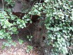
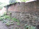
Much of what is now Beacon Park in Lichfield once belonged to the Beacon Place (sometimes known as House) estate. The house is long gone, demolished in 1964, but I know that there are some remnants left over! I enjoyed my ‘treasure hunt’ around the old Fisherwick Estate and thought it might be interesting to do something similar a bit closer to home. To avoid this being too long a post, I’m doing it in two parts. Part one is a very brief history of the estate.

George Hand built Beacon Place in the late 18th century. 1 On the death of his widow Ann in 1826, the house was sold in an auction at the George Hotel on Tuesday 28th March 1826. Amongst other things, it was described as having contained a handsome staircase of Hopton Stone, lit by a skylight, a kitchen garden with hothouses and orchards, and good cellars under an excellent kitchen.2

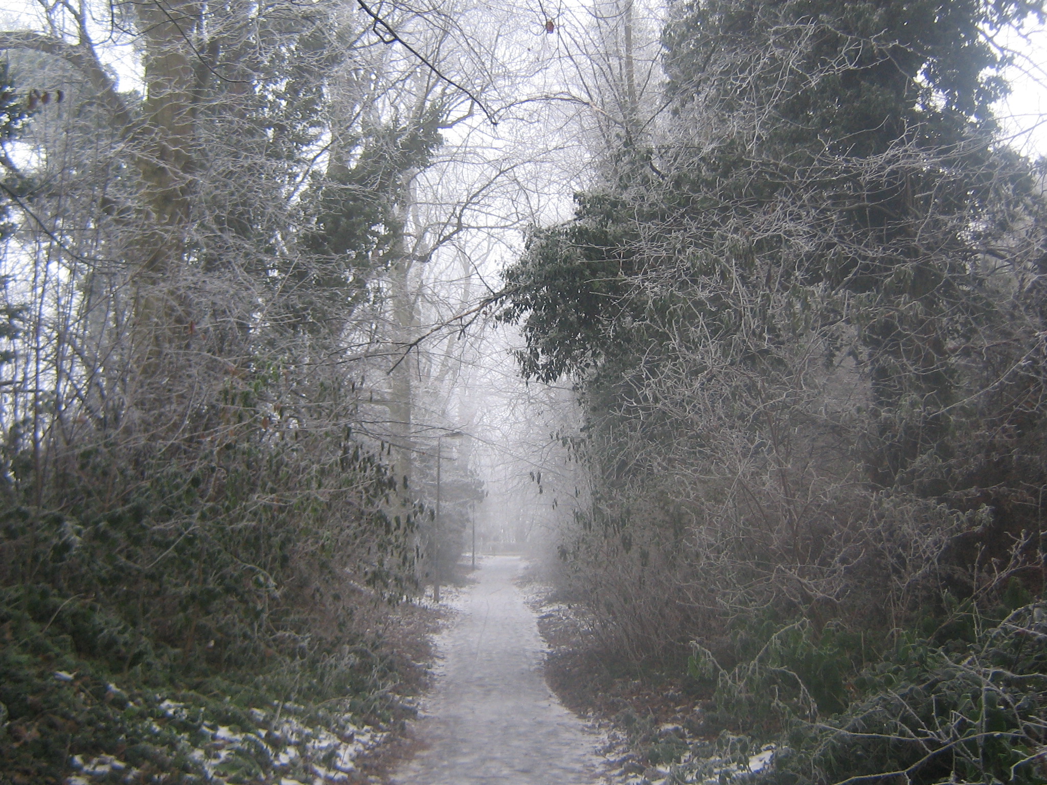
From 1837, Beacon Place was the home of Richard and Ellen Jane Hinckley. As well as extending the house itself, they also gave land for the construction of Christ Church in 1847.  The Hinckley’s had their own pew at the church3, and could see it from the house. As I’ve mentioned before, the lane running alongside the church, over the A51 and into Beacon Park, is an old carriageway that would have led to the house (I think it was also the old Walsall Rd until 1832).4

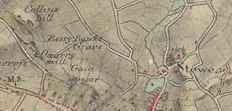
The path between Christ Church and Beacon Park in winter

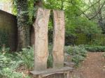
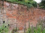
Richard and Ellen Jane Hinckley are buried in two of the three tombs behind Christ Church. The third tomb is that of Ellen’s son Hugh from her previous marriage to Hugh Acland. Hugh jnr. was one of the first people to be buried in the graveyard.5

Hinckley Tombs, Christ Church

A document at Lichfield Record Office gives an insight into how some of the rooms were furnished. The Inventory and Valuation of Beacon House for Probate on 2nd November 1870, following the death of Mrs Hinckley lists furniture, artwork and decorative items, and even some of the books that she owned.  For example, Mrs Hinckley’s dressing room contained a fire screen, bookshelves, a weather house, an easy chair, a small ivory bust, two cases of insects in glass, a Bible and five pieces of ornamental china. I think there were also portraits of her Father and second husband. The best dinner service used in the house was Ironstone China (from Staffordshire of course!). Some of the Hinckley’s silverware was engraved with family crests or initials. I wonder if there is any still around in someone’s cabinet!6

On Mrs Hinckley’s death the estate passed to her husband’s nephew Arthur Hinckley7  and it was sold at The Swan Hotel on Wednesday 27th October 1880 at 6 o’clock to Samuel Lipscomb Seckham (who I believe was renting Hanch Hall at the time and later also purchased Whittington Old Hall)8. Some of the items listed on the sales particulars are extensive pleasure grounds, flower and kitchen gardens, vineries, peach and hothouses, a coach house, stabling for 6 horses and a labourer’s cottage.  It was described as standing on an elevation which commands beautiful views of the Cathedral and of the open country with ornamental pools and plantations in view of the windows.9

So that’s a brief description of how it was, but what remains of the estate today? Part two to follow shortly!

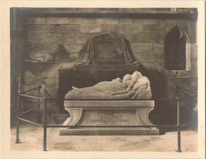
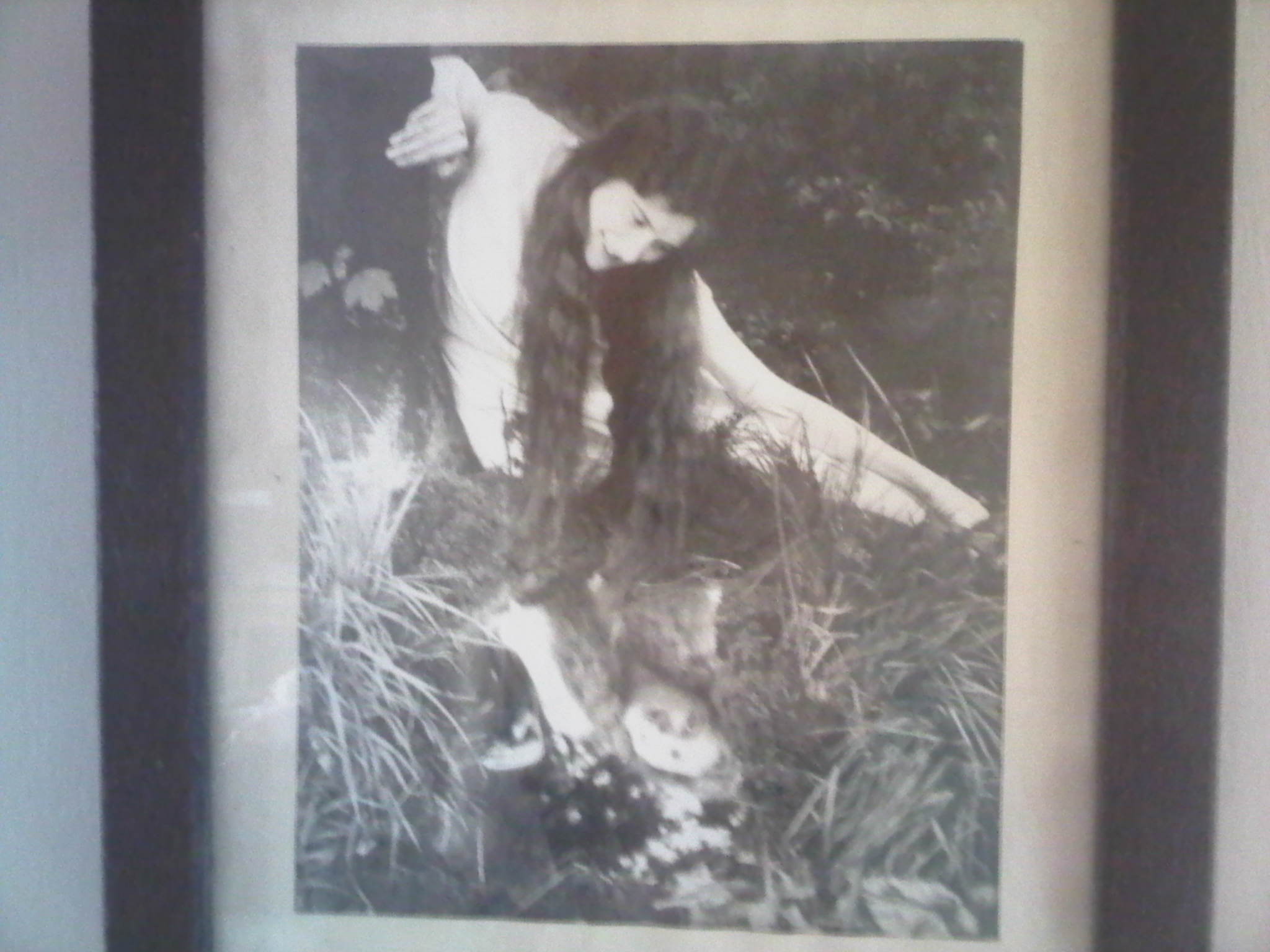
*Ellen Jane Hinckley was the mother of Marianne and Ellen-Jane Robinson, who are the subjects of the ‘Sleeping Children’ monument in Lichfield Cathedral. The plaque behind the monument belongs to her first husband, and father of the children, Rev Robinson. I learned something new about this well known sculpture recently from a friend who had been on a tour of the Cathedral. Sir Francis Chantrey, the sculptor, apparently left an uncarved piece of marble on the foot of one of the children, as he believed that only God was able to create perfection.

Edit 6/9/2011

There’s a program on BBC iPlayer called Romancing The Stone: The Golden Ages of British Sculpture. In part 2, Mavericks of Empire there is a section on Chantrey and the presenter Alistair Sooke visits Lichfield Cathedral and discusses the monument with the Head Verger. This link should take you to this part of the program http://www.bbc.co.uk/i/yml9v/?t=26m04s

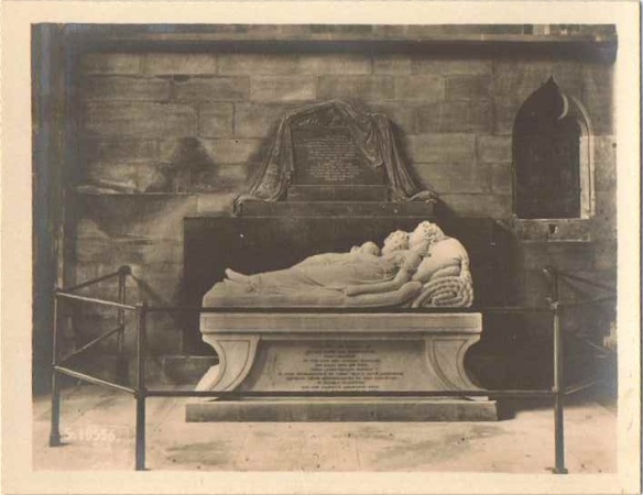
An old photograph of The Sleeping Children Monument in Lichfield Cathdral

Sources:

1. ‘Lichfield: Manors and other estates’, A History of the County of Stafford: Volume 14: Lichfield (1990), pp. 67-72.

2. Sales particulars of Beacon House estate 1826, accessed at Lichfield Records Office

3. The Gentlemans Magazine By Sylvanue Urban Vol XXIX

4. ‘Lichfield: The 19th century’, A History of the County of Stafford: Volume 14: Lichfield (1990), pp. 24-32.

5. Cathedral City by Howard Clayton

6. Inventory & Valuation of Beacon House for Probate accessed at Lichfield Records Office

7. ‘Lichfield: Manors and other estates’, A History of the County of Stafford: Volume 14: Lichfield (1990), pp. 67-72.

8. https://lichfieldlore.co.uk/wp-content/uploads/2011/09/howell.pdf

9. Sales particulars of Beacon House estate 1880, accessed at Lichfield Records Office

Hollow within a holloway

Like its neighbour Abnalls Lane, Cross in Hand Lane is (at least in parts) a holloway. As mentioned before, Cross in Hand used to be the main road to Stafford. I understand from reading information on the Two Saints Way project that it would also would have been one of the last stages of the pilgrimage route between Chester and Lichfield. According to Thomas Harwood it was also where the Sheriff’s Ride (the next one coming up soon on 10th September) used to begin and finish. So, that’s what I do know.

Now for what I don’t know…..

This ‘cave’ can be found by walking about 200m up Cross in Hand Lane from the A51. It’s on the right hand side, opposite a lovely white cottage.  I first read about it in Cuthbert Brown’s Lichfield Remembered, but he doesn’t know what it is either! Is it somewhere stone has been extracted from? A natural feature? Anyone have any ideas?

Edit 25 minutes later!
It is natural. Brownhills Bob tells me via Twitter that it is a water fissure where softer rock has been washed out. So thank you to him, mystery solved 🙂

Monk's Walk

I discovered this gorgeous garden at the back of Lichfield Library a few weeks ago.  There are plants from the 17th and 18th century, supplied by Castle Bromwich Hall Gardens and Victorian plants from The Walled Garden nursery at Bretby Park, Burton on Trent. The walls running alongside are interesting. There’s a mixture of brick and stone and a bricked up entrance. I’m guessing that it’s called Monk’s Walk in reference to the Friary which once occupied the site, but I’ve yet to find much information about the history of the garden.

Edit 11/10/2011

I’ve found more information on the history of the garden on the Staffordshire Gardens & Park Trusts website.

A Bower Queen in Beacon Park

This beautiful photograph is of Clara Talbott, and it was her prize for being chosen as the Lichfield Bower Queen in 1931. Clara was the third Queen to be crowned and although other parts of the Bower date back to much earlier, it seems this tradition only began in 1929. The Lichfield Mercury reported that Clara’s ‘long auburn hair had provided a very favourable comparison with the more modern ‘bobs’ and ‘shingles’. It goes on to tell us that Clara was assisted by her ‘fair maids of honour’ Misses R Orton, M Barker, F Nevill and K Carroll.

A mirror was used to give the impression of a reflection in water.

The photograph belongs to Vickie Sutton, Clara’s granddaughter. She told me that the photograph was taken in woods around Leomansley, where the A51 western bypass now cuts through the woodland. I understand that these trees here were planted by the owners of the now vanished Beacon Place.

Woodland at the edge of Beacon Park and the old carriage driveway from Christ Church to Beacon Place, with the A51 through the middle!

Clara’s family farmed land on Beacon Park and once married, Clara and her husband Frederick Hatchett lived in The Lodge in Greenhough Rd. As the name suggests this was a lodge for Beacon Place and at one point was used as a laundry for the house – it was known as Laundry Lodge in 1891! Vickie has heard from a family member that it may also have been used a some sort of cafe for soldiers in the first world war. I haven’t been able to find any specific references to this yet but records show that Beacon Place was used by officers during WWI and was purchased by the war department in 1922. Cuthbert Brown remembers military figures entering Beacon Place in his wonderful book ‘Lichfield Remembered’.

Once again huge thanks to Vickie for allowing me to share this. The Beacon Place Estate is definitely on my list of things to explore. It may be long gone, but traces of it still linger on….

Sources:

Lichfield Mercury May 1931
A History of the County of Stafford: Volume 14: Lichfield (1990)
1891 Census
Lichfield Remembered by Cuthbert Brown
Chatting to Vickie Sutton, font of Lichfield knowledge!

The Tombstone at Lichfield Library

I may be wrong but I’m assuming that there aren’t many libraries which have a 14th century tombstone embedded in their wall. I couldn’t quite believe that Lichfield library did either and so after watching the Queen travel up Bird St to the Cathedral, it was time for the really exciting part of yesterday to commence! Sorry Ma’am.

I was reading a copy of ‘Hyacinths and Haricot Beans: Friary School Memories’ by Jean Bird.  The book tells of a slab from a tomb found during renovations in 1926 being incorporated in the Friary building itself, which of course housed the school prior to its move to Eastern Avenue.

Checking the site’s listed building description confirmed this:

“…window to right of entrance has ex-situ gravestone of C14 or earlier below: calvary cross fleury and worn inscription to Richard the Merchant, found in 1746”

Another fairly recent reference was the Public Monument and Sculpture Association National Recording Project which described the stone as being placed ‘at the rear of Tamworth & Lichfield College, set into the wall by founder’s door’.

Anyone passing would never notice the stone....

At the rear? Well, at least that would explain how I managed to visit at least once a week, without noticing a large tombstone embedded into the wall.  In fact, once I got to the back of the building and the founder’s door, it was clear that few would notice the stone. Partially obscured by a shrub, a faint carving of a cross can be detected. Time and weather have not treated the stone well.

The fading stone

A trip to the Staffs Past track website reveals a drawing of the stone as it was around 250 years ago. It seems the stone was found in 1746 and then somehow lost and then rediscovered in 1926!  Bulldozers working on the new Friary Road in the 1920s cut through the site of the Grey Friars cemetery.  One of the contributors to the Friary School book recalls the bones that were uncovered being reburied ‘in the site opposite’.  Perhaps that’s where the remains of Richard are today.

Whilst round the back of the library, I also discovered the wonderful Monk’s Walk garden, which I shall do a separate post on.  Something else I hadn’t noticed on all of my visits to the library. That’s one of the things with Lichfield, you just never know what’ll turn up next……

Edit 29/8/2011

In ‘A Topographical History of Staffordshire ed. William Pitt’ (1817), I came across a description of how the tombstone turned up in 1746. Apparently on October 14th of that year, Mr Michael Rawlins was living at the Friary and was building a wall with a gate. Whilst digging the foundations, he found the grave stone about 6 foot under the surface with a coffin and bones underneath it. He placed the stone in a niche in the wall of the stables.

 Sources:

Hyacinths and Haricot Beans: Friary School Memories 1892 – 1992 by Jean Bird

From: ‘Lichfield: Education’, A History of the County of Stafford: Volume 14: Lichfield (1990), pp. 170-184. URL: http://www.british-history.ac.uk/report.aspx?compid=42354 Date accessed: 20 July 2011.

http://lichfielddc.limehouse.co.uk/portal/planning/conservation_area_appraisals/lichfieldcaa?

http://www.staffspasttrack.org.uk

Public Monument and Sculpture Association National Recording Project

You say Leamonsley, I say Leomansley

I still don’t think anyone is quite sure how this area of Lichfield is actually spelled. It’s not suprising, I’ve come across at least five different versions over the last five years! I remember there was an issue with signposts some years ago too. I’m going with Leomansley for consistency as this seems to be the current spelling that most would recognise.

Accoring to a transaction on pre-conquest Lichfield from the Staffordshire Archaeological & Historical Society, the name Leomansley contains elements indicating there may have been a Welsh settlement here around the 6th century.

Lemansyche

In ‘Lichfield: The cathedral close’, A History of the County of Stafford: Volume 14: Lichfield (1990), pp. 57-67, it tells us that

“in the 13th century the cathedral was described as being between Lemansyche and Way Clife. Gaia Lane may have been called Lemansyche as Shaw Lane, the extension of Gaia Lane on the west side of Beacon Street, is in the direction of Leamonsley”.

Edit 2/2/2012 : The origins of placenames is a fascinating but tricky subject. I did read a few days ago that ‘sike’ or ‘sitch’ could be a regional names for a small streams (especially one flowing through flat or marshy ground). Apparently the word was used especially when describing boundaries. It comes from the OE ‘sic’ and in the Midlands became ‘sich’ by the 1500s (2).

So could I be right in thinking that the Lemansyche referred to might be Leomansley Brook, which runs across Beacon Park? This would be in keeping with the boundary idea and also with the stream over marshy ground. As this excerpt from wikipedia says ‘The land on which Beacon Park now stands was originally low lying, poorly drained pasture alongside the Leamonsley Brook. The Museum Gardens and Recreation Grounds were the site of Bishops Fish Pool or Upper Pool. The pool was created when a causeway was built on Beacon Street in the 14th century separating it from Minster Pool. The area around Bishops Fish Pool in all directions was waterlogged marshland, this area south of Bird Street became known as the moggs from the 15th century and later Swan moggs’.

Is this feasible? As I said, a tricky subject, even for experts, and especially for dabblers like me!

Leamonsley

We are told by the County History that that the hamlet* of Leamonsley grew up around the fulling mill on Leamonsley brook in the early 1790s. In 1841 census there were 13 households, including that of the tenant of the mill; with the number rising to 27 households in 1851.

* a term often used to describe a village without a church

Lemondsley

In 1806, the Rev Thomas Harwood referred to “four closes of land, pasture and meadow, lying next together near the said city (Lichfield), called Lemondsley for which the rent of 10s per annum is now paid”.

Lemmonsly

In the book “Trade Tokens” by J.R.S.Whiting, and on http://www.windmillworld.com, there is a reference to a twopenny token of Lemmonsly Worsted Mill, Lichfield (John Henrickson). Henrickson is a “calico, cotton and shirting manufacturer” . The token shows a mill with trees at sides, and river. On the reverse is the arms of Lichfield between oak branches, and text “One pound note for 120 tokens”. A picture can be seen on Flickr following this link.

www.flickr.com/photos/30084068@N08/3305680975/in/photostream

There is no date on the token but John Henrickson let and ran the mill from around 1810 until he went bankrupt in 1815.

Leomansley Mill, now that sounds like an interesting place………..

Sources

‘Lichfield: The 19th century’, A History of the County of Stafford: Volume 14: Lichfield (1990), pp. 24-32. URL: http://www.british-history.ac.uk/report.aspx?compid=42338 .

(2) Edit 2/2/2012 http://voices.yahoo.com/shallow-shoal-shoot-sike-sitch-origins-forms-histories-5293647.html

The Grave of Poor Bessy Banks

I spotted a place labelled Bessy Banks’ Grave on the 1815 Ordnance Survey drawing of Lichfield by Robert Dawson 1815.

Immediately, I thought of the story of Kitty Jay on Dartmoor. A little investigation has revealed a few details. In ‘History of the City and Cathedral of Lichfield’ by John Jackson (1805), I found the following;

“…of Betsy Banks grave* once the famous rendezvous of lovers….now no more is remembered than that poor Betsy is said to have fallen victim to hapless love.

*there is a spot in a field in Lichfield still distinguished by that name”

Anna Seward wrote to her friend Honora Sneyd about the place in a letter dated May 1772, that she described as ‘Written in a summer evening from the grave of a suicide’. I’ve only included the first part as its quite long.

“It suits the temper of my soul to pour
Fond, fruitless plaints beneath the lonely bower,
Here, in this silent glade, that childhood fears,
Where the love-desperate maid, of vanish’d years,
Slung her dire cord between the sister trees,
That slowly bend their branches to the breeze,
And shade the bank that screens her mouldering form,
From the swart Dog-Star, and the wintry storm….”

Another reference can be found in one of David Garrick’s letters.  He wrote that “the name Dimble is given to a sunken road leading north from Lichfield past a spot, supposedly haunted called Betty Honks Grave. Two sister trees form an elegant arch over a stream”.

By 1791, it was found that the sister trees had been recently cut down.

So who was Bessy Banks, did she really exist? If so, is her grave still there, now unmarked and unremembered?

Edit 5/9/2011

I recently had the St Chad’s tithe map (1849) out in Lichfield Record Office, looking for something else. A whole plot of land is listed as ‘Bessy Banks’. Born a Lichfeldian has kindly worked out where the stream in this area would have been. Taking into account this and the tithe map it seems that ‘Bessy Banks’ was somewhere in the region between Dimbles Lane and Greencroft.
John Jackson’s description suggects that in 1805 the story is already an old one. It does seem a fairly well-known tale, to have actual places on maps marked after it, as well as being mentioned by Garrick (albeit with the name Betty Honks!) & Seward.  Was it just a made-up story, or did it arise from actual events? I wonder when (and why?) the people of Lichfield stopped telling the story? Or could there even still be people who could tell us the tragedy of Lichfield’s ‘love-desperate maid?’

Edit: 15/4/2012

A notice in the Lichfield Mercury 20th February 1914 lists a lot for sale as garden land, known as Bessy Banks, adjoining a plot of arable land let by T Chapman and located next to Gaiafields House and Gaia Fields Cottage.

Lichfield Brewery & The Bridge Tavern

The Lichfield Brewery Co was formed in 1869, a merger of two local breweries, owned by the Griffith Brothers Co and The Lichfield Malting Co.1 The name is fading, but just about legible on this building behind Lichfield City railway station. Observant readers will notice that the date on the building of 1858 predates the company by 11 years  – it’s thought the building originally belonged to the Griffith Brothers. Perhaps Lichfield Brewery Co was added at the time of the merger.

In Howard Clayton’s Victorian Lichfield, there is reproduction of a Lichfield Brewery Co advert. On offer are Pale Ales, Light Pale Ale ‘AK’ (intriguingly recommended for family use!), Strong Ale, Mild Ales, Stout and Porter along with Harvest Burgundy (Red or White) and Tintara wines.

The company was taken over by Samuel Allsopp and Co in 1930 and production at the Lichfield Brewery ceased soon afterwards. In 1931, The Lichfield Aerated Water Co set up at the site, but were taken over by a Derby company, Burrows & Sturgess (who produced soft drinks and who claimed to have produced the first Iron Bru.2 I always thought it was made in Scotland, from girders!). A new company called the Birmingham Chemical Co was established from this takeover. Apparently, the site became known as the ‘Wiltell Works’, after this company’s slogan ‘Quality Will Tell’, and there’s a Wiltell Rd nearby too!3

The majority of the buildings were demolished in 1969.  However, still standing are the Brewery Offices with their roll of honour, still actively used to pay tribute to the 13 employees killed in the First World War.  Their names are also included on the memorial in the Remembrance Garden.

On the opposite side of Upper St John St is a building that was once the Bridge Tavern4. Staffordshire Pasttrack has two photographs taken outside the pub around 1910. The first depicts the publican, stood outside by a horse & cart. The second, shows the pub decorated with greenery, and a huge crowd of people gathered for a celebration, possibly the Bower.

You can still see where the pub sign used to be, and a little further down, the place where a board proudly announced:

‘William Whatkiss Licensed Retailer Ale, Beer, & Foreign and British Wines and Spirits. Dealer in Tobacco’

In my previous post, I said I’d like to find out about current local breweries. It’s been a lot easier to find out about the old Lichfield Brewery than it has about the new Lichfield Brewery!  I’m sure I had one of their beers at the Lichfield Medieval Market a couple of years back, called Festival Ale.  I’ve been trying to find out if the brewery is still going.  You can buy pump clips on ebay for their beers such as Steeple Jack and MT Pocket, but I can’t find much more at the moment.

Sources:
1. ‘Lichfield: Public services’, A History of the County of Stafford: Volume 14: Lichfield (1990)
2. http://www.bygonederbyshire.co.uk/
3 & 4 The Old Pubs of Lichfield – John Shaw*

*I had a copy of this ages ago and lent it out.  Chatting on Twitter with @brownhillsbob a while ago he reminded me about what a great book it is and I treated myself to another copy.   Loads of info & some great photos too. If you’re interested in Lichfield History (and if you’re here, I’m assuming you are ;0), you should invest in a copy. Go on, go on, go on….

Woe unto the bloody City of Lichfield


Plaque on St Marys Church. Lichfield Market Square


You may have guessed from the fact that George Fox ‘stood without shoes on a market day in this Market Place and denounced the City of Lichfield’, that his visit was a little out of the ordinary! Here is the full story, based on the founder of the Quaker’s own version events.(1)

Following his release from Derby Gaol, Fox was walking with friends when he noticed the three spires of Lichfield Cathedral in the distance.Leaving his companions behind, he headed towards the City.When he was within a mile of Lichfield, he was commanded by God to remove his shoes.Leaving the footwear with some startled shepherds, he carried on into the City, where God once again spoke to him, telling him to “Cry woe unto the bloody City of Lichfield”. Fox made his way into the bustling Market Place, where he did exactly that.He continued to wander the streets of Lichfield, crying out the phrase over and over again.Whilst doing this, Fox had a vision that there was a channel of blood running through the streets and the market place appeared to him like a pool of blood.Eventually, he returned to the shepherds for his shoes, but found that the fire of the Lord was still in his feet where it remained until he washed them.

Spence, Robert 1871-1964.
“Woe to the Bloody City of Lichfield”
From Lichfield District Council collection


The reaction of the people of Lichfield is interesting. Rather than be frightened or hostile towards this strange man ranting in their midst, they seem to have been concerned.Fox says “friendly people came to me and said, ‘Alack George, where are thy shoes?'”. It’s not recorded but they may have asked if he’d like a nice cup of tea too!

Some people believe that Fox’s behaviour was caused by a fragile mental state, having been recently released from prison. However, Charles Haddon Spurgeon had a theory that it was some kind of PR stunt – no one would take notice of yet another dull sermon, but few could fail to ignore the dramatic ravings of a barefooted man in the snowy market place. Explaining the events of that day, Fox claimed that God had wished him to preserve the memory of the thousand Christian Martyrs slaughtered by the Romans at Lichfield in the time of the Emperor Diocletian. It had been their blood that had filled the streets and market place during his vision.

It’s been suggested that the martyrs Fox actually had in mind were those burnt in the Market Place for heresy.(2) Why would he claim otherwise? Perhaps, on reflection, he thought better of associating himself so publicly with heretics, having been so recently imprisoned for the same crime.

George Fox may have made a lasting impression in Lichfield, but surely not in the way he’d have hoped.  He founded the Society of Friends the following year, but according to a talk given by one of the Friends in Lichfield Cathedral in 1996, Quaker meetings scarcely feature in Lichfield history.(3)

Sources:

1Autobiography of George Fox
2.Classic Encylopedia (based on the 11th edition of the Encyclopedia Britannica 1911)
3.Talk in Lichfield Cathedral by Lichfield Friend Anthony Wilson