Through Doors and Windows

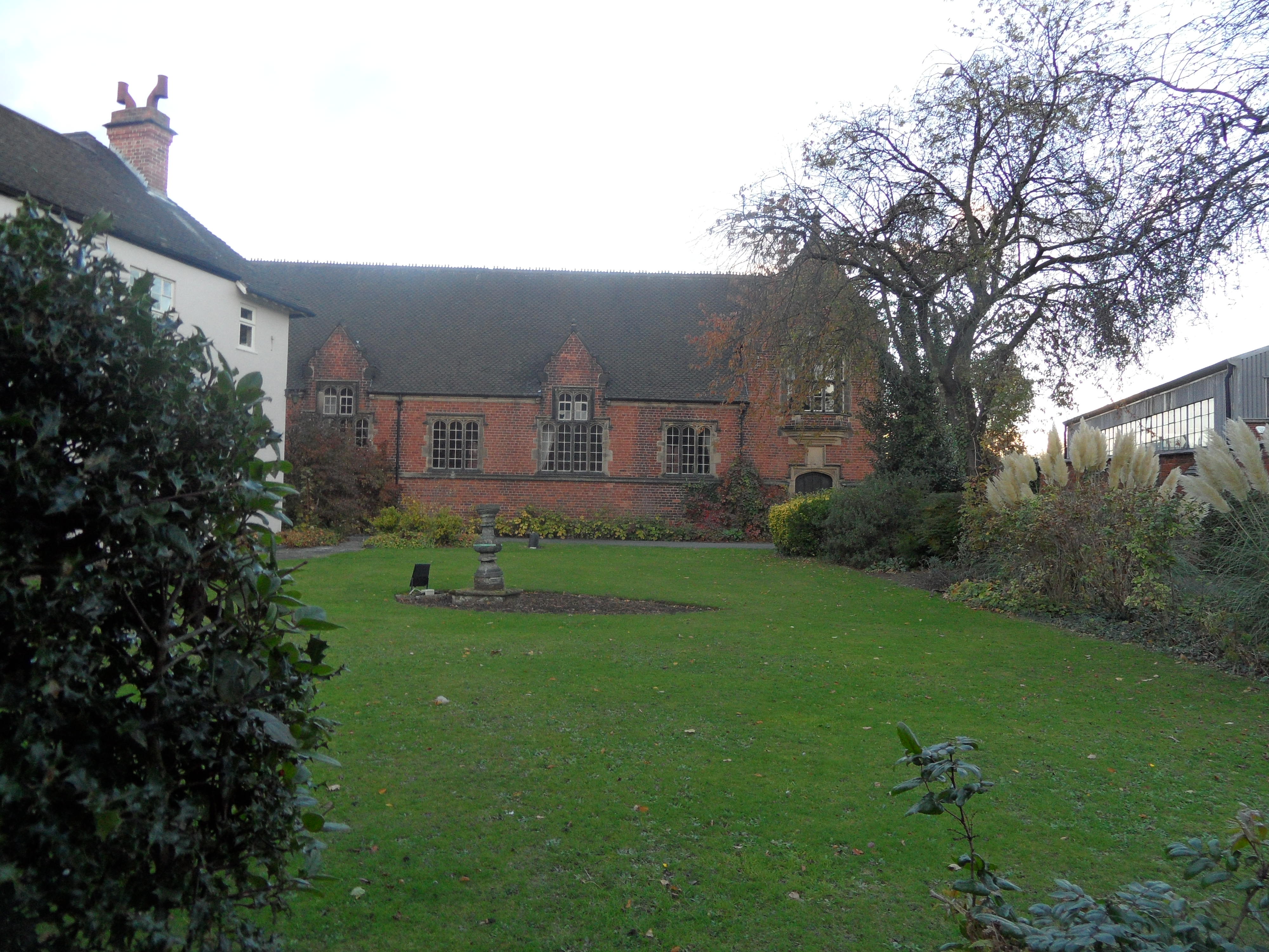
Anyone who has read the Written into Lichfield History and Making your Mark posts, will know that Gareth Thomas has been exploring the Lichfield District Council Offices, and very kindly sharing the photos here on the blog.  Gareth’s doing this because the buildings were once the Lichfield Grammar School, and generations of pupils, dating back to the 17th century have left their mark on the building.

I like the idea that even those who didn’t go as far as leaving their name still left a trace on the worn bannisters and floorboards

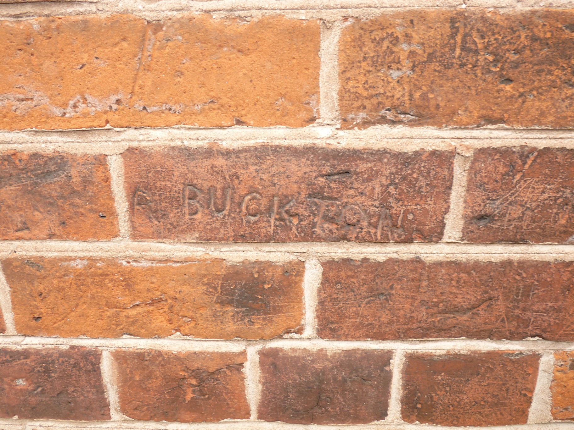
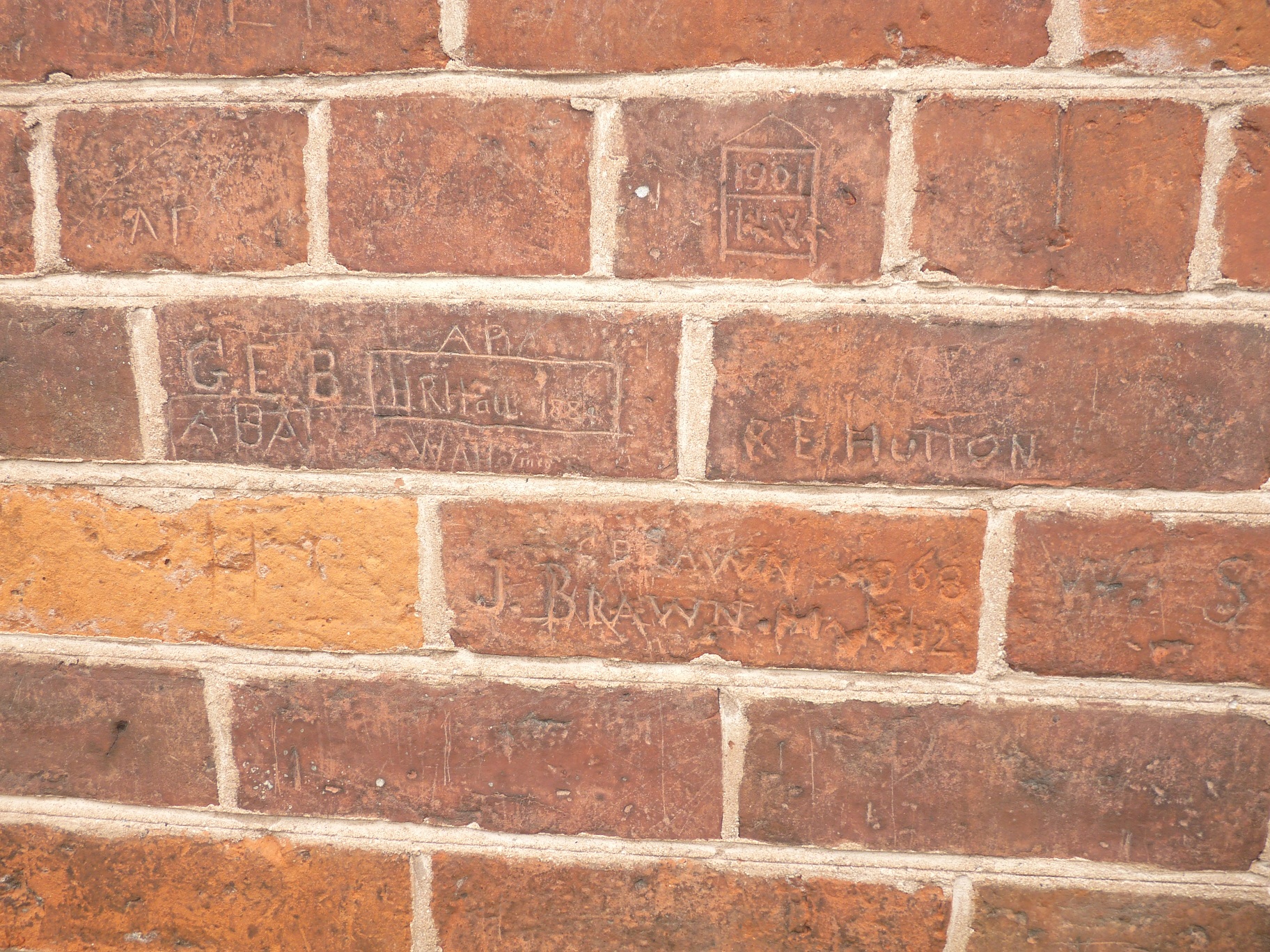
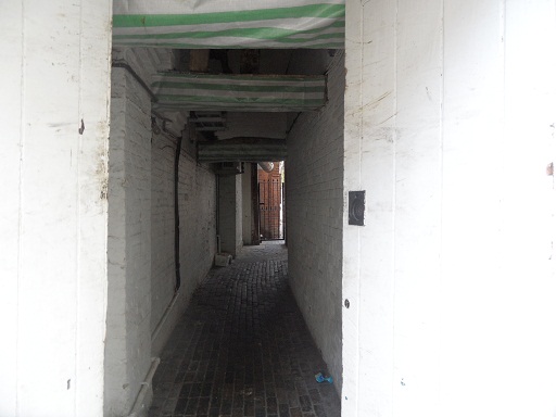
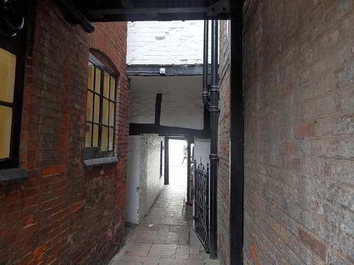
Last time, we got as far as the attic doors, where someone called ‘Watkins’, carved his name in February 1714/5. Amongst the other graffiti is the name WHoll, and Roger Jones (Ziksby) put forward the idea that this could be William Holl the engraver, which certainly warrants further investigation.  Back then the doors would have lead to the dormitories for the boarders at the school. Now thanks to Gareth, we get to have a look at what lies behind those potentially three hundred year old doors……

Who was WL Holden? Does C1 refer to his form or something else?

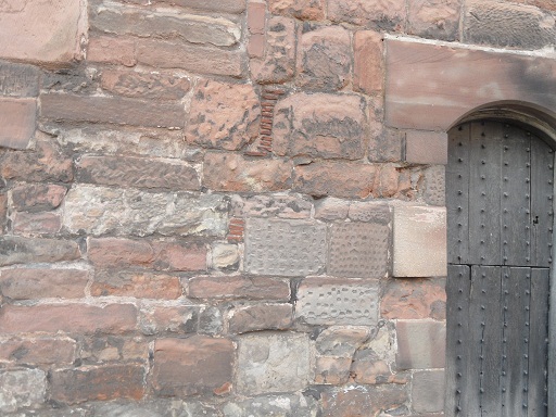
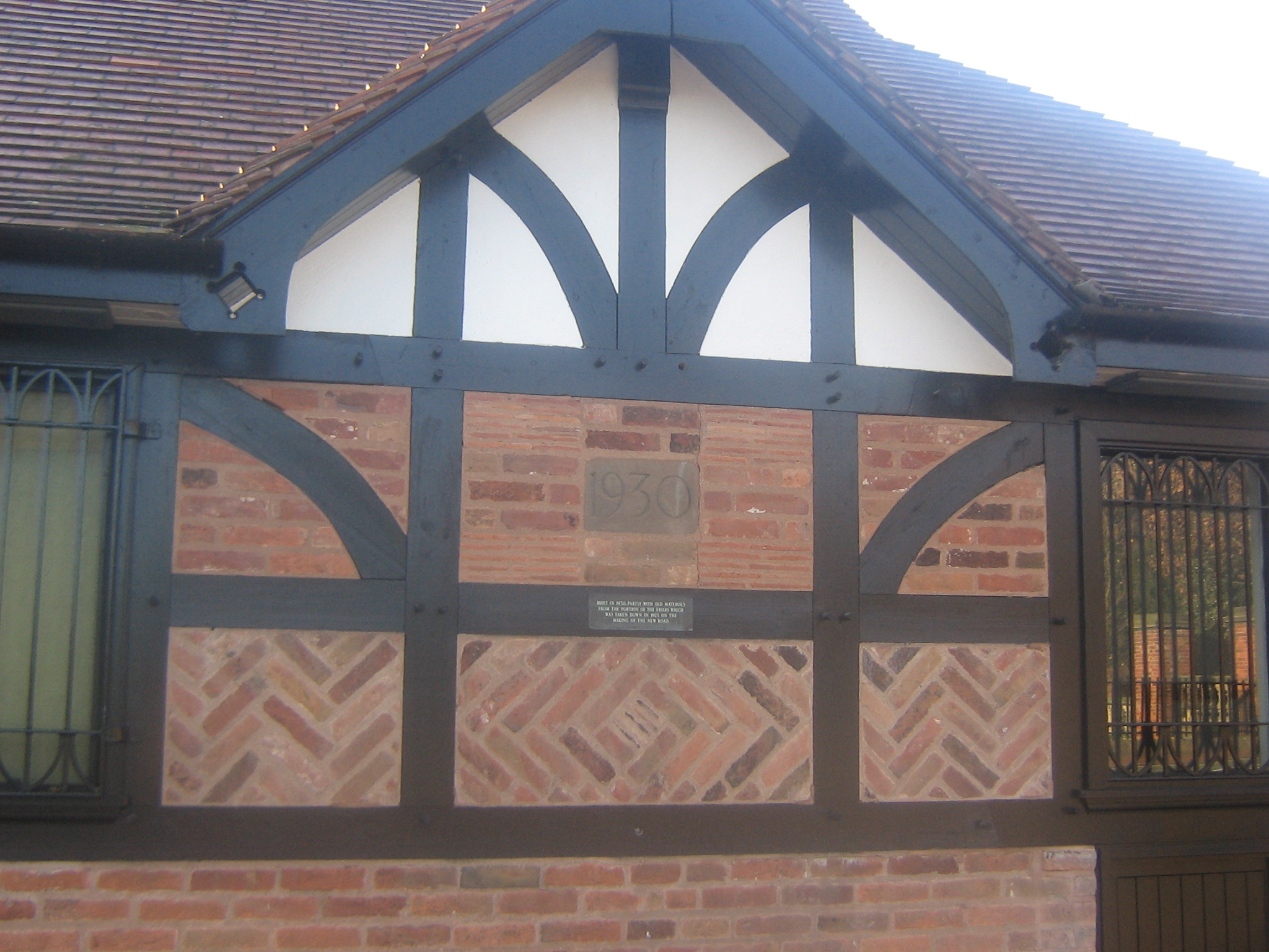
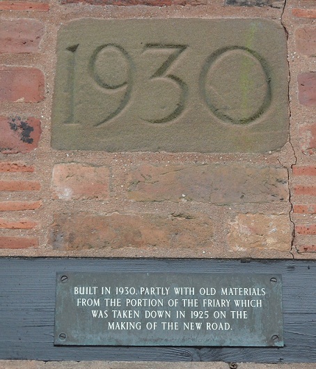
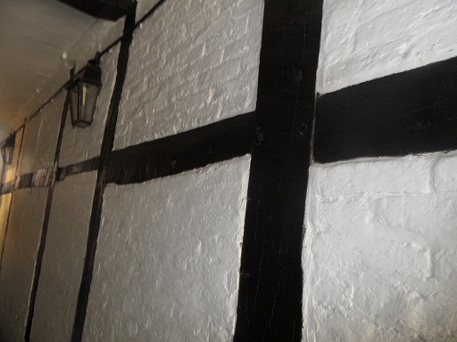
To us these are old timber beams, yet once they were brand new, and according to the Lichfield Conduit Lands archives, mostly donated in the form of individual trees!


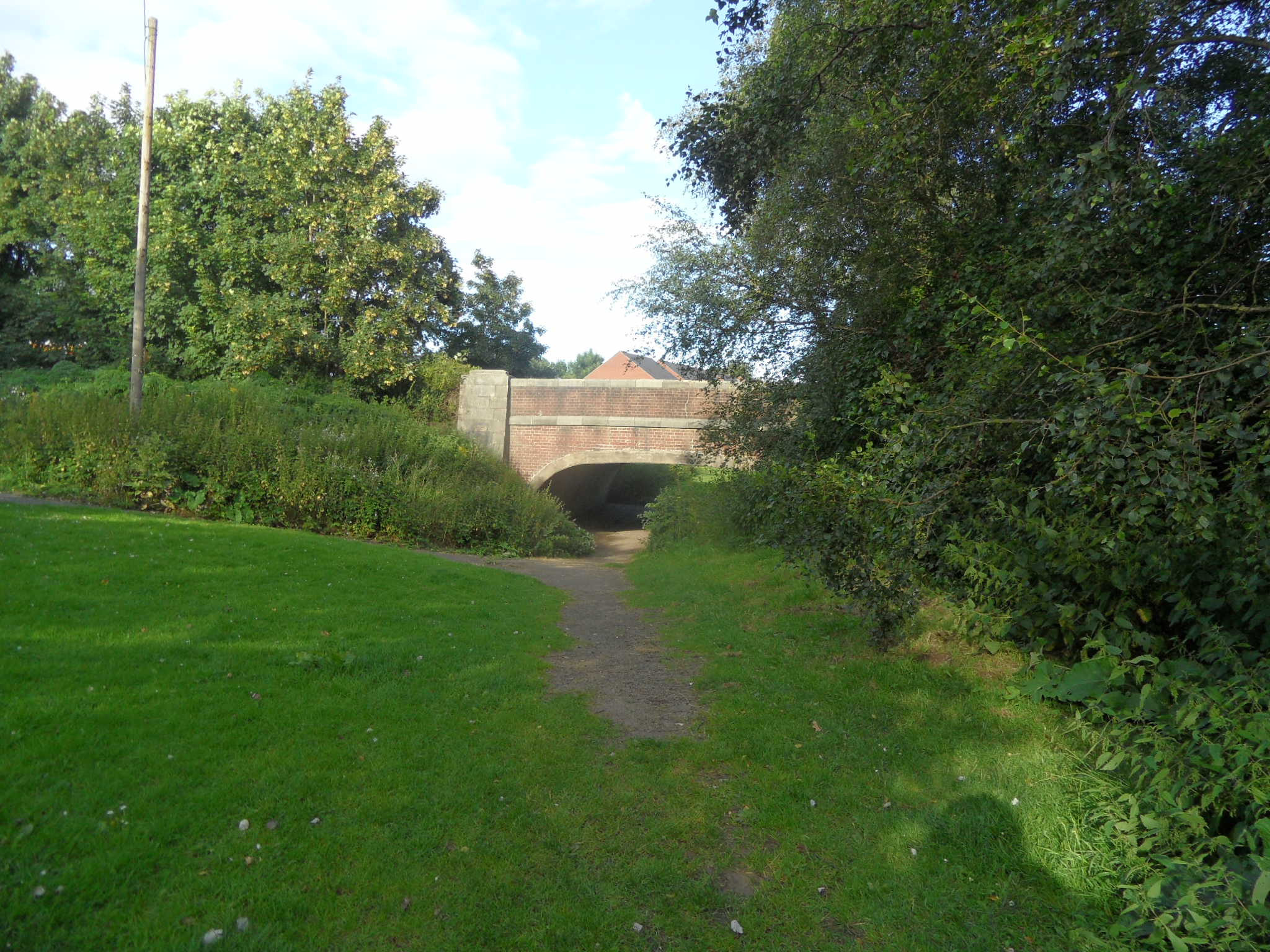
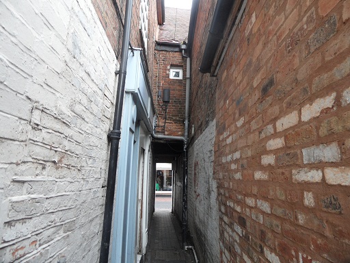
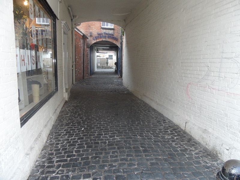
Gareth has taken some photographs from the windows. Not only does this give an interesting perspective of the city, it also invites you to imagine what the boys would have seen looking out of this window, what’s changed and what’s the same.

In around 1813, Cowperthwaite Smith was appointed headmaster of the school with a salary of £170 per annum, plus rent free accomodation. At the time, board, lodging & tuition was being charged at between 40 and 50 guineas a year for each scholar. In 1828, according to the ‘Account of Public Charities in England and Wales’, there were 18 boarders, and around 30-40 students in total. It goes on to say that the only scholars receiving their education free at the school were the ‘six children of poor men born within the City’ (who were also given money for books, and slightly more curiously brooms, when the school was first endowed).  The people of Lichfield were apparently not happy that their grammar school was no longer a free school.

By then end of Cowperthwaite Smith’s time as headmaster in the 1840s, no boys at all were coming to the school. Allegations were made in the Wolverhampton Chronicle that Lichfield Grammar School had been closed for six years due to the the misconduct of the master. It claimed he was violent towards the children in his care, and that ‘his treatment of two boys on two separate subjected his modes of punishment to investigation before the magistrates one boy having subsequently confined to his bed under surgical advice for a fortnight’.

The newpaper was sued for its attempt to injure Cowperthwaite’s ‘good name fame and credit’ as a schoolmaster and clergyman, and ‘to bring him into public scandal infamy and disgrace’ and ‘to hold him up to public contumely scorn and ridicule and to vex harass oppress impoverish and wholly ruin (him)’. I’m trying to piece together exactly what happened as best I can from the court cases that followed these allegations and I’m hoping that the original newspaper reports might be available. There’s also a vast amount of information at Lichfield Record Office that I’d like to look through, and I think it’s best not to speculate or comment further until I have read more on this.

I am also working on another post as Gareth’s investigations took him to another part of the building, where he made another fantastic discovery, including our oldest dated graffiti yet.  In the meantime, Gareth, do you fancy going up that ladder in the attic?

(1) A Concise Description of the Endowed Grammar Schools of England and Wales, Nicholas Carlise 1818

http://hansard.millbanksystems.com/commons/1846/apr/01/the-lichfield-grammar-school

http://www.lichfielddc.gov.uk/info/100004/council_and_democracy/588/history_of_district_council_house/2

http://eagle.cch.kcl.ac.uk:8080/cce/persons/DisplayPerson.jsp?PersonID=19831

Paths that Cross

On my way to pick up some tickets from the Garrick the other day, I passed Lichfield Library. I couldn’t resist popping in to have a quick peek at the local history section to see if they had any more information on the history on the grammar school,  following on from Gareth’s graffiti photographs.  (They did. A whole book in fact and I’ve updated the post accordingly!). So inevitably, my quick peek turned into two hours.

There was an added bonus to the visit too. Anyone who read my Cross City and Cross County posts will know that I was hoping there would be an ancient cross somewhere in Lichfield. Well, I finally found one! Actually that’s a fib. What I found is a photograph in a book of archaeologists finding one. A decorated cross shaft was discovered built into the foundations of the north wall of the nave of Lichfield Cathedral. It’s thought to be Saxon or Saxo-Norman, and could be a surviving remnant of the earlier church on the site. I wish I could share a photograph here, but all I can do is tell you that it’s on plate 1 in the ‘South Staffordshire Archaeological and Historical Society Transactions 1980-1981 Volume XXII’ book, on the local history shelves at the library!.

I have a confession to make. Generally, I’ve thought that places like the Cathedral are so well known, there’s nothing much left to say. Yet, now I recognise that this was wrong. Whether it’s the magnificent discovery of the Lichfield Angel in 2003, the downright curious tale of a live frog embedded in one of the stones used to repair the Cathedral during the restoration*, or rolls of parchment, beer and tobacco found in the gilded balls on the top of the central spire – the Cathedral, as everywhere, is made of stories, as much as it is made of stone. There are those we know well, those we don’t, and those that haven’t even been told yet.  We need to make sure we  are listening, just as Gareth was when he discovered and questioned that graffiti on the walls of the old Grammar school.

*I’m not making this up…..but someone else may well have been!

Written into Lichfield history

One of my recent posts mentioned layers of history and people leaving their mark on a building.  A literal example of this is graffiti and Gareth Thomas has sent me some great photos of names he found carved into the brickwork of the Lichfield District Council offices, formerly the Lichfield Grammar School.

Lichfield District Council Building, formerly Lichfield Grammar School

The graffiti is on the above building, the old school room, rebuilt in the mid 1800s by architect Thomas Johnson, after falling into a ruinous state. Staffordshire Past Track has an engraving from 1833, taken from a similar position. It shows the previous incarnation of the school room (which stood from 1577 to 1849), as seen from the school-yard (now the grassed area).

In 1818, a book on the endowed grammar schools of England and Wales listed the former pupils of the grammar school ‘who in the splendour their names, have reflected honour upon Lichfield’.

The elegant Addison, Elias Ashmole the Philosopher Chemist and Antiquary and Founder of the valuable Musem called after his name at Oxford, Gregory King an heraldic and commercial writer, George Smallridge Bishop of Bristol, Thomas Newton Bishop of Bristol, Lord Chief Justice Willes, Lord Chief Baron Parker, Mr Justice Noel, Lord Chief Justice Wilmot, Sir Richard Lloyd Baron of the Exchequer, Robert James MD well known for his Medical Dictionary and as the inventor of the Fever Powder, Isaac Hawkins Browne an ingenious and elegant Poet, David Garrick the unrivalled actor, Samuel Johnson LL D

The names of Johnson, Ashmole and Garrick and the others are written into the history books, but what about those names on the old school wall? Can we find the stories of Buckton, Brawn, Beckwith and others written in censuses, newspaper reports and other archives? There’s an inspector’s report from 1869 that tells us something about how they’d have spent their time at school (when not carving their name into brickwork, of course!). What became of them when they left?

Brownhills Bob did a wonderful post on a similar theme called the Persistence of Memory, with some equally wonderful comments from people who recognised the names. You don’t have to look to hard to find bridges, walls, trees, and other surfaces marked with names and initials. Why do people seem compelled to add their names to the fabric of a place? I may even have written the odd ‘Kate was here’ myself, on a school desk or two in my time. And does that ‘….was here’ explain why we do it? Knowing that few of us will ever get a statue or our own museum, is this a way of letting people know that once, we were here?

A huge thank you to Gareth for the photographs and drawing my attention to this. Also, Gareth, if you’re reading this, I’ve read that there’s more graffiti to be found, carved into  the wooden attic doors of the schoolmaster’s house next door. It’d be great to see some photos…..hint, hint!

Sources

A Concise Description of the Endowed Grammar Schools of England and Wales, Nicholas Carlise 1818

Lichfield City Conservation Area Document


Tow Bone

As I’ve been telling anyone who’ll listen, I went to Manchester at the weekend. One of the highlights (or should that be lowlights?) was a tour beneath one of the city’s warehouses to see the remains of the Manchester and Salford Junction canal.

Standing in the canal! Tow path to the left.

I’m not going to say any more about it,  writing about a place 82 miles away is stretching it even for me (but for anyone interested, there’s some more of my photos and a bit about the  experience here). So, I’ll say a bit about the Lichfield canal instead…

I imagine most people know that there is an ongoing project being carried out by the Lichfield and Hatherton Canals Restoration Trust and you can read about and see photographs of the sections of the Lichfield Canal that are already under restoration on their website. A while ago, I was at the bridge on the London Rd, and decided to walk home following the route of the disappeared canal, down to Sandfields. I know there was a section of canal here, because I had read about it in a post Annette Rubery did about Sandfields Pumping station. Here are some photos of the walk, featuring one of my favourite things – bits of old brick hinting at a trace of something long gone!

I think somewhere around here was Gallows Wharf. The gallows were apparently located somewhere near to the Shell Garage on the London Rd.


The obvious route of the canal finished about here on Shortbutts Lane.

Then I mistakenly went up Fosseway instead of taking a right onto the Birmingham Rd and lost the canal route altogether but I did find a nice plaque!

Plus some interesting but I think non-canal related bricks at the junction of Fosseway and Shortbutts Lane with the Birmingham Rd.

I knew that if I got to Sandfields Pumping Station, I’d manage to pick the canal back up!

I noticed on an 1834 map of Lichfield that the canal in this area passed something called ‘The Bone House’. The county history says ‘There was a bonehouse evidently on the north side of the Wyrley and Essington Canal west of Chesterfield Road by 1806. The miller, Thomas Wood, was ordered that year to stop production following a complaint by the vicar of St. Mary’s that the works was ‘a noisome and offensive building and a great nuisance to the inhabitants of the city’. He was still in business in 1818 and the bonehouse remained there in 1836′.

I imagine it was used to grind down animal bones to make fertiliser, but if anyone knows any different, please let me know!

The idea of exploring the impact that the presence of water had on the surrounding landscape is something that really interests me. I think walking alongside our streams and canals, around our pools and millponds gives you the chance to look at a places from a different perspective. Next time though, I might take a map!

Sources:

Lichfield: Economic history’, A History of the County of Stafford: Volume 14: Lichfield(1990), pp. 109-131

Perspexive

This morning, I went to the dentist. On the way home I walked past St John’s Hospital. With the sun shining, I decided to pop in and allow myself a minute to take in the lovely surroundings and the calm atmosphere of the courtyard, before heading home.

At least that was my intention. As hospitable as ever, someone in the courtyard came over to welcome me, and invited me to have a look around the chapel. Never one to miss an opportunity to be nosey, I accepted with thanks.

I have been inside once before, but that visit was dominated by standing in front of John Piper’s striking window for the first time. Today, I sat on a back pew and found myself next to a perspex window. A small sticker told me that the stonework behind the perspex was the remains of a Norman water stoup. I understand that this would once have held holy water, into which those entering the chapel could dip their fingers, and make the sign of the cross. Apparently, many stoups were destroyed during the reformation but whether this is the case here I don’t know.  As the chapel has been heavily restored and altered over the centuries, I was delighted to have this chance encounter with part of the older fabric of the chapel.   Unfortunately, as I hadn’t anticipated there being many photo opportunities on a trip to the dentists, I had no camera. But the chapel is open everyday until 5pm, so if you can, please do go and take a look yourself, and enjoy visiting the grounds at the same time.

This got me thinking about the idea of layers of history within buildings, where generations of people have made their mark, by accident or by design, for better or for worse.  When I was volunteering at the Guildhall, someone told me I could get out using the back door. It was news to me that there was a back door but once through it, I made the even more exciting  discovery that  traces of the older building were still in evidence. For example, whilst the main hall and the front of the Guildhall date to the mid 1800s, the blocked window on the photograph below is thought to date to the 16thc.

Brickwork from different periods, round the back of the Guildhall

Another couple of examples to be going on with – what’s gone on here with all the different brickwork at this house in The Close?

This metal….thing, above a restaurant on Bird St, must have played some role in the building’s past, but what?

And when we’re talking about layers of history, should we also consider the present and future of buildings? I notice that the Angel Croft hotel has unsurprisingly made its annual appearance on the English Heritage At Risk register…..

Sources

http://www.british-history.ac.uk/report.aspx?compid=37864

Hospital Ward

In 1781, John Snape carried out a census of Lichfield, making a list of the different wards of the city in the process. The wards are as follows: Bacon St (now Beacon St), Bird St, Sandford St, Sandford St below the water, St John’s St, St John’s St above the bars, Sadler St (now Market St), Bore St, Wade St, Dam St, Tamworth St, Lombard St, Stow St and Greenhill.

I think that these are the wards depicted by the flags hanging from the ceiling of the Guildhall, discussed here in my previous post. Now that I’ve finally made it back into the Guildhall to check which flag corresponds with which ward, I’m going to take each one in turn, trying to discover the significance of the design on each flag. Some I’m pretty sure of, others I’m really not (I’m talking about you Sandford St below the water ward!)


Photo from Ell Brown via flickr

 I’m starting with the flag that represents St John’s ward. Not only is it my favourite of the banners, it’s also seasonal with the feast of St John’s (or Midsummer’s Day) on 24th June. St John St gets its name from The Hospital of St John The Baptist (the place with the chimmneys!). The design from the flag is also on the board outside St John’s chapel, but what does it represent? The yellow flowers must be St John’s Wort, associated both with the saint and midsummer. What are the flowers growing around though?  Well, it’s taken a lot of googling but I think that it’s St Anthony’s Cross (also known as the Cross of Tau), often associated with St Francis. This possibly explains its inclusion, as the site of the Franciscan Friary lies within this ward . Part of the old Friary wall can still be seen on St John St.

Please feel free to join in with the speculation on this and any of the other flags that follow!

Photo of St John’s board from Ell Brown’s Lichfield Group photo set on his flickr stream, included with thanks.

West Side Story

The view of the Cathedral as you turn from Beacon St into the Close, must be one of the most photographed in Lichfield. It’s stunning. However, if you can tear your eyes away from the spectacular west front of the Cathedral, there’s something else here that I think is rather special.

Remains of the West Gate.

Sandwiched between two houses are the remains of the West Gate, dating back to the early fourteenth century. The rest of the gate was demolished in 1800, as Thomas Harwood describes, “…that noble gate at the west entrance into the Close, a beautiful structure worthy of its munificent founder and which in April 1800 was with a barbarous taste, pulled down, and the materials applied to lay the foundation of a pile of new buildings for the residence of necessitous widows of clergymen”. (The new buildings Mr Harwood describes is Newton’s College opposite. If this is true it’s a bit more house old recycling!).

In the same book, Harwood mentions the gate again saying,”At the entrance into the close on the west stood the beautiful gate which was built by Bishop Langton in the early part of the fourteenth century. It was a very strong a double gate with portcullis of great strength and majesty. The strong tower over the gate was finished in the time of Bishop Northburgh, the successor of Langton. This noble structure which had unimpaired during the revolution of five centuries and had withstood the destructive ravages of civil war was pulled down in April 1800 to widen the road into the Close”

Personally I’m a big fan of crumbling, old bricks, but if the gate had remained then, we wouldn’t be treated to that amazing view. Whether the decision to demolish the gate was barbarous or not, all we have now are these remaining stones and the descriptions, together with some maps and drawings.  The rest is down to our imagination….

The Lichfield District Council flickr stream has this image.

Taken from Lichfield District Council flickr group

On the Staffordshire Past Track website, you can also see a view of the gate published in 1805. Still a ruin, but in slightly better repair than the previous image. There’s another image here , this time from further away showing how the gate fitted into the area around the Close. This ‘ancient view’ of the Close, seems to be an artist’s impression from 1805 to show how the Close would have looked surrounded by its protective walls, gates and towers. John Speed’s 1610 map also shows the defences, including the gate.

1610 map of Lichfield

I’d like to explore the other remaining fragments of the defences, but for now I’ve got enough questions about this part to be going on with! Why leave this portion of wall   – why not demolish the whole thing? On the wall itself, why do some of the stones have dimples on (I bet there is a technical term for this!) Were materials really used for Newton’s College?

And what about that door! What’s behind there? Who was the last person to go in there (and did they ever come out again!). Why is there a door there at all? To access the ‘strong’ tower in Harwood’s descriptions?  Most importantly, where do they keep the key and could they open it for the Heritage Weekend?!

Edit: Take a look at the comments section – some of the questions have already been answered by Nigel, Managing Director of Lichfield Lock & Key, up on Church St and Pat, who seems to know a thing or two about old bricks!

Sources

The History & Antiquities of the Church and City of Lichfield – Thomas Harwood

Lichfield: The cathedral close – A History of the County of Stafford: Volume 14: Lichfield (1990), pp. 57-67. URL: http://www.british-history.ac.uk/report.aspx?compid=42343

House Old Recycling

With a long awaited cafe & kiosk opening in Beacon Park this week, it reminded me that I wanted to have a look at the reuse of old buildings parts in Lichfield.

The connection? Well, the new Chandlers Cafe is in the 1930’s mock tudor building on the edge of Beacon Park. According to a plaque, it incorporates materials from the old Friary. I’d love to find some records that confirm whether or not this is true and if so,  how this came to be.

The provenance of the nearby balustrade running around Beacon Park is more of a mystery. Both Annette Rubery and myself have so far drawn a blank when attempting to discover its origins. Did this start life elsewhere?

More information is available on the balustrade running around the Garden of Remembrance opposite, albeit a little contradictory. The listed building description suggests that the balustrade came from Moxhull Hall in Wishaw, although Lichfield DC’s website disagrees, saying that it came from Shenstone Court, and that it’s the stone lions on the pillars that come from  Moxhull Hall. Does anyone know any different?

If the balustrade is from Shenstone Court, then its not the only bit of that old house we’re supposed to have made use of here in Lichfield! The portico at the entrance to the site of the Friary is also said to have been salvaged from the demolition of the Cooper Family mansion. However, according to the Lichfield Council Conservation Area Document, this is one of ‘countless unsubstantiated stories about the portico coming from important buildings in the Lichfield area and ‘it is equally possible that it was made in 1937’. I think this might be another one for further investigation!

Finally, for this post at least, there’s the Old Stables in The Close (formerly the Visitors Study Centre). These belonged to Bishop Hacket’s now demolished house which stood on this site until 1799.   Material from the remains of the walls of The Close, from the heavily damaged, original Bishops Palace, and possibly even the Cathedral itself are thought to have been used during construction of these buildings, which are alongside Chapters Restaurant.

I’m sure there must be more in Lichfield –  I’ve even seen garden walls built with what looks like the remnants of old buildings. If anyone knows of any more examples,  I’d love to hear. In the meantime, I’ve heard that there may be more parts of Fisherwick Hall to track down….

Sources: http://www.lichfielddc.gov.uk/downloads/file/375/lichfield_conservation_area_document

http://www.pmsa.org.uk/national-recording-project/

http://en.wikipedia.org/wiki/Bishop’s_Palace,_Lichfield

http://www.british-history.ac.uk/report.aspx?compid=42343#s3


http://www.british-history.ac.uk/report.aspx?compid=42344#s7

What lies beneath Lichfield?

A very quick post to say that there is an archaeological investigation taking place at the Friary Outer car park. You can read a little more here at the project redevelopment website http://www2.lichfielddc.gov.uk/friaryouter/2012/05/02/friary-outer-archaeology-investigations/. It says they will be posting updates should anything be found.

I passed by last night and the dig has revealed what looks like the foundations of at least one building, including steps, a cellar and what could be a tiled floor.* I’m having a look at some old maps to see what used to occupy that site.

Unfortunately & unusally for me I didn’t have my camera or even my phone with me to take a photo. I’ll try and get one later but if you’ve got 10 minutes to spare on this dull bank holiday Monday, go and have a look and see it for yourself before it’s hidden from view once more. It’s intriguing to think how much history must lie beneath us, revealed to us from time to time by either by accident or design, or even nature (moles are particularly good at this apparently!)

* disclaimer – this is what it looked like to my untrained eyes. It could be something completely different!

Edit: Keep an eye on Annette Rubery’s blog as unlike me, Annette had the good sense to take a camera and will be posting some photos later! It’s here –  http://www.annetterubery.co.uk/

Edit part 2: This of course isn’t the first archaeological investigation in the Sandford St area. The Staffordshire Heritage gateway contains information about the previous discoveries near here for example,  a possible section of the ditch thought to have formed part of Lichfield’s medieval defences, remains of a house dating to around the C14th , tanning pits from the C16th to C17th, a possible post-medieval iron working complex and of course discoveries relating to the Friary complex.

Source:

Staffordshire Historic Environment Record, accessed via the Heritage Gateway


The Streets of Lichfield

It’s quite well known that Bishop Roger de Clinton laid out the main streets of Lichfield in a grid pattern, still in evidence over 800 years later.

Lichfield 2011-ish

What about those in between though? An email from Pat and a chance conversation about a book ‘A Walk Around the Snickelways of York’ by Mark W Jones (1) got me thinking about the alleys, the passageways, the shortcuts and the entries, winding themselves around buildings and connecting one Lichfield street with another.

Pat’s email asked if I knew anything about The Tanneries, running from Tamworth St, along the left handside of what was the old Kwiksave building, (and the Regal Cinema before that) to Cross Keys carpark.

The Tanneries

The Tanneries is blocked off at present

I don’t, but I’m interested how long this pathway and the others around the city have been around for.

Some are documented better than others. Friar’s Alley running alongside the edge of the site of the old Friary and onto Bird St appears as Friers Lane on John Speed’s 1610 map (no 29).

1610 map of Lichfield

Later it shows up on John Snape’s map as Friers Alley in 1781. On later maps, the narrow part leading to (or from depending which way you are going!) Bird St was known as Moss’s Entry.

Moss's Entry/Friars Alley onto Bird St

One of my favourites is the old carriageway leading to the courtyard of the George Hotel. It takes you past doors and bricked up windows, but it’s the floor with its Rowley Ragstone Setts (2) that I really like, as this small side passage gives an idea how Lichfield’s main streets would have been paved in the late 18th century.

George Hotel from Market St
 

I’ve taken some photos of others I came across. Most are found in the city centre though I’m sure there are loads more to be found throughout Lichfield. Of course, if anyone wants to share one they know of, or has any more information about any of the above or below, that’d be fantastic!


Bolt Court - a really busy little street


Inside Bolt Court


Alongside butcher shop on Market St


From Market St...


The Close to Erasmus Darwin House

Lloyds Walk


Tudor Row out onto Bore St

You see buildings differently walking these paths, maybe I’ll explore the backside of Lichfield a little more……

Footnotes:

(1)Snickelway is a great word created by Mark W Jones. It’s a portmanteau (which is in itself a great word!) of Snicket, Ginnel and Alleyway and Mr Jones explains, ‘A Snickelway is a narrow place to walk along, leading from somewhere to somewhere else, usually in a town or city, especially in the city of York’.

(2) Information taken from Staffordshire Pastrack website.

Map information from: ‘Lichfield: The place and street names, population and boundaries ‘, A History of the County of Stafford: Volume 14: Lichfield (1990), pp. 37-42. URL: http://www.british-history.ac.uk/report.aspx?compid=42340