I’m really enjoying taking part in Pastorm, a new collaborative history experiment created by Mark of Tamworth Time Hikes. Here’s a link to the site, which explains exactly what Pastorm is and what it hopes to achieve.

Horseshoe carved into Fisherwick Hall gate pier
My contributions so far have focused on the Fisherwick Estate, which was purchased by Arthur Chichester, 5th Earl of Donegall (later to become the first Marquess of Donegall), in 1761. With the involvement of Lancelot ‘Capability’ Brown, he remodelled the grounds and replaced the ‘fine old timbered and gabled’1 hall from the 16th century with an extravagant new mansion which left some visitors ‘at a loss whether most to admire the beauty of its proportion, or the elegance of its embellishments’2.
After the death of the Marquess, the estate passed to his second son, Lord Spencer Chichester. From what I understand, Chichester could not afford to keep the estate and in 1808 it was put up for sale. Furniture, artwork and even some of the building itself were auctioned off. One of the items sold was a virginal belonging to Queen Elizabeth I3 and the portico of the house itself was eventually found a new home, at The George Hotel in Walsall (now also demolished)4.
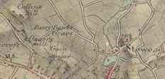
The Hall was demolished by its new owner, Richard Howard, in around 1814 and what was left of the estate was split up. Today, the remnants are scattered across Fisherwick and they’re being documented over on Pastorm, where there are photographs and some more information. There’s the Walled Garden & Orangery, bridges, a pair of gate piers covered in carvings, and the stables, a ha-ha and part of the estate’s wall boundary. It’s a bit like doing a treasure hunt! On the subject of treasure, take a look here at the gold ring with a mermaid seal that someone found in one of the fields around Fisherwick.
There is still a whole lot more to discover about Fisherwick, from the Iron Age right up until the present day. If anyone has anything to contribute on this or wants to take part in the Pastorm project in a different way, here’s how to get involved.
Sources:
- The Natural History of the County of Stafford by Robert Garner
- A Companion to the Leasowes, Hagley and, Enville with a sketch of Fisherwick
- The New Monthly Magazine, Vol 4 1815
- History of the Borough & Foreign of Walsall by E L Glew
Townships: Fisherwick with Tamhorn’, A History of the County of Stafford: Volume 14: Lichfield (1990), pp. 237-252.
The Historic Gardens of England: Staffordshire by Timothy Mowl and Dianne Barre