Midnight on the Hill

borrowcop

Borrowcop Hill is a place that doesn’t want to give up its secrets easily. What interests me about places like this is how gaps in our knowledge create a space where legends and folklore can grow unchecked. It’s not just a hill with a nice view. It’s the burial place of kings and martyrs, the site of Lichfield Castle.

to borrowcop gazebo

Stand at the summit and you’re standing at the highest point in Lichfield. Beacons have been lit here certainly for celebrations, possibly as warnings. The grammar school moved here from St John Street in 1903 and in 1971, merged with the adjacent Kings Hill secondary modern school to form the current King Edward VI School.  Interesting how the folklore was even referenced in the school name here. Another school on the site, the just as evocatively named Saxon Hill, was opened in 1979.

borrowcop sign

Christmas 1940

At last year’s Lichfield Discovered talk by Peter Young on Philip Larkin’s connections to the city, he told us that that whilst staying with relatives at Cherry Orchard in 1940, Larkin had written three poems. Only one, ‘Out in the Lane’, was published but all three were inspired by his temporary surroundings. Peter believes the arched field of ‘Christmas 1940’ refers to Borrowcop Hill. I’ve reproduced it here from a folio collated by The Philip Larkin Society for their celebration of his birthday in August 2001. I hope they don’t mind, but I can’t find it anywhere else!

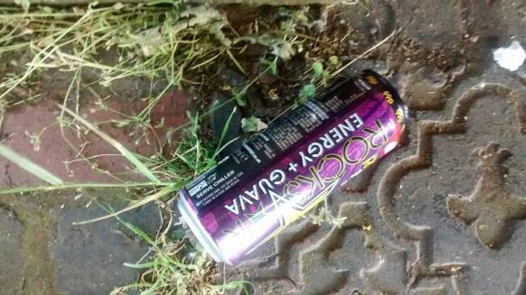
The name ‘Borrowcop’ does hint that there was once something here. Its earliest written forms, Burwey or Burwhay, feature the Old English element ‘burh’,  suggesting a fortified place (1).  Whilst there are vague reports of Erasmus Darwin recovering bits of burnt bone from somewhere up here, according to the Heritage Environment Report, ‘more recent excavations have so far failed to recover any evidence for human activity’. Well, I went up there on Sunday and I found this:

borrowcop chair

And this:

"The bubbles up your nose, spill on your summer clothes"

“The bubbles up your nose, spill on your summer clothes”

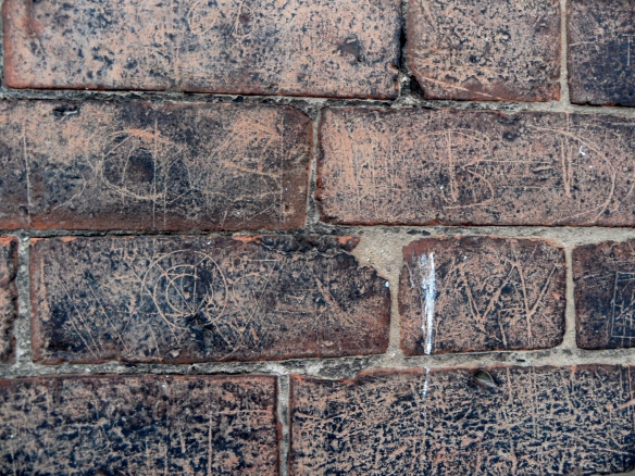
And this:

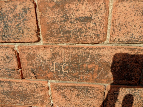
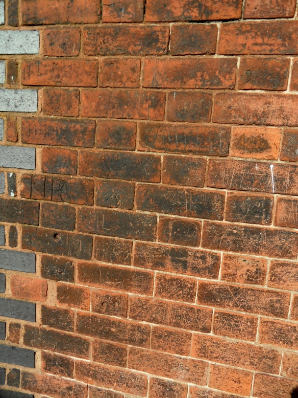
borrowcop graffiti

Plenty of human activity in what Five Spires Live , the Lichfield satirist who also doesn’t give up his secrets easily, yesterday described as  “… the perfect setting for bit of Larkin”. See, as much as I like legends, I also like the real.  I like layers of history that celebrate everything a place is and not just what we want it to be. The way our own memories of a place form our own folklores. The title for this post is one I’ve appropriated from one of my favourite songs by one of my favourite bands. It’s summer nights, it’s cheap cider (or ‘energy and guava’, if you’d rather), it’s messing about with your mates in a space maintained by the council because you’ve nowhere else to go. It’s perfect. Borrowcop or not, we’ve all been there. And like it or not, that’s as much a part of history as those kings and castles are.

1) A Survey and Analysis of the Place-Names of Staffordshire’ by David Horovitz, https://lichfieldlore.co.uk/wp-content/uploads/2015/06/397633_vol1.pdf

Guardian Angel

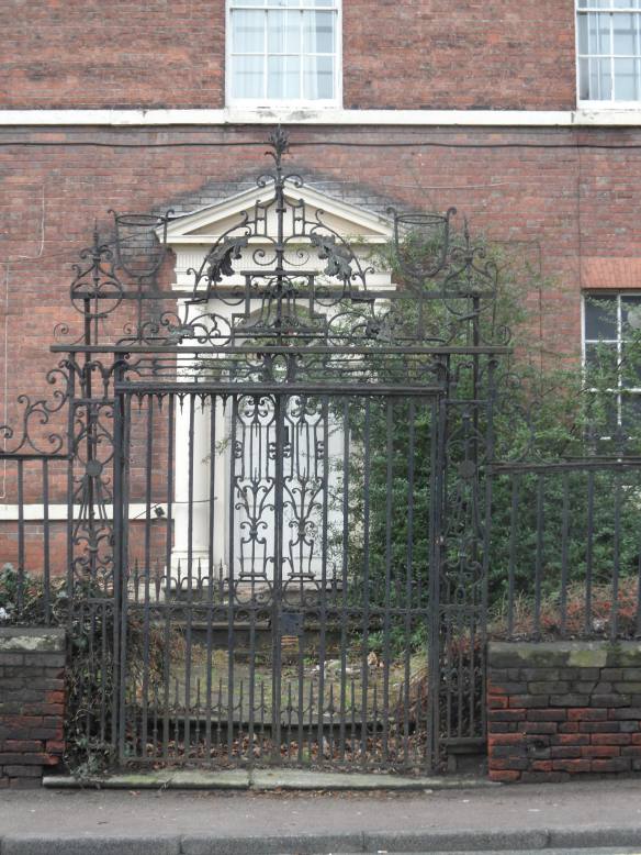
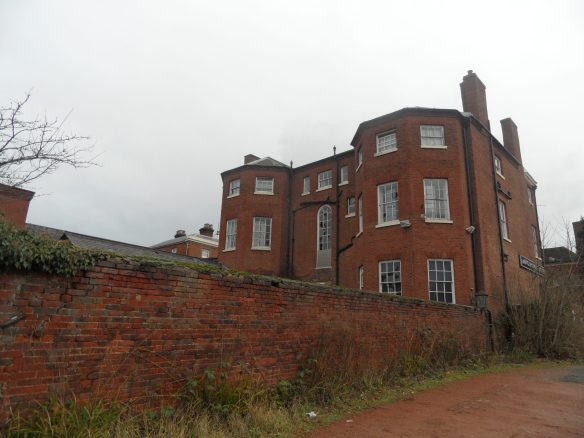
The whispers on the (Beacon) street were true. A new planning application is in the offing to convert the former Angel Croft Hotel into apartments.

The eighteenth century Angel Croft has been one of the most discussed buildings in Lichfield in recent times. Since 2008 it has been empty and vulnerable and its annual appearance on the English Heritage At Risk register has given people real concern about what its future might hold.

As it stands at present, the Angel Croft is at risk from further vandalism and, worse still, arson, which can prove devastating to so many heritage buildings.  My view is ‘use it or lose it’. Sometimes, in order to survive, buildings must adapt and play many roles over the course of their lives. In fact, the Angel Croft was a residential property until its conversion to a hotel in the 1930s. If something positive doesn’t happen soon then there is a possibility that we may lose it altogether and be left with nothing more than a vacant building plot.  I hope that this proposal, which will secure the future of the building and its features, will be supported and that the Angel Croft will not be put at further risk by short sightedness and nostalgia about an unsustainable past.

You can see the documents supporting the planning application here (the planning, design and access statement) and here (the heritage statement), which I’m grateful to the Beacon Street Area Residents Association for forwarding to me.

N.B For anyone interested in the history of this building, the Heritage Statement contains historical information about the Angel Croft, including descriptions, old plans, maps and photographs.


Cornercopia

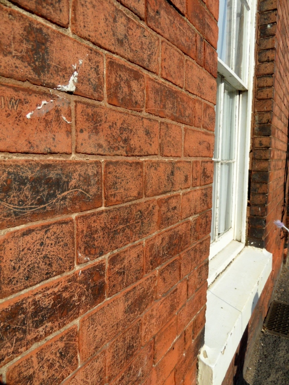
Last week we went to the George and Dragon on Beacon St. After an outstanding pork pie washed down by a cheeky half, it was time to leave. On heading back towards the park, I noticed that the building on the corner of Beacon St and Gaia Lane was covered in graffiti albeit nothing of particular note, just patterns and the usual initials. However, I had a look in both directions and couldn’t see anything similar on the bricks of the adjoining buildings and so I’m curious.  Why this particular building? Is it due to its proximity to the pub, is it simply because it’s a corner where people would wait (for something or somebody…) or do you think there another reason?

The building on the corner of Gaia Lane/Beacon St opp. the George & Dragon


Pillars of the Community

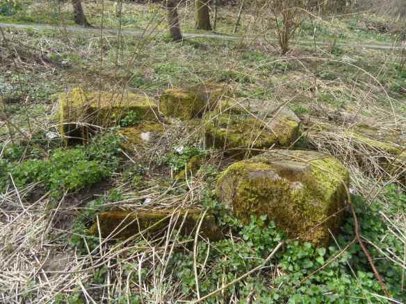
Back in April, I found what I thought were moss covered stone pillars in the undergrowth at Beacon Park, and asked if anyone knew what they were, or where they had come from. Well now, thanks to members of Lichfield District Council and the Beacon Street Area Residents Association, we have not one possible solution but three!

Could they be:

a) a section of balustrading from the Bird St/Beacon St side of the park, removed in the 1980s to create a corner entrance to the park over by the new Chandlers kiosk and the public toilets?

b) part of a structure used by a dairyman to shelter in during bad weather? There was once a farm in the vicinity of the Bunkers Hill Car Park, and a dog walker remembers that before the war, dairy cows were kept on the land that is now the football pitches and woodland.

Beacon Park map. Source: Gareth Thomas and his excellent blog – http://allaboutlichfield.blogspot.co.uk/

c) part of a “tower” that was originally at Stowe pool?  Apparently, after it became unsafe, the tower was dismantled and some of the stonework was put in the woodland.

d) None of the above?!

It’s great how by trying to uncover the story behind the stones, it’s also uncovered other things – the memories of cows on what’s now the football pitch and the possibility of a tower at Stowe Pool for starters! It’s also a good reminder that the version of a story we’ve been told, or the one we remember, might not be altogether correct. That’s not to say that such stories don’t have value, it’s just we need to be careful about accepting things at face value.

By the way,  if I was betting woman I’d go for option a….

A Fleeting Present

A while back I wrote about Mr J W Jackson, the ghost hunting city librarian who wrote a local history column for the Lichfield Mercury in the 1930s and 40s. Last night I found an article about ‘dear old Beacon Street’, written by Mr Jackson in November 1943, in response to a letter from one of his old school friends who emigrated to Canada in 1870, at the age of twelve. Of course, in describing the changes that have taken place in seventy years, Mr Jackson gives us a glimpse of Beacon St in both his past and his present, which is actually now our past. Before things get too wibbley wobbley timey wimey, let’s move on to a summary of the changes Mr Jackson noted in Beacon Street over the seventy years leading up to 1943.

Mr Jackson says the old pinfold still remained but was hardly, if ever, used for its original purpose – in the past it frequently containing horses, cattle or sheep caught straying on the road and penned by official pinner, Watty Bevin.  Fifty yards away from the pinfold as you walked back towards the city there used to be an old iron pump where the children used to fill up the vinegar bottles they were taking home from Hagues in Beacon St, after enjoying a couple of sips.  The Anchor Inn kept by Billy Godwin had been cleared away and the field between the Inn and Smith’s Brewery was now the residential school. The brewery itself where the children took cans to be filled with barm had been converted into a foundry.

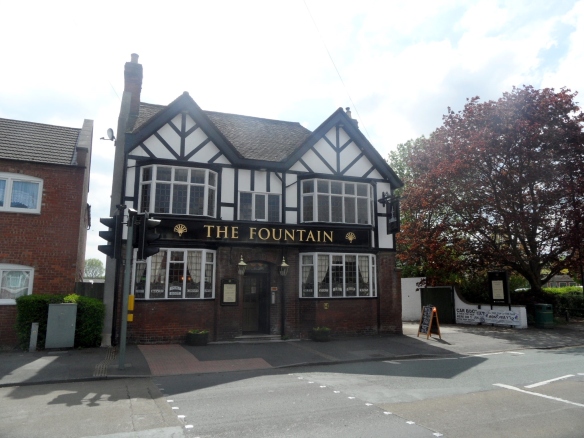
The Fountain Inn still remained  but visitors from the Black Country no longer came to play bowls on its lawns. The Lemon Tree Inn, kept by Sam Boston was now a house, as was the old butchers shop (kept by Mr Yeomans) and the Pheasant Inn previously kept by Mr Stone is also a house.  The wall shutting off Beacon Hall had been partly taken down and was now a garage and a residence. The old fashioned grocery shop at corner of Shaw Lane, owned by Mr Hall had been sold and replaced by a much larger shop, eventually becoming an antiques shop. Whitehall and Milley’s Hospital remained as they were in 1870 but the Free Library & Museum had been built near to the site of Griffith’s Brewery. (Note: Think this was probably earlier – Free Library & Museum built 1859?)

Green house was formerly the Lemon Tree Inn

The Angel Croft was described by Mr Jackson as ‘now a hostel’. The Old Beehive Inn had also been converted into a residence as had the Wheel Inn at the corner of Wheel Lane. The windmill where Mr Jackson played as a child was no longer in use but converted to a picturesque residence. Apparently the miller came in a considerable fortune and disappeared leaving everything as it stood and nothing was heard of him again.

Beacon Gardens built 1925

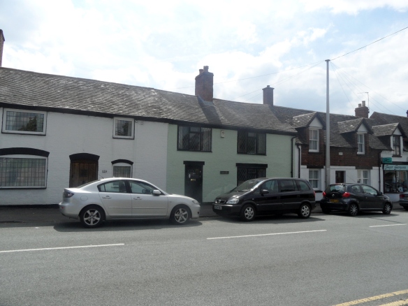
Council houses known as Beacon Gardens had been built on the fields in front of the Fountain Inn. The old blacksmiths, where legend has it that a French man once took his dancing bear to be shod was still going strong.  The Feathers Inn was still licensed and the row of cottages adjoining was much the same. The Old St Chad’s Rectory garden and field had been built over, the new road known as Nether Beacon. By 1943, the wheelwrights shop on brow of Beacon Hill had long since disappeared but the Little George Inn still stood as did the George & Dragon.

Of course, we can also now compare Beacon St seventy years on from when Mr Jackson did his comparison. I took most of the photos on Sunday (before I found the article weirdly!). The old pinfold still remains, but I doubt anyone now even remembers it being used to lock up straying animals.

Beacon Street School Sanatorium

The residential school has now been converted into apartments and the site of the Foundry is now Morrison’s Supermarket. Funnily enough you can probably get barm, or something similar there once again, as I think it’s a type of yeast (as in the northern ‘Barm Cake’). The Fountain Inn is still open, and Milley’s Hospital and Whitehall are still there. The Free Library and Museum building is of course now used as the Registry Office. As we are all too aware the Angel Croft is still there, but for how much longer in its desperate state?

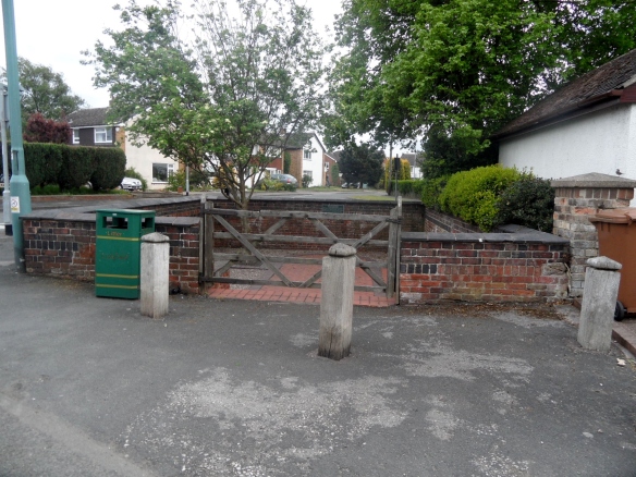
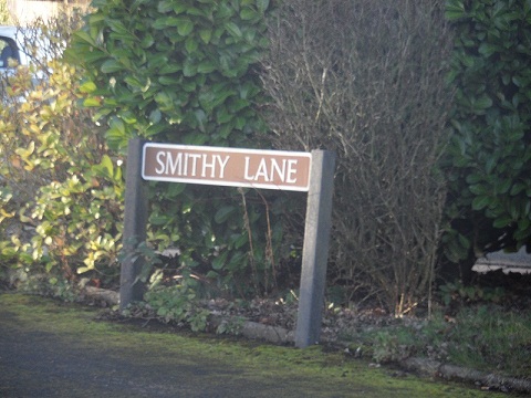
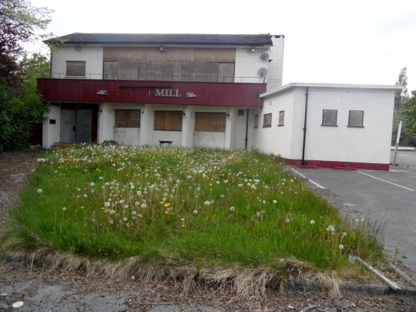
The blacksmiths has gone but is not altogether forgotten with road names ‘Forge Lane’ and ‘Smithy Lane’ to remind us. The Feathers Inn is still licensed but has now expanded into the row of cottages adjoining (for the record, I had a very nice jacket potato in the beer garden there on Bower Day this year). The George and Dragon, thankfully, still stands but the Little George is now a private, rather than public house. According to John Shaw’s Old Pubs of Lichfield, after WW2, the licence of the pub was transferred to the new pub on Wheel Lane, known as the Windmill. This ‘new’ pub which, wasn’t around in Mr Jackson’s time will probably not be around for much longer, as it is has been closed for some time and the site earmarked for development.

Mr Jackson’s article reminds me of the need for recording the everyday and the seemingly ordinary, as one day the present will be the past and what was once commonplace may no longer be.  I’m a big believer in using place names that reflect the history of a place, but on its own, a street sign for ‘Smithy Lane’ only tells you part of the story. Had Mr Jackson not added the story of the dancing bear’s shoes and the missing miller and his money to his reminiscences, they may well have been forgotten. “So what?” some may say, dismissing them as mere trivialities, but I disagree. I think stories matter.

Perhaps in seventy years time someone will look back at how Beacon St was in 2013. I wonder what will have changed and if we’ll have left them with any good stories?

Sources:
Lichfield Mercury archive
The Old Pubs of Lichfield, John Shaw

Cross City

There’s some evidence that there were several stone crosses in Lichfield, although as far as I know, no physical remains have ever been found.

The most well documented of these is the market cross. According to the Lichfield volume of the History of the County of Stafford (1), a market cross stood north of St. Mary’s in the late Middle Ages and then some time around 1530, Dean Denton surrounded it with eight arches and added a roof  to keep the market traders dry. The building was topped with eight statues of apostles, two brass crucifixes on the east and west sides, and a bell, as you can see in this picture on the Staffordshire Past Track site.    The cross was destroyed in the civil war, and replaced with a market house, as shown in the illustration below (although it is referred to as a cross on the notes?) which has also now disappeared.
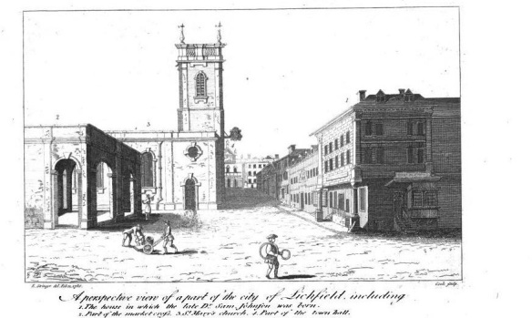
Taken from John Jackson’s book, History of the City and Cathedral of Lichfield, 1805

There is a possibility that there was a preaching cross in the grounds of St John’s Hospital as documentation shows that Dean FitzRalph preached outside in the cemetery. (2) Information on this specific example is really sketchy, but there is a surviving preaching cross in Bloxwich which you can read about in a great article on The Borough Blog.

More evidence exists for a cross at the junction of Tamworth St and Lombard St. There is a cross like structure shown there on John Speed’s 1610 map, and in 1805 Thomas Harwood wrote that there was a stone cross in Tamworth St. (3) There are also a couple of references in old property deeds such as one from April 1316 describing a ½ burgage in street between the Stone Cross and Stow Gate.(4)
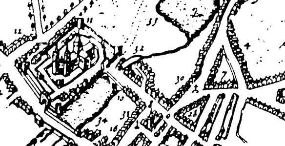
The Market Cross and the Stone Cross at Tamworth St can be seen depicted on John Speed’s 1610 map of Lichfield

A cross apparently stood near Cross in Hand Lane in Lichfield, giving rise to a theory that it this is where the lane got its name from (the other theory is that is was a pilgrimage route, to St Chad’s shrine, where people would walk with ‘cross in hand’. The route has recently been incorporated into a new pilgrimage and heritage route called Two Saints Way). Harwood said,  “(Beacon Street) extends from the causeway over the Minster pool which separates it from Bird Street to houses at the extremity of the city called the Cross in the Hand and where stood an ancient cross ad finem villas.’ The pastscape record for the cross is here.

This week I came across another reference, this time Bacone’s Cross, and which was also thought to be in Beacon St, at the end of the town. Was the ancient cross at Cross in Hand Lane and Bacone’s Cross the same cross?

The Bacone’s Cross/The Cross in Hand and the Tamworth St cross were both situated at the ends of the town. Does this mean that they were boundary markers of some sort?  If so, could there have been more crosses marking other places on the City’s boundary.  There were city gates at both Beacon St and Tamworth St.  However, the probable sites of the gates don’t correspond exactly with the probable sites of the crosses e.g. the above example says ‘between the Stow Gate and the Stone Cross’.
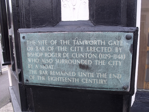
Tamworth Gate plaque on Lee Garden Chinese Restaurant Credit: Ell Brown (taken from flickr photostream).

In the absence of more information about Lichfield specifically, I looked elsewhere to see if crosses would have been used to mark boundaries. St Albans was surrounded by a ditch, like Lichfield (and there’s a link with the story of the  Christian martyrs but that’s a bit too much of a tangent for now!). The History of the County of Hertford, says this about the city’s boundary (5)

Crosses were at an early date erected at important points in the line of boundary, and at each of the entrances to the town, namely, the Stone Cross or North Gate Cross  at the north on the Sandridge Road, the Red Cross in Sopwell Lane, at the entrance by the old road from London, the Cross with the Hand in Eywood Lane, the Black Cross, probably at the angle where Tonmans Dike goes from the boundary of the houses in Fishpool Street towards the Claypits, and St. John’s Cross at an angle of the boundary in what is now known as Harley Street, but lately as Mud Lane.

It’s interesting to see that some of the names are the same – Stone Cross, Cross with the Hand – but I don’t want to start jumping to conclusions until there is much more evidence!

Finally, there is a document relating to property in Freeford (4), which describes ‘three selions of land at Lichfield, near Le Hedeless Cross, on the road towards Freeford’ in the time of Edward III – Henry V. Does this refer to the Tamworth St Stone Cross, or another cross altogether?

What happened to these crosses? Time? Religious differences? Where did they end up? There’s something in one of my all time favourites book that gives me hope (possibly misguided) that there is a chance, no matter how slim, that things that have long been thought to have vanished might turn up again one day in some form or another. In England in Particular (6), in the section on Wayside and Boundary Crosses, it says that,

Some crosses have been found in hedgebanks, with shafts used as gateposts. A number have been found by researching field names:two fields called Cross Park revealed previously undiscovered stones.

Fingers crossed!

Edit:

In view of the above, I thought it’d be worth having a look at field names etc, in Lichfield. There is an entry in an transcribed inventory relating to the real estate of the vicars that says Deanslade: Falseway to cross called Fanecross (4). There’s a Banecross on another transcription and I think one of these could be down to a typo and that they could be the same place, There is also an entry for a place known as Croscroft, which was on the road to Elford, near St Michael’s Churchyard (3)

Another edit:

I was hoping there would be an ancient cross somewhere in Lichfield. Well, I finally found one! Actually that’s a fib. What I found is a photograph in a book of archaeologists finding one. A decorated cross shaft was discovered built into the foundations of the north wall of the nave of Lichfield Cathedral. It’s thought to be Saxon or Saxo-Norman, and could be a surviving remnant of the earlier church on the site. I wish I could share a photograph here, but all I can do is tell you that it’s on plate 1 in the ‘South Staffordshire Archaeological and Historical Society Transactions 1980-1981 Volume XXII’ book, on the local history shelves at the library!.

Sources:

(1) Lichfield: Economic history’, A History of the County of Stafford: Volume 14: Lichfield(1990), pp. 109-131http://www.british-history.ac.uk/report.aspx?compid=42349#s6

(2) Hospitals: Lichfield, St John the Baptist’, A History of the County of Stafford: Volume 3(1970), pp. 279-289

(3) The history and antiquities of the church and city of Lichfield by Thomas Harwood

(4) Collections for a History of Staffordshire Part II- Vol VI (1886), William Salt Archaeological Society

(5)  ‘The city of St Albans: Introduction’, A History of the County of Hertford: volume 2 (1908), pp. 469-477

(6) England in Particular, Sue Clifford & Angela King for Common Ground

Under the Bridge

It might not have rained on St Swithin’s day here in Lichfield but water was still the theme this weekend. On Saturday, I was supposed to be at the Festival of History at Kelmarsh in Northamptonshire. However, it seems that nature wanted to get involved in the reenactment of history too and successfully managed to put the marsh back into Kelmarsh. Maybe Dr Rawson was right when he warned “Drive nature out as you will, and she will come back”!

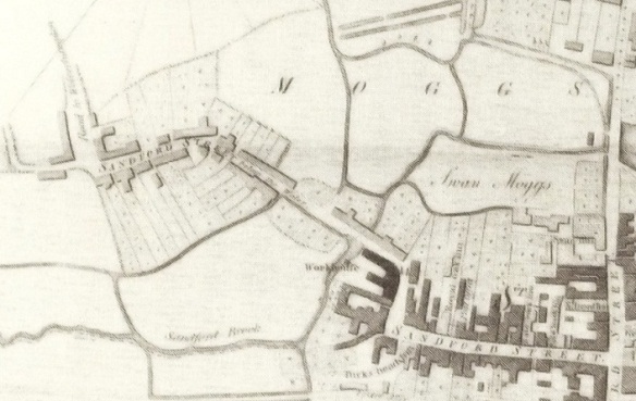
Here in Lichfield, I’ve read that marshy land was known as ‘moggs’ and that the Museum Gardens were once known as Swan Moggs or the Bishop’s Fish Pool.  You can see an artist’s impression from 1848 of the scene in 1548 here.

A causeway was built to separate the Moggs from from Minster Pool in the early 1300s, and the road became known as Newebrugge St, later Brugge St and eventually Bird St. According to Rawson, the original bridge was widened by 5 foot in 1768. It was replaced by a new bridge in 1816, but I was quite excited to see that the listed building description  says that the remains of the old bridge could still be below the water of Minster Pool. Has anyone anyone ever been down there to have a look, I wonder? I’m probably not quite excited enough to hire a wetsuit and go looking for it, but you never know!

Adding Olympic Flames to the waters of Minster Pool, near the Causeway Brige

It seems that other interesting discoveries have been made near the site of the bridge. According to the Pastscape record, during the 19th century there was a malthouse on the causeway and in 1802, when they were digging a well they discovered a roman goblet called a cyathus and fragments of several human remains. How did they come to be there?

Once again, it’s worth taking a look at John Snape’s 1781 map of Lichfield as it show the extent of the Moggs at that time.

While we’re at it, here’s John Speed’s 1610 map again as well!

1610 map of Lichfield

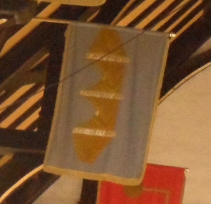
As you might expect, the Bird St ward banner features the Causeway.

Something I’m especially interested in relating to all this are the references I’ve seen to a well in the vicinity. So far, I’ve seen it called Merelynswele, Merliche Well and Maudlin’s Well and various sources seem to place it adjoining the Bishop’s Fish Pool, and accessible from Shaw Lane.

View down Shaw Lane, off Beacon St

I might be wrong but is the original name made up of three watery elements i.e. Mere-lyns-wele with mere as in Windemere, lyn deriving from the celtic word for for lake and of course wele for well?

The name of the well seems to have changed over the years.  For example, John Jackson suggested that the well became known as Maudlin’s as, ‘Tradition says some person having enjoyed his bottle rather too freely tumbled into this well which has since been distinguished by its present epithet Maudlin signifying a state of inebriation. It is clearly however an abbreviation of Magdalen’s’. Dr Rawson referred to it as Merliche, the pool-marsh well.

What I really need to do is to get down to the record office to have a look at the plan of Maudlins Well and Dean’s Croft that they I’ve just found out that they have. Wait, Dean’s Croft? That sound’s familiar….. Might wait until it stops raining AGAIN though 😦

Sources:

(1) An inquiry into the history and influence of the Lichfield waters by Rawson 1840

(2) A short account of the city and close of Lichfield by Thomas George Lomax, John Chappel Woodhouse, William Newling

History & Antiquities of the Church & city of Lichfield by Thomas Harwood

Collections for a History of Staffordshire Part II- Vol VI (1886)

History of the City and Cathedral of Lichfield by John Jackson

A History of the County of Stafford Vol 14: Lichfield edited by MW Greenslade


Pay Days

“Nothing really seems to happen in this sleepy old town, except plenty of work….”, begins the Summer 1935 entry for Lichfield in The Royal Army Pay Corps Journal.

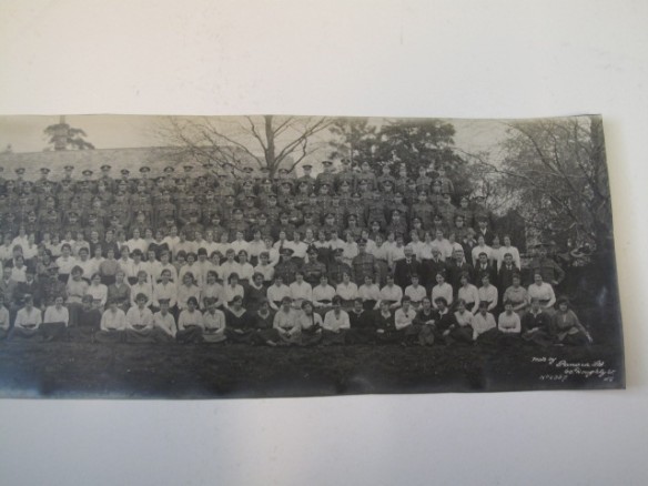
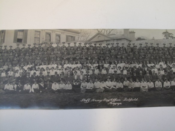
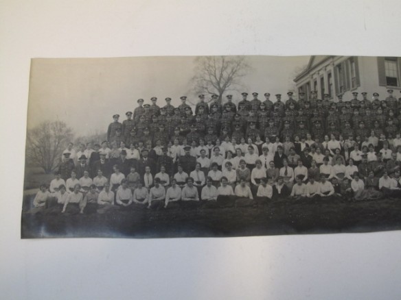
For at least 20 years, possibly longer, Lichfield was home to one of the army’s regimental pay offices.  The Army Pay Corps (known as Royal Army Pay Corps from 1920) if my understanding is correct, was the payroll department for the army. The office at Lichfield seems to have been based at Beacon Place, the house whose grounds formed much of what is now Beacon Park. This staff photo was taken outside there in May 1918. The photo is huge and so is in three parts.

The quarterly journal entries that I have copies of begin in Spring 1931 and focus mainly on sports, but inbetween the reports of cricket, tennis, football, bridge and table tennis there are other snippets of life at Beacon Place, and in Lichfield as a whole, during the period.

Here are some extracts from Spring 1937:

Spring must be on the way: the surest sign here is that the white lines on the tennis courts have been painted….Flannels are being sent to the cleaners, rackets are being plonked banjo fashion and sent to be restrung, and the good players are looking up the season’s catalogues and deciding on something really posh for this season….

Lichfield, in common with other great cities, is according to the press, going to do itself well for the Coronation. Flood lighting of the Cathedral and other important buildings, sports in the recreation grounds, glee-singing on Minster Pool (of course, this may be a stunt to make spome of these three-feet pike give themselves up), presentation of mugs to the children in the Market Place, after they have watched and cheered the Lord Mayor and all the City’s dignitaries. It will be a fine rehearsal for the Lichfield Bower which happens the following Monday and all who know Lichfield know what a fine day that is.

SQMS H Horan and Sgt R Mackreth have left us for Woolwich and Egypt respectively and Sgt R Tolley and L/Sgt J Duckworth, to whom we also extend the welcome mitt, have joined us from Palestine and Egypt respectively.

The decision to close the Lichfield office, due to a reorganisation of the system, was reported in The Tamworth Herald on April 24th 1937. Documents were transferred to York and Shrewsbury and it was said that,

The closing of Beacon Place, with the resultant removal of the entire staff would be a great loss to Lichfield

The last entry for the Lichfield office in the Royal Army Pay Corps journal that I have is Autumn 1937. I understand that Beacon Place was taken over by The Royal Army Service Corps during the Second World War, something I haven’t even begun to look at yet!

The photo and the journal entries were sent to me by Mr Bailey, curator of the AGC Museum in Winchester, after I made some enquiries for a walk I was doing in Beacon Park.  Mr Bailey has been incredibly helpful in helping me to discover more about the use of Beacon Place by the Army Pay Office and in telling me more about the RAPC generally. I have several other pieces of information that Mr Bailey has sent me, including lists of some of the employees at various times . One thing he mentioned that I find particularly interesting is that research by Dr John Black has indicated that following the campaign on the Somme in 1916, Army Pay Corps staff were sent to the Western Front and women were recruited locally to replace these men. Are these the women in the 1918 staff photo? Unfortunately, Mr Bailey hasn’t been able to find any records of names for the soldiers who departed or of the women who replaced them.

I’m especially interested in finding out more about the local people who worked at the Beacon Place office. If anyone has any further information regarding any of the above, it’s be great to hear from you.

Smoky Bacon

Why is Beacon St called Beacon St? Once upon a time it was known as Bacon St (or variations of this such as Bacunne). It’s suggested that at some point around the beginning of the 19thc, someone decided that Beacon St was a more fitting name.  It’s pure speculation on my part, but I wonder whether this name change had anything to do with the building of Beacon Place around 1800? The man who built the house was called George Hand. As there’s a cut of pork called ‘the Hand’, maybe he was keen to distance himself from all things porcine? As I said, mere speculation.
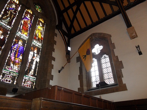
In books about Lichfield published at the beginning of the 1800s, both names are often given. One (1) gives the following description:-

Bacon or Beacon street anciently written Bakun or Bacun street, takes its name from a beacon placed upon the top of a tower which stood the Dean’s croft and adjoining field. It was the principal street of the town and was burnt down in 1646 at which time it was chiefly inhabited by cappers whose business was staple of the place

Beacon St Ward banner?

Is there any truth in this explanation? Or is a story, created to support the name change?  Is there any other evidence of an actual Beacon?  The above ward banner in the Guildhall surely relates to the Beacon St ward (although it’s another one where the name plaque is obscured). Alone it’s not evidence for the Beacon theory, although as I’ve mentioned before, I would be interested to see when/where the designs for these banners came from. There is a place in Lichfield called Dean’s Croft, but it’s near St Michaels, not Beacon St.

Thomas Harwood’s book (2) throws another explanation into the ring.

It is probable from the situation of Bacon street that name is an abbreviation from Barbican or Barbacane a word of Arabic original (sic). A barbacan is a sort of hold or fort for the security of the a munition placed in the front of a castle or an outwork.

In 1886, the William Salt Archaeology Society noted (3)’The present spelling of the name of this street is altogether unauthorised, and an innovation of this century. It is found spelt Bacon, Bacun, or Bacune uninterruptedly from the 13th to the 18th century’.
Likewise, I’m not convinced by the Beacon or Barbican theory….yet. As ever, would like to know what others think. I wonder what the good people of the Bacon Beacon Street Blog, think?

Edit 15/7/2012

Referring to the Beacon St area, the Collections for a History of Staffordshire Part II- Vol VI (1886) record that there is a reference to a Bacone’s Cross, along with a Swane Lane (now Shaw), Merliches Well, Poole Hall and Whitehall that I missed before.
Sources:

(1)A short account of the city and close of Lichfield by Thomas George Lomax, John Chappel Woodhouse, William Newling

(2) The history and antiquities of the church and city of Lichfield by Thomas Harwood

(3) Collections for a History of Staffordshire Part II- Vol VI (1886)

West Side Story

The view of the Cathedral as you turn from Beacon St into the Close, must be one of the most photographed in Lichfield. It’s stunning. However, if you can tear your eyes away from the spectacular west front of the Cathedral, there’s something else here that I think is rather special.

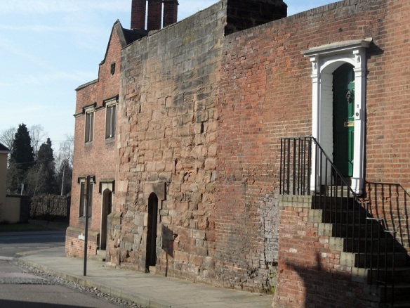
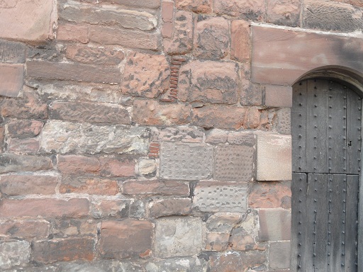
Remains of the West Gate.

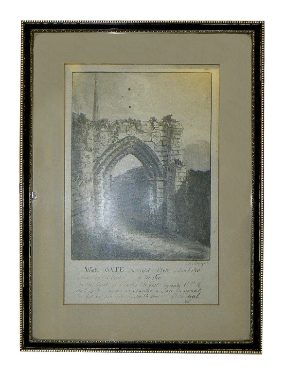
Sandwiched between two houses are the remains of the West Gate, dating back to the early fourteenth century. The rest of the gate was demolished in 1800, as Thomas Harwood describes, “…that noble gate at the west entrance into the Close, a beautiful structure worthy of its munificent founder and which in April 1800 was with a barbarous taste, pulled down, and the materials applied to lay the foundation of a pile of new buildings for the residence of necessitous widows of clergymen”. (The new buildings Mr Harwood describes is Newton’s College opposite. If this is true it’s a bit more house old recycling!).

In the same book, Harwood mentions the gate again saying,”At the entrance into the close on the west stood the beautiful gate which was built by Bishop Langton in the early part of the fourteenth century. It was a very strong a double gate with portcullis of great strength and majesty. The strong tower over the gate was finished in the time of Bishop Northburgh, the successor of Langton. This noble structure which had unimpaired during the revolution of five centuries and had withstood the destructive ravages of civil war was pulled down in April 1800 to widen the road into the Close”

Personally I’m a big fan of crumbling, old bricks, but if the gate had remained then, we wouldn’t be treated to that amazing view. Whether the decision to demolish the gate was barbarous or not, all we have now are these remaining stones and the descriptions, together with some maps and drawings.  The rest is down to our imagination….

The Lichfield District Council flickr stream has this image.

Taken from Lichfield District Council flickr group

On the Staffordshire Past Track website, you can also see a view of the gate published in 1805. Still a ruin, but in slightly better repair than the previous image. There’s another image here , this time from further away showing how the gate fitted into the area around the Close. This ‘ancient view’ of the Close, seems to be an artist’s impression from 1805 to show how the Close would have looked surrounded by its protective walls, gates and towers. John Speed’s 1610 map also shows the defences, including the gate.

1610 map of Lichfield

I’d like to explore the other remaining fragments of the defences, but for now I’ve got enough questions about this part to be going on with! Why leave this portion of wall   – why not demolish the whole thing? On the wall itself, why do some of the stones have dimples on (I bet there is a technical term for this!) Were materials really used for Newton’s College?

And what about that door! What’s behind there? Who was the last person to go in there (and did they ever come out again!). Why is there a door there at all? To access the ‘strong’ tower in Harwood’s descriptions?  Most importantly, where do they keep the key and could they open it for the Heritage Weekend?!

Edit: Take a look at the comments section – some of the questions have already been answered by Nigel, Managing Director of Lichfield Lock & Key, up on Church St and Pat, who seems to know a thing or two about old bricks!

Sources

The History & Antiquities of the Church and City of Lichfield – Thomas Harwood

Lichfield: The cathedral close – A History of the County of Stafford: Volume 14: Lichfield (1990), pp. 57-67. URL: http://www.british-history.ac.uk/report.aspx?compid=42343