A Flag Post

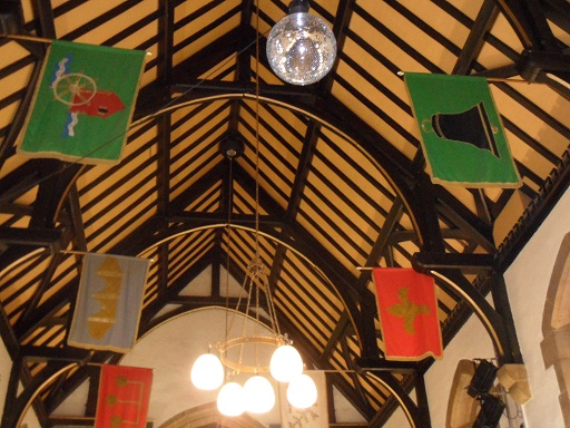
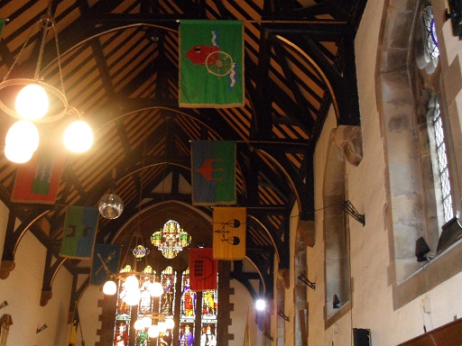
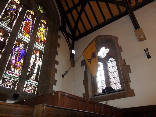
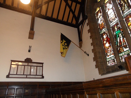
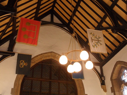
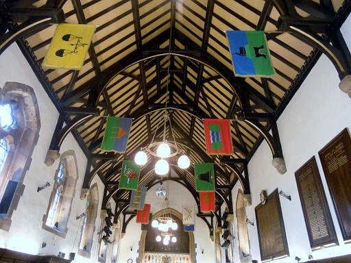
Hanging in the main hall of Lichfield’s Guildhall are banners representing the city’s wards. I’ve read on an information sheet about the Guildhall that these flags were created in 1975, by students from Lichfield’s School of Art. However, I’m wondering if they are based on anything earlier or if they are just recent(ish) designs? It does seem possible that each ward may have had its own symbol in the past – talking about The Court of Array in 1805, Thomas Harwood said,

“The public officers of the city attend and various processions are made by the constables and dozeners of each ward who in these processions anciently bore tutelary saints but which are now converted into garlands of flowers or emblems of their trade”.


Now, I had written down which flag in the Guildhall related to which ward on a piece of paper but I left it at the pub over the jubilee weekend (Ye Olde Windmill in Gentleshaw where I had a lovely steak & ale pie.  In fact, as the name suggests there is a ruined old windmill in the grounds, so the pub probably deserves a post of its own). I’ve been back to the Guildhall several times since, but haven’t been able to get into the main hall for one reason or another.

I can remember all but two. I think. Some are definitely more obvious than others. I reckon the best thing to do is put the photos up and see if anyone has any ideas about which flag relates to which ward and why. In the meantime I’ll try and get back to the Guildhall to make another list and hold onto it this time!  

.


By the way, there is no flag for Leomansley, so I’ll just have to design my own. If anyone from the Lichfield School of Art Class of 1975 wants to get in touch to give me a hand with this, or to share the story of how the other banners came to be made,  that would be fantastic!

(1) History, Gazeteeer & Directory of Staffordshire William White 1834

A Short Account of the City & Close of Lichfield’ by Thomas George Lomax, John Chappel Woodhouse, William Newling (1819)

Lichfield: Town government, A History of the County of Stafford: Volume 14: Lichfield (1990), pp. 73-87


In defence of Lichfield

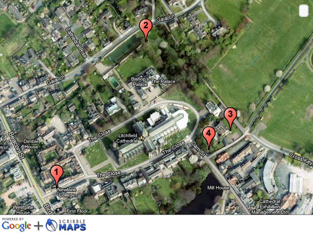
As I mentioned in the last post about the West Gate, some other remnants of the Close’s medieval defences are visible.  I’ve marked the ones I know about, on the map below, with a bit of information on each. I’m sure there’s probably more, and we could probably work out where the other defences were, but it’s a start!

1. Site of the West Gate – see previous post here

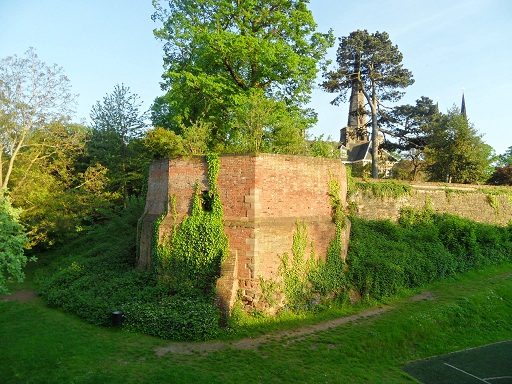
2. Remains of North East Tower & ditch. A scheduled monument, sometimes known as the Bishop’s Tower, this was part of the original, medieval bishop’s palace. The pastscape record can be seen here. A description of the tower and how it fitted into the rest of the palace can be found in several books on the Cathedral & Close (1) and is based on a plan that was held in the Bodleian Library (is it still there?). A plan drawn from this can also be found here.

At the north east corner was a tower fifty two feet high and each of its ten sides thirteen feet on the outside. It was called the bishop’s tower and the ruins yet remain. Adjoining this tower was a square room with stone stairs leading to the top on the north west of which was an apartment with a cellar underneath twenty two feet in breadth and sixty three feet in length. The bishop’s lodging room was forty feet by thirty two with a leaden roof and cellar underneath. On the north side of this room was a large chimney piece opposite to which a door led to the dining room sixty feet long and thirty broad. At the east end was a door opening into the second tower which consisted of five squares eleven feet in width and thirty two in height. There were two apartments each twenty feet by seven separated from each other by the large hall chimney, , the lady’s chamber…the brewhouse…and the kitchen.


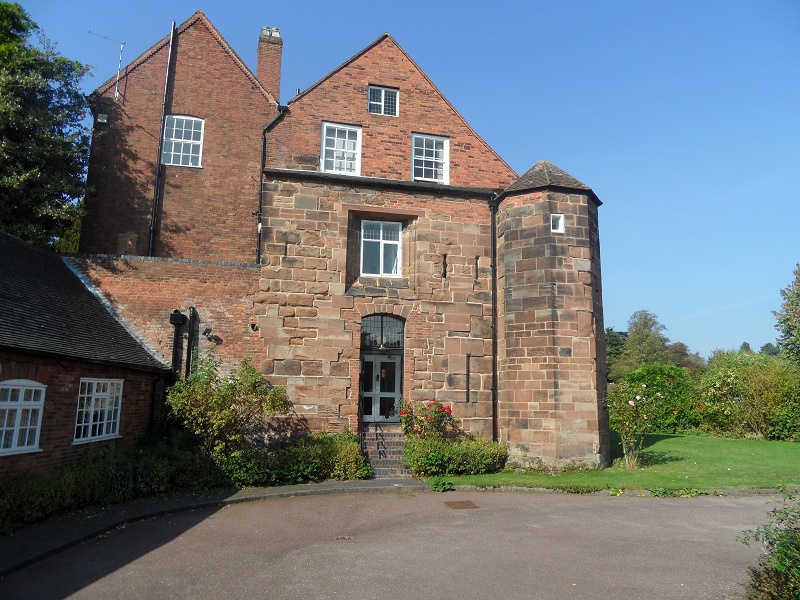
 3. St Mary’s House. Incorporates a turret and part of the Close wall on the east and south side. Not only are there are arrow slits, but there are also rumours of a secret tunnel down below….Actually, it’s not that secret as loads of people seem to have heard about it.

 4. Remains of Eastern Tower of South East Gate. This description comes from the ‘Lichfield: The cathedral close’, A History of the County of Stafford: Volume 14: Lichfield

The gate built by Langton at the south-east corner of the Close had two towers. The eastern one, whose base was excavated in the late 1980s, was a half-octagon with 12-ft. sides. The western tower was presumably of similar dimension. The gate had a portcullis in 1376.  There was a drawbridge, still in existence in the earlier 18th century, which crossed the outflow of water from Minster Pool, and also a wicket for pedestrians. The gate was removed in the mid 18th century in order to improve access for coaches into the Close.


There’s also this bit of wall behind the Chapters coffee shop, which provoked a bit of discussion on Brownhills Bob’s Brownhills Blog, and with Annette Rubery. Especially about what that recess is!

While I was having a flick through googlebooks trying to find information on the subject, I came across an interesting snippet. Adrian Pettifer, in ‘English Castles: A County Guide’ makes the point that that unlike the majority of cathedral cities, there was no wall around the city of Lichfield as a whole.

So whilst the Close was protected by a strong wall, a ditch, 50ft towers, drawbridges and portcullises (when you put it like that it really does sound like a castle!), what did the rest of the city have? Well, there was a ditch. It’s thought even this was used more for controlling traders coming in and out of the city, than for defences. An archaeological dig carried out on the Lichfield District Council carpark in Frog Lane, also confirmed that the ditch was used as the city dump and found a variety of material, including it appears, the dog from Funnybones. There were gates too, the positions of which are still marked by plaques. Again, though it’s thought these might not have been defensive. I think the ditch and the gates deserve a post of their own, so I’ll come back to them another time.

Credit: Ell Brown (taken from flickr photostream)

This will also give me time to think about my latest question (one I’m sure has been thought about and answered by clever people already!). Was the city of Lichfield defended, along with the Close? And if not, then why not? Of course, if anyone has any ideas about this in the meantime, please let me know!

Footnootes:

(1) This particular description is taken from ‘A short account of the city and close of Lichfield by Thomas George Lomax, John Chappel Woodhouse, William Newling

(2) Thanks to this website http://gatehouse-gazetteer.info/English%20sites/3329.html for pointing me in the direction of some great links.

(3) I’ve also used this book From: ‘Lichfield: The cathedral close’, A History of the County of Stafford: Volume 14: Lichfield (1990)

West Side Story

The view of the Cathedral as you turn from Beacon St into the Close, must be one of the most photographed in Lichfield. It’s stunning. However, if you can tear your eyes away from the spectacular west front of the Cathedral, there’s something else here that I think is rather special.

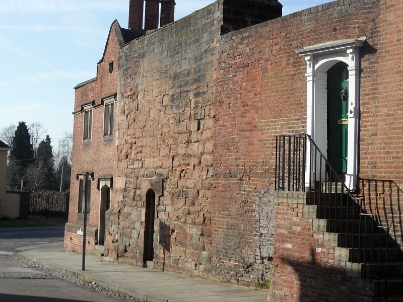
Remains of the West Gate.

Sandwiched between two houses are the remains of the West Gate, dating back to the early fourteenth century. The rest of the gate was demolished in 1800, as Thomas Harwood describes, “…that noble gate at the west entrance into the Close, a beautiful structure worthy of its munificent founder and which in April 1800 was with a barbarous taste, pulled down, and the materials applied to lay the foundation of a pile of new buildings for the residence of necessitous widows of clergymen”. (The new buildings Mr Harwood describes is Newton’s College opposite. If this is true it’s a bit more house old recycling!).

In the same book, Harwood mentions the gate again saying,”At the entrance into the close on the west stood the beautiful gate which was built by Bishop Langton in the early part of the fourteenth century. It was a very strong a double gate with portcullis of great strength and majesty. The strong tower over the gate was finished in the time of Bishop Northburgh, the successor of Langton. This noble structure which had unimpaired during the revolution of five centuries and had withstood the destructive ravages of civil war was pulled down in April 1800 to widen the road into the Close”

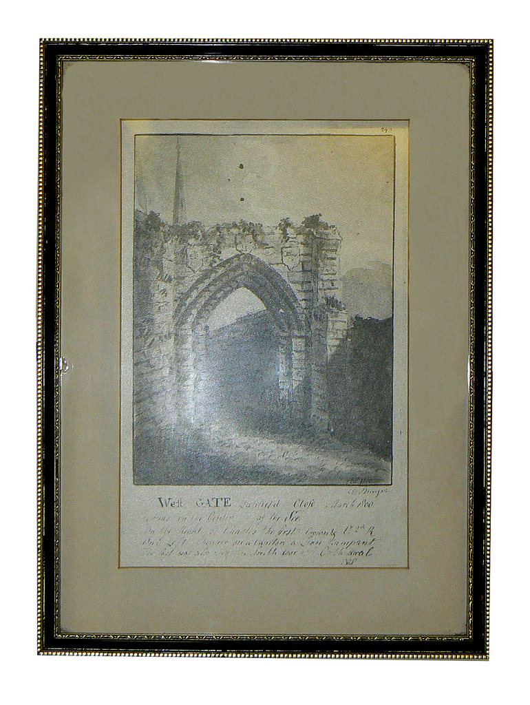
Personally I’m a big fan of crumbling, old bricks, but if the gate had remained then, we wouldn’t be treated to that amazing view. Whether the decision to demolish the gate was barbarous or not, all we have now are these remaining stones and the descriptions, together with some maps and drawings.  The rest is down to our imagination….

The Lichfield District Council flickr stream has this image.

Taken from Lichfield District Council flickr group

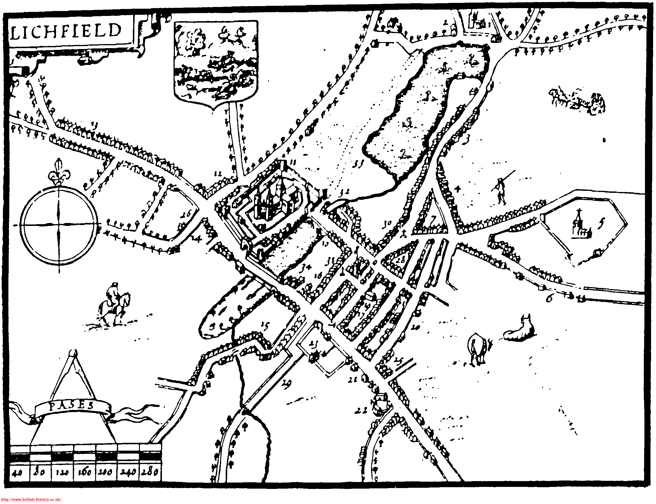
On the Staffordshire Past Track website, you can also see a view of the gate published in 1805. Still a ruin, but in slightly better repair than the previous image. There’s another image here , this time from further away showing how the gate fitted into the area around the Close. This ‘ancient view’ of the Close, seems to be an artist’s impression from 1805 to show how the Close would have looked surrounded by its protective walls, gates and towers. John Speed’s 1610 map also shows the defences, including the gate.

1610 map of Lichfield

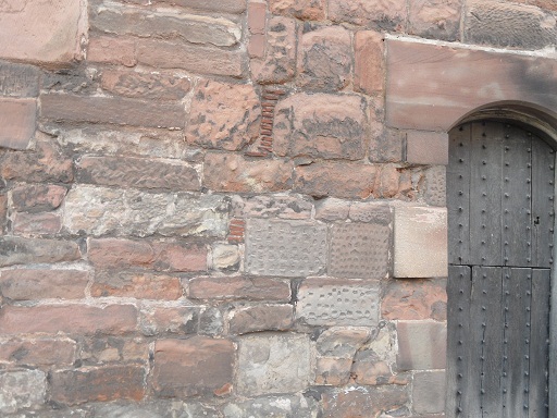
I’d like to explore the other remaining fragments of the defences, but for now I’ve got enough questions about this part to be going on with! Why leave this portion of wall   – why not demolish the whole thing? On the wall itself, why do some of the stones have dimples on (I bet there is a technical term for this!) Were materials really used for Newton’s College?

And what about that door! What’s behind there? Who was the last person to go in there (and did they ever come out again!). Why is there a door there at all? To access the ‘strong’ tower in Harwood’s descriptions?  Most importantly, where do they keep the key and could they open it for the Heritage Weekend?!

Edit: Take a look at the comments section – some of the questions have already been answered by Nigel, Managing Director of Lichfield Lock & Key, up on Church St and Pat, who seems to know a thing or two about old bricks!

Sources

The History & Antiquities of the Church and City of Lichfield – Thomas Harwood

Lichfield: The cathedral close – A History of the County of Stafford: Volume 14: Lichfield (1990), pp. 57-67. URL: http://www.british-history.ac.uk/report.aspx?compid=42343

Well Being

My visit to Farewell several weeks ago got me interested in finding out more about wells. Brownhills Bob showed me a map of the area around Farewell and it’s amazing to see how many other ‘well’ related placenames there are in that area alone e.g. Stoneywell, Cresswell, Coldwell, Nuns Well and my own personal favourite, Giddywell (wonder what was in the water there?!).

I’ll come back to these another time but for now I thought it would be interesting to find out a bit about what’s probably the most well known well in our area – St Chad’s Well here in Lichfield.

The well has changed a fair bit over the years. The earliest description of the well is said to come from Leland who visited in the 1500s and is quoted in a Lichfield history book published in 1819 as saying “…Stowe church on the east of the towne where is St Chad’s well a spring of pure water where is seen a stone in the bottom of it on which some say St Chad was wont naked to stand in the water and pray at this stone…”.

Today, St Chad’s Well looks like this.
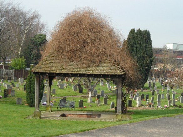


Below is a picture of the well and church drawn by William Stukeley in 1736. As far as I know, it’s the oldest image of the well that there is.
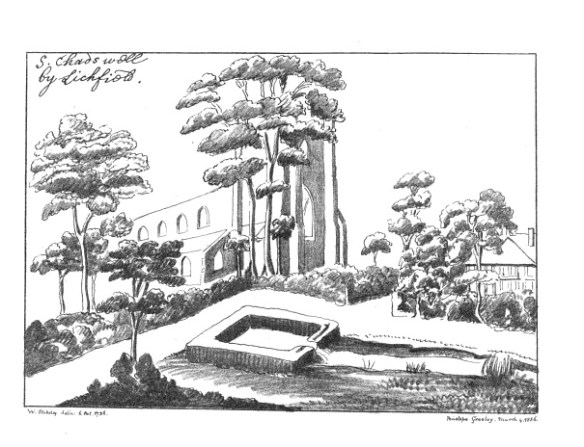
However, James Rawson reported that by 1833 the well had ‘degenerated into a most undignified puddle, more than 6 feet deep’. He seems to dispute Stukeley’s drawing, saying that there was no outlet for escape of water and the brook was not near to the well as depicted above. The well basin had become ‘filled up with mud and filth’ which Rawson believed was due to drainage in the surrounding meadows. As a result an octagonal building was erected over the well, which remained in place until 1947, when I understand that the well was actually moved to its present position and took on its current form. It would be interesting to see if there are any first hand accounts of this?

St Chad's Well, 1915. Image from Wikipedia

 
At some point it seems people may have thought the water in the well was harmful to drink. In a volume of ‘The Antiquary’, published in 1889 a Rev C F R Palmer is quoted as saying “It is popularly believed that it is dangerous to drink of the water of St. Chad’s Well, as it is sure to give a fit of the ” shakes,” Yet, in spite of the attendant’s remonstrances, I took a good draught, and, instead of ague, experienced only great refreshment in a fatiguing walk on a sultry day”. Like Rev Palmer, the lad in the photo looks like he’s about to take a good draught and doesn’t seem too concerned!

In 1806, Thomas Harwood wrote that ” The superstitious custom of adorning this well with boughs and of reading the gospel for the day at this and at other wells and pumps is yet observed in this city on Ascension Day”.  According to St Chad’s church website, the tradition of well dressing (mostly associated with our neighbours over in Derbyshire) was revived in 1995 to commemorate the 50th anniversary of Christian Aid. I think the last well dressing was in 2010 with a girl guide theme. I wonder if the custom will be revived again?

I had always assumed that the well and the spring were one and the same, but it seems that it was separate, or at least it became separate at some point. I don’t feel too bad about my ignorance though, as in 1923, the churchwarden Thomas Moseley said ‘no living person knew where the water came from’. In a book published in 1846, I’ve read that ‘The water of the well is sulphurated and near to it is a pretty iron pump giving water from a second well which is a superfine chalybeate’ and in an archaeological survey from 2006, it refers to a little brick building containing the spring. The survey was carried out as there was a proposal to build a visitors centre in the well’s vicinity. I understand that plans for the centre were abandoned in February 2008 but the survey makes for an interesting read and you can find it here.

Though plans for a visitors centre didn’t come to fruition, there is another project that will bring people to the well. On 1st April,  at 2.30pm the Bishop of Lichfield will be opening the first interpretation panel on the Two Saints Way, a pilgrimage route linking Lichfield Cathedral and St Chad’s Well with the shrine of St Werburgh at Chester Cathedral. I hope this is a success and I wish David Potts and all those involved……well!

Sources:

Some account of Croyland Abbey, read by JM Gresley by William Stukeley

A Short Account of ther City and Close of Lichfield by Thomas George Lomax, John Chappel Woodhouse and William Newling

The Gentleman’s magazine, Volume 217

www.saintchads.org.uk/sitebuildercontent/sitebuilderfiles/parishprofile2011.pdf

www.stchads.org.uk

 The Wanderings of a Pen & Pencil by F P Palmer (1846)

The Antiquary Vol 22

http://archaeologydataservice.ac.uk/catalogue/adsdata/arch-841-1/dissemination/pdf/oxfordar1-50626_1.pdf


Monumental Task

I’ve used this database created by the Public Monuments & Sculptures Association a lot. It’s a national recording project that aims to collect information on all British public sculpture and monuments, whether historic or contemporary.

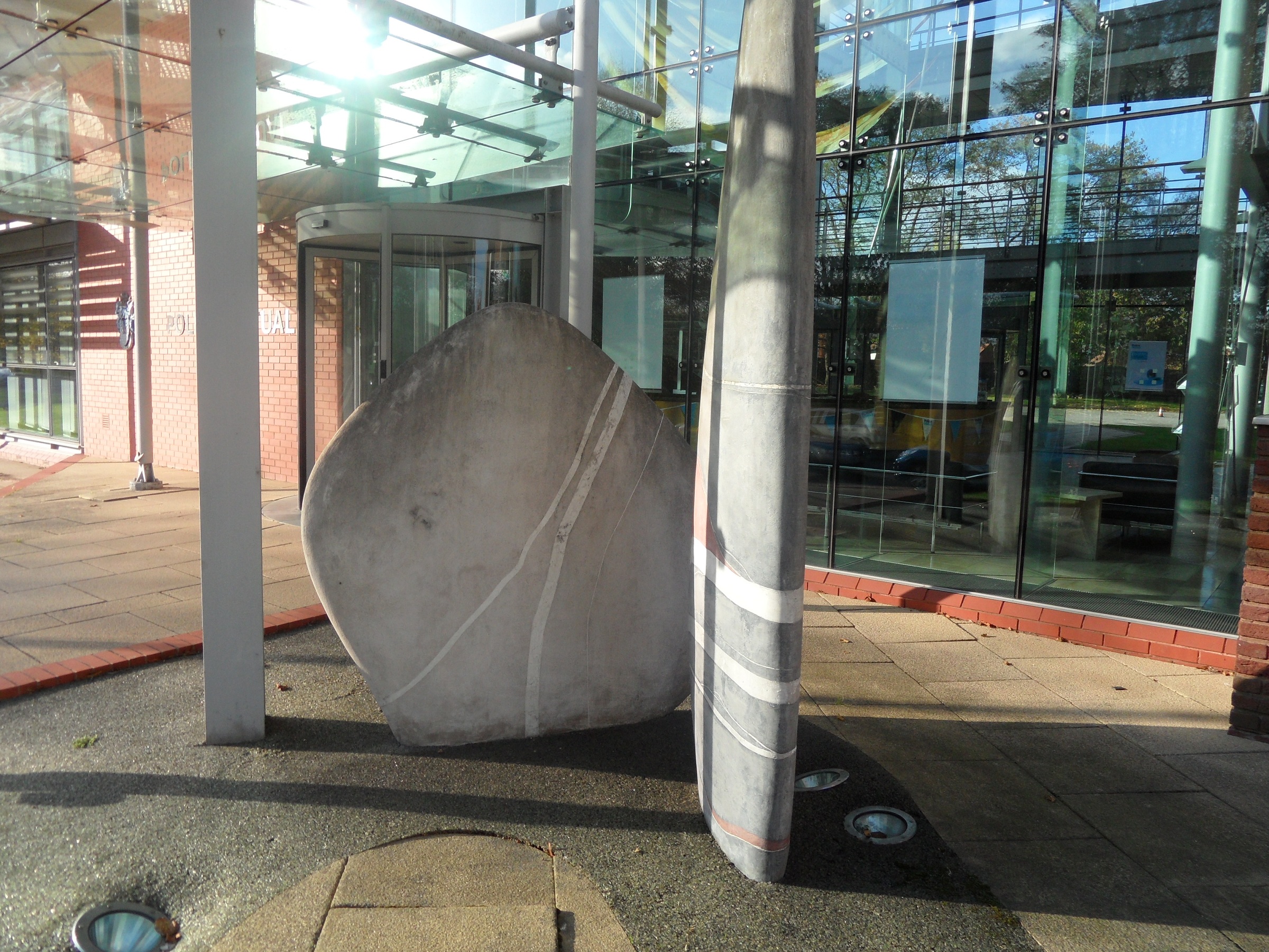
As well as including Lichfield’s usual suspects, the database also features some of our less obvious works such as the Calming Stone in Beacon Park, the etched glass in the Library foyer, the facade of Boots in Tamworth St and the Standing Stones I formed a bit of an attachment to back in November 2011.


Facade of Boots created 1908. Decorations include an owl, a beehive and a piper. There must have been a good reason for this motley crew!

They're outside!


Not everything on the list is still around – there’s an entry for Dean Denton’s Market Cross which was pulled down in 1849. There are also entries on the database that don’t seem to have made it as fully fledged pieces of Lichfield public sculpture.  Since Pat brought it to our attention back in November 2011 an entry has now appeared on the database about the Vision & Youth sculpture.

As the association says,  ‘The database is an excellent resource for students & researchers, conservators, local historians, art buffs, enthusiasts, genealogists and all who want to know more about public sculpture: statues; obelisks; columns; sculptures; installations; fountains; follies; commemorative clocks; wayside markers; and towers – from the Stuart era to the present day.’ I think it’s fantastic and you can read more about future plans & how you can get involved in contributing information here.

One to be added to the database in the future is the proposed statue of Erasmus Darwin at Cathedral Walk (I think there’s another one planned for Beacon Park too). I’ve just been reading a few of the comments about this on the S106 document. One person said that they were in favour of the statue, as Darwin is a local hero we should be proud of. However, the comment goes on to say that Lichfield should also celebrate more contemporary heroes relevant to young people and also more women ‘not just old blokes’.* I think this is potentially a whole new blog post but this is a really interesting point. Who or what should we be commemorating with our future public art & monuments?  

*I remember when I was a young person. A young person who used to go out on a Saturday night instead of sitting in reading the comments on S106 consultations 😉

Shopping Daze

Dam St is one of the most wonderful places in Lichfield, offering a winning combination of varied architecture, independent shops, duck feeding and ice-cream on route to the Cathedral. 

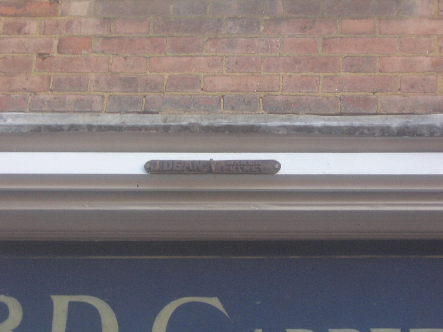
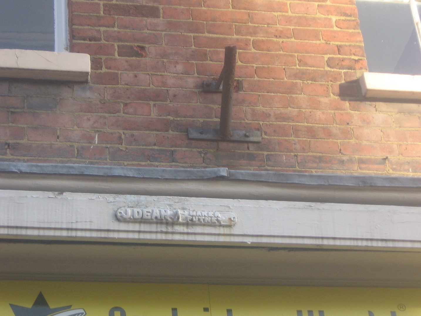
Three small signs above the shops at the Market Square end may well go unnoticed. They say ‘J Dean Putney Maker’ and have little hooks on them. A quick google search leads to the website of ‘Deans Blinds & Awnings’ established 1894 and tells how the company was started by a policeman’s son called Tom Dean, and was taken over by his brother John. It seems John Dean and subsequent generations of his family were involved in the ownership of Fulham FC as well as manufacturing blinds and awnings.


J Dean Putney


The listed buildings describes them as ‘late C19 shop fronts with bracketed cornice and canvas canopies’. Another look at these buildings and you can also see the chains attached to these awnings, which presumably must still be there, tucked away from sight. I wonder when they were rolled shut for the last time? What kind of shop was this when these canopies were added? There was a drapers & silk merchants in this area of Dam St in 1914, could this have been it?

J Dean 2 with Metal erm thing

On the second photo, there is also a metal….thing. I first came across these in Tamworth, where nearly every shop seems to have one albeit slightly newer looking.

Tamworth version of 'the metal thing'. They have lots of interesting things on buildings in Tamworth including mermaids.

Someone got in touch on flickr and suggested they were holders for flags or Christmas trees. I was in Bakewell in Derbyshire last week where they seem to be using them for the latter, as you can see here in the Matlock Mercury. Looks pretty, doesn’t it! I’m guessing the Dam St one was a flag holder but am more than happy to be proved wrong by memory or photographic evidence or just a convincing argument as to what else it might be 😉

You can also have a look at the Street View here, perhaps whilst eating a mincepie by a roaring fire (although it is out of date, as The Staffs Bookshop is now Realwoods).

Last weekend someone spotted something else interesting high up on another building in the city centre. I’m not saying anymore, as I’m hoping that they might consider doing something on this themselves. No matter how well you think you know your surroundings, there are always still things to discover. So whilst out and about shopping in the 8 (is that all!) shopping days left until Christmas try looking at Lichfield from a different angle. Who knows what you might notice…..

Edit 23/12/2011

Pat’s been on googlemaps and has spotted not only a whole load of these brackets on Tamworth St but also one actually in use outside the Scales! So I think that definitely answers this little Lichfield mystery!