On the Rocks

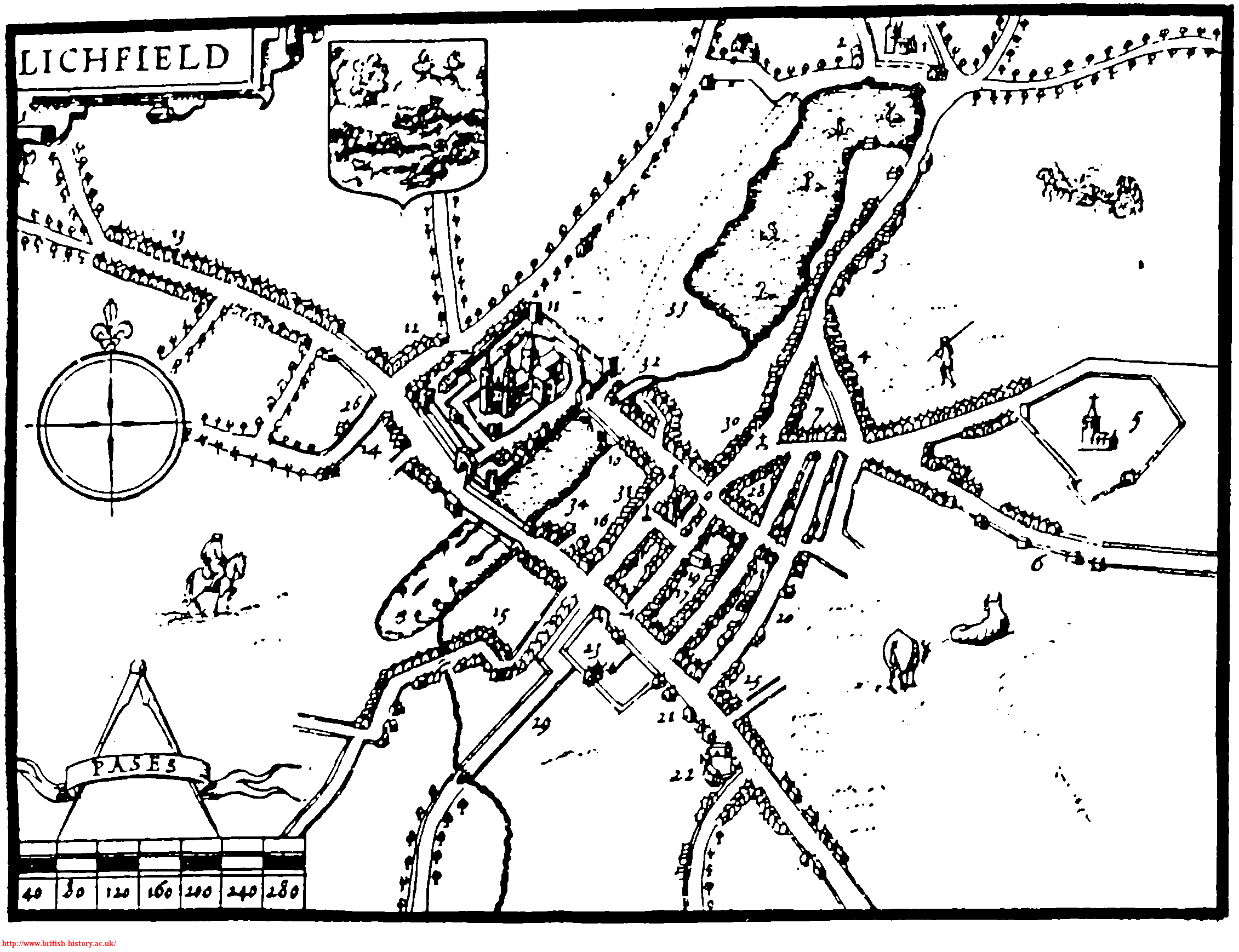
Lichfield is about as far as you can get from the sea. Somebody once wrote to the Guardian to say there was a plaque somewhere in the city making this claim but I’ve never seen it. However, being stuck in the middle of the country has not prevented the formation of the Lichfield Lighthouse Company, a group who meet at the Kings Head to sing sea shanties each month. It also didn’t stop me from heading out to look for shells in the city centre yesterday.

I’d read about the London Pavement Geology project over breakfast and I persuaded the other half to put his geology degree to good use and help me find out what Lichfield is made of, other than the ubiquitous sandstone (lovely though it is).

Lichfield Cathedral on Martyrs Plaque, Beacon Park

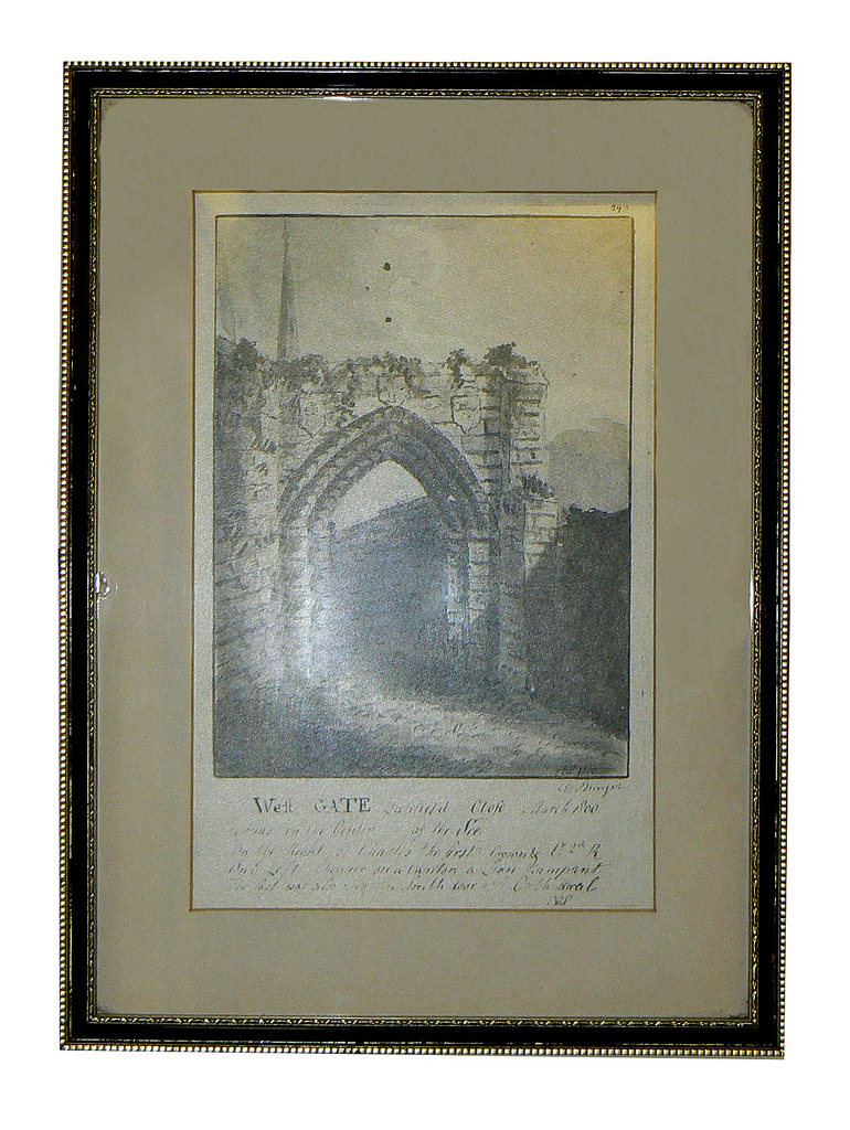
Lichfield Cathedral on Martyrs Plaque made from sandstone

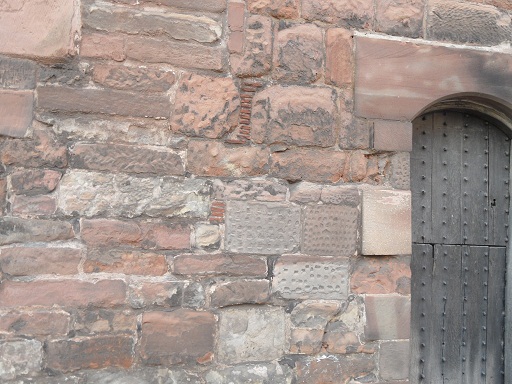
Our first port of call was another of landlocked Lichfield’s nautical links. Unless you live under a rock, you’ll probably be familiar with Beacon Park’s statue of Captain Smith which someone from Hanley in Stoke on Trent tries to appropriate whenever there’s a new chapter in the Titanic story, due to the mistaken belief that the statue was originally intended for their town. On this occasion, it wasn’t the bronze captain but the plinth he was stood on that interested me. The nearby plaque told me it was Cornish Granite, a material which has also been used at the Titanic Memorial in London and the memorial at Belfast. I wonder whether there are any symbolic reasons for choosing this stone alongside the practical and aesthetic ones?

Captain Smith plaque, Beacon Park

Captain Smith plaque, Beacon Park

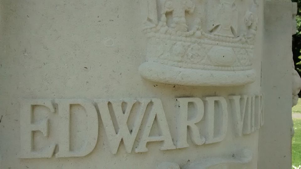
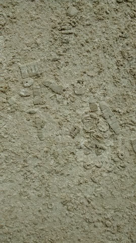
Not far from the Captain, King Edward VII stands on a base made of Hopton Wood stone. Get up close and you can see that the limestone is full of fossils including (and please correct me if I’m wrong) corals, crinoids and brachiopods from around 350 million years ago when the area that was to eventually become Derbyshire was under water. Lichfield wasn’t always so far from the sea!  It seems a similar stone has been used for the plinth Samuel Johnson sits on in the Market Square, as that too is full of fossils.

Samuel Johnson statue, Market Square, Lichfield

Samuel Johnson statue, Market Square, Lichfield

Fossils in Dr Johnson statue Fossils in Dr Johnson statue 2Of all the building materials we saw on our travels, the most unusual were to be found in a wall on Christchurch Lane. According to a booklet on the history of Leomansley compiled by the Friends of Christ Church, it was built by Cloggie Smith who used anything suitable that he had in his yard at the time. So, no Portland Stone here, just two Belfast Sinks. Are there any other examples of unorthodox construction materials used in and around the city?

Wall mounted Belfast sink

Wall mounted Belfast sink

You’ve probably guessed that I am way out of my depth when talking about geology, but the point is that after eleven years, seven months and two days here in Lichfield, someone made me look afresh at things so familiar that I barely saw them any more. Sometimes, the most amazing things are right under your nose. Or, in this case, under Dr Johnson’s and King Edward VII’s noses.

11894032_818906104889274_1449376816726442835_o

King Edward VII statue Lichfield Fossils in King Edward VII statue Lichfield


Time On Our Hands

On my way to do some Christmas shopping in Lichfield,  I went to Beacon Park to see our new old friend Erasmus Darwin properly now that the crowds had dispersed. I thought it would just be me and the good doctor this Saturday lunchtime, but in fact there were already people reading the plaque, when I arrived and another small group turned up whilst I was there. I touched the shell in Darwin’s hand, and continued over to The Close, as with all the talk of water and conduits recently, I also wanted to have another look at the old pump outside the Cathedral.

Wall of Bishop’s Palace, North East corner of The Close

I then continued my walk north of the Cathedral, along the wall of the Bishop’s Palace, wondering about the provenance of the stone used to build it. In the north east corner of The Close, next to a pile of old grass cuttings and leaves, I peered over into what would have been the old ditch surrounding The Close. Something on one of the worn sandstone blocks caught my eye. Graffiti carved into the wall! Was there any more? Retracing my steps back along the wall I found several more examples.

Unfortunately, most of the markings either aren’t dated, or the dates have weathered away. So we are left with a series of initials, and not much else to work with. They may have been carved within weeks of each other or centuries apart. They may belong to pupils of the school, or they may belong to someone passing by with time on their hands. All that we really know, is that at various points in time, people decided to make their presence known in this quiet corner of The Close

One of the only legible dates on the wall. 188?

The listed building description for the wall (which can be found here) tells us that it’s probably over 300 years old. I haven’t yet been able to find where the stone was quarried from but the variation in colour and texture is beautiful. (Yes, I touched this too!)

The wall dates back to the rebuilding of the Bishops Palace in 1687. The original palace sustained severe damage in the Civil War and since then has actually only been the residence of the Bishop of Lichfield for a relatively short period. Bishop Selwyn took up residence in the 1860s and just under a hundred years later, in 1953, Bishop Reeve moved into a house on the south side of The Close. Since then the Palace has been part of Lichfield Cathedral School.

I have a photograph of the Bishop’s Palace from the back, but not the front. I do wonder about my thought process sometimes…

Of course, if anyone has any insights or information, please do get in touch. If it was you that stood here and added your initials to this old wall, I’d love to know when and why. However, I think that sometimes we have to accept that we will never know all the answers and just enjoy the time spent asking the questions.

Sources:

Lichfield: The cathedral close’, A History of the County of Stafford: Volume 14: Lichfield (1990), pp. 57-67

Features and Reviews

Hopefully, anyone reading the blog recently has found the old graffiti interesting. I know that Gareth and I, and (for a few days at least!) a large broadcasting corporation did. After all of the excitement, I thought it was time for a bit of musing….

The discoveries (or perhaps rediscoveries is more accurate) in the Lichfield District Council offices got me thinking about the potential for other ‘unseen’ history out there. There’s unseen in the sense of being hidden away from view –  in attics, down pub cellars and down the bottom of the garden. However, I also think that something in plain view can be unseen –  people may pass by everyday, but no longer see what’s actually there or the potential of it, due to familiarity. During discussions about the graffiti, someone said to me, “I’ve walked past that graffiti loads of times and never even thought about it”.

The bread oven above is in the house of someone I know. I remember them buying the property years ago and excitedly telling me after their first viewing with the estate agent, “It has an old bread oven!”. When they moved in we all keen to peer inside but prior to taking the photo, it was last interacted with as part of an Easter Egg hunt.  However, taking the photo to show a friend, sparked a whole new conversation about the oven. Was it original? If so, would this have been the kitchen? Wasn’t it once divided into two houses? How was it laid out back then? Why was the house built in the first place? And so on….My point is, sometimes, we need to look with a fresh pair of eyes to see what’s in front of our nose.

I don’t think that the history in question even has to be a specific feature like the bread oven. I find the traces of people’s everyday lives fascinating. I visited a house in The Close last Christmas. Unfortunately, I hadn’t had nearly enough mulled wine to pluck up the courage to ask if I could take photos, so I’ll have to describe it. There were stone steps down into the cellar, worn away in the centre by centuries worth of footsteps. There were attic beams with layers of fading wallpaper still clinging to them up in the attic. To describe the place as ‘lived in’ would be an understatement.  The next question inevitably is ‘lived in by who’? Actually, photos wouldn’t really have done the place justice anyway because it was more than a visual thing. You wanted to touch, as well as see. ….

I’m really hoping that Lichfield District Council open their offices up for the next heritage weekend, so that people get to look around what was one the Old Grammar School for themselves. I’m not suggesting people throw the doors of their homes open to the public, but perhaps if we want to explore the history of the city and all its inhabitants, we sometimes need to look at the ‘normal’ buildings and places, where people lived and worked, and still do! I’m by no means detracting from those special, extraordinary buildings like the Cathedral, just saying that sometimes it might be worth looking again a little closer to home.

One of these terraced houses in Leomansley still has a tall chimmney at the back. An old washroom?

A wall brace on Greenhill. Does that say R Crosskex? Who was that? See edit below.


A selection of objects found in the garden Of Vicky Sutton’s Nan’s house near to Beacon Park (not including the pink flowery plate!).

The remains of a cherry orchard can still be found near…Cherry Orchard!

Edit:

After I woke up properly, I realised this actually said R Crosskey. I found a book about Henry William Crosskey, a geologist and Unitarian minister from Lewes (1) and found that his younger brother, Rowland Crosskey came to Lichfield as an apprentice ironmonger. He emigrated to Australia for a while and then,  after he returned to England, he started a business in Birmingham. Afterwards, he took over the Lichfield firm where he had served his apprenticeship. In 1868 he became Mayor of Lichfield and donated a civic sword to the City (Is this the one still used in processions today?).  He died in 1890. From census records, it looks like his home and business premises were initially in Market St. In 1888, he was in Bore St, trading as a ‘Military Camp and Store Furnisher’ with premises on the Burton Rd in partnership with Charles John Corrie. Also, just as a point of interest, Rowland was his Mother’s maiden name.


(1)Henry William Crosskey, LL.D., F.C.S. : his life and work by Richard Agland Armstrong; with chapters by E. F. M. MacCarthy and Charles Lapworth. http://www.ebooksread.com/authors-eng/e-f-m-maccarthy-richard-acland-armstrong.shtml

(2) London Gazette 1888


Hospital Ward

In 1781, John Snape carried out a census of Lichfield, making a list of the different wards of the city in the process. The wards are as follows: Bacon St (now Beacon St), Bird St, Sandford St, Sandford St below the water, St John’s St, St John’s St above the bars, Sadler St (now Market St), Bore St, Wade St, Dam St, Tamworth St, Lombard St, Stow St and Greenhill.

I think that these are the wards depicted by the flags hanging from the ceiling of the Guildhall, discussed here in my previous post. Now that I’ve finally made it back into the Guildhall to check which flag corresponds with which ward, I’m going to take each one in turn, trying to discover the significance of the design on each flag. Some I’m pretty sure of, others I’m really not (I’m talking about you Sandford St below the water ward!)


Photo from Ell Brown via flickr

 I’m starting with the flag that represents St John’s ward. Not only is it my favourite of the banners, it’s also seasonal with the feast of St John’s (or Midsummer’s Day) on 24th June. St John St gets its name from The Hospital of St John The Baptist (the place with the chimmneys!). The design from the flag is also on the board outside St John’s chapel, but what does it represent? The yellow flowers must be St John’s Wort, associated both with the saint and midsummer. What are the flowers growing around though?  Well, it’s taken a lot of googling but I think that it’s St Anthony’s Cross (also known as the Cross of Tau), often associated with St Francis. This possibly explains its inclusion, as the site of the Franciscan Friary lies within this ward . Part of the old Friary wall can still be seen on St John St.

Please feel free to join in with the speculation on this and any of the other flags that follow!

Photo of St John’s board from Ell Brown’s Lichfield Group photo set on his flickr stream, included with thanks.

West Side Story

The view of the Cathedral as you turn from Beacon St into the Close, must be one of the most photographed in Lichfield. It’s stunning. However, if you can tear your eyes away from the spectacular west front of the Cathedral, there’s something else here that I think is rather special.

Remains of the West Gate.

Sandwiched between two houses are the remains of the West Gate, dating back to the early fourteenth century. The rest of the gate was demolished in 1800, as Thomas Harwood describes, “…that noble gate at the west entrance into the Close, a beautiful structure worthy of its munificent founder and which in April 1800 was with a barbarous taste, pulled down, and the materials applied to lay the foundation of a pile of new buildings for the residence of necessitous widows of clergymen”. (The new buildings Mr Harwood describes is Newton’s College opposite. If this is true it’s a bit more house old recycling!).

In the same book, Harwood mentions the gate again saying,”At the entrance into the close on the west stood the beautiful gate which was built by Bishop Langton in the early part of the fourteenth century. It was a very strong a double gate with portcullis of great strength and majesty. The strong tower over the gate was finished in the time of Bishop Northburgh, the successor of Langton. This noble structure which had unimpaired during the revolution of five centuries and had withstood the destructive ravages of civil war was pulled down in April 1800 to widen the road into the Close”

Personally I’m a big fan of crumbling, old bricks, but if the gate had remained then, we wouldn’t be treated to that amazing view. Whether the decision to demolish the gate was barbarous or not, all we have now are these remaining stones and the descriptions, together with some maps and drawings.  The rest is down to our imagination….

The Lichfield District Council flickr stream has this image.

Taken from Lichfield District Council flickr group

On the Staffordshire Past Track website, you can also see a view of the gate published in 1805. Still a ruin, but in slightly better repair than the previous image. There’s another image here , this time from further away showing how the gate fitted into the area around the Close. This ‘ancient view’ of the Close, seems to be an artist’s impression from 1805 to show how the Close would have looked surrounded by its protective walls, gates and towers. John Speed’s 1610 map also shows the defences, including the gate.

1610 map of Lichfield

I’d like to explore the other remaining fragments of the defences, but for now I’ve got enough questions about this part to be going on with! Why leave this portion of wall   – why not demolish the whole thing? On the wall itself, why do some of the stones have dimples on (I bet there is a technical term for this!) Were materials really used for Newton’s College?

And what about that door! What’s behind there? Who was the last person to go in there (and did they ever come out again!). Why is there a door there at all? To access the ‘strong’ tower in Harwood’s descriptions?  Most importantly, where do they keep the key and could they open it for the Heritage Weekend?!

Edit: Take a look at the comments section – some of the questions have already been answered by Nigel, Managing Director of Lichfield Lock & Key, up on Church St and Pat, who seems to know a thing or two about old bricks!

Sources

The History & Antiquities of the Church and City of Lichfield – Thomas Harwood

Lichfield: The cathedral close – A History of the County of Stafford: Volume 14: Lichfield (1990), pp. 57-67. URL: http://www.british-history.ac.uk/report.aspx?compid=42343