
As I’ve been telling anyone who’ll listen, I went to Manchester at the weekend. One of the highlights (or should that be lowlights?) was a tour beneath one of the city’s warehouses to see the remains of the Manchester and Salford Junction canal.

Standing in the canal! Tow path to the left.
I’m not going to say any more about it, writing about a place 82 miles away is stretching it even for me (but for anyone interested, there’s some more of my photos and a bit about the experience here). So, I’ll say a bit about the Lichfield canal instead…
I imagine most people know that there is an ongoing project being carried out by the Lichfield and Hatherton Canals Restoration Trust and you can read about and see photographs of the sections of the Lichfield Canal that are already under restoration on their website. A while ago, I was at the bridge on the London Rd, and decided to walk home following the route of the disappeared canal, down to Sandfields. I know there was a section of canal here, because I had read about it in a post Annette Rubery did about Sandfields Pumping station. Here are some photos of the walk, featuring one of my favourite things – bits of old brick hinting at a trace of something long gone!

I think somewhere around here was Gallows Wharf. The gallows were apparently located somewhere near to the Shell Garage on the London Rd.
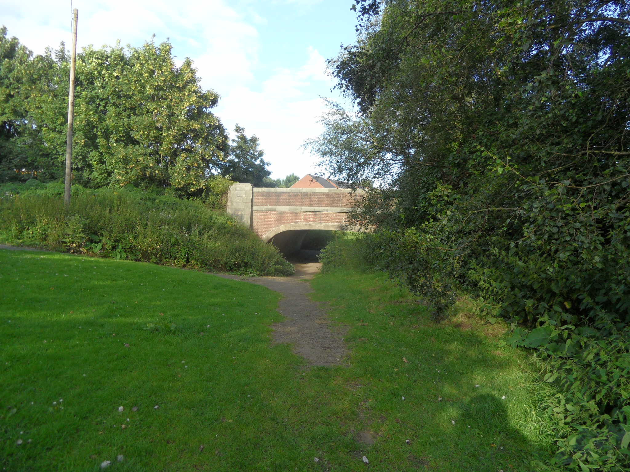


The obvious route of the canal finished about here on Shortbutts Lane.
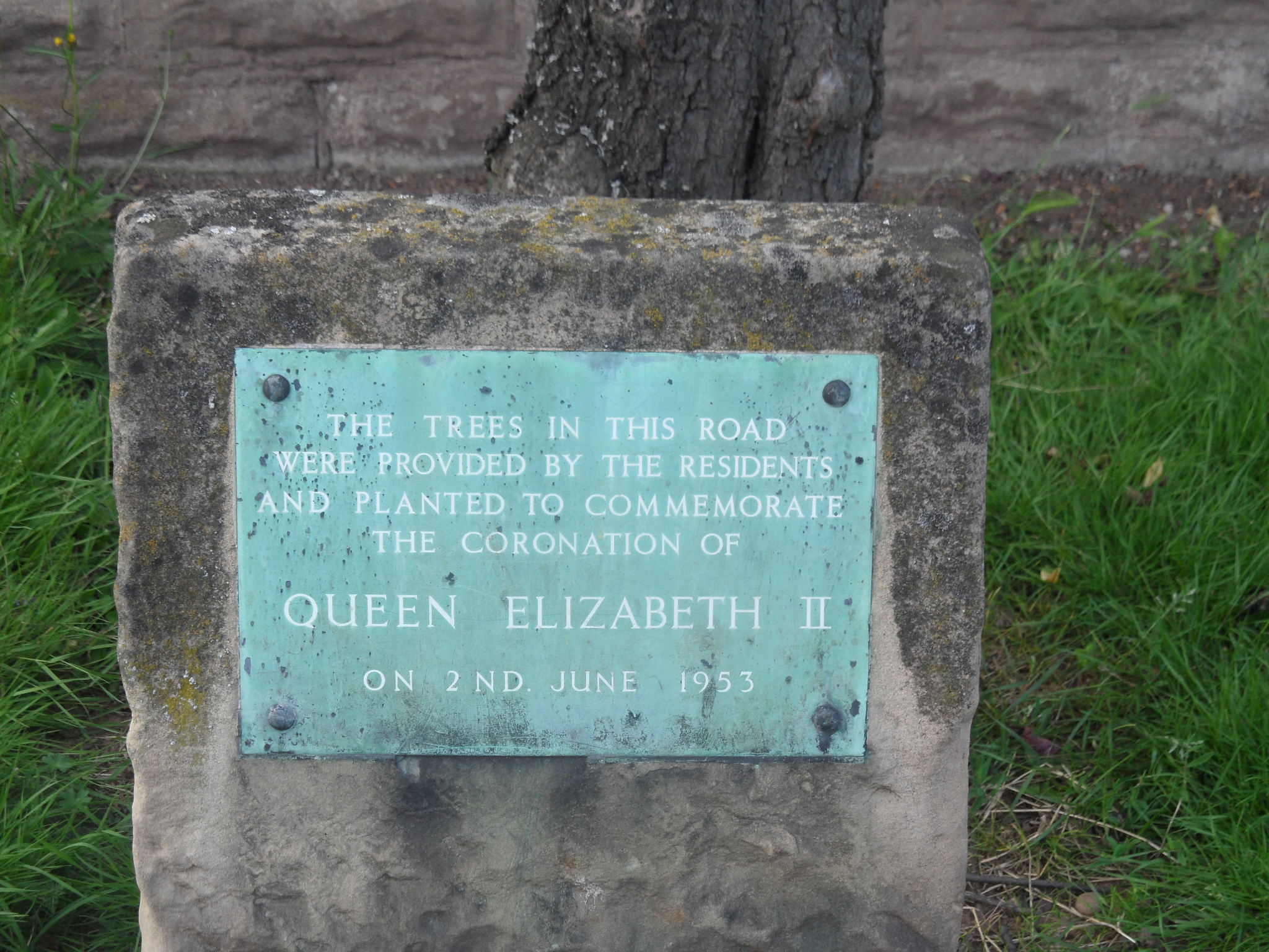
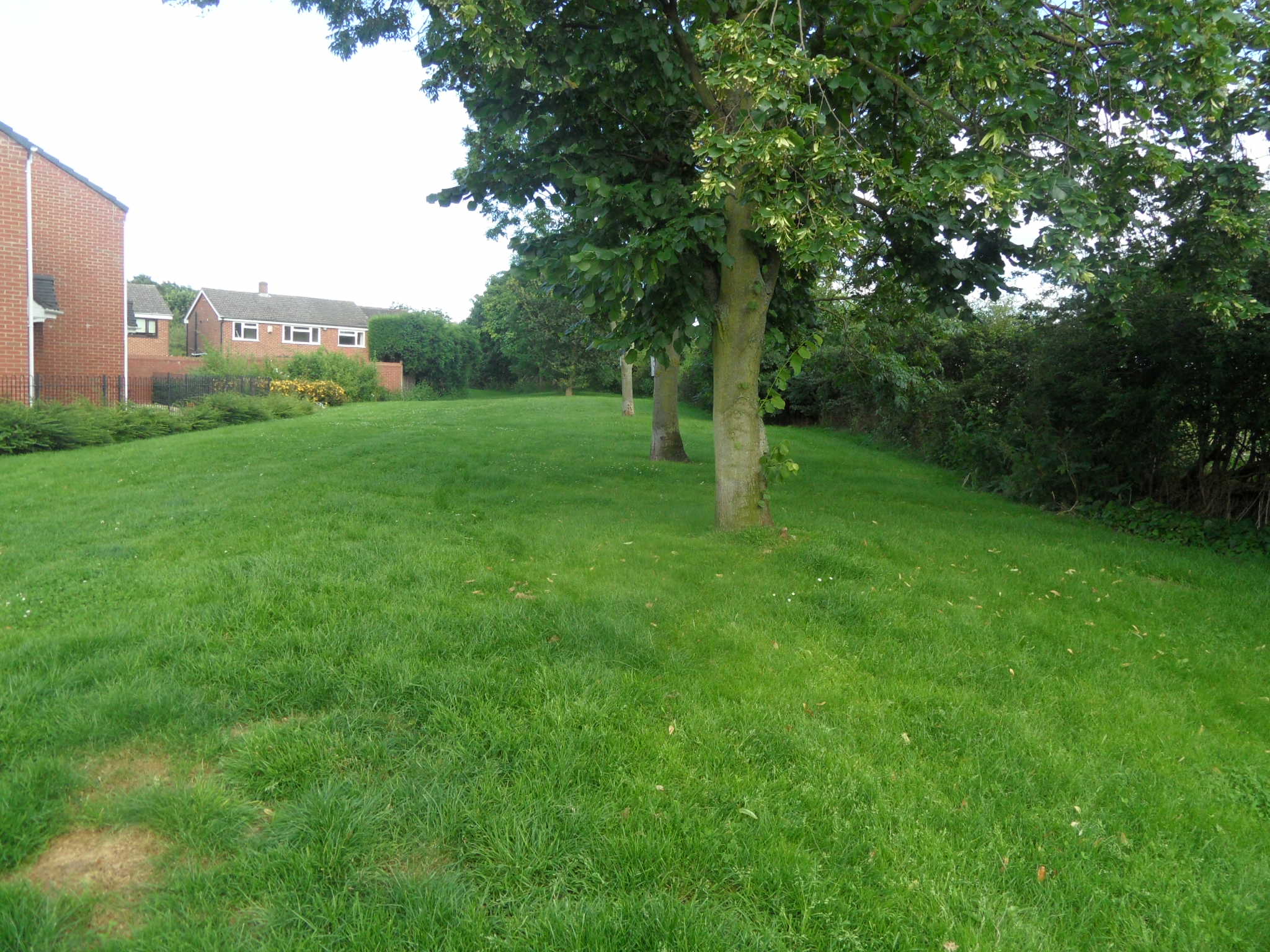
Then I mistakenly went up Fosseway instead of taking a right onto the Birmingham Rd and lost the canal route altogether but I did find a nice plaque!

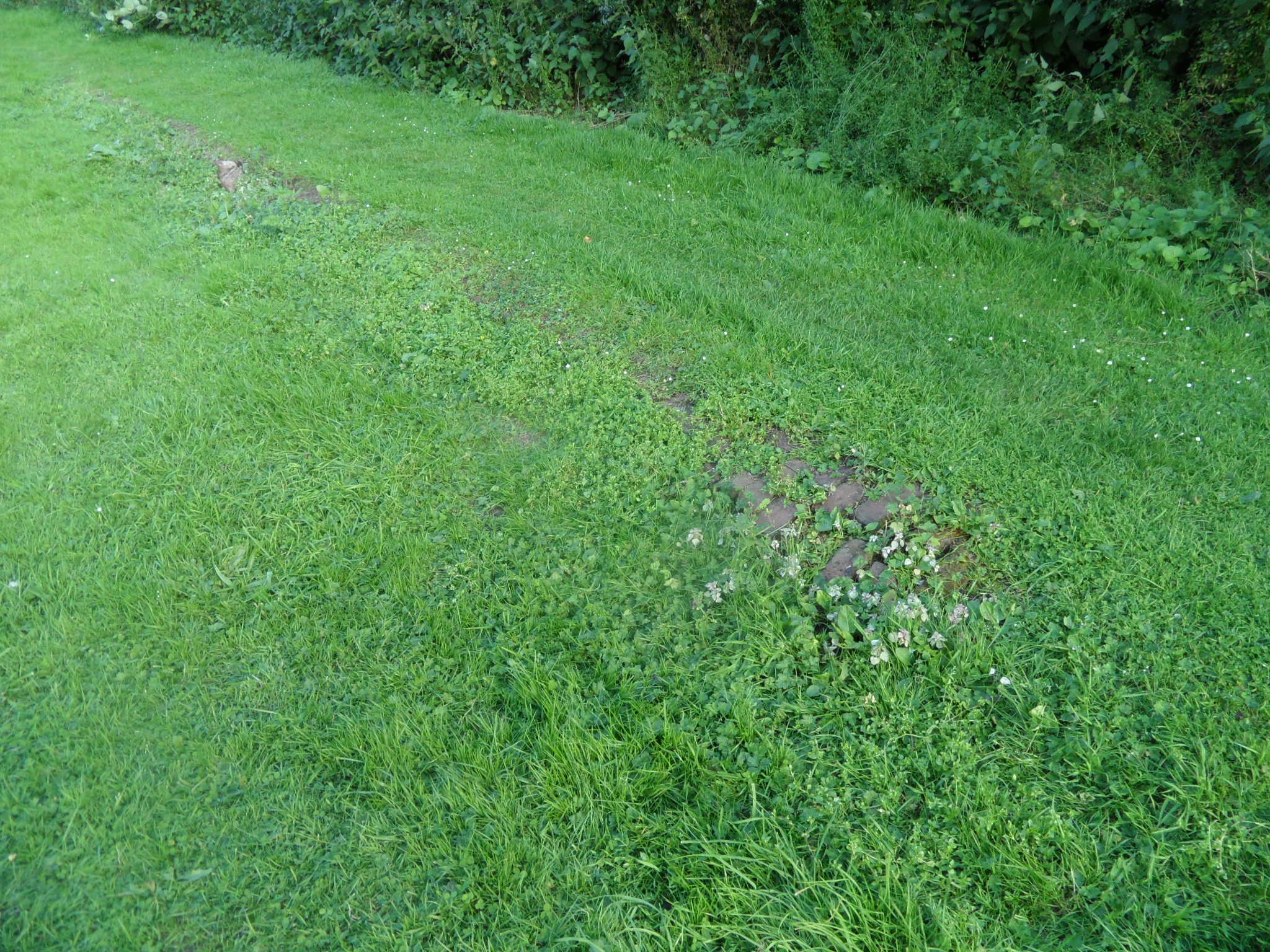
Plus some interesting but I think non-canal related bricks at the junction of Fosseway and Shortbutts Lane with the Birmingham Rd.

I knew that if I got to Sandfields Pumping Station, I’d manage to pick the canal back up!
I noticed on an 1834 map of Lichfield that the canal in this area passed something called ‘The Bone House’. The county history says ‘There was a bonehouse evidently on the north side of the Wyrley and Essington Canal west of Chesterfield Road by 1806. The miller, Thomas Wood, was ordered that year to stop production following a complaint by the vicar of St. Mary’s that the works was ‘a noisome and offensive building and a great nuisance to the inhabitants of the city’. He was still in business in 1818 and the bonehouse remained there in 1836′.
I imagine it was used to grind down animal bones to make fertiliser, but if anyone knows any different, please let me know!
The idea of exploring the impact that the presence of water had on the surrounding landscape is something that really interests me. I think walking alongside our streams and canals, around our pools and millponds gives you the chance to look at a places from a different perspective. Next time though, I might take a map!
Sources:
Lichfield: Economic history’, A History of the County of Stafford: Volume 14: Lichfield(1990), pp. 109-131

Kate,
Google Books finds a report in 1862 about the ongoing nuisance caused by the Bone House.
http://bit.ly/RZPplL
LikeLike
Thanks Roger, what a great find. Fascinating that the bone factory was part of the evidence given to the select committee on injury from noxious vapours – the stench of a bone manure factory! I also like the fact that the report says ‘in hot weather when the labourers are at work in the fields they are obliged to administer brandy and other to keep their stomachs in order to enable them to go on with their work’. I wonder if drinking brandy in the hot weather really helped? I know it’d have the opposite effect on me!
LikeLike
Thanks for the link, Kate. The bone house sounds thoroughly unpleasant in that report mentioned by Roger (above). Wasn’t it Erasmus Darwin that advocated the use of bone dust as a fertiliser? I know it was used anciently, but I think Darwin was one of the first to look at the science behind it. Pretty ironic, considering.
LikeLike
Thanks, I had no idea that was one of Darwin’s ideas!
LikeLike
We often walk thru’ following the (not so!) yellow brick road left by the old canal, too. I think the early parts of your walk are soon to be surrounded by more houses in the development plan.
I’m not so sure it would be possible to link the bricks shown in your outcrop at the junction of Shortbutts Lane & Birmingham Road down to the Bone Mill, though. When we arrived in Lichfield 24 years ago, the space now occupied by houses on this spot was a dairy company distribution depot (…can’t remember which Company). That and the railway probably obscure any possible archaeology around there, I suspect
LikeLike
Thanks, I did see a planning application notice whilst I was walking.
I think you’re right about the mystery bricks not belonging to the canal, maps show that the canal ran behind the Duke of York, then past the old City Brewery before crossing the Chesterfield Rd and then running adjacent to the train track (the route seem quite obvious if you look on google maps actually, I’m kicking myself!)Then, as you say the spot was occupied by a depot (as per a 1977 map). Of course the question is what do they belong to?!
LikeLike
Hi Kate,Bone was used for buttons,buckles,knife&fork handles,also inlaid into boxes
and furniture ,Musical insruments also had bone used in them,If been turned into
bonemeal I don’t think they would be boiling them the fat that come from the bones
went to make soap.
LikeLike
It’s amazing how many uses there were for old bones!
LikeLike
Was looking at @Gaz_Lichfield ‘s Pinterest board today, and see he’s posted a map of the proposed Lichfield & Hatherton Canal restoration. Interestingly, it deviates from the old route that you followed towards the end of Shortbutts Lane – one of the relatively few points where it doesn’t follow the original path. I presume the bit behind Duke of York etc was a spur on the original canal to get closer to the town centre?
LikeLike
I’m just reading about this on the L&HCR website. It says there was a (unworkable) proposal by the Staffs County Council that a tunnel should be constructed to carry the canal under the bypass from a point South of Byron Avenue to the London Road. So we could have had our own bit of underground canal after all! Or not…
This website is much better at outlining the whole route than my little meander! http://members.madasafish.com/~d_hodgkinson/wyrley-walk5.htm I’ll have another look on the map at the stretch by the Duke of York.
LikeLike
Pingback: Concrete Evidence | Lichfield Lore